Hope, Kansas

Last updated

Hope, Kansas
Aerial photo of Hope, Kansas 09-04-2013.JPG
Aerial photo of Hope (2013)
Dickinson County Kansas Incorporated and Unincorporated areas Hope Highlighted.svg
Location within Dickinson County and Kansas
Map of Dickinson Co, Ks, USA.png
Coordinates: 38°41′28″N97°04′35″W / 38.69111°N 97.07639°W / 38.69111; -97.07639 [1]
Country United States
State Kansas
County Dickinson
Founded1871
Incorporated 1886
Government
  Type Mayor–Council
Area
[2]
  Total0.39 sq mi (1.01 km2)
  Land0.39 sq mi (1.01 km2)
  Water0.00 sq mi (0.00 km2)
Elevation
[1]
1,398 ft (426 m)
Population
 (2020) [3]
  Total317
  Density810/sq mi (310/km2)
Time zone UTC-6 (CST)
  Summer (DST) UTC-5 (CDT)
ZIP code
67451
Area code 785
FIPS code 20-33075
GNIS ID 2394416 [1]
Website cityofhopeks.com

Hope is a city in southern Dickinson County, Kansas, United States. [1] As of the 2020 census, the population of the city was 317. [3]

Contents

History

1915 Railroad Map of Dickinson County Stouffer's Railroad Map of Kansas 1915-1918 Dickinson County.png
1915 Railroad Map of Dickinson County
Limestone welcome banner in Hope (2017) There will always be Hope in Kansas.jpg
Limestone welcome banner in Hope (2017)

Early history

For many millennia, the Great Plains of North America was inhabited by nomadic Native Americans. From the 16th century to 18th century, the Kingdom of France claimed ownership of large parts of North America. In 1762, after the French and Indian War, France secretly ceded New France to Spain, per the Treaty of Fontainebleau.

19th century

In 1802, Spain returned most of the land to France. In 1803, most of the land for modern day Kansas was acquired by the United States from France as part of the 828,000 square mile Louisiana Purchase for 2.83 cents per acre.

In 1854, the Kansas Territory was organized, then in 1861 Kansas became the 34th U.S. state. In 1857, Dickinson County was established within the Kansas Territory, which included the land for modern day Hope.

In 1871, a group of about forty people, led by Newell Thurstin, began planning a town site in Hope. The town is said to be named after one of Thurstin's sons.[ citation needed ]

The first post office in Hope was also established in July 1871. [4]

David Jacob Eisenhower, the father of US President Dwight David Eisenhower, lived in a 160-acre (0.65 km2) ranch near Hope from 1878 to his enrollment at Lane University. He and his partner, Milton Good, operated a general store here in 1885. [5]

Hope was incorporated in 1886, and at that time it had a population of over 700, larger than what it is today. The arrival of the railroad one year before, brought access of bustling Chicago to tiny Hope.[ citation needed ]

In 1887, Atchison, Topeka and Santa Fe Railway built a branch line from Neva (3 miles west of Strong City) through Hope to Superior, Nebraska. In 1996, the Atchison, Topeka and Santa Fe Railway merged with Burlington Northern Railroad and renamed to the current BNSF Railway. Most locals still refer to this railroad as the "Santa Fe".

The motto of Hope is "There Will Always Be Hope In Kansas", which is also the name of a song.

Geography

According to the United States Census Bureau, the city has a total area of 0.39 square miles (1.01 km2), all of it land. [6]

There are two parks in Hope: one in the downtown area on Main Street and an older one in the northern edge of town.

Climate

The climate in this area is characterized by hot, humid summers and generally mild to cool winters. According to the Köppen Climate Classification system, Hope has a humid subtropical climate, abbreviated "Cfa" on climate maps. [7]

Demographics

Historical population
CensusPop.Note
1890 632
1900 557−11.9%
1910 5671.8%
1920 5893.9%
1930 556−5.6%
1940 500−10.1%
1950 480−4.0%
1960 463−3.5%
1970 438−5.4%
1980 4686.8%
1990 404−13.7%
2000 372−7.9%
2010 368−1.1%
2020 317−13.9%
U.S. Decennial Census

2020 census

The 2020 United States census counted 317 people, 146 households, and 82 families in Hope. [8] [9] The population density was 814.9 per square mile (314.6/km2). There were 175 housing units at an average density of 449.9 per square mile (173.7/km2). [9] [10] The racial makeup was 92.74% (294) white or European American (91.8% non-Hispanic white), 0.32% (1) black or African-American, 0.63% (2) Native American or Alaska Native, 0.32% (1) Asian, 0.0% (0) Pacific Islander or Native Hawaiian, 1.26% (4) from other races, and 4.73% (15) from two or more races. [11] Hispanic or Latino of any race was 2.52% (8) of the population. [12]

Of the 146 households, 22.6% had children under the age of 18; 46.6% were married couples living together; 24.0% had a female householder with no spouse or partner present. 41.1% of households consisted of individuals and 18.5% had someone living alone who was 65 years of age or older. [9] The average household size was 2.5 and the average family size was 3.7. [13] The percent of those with a bachelor’s degree or higher was estimated to be 13.9% of the population. [14]

21.8% of the population was under the age of 18, 4.4% from 18 to 24, 18.3% from 25 to 44, 28.1% from 45 to 64, and 27.4% who were 65 years of age or older. The median age was 51.5 years. For every 100 females, there were 112.8 males. [9] For every 100 females ages 18 and older, there were 103.3 males. [9]

The 2016-2020 5-year American Community Survey estimates show that the median household income was $40,833 (with a margin of error of +/- $11,846) and the median family income was $63,750 (+/- $13,471). [15] Males had a median income of $34,306 (+/- $5,297) versus $29,375 (+/- $28,309) for females. The median income for those above 16 years old was $34,028 (+/- $5,808). [16] Approximately, 18.9% of families and 27.3% of the population were below the poverty line, including 36.9% of those under the age of 18 and 3.2% of those ages 65 or over. [17] [18]

2010 census

As of the census [19] of 2010, there were 368 people, 166 households, and 104 families residing in the city. The population density was 943.6 inhabitants per square mile (364.3/km2). There were 192 housing units at an average density of 492.3 per square mile (190.1/km2). The racial makeup of the city was 93.5% White, 2.4% African American, 0.8% Native American, 0.3% Asian, and 3.0% from two or more races. Hispanic or Latino of any race were 0.3% of the population.

There were 166 households, of which 22.9% had children under the age of 18 living with them, 54.2% were married couples living together, 6.0% had a female householder with no husband present, 2.4% had a male householder with no wife present, and 37.3% were non-families. 33.7% of all households were made up of individuals, and 18.7% had someone living alone who was 65 years of age or older. The average household size was 2.22 and the average family size was 2.81.

The median age in the city was 48.7 years. 19.8% of residents were under the age of 18; 6.9% were between the ages of 18 and 24; 16.3% were from 25 to 44; 34% were from 45 to 64; and 23.1% were 65 years of age or older. The gender makeup of the city was 49.7% male and 50.3% female.

2000 census

As of the census of 2000, there were 372 people, 164 households, and 106 families residing in the city. The population density was 821.8 inhabitants per square mile (317.3/km2). There were 185 housing units at an average density of 408.7 per square mile (157.8/km2). The racial makeup of the city was 98.12% White, 0.81% African American, 0.54% Native American, 0.27% Asian, and 0.27% from two or more races. Hispanic or Latino of any race were 0.27% of the population.

There were 164 households, out of which 29.9% had children under the age of 18 living with them, 57.3% were married couples living together, 5.5% had a female householder with no husband present, and 34.8% were non-families. 32.9% of all households were made up of individuals, and 21.3% had someone living alone who was 65 years of age or older. The average household size was 2.27 and the average family size was 2.88.

In the city, the population was spread out, with 24.5% under the age of 18, 3.8% from 18 to 24, 25.3% from 25 to 44, 24.2% from 45 to 64, and 22.3% who were 65 years of age or older. The median age was 43 years. For every 100 females, there were 84.2 males. For every 100 females age 18 and over, there were 82.5 males.

The median income for a household in the city was $28,365, and the median income for a family was $32,813. Males had a median income of $27,639 versus $18,036 for females. The per capita income for the city was $14,300. About 4.8% of families and 7.4% of the population were below the poverty line, including 4.6% of those under age 18 and 14.0% of those age 65 or over.

Government

The Hope government consists of a mayor and five council members. The council meets the 2nd Wednesday of each month at 7 pm while in daylight savings and 6pm during standard time. The current mayor is Larry Ryff. [20] [21]

Education

The community is served by Rural Vista USD 481 public school district. [22] [23]

Transportation

Hope is located on K-4, the longest highway in the state. It was once at the junction of the BNSF and Missouri Pacific railroads, but is no longer served by either Railroad.

Notable people

See also

Related Research Articles

<span class="mw-page-title-main">Horton, Kansas</span> City in Brown County, Kansas

Horton is a city in Brown County, Kansas, United States. As of the 2020 census, the population of the city was 1,523.

<span class="mw-page-title-main">Waverly, Kansas</span> City in Coffey County, Kansas

Waverly is a city in Coffey County, Kansas, United States. As of the 2020 census, the population of the city was 574.

<span class="mw-page-title-main">Hepler, Kansas</span> City in Crawford County, Kansas

Hepler is a city in Crawford County, Kansas, United States. As of the 2020 census, the population of the city was 90.

<span class="mw-page-title-main">Mulberry, Kansas</span> City in Crawford County, Kansas

Mulberry is a city in Crawford County, Kansas, United States. As of the 2020 census, the population of the city was 409.

<span class="mw-page-title-main">Jennings, Kansas</span> City in Decatur County, Kansas

Jennings is a city in Decatur County, Kansas, United States. As of the 2020 census, the population of the city was 81.

<span class="mw-page-title-main">Norcatur, Kansas</span> City in Decatur County, Kansas

Norcatur is a city in Decatur County, Kansas, United States. As of the 2020 census, the population of the city was 159.

<span class="mw-page-title-main">Kinsley, Kansas</span> City in Edwards County, Kansas

Kinsley is a city in and the county seat of Edwards County, Kansas, United States. As of the 2020 census, the population of the city was 1,456. It is located along Highway 50.

<span class="mw-page-title-main">Gove City, Kansas</span> City in Gove County, Kansas

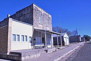
Gove City, more commonly known as Gove, is a city in and the county seat of Gove County, Kansas, United States. As of the 2020 census, the population of the city was 80.

<span class="mw-page-title-main">Mankato, Kansas</span> City in Jewell County, Kansas

Mankato is a city in and the county seat of Jewell County, Kansas, United States. As of the 2020 census, the population of the city was 836.

<span class="mw-page-title-main">Mission, Kansas</span> City in Kansas, United States

Mission is a city in Johnson County, Kansas, United States, and part of the Kansas City Metropolitan Area. As of the 2020 census, the population of the city was 9,954.

<span class="mw-page-title-main">Lansing, Kansas</span> City in Kansas, United States

Lansing is a city in Leavenworth County, Kansas, United States. It is situated along the west side of the Missouri River and Kansas-Missouri state border. As of the 2020 census, the population of the city was 11,239. It is the second most populous city of Leavenworth County and is a part of the Kansas City metropolitan area. The Lansing Correctional Facility, which includes the state's main maximum-security prison, is located in Lansing.

<span class="mw-page-title-main">Oketo, Kansas</span> City in Marshall County, Kansas

Oketo is a city in Marshall County, Kansas, United States. As of the 2020 census, the population of the city was 64.

<span class="mw-page-title-main">Meade, Kansas</span> City in Meade County, Kansas

Meade is a city in and the county seat of Meade County, Kansas, United States. As of the 2020 census, the population of the city was 1,505.

<span class="mw-page-title-main">Ness City, Kansas</span> City in Ness County, Kansas

Ness City is a city in and the county seat of Ness County, Kansas, United States. As of the 2020 census, the population of the city was 1,329. Ness City is famous for its four-story Old Ness County Bank Building located downtown, and nicknamed Skyscraper of the Plains.

<span class="mw-page-title-main">Lyndon, Kansas</span> City in Osage County, Kansas

Lyndon is a city in, and the county seat of Osage County, Kansas, United States. As of the 2020 census, the population of the city was 1,037.

<span class="mw-page-title-main">Belleville, Kansas</span> City in Republic County, Kansas

Belleville is a city in and the county seat of Republic County, Kansas, United States. As of the 2020 census, the population of the city was 2,007.

<span class="mw-page-title-main">Munden, Kansas</span> City in Republic County, Kansas

Munden is a city in Republic County, Kansas, United States. As of the 2020 census, the population of the city was 96.

<span class="mw-page-title-main">Clearwater, Kansas</span> City in Sedgwick County, Kansas

Clearwater is a city in Sedgwick County, Kansas, United States. As of the 2020 census, the population of the city was 2,653.

<span class="mw-page-title-main">Mount Hope, Kansas</span> City in Sedgwick County, Kansas

Mount Hope is a city in Sedgwick County, Kansas, United States. As of the 2020 census, the population of the city was 806.

<span class="mw-page-title-main">Leoti, Kansas</span> City in Wichita County, Kansas

Leoti is a city in and the county seat of Wichita County, Kansas, United States. As of the 2020 census, the population of the city was 1,475.

References

  1. 1 2 3 4 U.S. Geological Survey Geographic Names Information System: Hope, Kansas
  2. "2019 U.S. Gazetteer Files". United States Census Bureau. Retrieved July 24, 2020.
  3. 1 2 "Profile of Hope, Kansas in 2020". United States Census Bureau. Archived from the original on November 13, 2021. Retrieved November 13, 2021.
  4. "Kansas Post Offices, 1828–1961 (archived)". Kansas Historical Society. Archived from the original on September 9, 2013. Retrieved June 8, 2014.
  5. Branigar, Thomas. "No Villains, No Heroes" (PDF). Retrieved November 16, 2016.
  6. "US Gazetteer files 2010". United States Census Bureau. Archived from the original on January 25, 2012. Retrieved July 6, 2012.
  7. Climate Summary for Hope, Kansas
  8. "US Census Bureau, Table P16: HOUSEHOLD TYPE". data.census.gov. Retrieved January 3, 2024.
  9. 1 2 3 4 5 "US Census Bureau, Table DP1: PROFILE OF GENERAL POPULATION AND HOUSING CHARACTERISTICS". data.census.gov. Retrieved January 3, 2024.
  10. Bureau, US Census. "Gazetteer Files". Census.gov. Retrieved December 30, 2023.
  11. "US Census Bureau, Table P1: RACE". data.census.gov. Retrieved January 3, 2024.
  12. "US Census Bureau, Table P2: HISPANIC OR LATINO, AND NOT HISPANIC OR LATINO BY RACE". data.census.gov. Retrieved January 3, 2024.
  13. "US Census Bureau, Table S1101: HOUSEHOLDS AND FAMILIES". data.census.gov. Retrieved January 3, 2024.
  14. "US Census Bureau, Table S1501: EDUCATIONAL ATTAINMENT". data.census.gov. Retrieved January 3, 2024.
  15. "US Census Bureau, Table S1903: MEDIAN INCOME IN THE PAST 12 MONTHS (IN 2020 INFLATION-ADJUSTED DOLLARS)". data.census.gov. Retrieved January 3, 2024.
  16. "US Census Bureau, Table S2001: EARNINGS IN THE PAST 12 MONTHS (IN 2020 INFLATION-ADJUSTED DOLLARS)". data.census.gov. Retrieved January 3, 2024.
  17. "US Census Bureau, Table S1701: POVERTY STATUS IN THE PAST 12 MONTHS". data.census.gov. Retrieved January 3, 2024.
  18. "US Census Bureau, Table S1702: POVERTY STATUS IN THE PAST 12 MONTHS OF FAMILIES". data.census.gov. Retrieved January 3, 2024.
  19. "U.S. Census website". United States Census Bureau . Retrieved July 6, 2012.
  20. Hope – Government
  21. Hope – Directory of Public Officials
  22. USD 481
  23. Kansas School District Boundary Map Archived 2011-07-21 at the Wayback Machine

Further reading