Horseshoe Bay, Texas

Last updated

Horseshoe Bay, Texas
Horseshoe Bay Texas City Hall.jpg
Horseshoe Bay City Hall
TXMap-doton-HorseshoeBay.PNG
Location of Horseshoe Bay, Texas
Burnet County HorseshoeBay.svg
Coordinates: 30°32′41″N98°22′6″W / 30.54472°N 98.36833°W / 30.54472; -98.36833
Country United States
State Texas
Counties Llano, Burnet
Area
[1]
  Total16.59 sq mi (42.96 km2)
  Land14.32 sq mi (37.10 km2)
  Water2.26 sq mi (5.86 km2)
Elevation
[2]
846 ft (258 m)
Population
 (2020)
  Total4,257
  Density260/sq mi (99/km2)
Time zone UTC-6 (Central (CST))
  Summer (DST) UTC-5 (CDT)
ZIP codes
78654, 78657
Area code 830
FIPS code 48-34862 [3]
GNIS feature ID1867551 [2]
Website www.horseshoe-bay-tx.gov

Horseshoe Bay is a city in Llano and Burnet counties in the U.S. state of Texas.

Contents

Situated on Lake Lyndon B. Johnson and the south branch of the Colorado River, it is known in the region for its golf courses, hotel and resort, and water sports. Prior to its incorporation in September 2005, [4] it was a census-designated place (CDP). The CDP population was 3,337 at the 2000 census. The 2010 census put the population at 3,418. The 2020 Decennial Census reported population was 4,257.

Geography

Horseshoe Bay is located at 30°32′41″N98°22′06″W / 30.544814°N 98.368428°W / 30.544814; -98.368428 (30.544814, –98.368428). [5] It is located primarily in Llano County and extends eastward into Burnet County, on the southern shore of Lake Lyndon B. Johnson. It is about 28 miles (45 km) southeast of Llano, about 8 miles (13 km) west of Marble Falls, and 51 miles (82 km) northwest of downtown Austin.

According to the United States Census Bureau, the city has a total area of 11.6 square miles (30.1 km2), of which 11.4 square miles (29.5 km2) is land and 0.23 square miles (0.6 km2), or 1.83%, is water. [6]

Demographics

Historical population
CensusPop.Note
2000 3,337
2010 3,4182.4%
2020 4,25724.5%
U.S. Decennial Census [7]

2020 census

Horseshoe Bay racial composition [8]
(NH = Non-Hispanic) [lower-alpha 1]
RaceNumberPercentage
White (NH)3,61284.85%
Black or African American (NH)190.45%
Native American or Alaska Native (NH)230.54%
Asian (NH)310.73%
Some Other Race (NH)70.16%
Mixed/Multi-Racial (NH)1032.42%
Hispanic or Latino 46210.85%
Total4,257

As of the 2020 United States census, there were 4,257 people, 2,040 households, and 1,309 families residing in the city.

2000 census

As of the census [3] of 2000, there were 3,337 people, 1,623 households, and 1,186 families residing in the CDP. The population density was 142.8 inhabitants per square mile (55.1/km2). There were 2,773 housing units at an average density of 118.7 per square mile (45.8/km2). The racial makeup of the CDP was 96.22% White, 0.33% African American, 0.24% Native American, 0.78% Asian, 1.47% from other races, and 0.96% from two or more races. Hispanic or Latino of any race were 4.29% of the population.

There were 1,623 households, out of which 11.6% had children under the age of 18 living with them, 68.5% were married couples living together, 2.8% had a female householder with no husband present, and 26.9% were non-families. 24.0% of all households were made up of individuals, and 12.1% had someone living alone who was 65 years of age or older. The average household size was 2.06 and the average family size was 2.37.

In the CDP, the population was spread out, with 10.6% under the age of 18, 3.4% from 18 to 24, 15.0% from 25 to 44, 36.2% from 45 to 64, and 34.8% who were 65 years of age or older. The median age was 58 years. For every 100 females, there were 95.7 males. For every 100 females age 18 and over, there were 95.7 males.

The median income for a household in the CDP was $54,073, and the median income for a family was $65,324. Males had a median income of $39,375 versus $23,019 for females. The per capita income for the CDP was $36,254. About 5.8% of families and 6.1% of the population were below the poverty line, including 9.2% of those under age 18 and 4.7% of those age 65 or over.

Education

The Llano County portion of Horseshoe Bay is served by the Llano Independent School District. The Burnet County portion is served by the Marble Falls Independent School District.

Climate

The climate in this area is characterized by hot, humid summers and generally mild to cool winters. According to the Köppen Climate Classification system, Horseshoe Bay has a humid subtropical climate, abbreviated "Cfa" on climate maps. [11]

Related Research Articles

<span class="mw-page-title-main">Llano County, Texas</span> County in Texas, United States

Llano County is a county located on the Edwards Plateau in the U.S. state of Texas. As of the 2020 census, its population was 21,243. Its county seat is Llano, and the county is named for the Llano River.

<span class="mw-page-title-main">Burnet County, Texas</span> County in Texas, United States

Burnet County is a county located on the Edwards Plateau in the U.S. state of Texas. As of the 2020 census, its population was 49,130. Its county seat is Burnet. The county was founded in 1852 and later organized in 1854. It is named for David Gouverneur Burnet, the first (provisional) president of the Republic of Texas. The name of the county is pronounced with the emphasis or accent on the first syllable, just as is the case with its namesake.

<span class="mw-page-title-main">Biola, California</span> Census-designated place in California, United States

Biola is a census-designated place (CDP) in Fresno County, California, United States. The population was 1,623 at the 2010 census, up from 1,037 in 2000. Biola is located 6 miles (9.7 km) north-northeast of Kerman, at an elevation of 253 feet.

<span class="mw-page-title-main">Bertram, Texas</span> City in Texas, United States

Bertram is a city in Burnet County, Texas, United States. The population was 1,764 at the 2021 estimate.

<span class="mw-page-title-main">Burnet, Texas</span> City in Texas, United States

Burnet is a city in and the county seat of Burnet County, Texas, United States. Its population was 6,436 at the 2020 census.

<span class="mw-page-title-main">Canyon Lake, Texas</span> CDP in Texas, United States

Canyon Lake is a census-designated place (CDP) in Comal County, Texas, United States. The population was 31,124 at the 2020 census. It is part of the San Antonio Metropolitan Statistical Area.

<span class="mw-page-title-main">Tornillo, Texas</span> Place in Texas, United States

Tornillo is a border town in El Paso County, Texas, United States. The population was 1,568 at the 2010 census. For statistical purposes, the United States Census Bureau has defined this unincorporated community as a census-designated place (CDP). It is part of the El Paso Metropolitan Statistical Area. The Tornillo and Guadalupe, Chihuahua, area is connected by the Tornillo–Guadalupe International Bridge.

<span class="mw-page-title-main">Stonewall, Texas</span> Census-designated place in Texas, United States

Stonewall is an unincorporated community and census-designated place (CDP) in Gillespie County, Texas, United States. The population was 525 at the 2010 census. It was named for Confederate General Thomas J. (Stonewall) Jackson, by Israel P. Nunez, who established a stage station near the site in 1870.

<span class="mw-page-title-main">Llano Grande, Texas</span> Census-designated place in Hidalgo County, Texas, United States

Llano Grande is a census-designated place (CDP) in Hidalgo County, Texas, United States. The population was 2,952 at the 2020 United States Census. It is part of the McAllen–Edinburg–Mission Metropolitan Statistical Area. Llano Grande means "Big Plain" in Spanish. Nearby Llano Grande State Park is popular with bird watchers and the supposed site of many ghost appearances, including the ghosts of historic figures in Texas history.

<span class="mw-page-title-main">Linn, Texas</span> Census-designated place in Hidalgo County, Texas, United States

Linn, formerly San Manuel-Linn, is a census-designated place (CDP) in Hidalgo County, Texas, United States. The population was 801 at the 2010 census, down from 958 at the 2000 census. It is part of the McAllen–Edinburg–Mission Metropolitan Statistical Area.

<span class="mw-page-title-main">Evadale, Texas</span> Census-designated place in Texas, United States

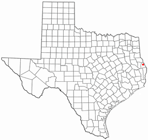
Evadale is an unincorporated community and census-designated place (CDP) in Jasper County, Texas, United States. The population was 1,246 at the 2020 census.

<span class="mw-page-title-main">Central Gardens, Texas</span> Census-designated place in Texas, United States

Central Gardens is an unincorporated community and census-designated place (CDP) in Jefferson County, Texas, United States. The population was 4,373 at the 2020 census. It is part of the Beaumont–Port Arthur metropolitan area.

<span class="mw-page-title-main">Lipscomb, Texas</span> Census-designated place in Texas, United States

Lipscomb is an unincorporated community and census-designated place (CDP) in Lipscomb County, Texas, United States. It is the Lipscomb county seat. The population was 37 at the 2010 census.

<span class="mw-page-title-main">Buchanan Dam, Texas</span> Census-designated place in Texas, United States

Buchanan Dam is a census-designated place (CDP) in Llano County, Texas, United States. The population was 1,519 at the 2010 census, down from 1,688 at the 2000 census.

<span class="mw-page-title-main">Kingsland, Texas</span> Census-designated place in Texas, United States

Kingsland is a census-designated place (CDP) in Llano County, Texas, United States. The population was 6,030 at the 2010 census, up from 4,584 at the 2000 census. Texas Ranch to Market Road 1431 runs through the community.

New Deal is a U.S. town in Lubbock County, Texas. The population was 794 at the 2010 census. It is part of the Lubbock Metropolitan Statistical Area and the Llano Estacado region.

<span class="mw-page-title-main">Deweyville, Texas</span> CDP in Texas, United States

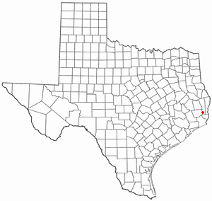
Deweyville is a census-designated place (CDP) in Newton County, on the central eastern border of Texas, United States. The population was 571 at the 2020 census, down from 1,023 at the 2010 census.

<span class="mw-page-title-main">Milam, Texas</span> CDP in Texas, United States

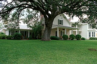
Milam is a census-designated place (CDP) in Sabine County, Texas, United States. It is located along the Sabine River at the junction of Highway 87 and Highway 21. The population was 1,355 at the 2020 census. Milam is the largest city in Sabine County.

<span class="mw-page-title-main">Port Mansfield, Texas</span> CDP in Texas, United States

Port Mansfield is a census-designated place (CDP) in Willacy County, Texas, United States. The population was 226 at the 2010 census.

<span class="mw-page-title-main">Rushmere, Virginia</span> Census-designated place in Virginia, United States

Rushmere is a census-designated place (CDP) in Isle of Wight County, Virginia, United States. The population was 1,018 at the 2010 census.

References

  1. "2019 U.S. Gazetteer Files". United States Census Bureau. Retrieved August 7, 2020.
  2. 1 2 U.S. Geological Survey Geographic Names Information System: Horseshoe Bay, Texas
  3. 1 2 "U.S. Census website". United States Census Bureau . Retrieved January 31, 2008.
  4. "Boundary Changes". Geographic Change Notes: Texas. Population Division, United States Census Bureau. May 19, 2006. Archived from the original on February 6, 2006. Retrieved May 27, 2008.
  5. "US Gazetteer files: 2010, 2000, and 1990". United States Census Bureau. February 12, 2011. Retrieved April 23, 2011.
  6. "Geographic Identifiers: 2010 Demographic Profile Data (G001): Horseshoe Bay city, Texas". U.S. Census Bureau, American Factfinder. Archived from the original on February 12, 2020. Retrieved April 23, 2014.
  7. "Census of Population and Housing". Census.gov. Retrieved June 4, 2015.
  8. "Explore Census Data". data.census.gov. Retrieved May 20, 2022.
  9. https://www.census.gov/ [ not specific enough to verify ]
  10. "About the Hispanic Population and its Origin". www.census.gov. Retrieved May 18, 2022.
  11. Climate Summary for Horseshoe Bay, Texas
  1. Note: the US Census treats Hispanic/Latino as an ethnic category. This table excludes Latinos from the racial categories and assigns them to a separate category. Hispanics/Latinos can be of any race. [9] [10]