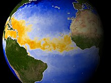
The North Atlantic Oscillation (NAO) is a weather phenomenon over the North Atlantic Ocean of fluctuations in the difference of atmospheric pressure at sea level (SLP) between the Icelandic Low and the Azores High. Through fluctuations in the strength of the Icelandic Low and the Azores High, it controls the strength and direction of westerly winds and location of storm tracks across the North Atlantic.

The 2006 Atlantic hurricane season was the least active in the basin since 1997, with nine named storms as well as an additional unnamed tropical storm identified by the National Hurricane Center. 2006 was the first season since 2001 in which no hurricanes made landfall in the United States, and was the first since 1994 in which no tropical cyclones formed during October. Following the intense activity of 2003, 2004, and 2005, forecasters predicted that the 2006 season would be only slightly less active. Instead, it turned out to be a below average season, as activity was slowed by a rapidly forming moderate El Niño event, the presence of the Saharan Air Layer over the tropical Atlantic, and the steady presence of a robust secondary high-pressure area to the Azores High centered on Bermuda. There were no tropical cyclones after October 2.

The 1925 Atlantic hurricane season was a below-average Atlantic hurricane season during which four tropical cyclones formed. Only one of them was a hurricane. The first storm developed on August 18, and the last dissipated on December 1. The season began at a late date, more than two months after the season began. The official start of the season is generally considered to be June 1 with the end being October 31; however, the final storm of the season formed nearly a month after the official end. Due to increased activity over the following decades, the official end of the hurricane season was shifted to November 30.

A parent to the Florida Current, the Loop Current is a warm ocean current that flows northward between Cuba and the Yucatán Peninsula, moves north into the Gulf of Mexico, loops east and south before exiting to the east through the Florida Straits and joining the Gulf Stream. The Loop Current is an extension of the western boundary current of the North Atlantic subtropical gyre. Serving as the dominant circulation feature in the Eastern Gulf of Mexico, the Loop Currents transports between 23 and 27 sverdrups and reaches maximum flow speeds of from 1.5 to 1.8 meters/second.
This is a list of all known or suspected Atlantic hurricanes up to 1599. Although most storms likely went unrecorded, and many records have been lost, recollections of hurricane occurrences survive from some sufficiently populated coastal areas, and rarely, ships at sea that survived the tempests.

In the Indian Ocean north of the equator, tropical cyclones can form throughout the year on either side of the Indian subcontinent, although most frequently between April and June, and between October and December.

A Pacific hurricane is a tropical cyclone that develops within the northeastern and central Pacific Ocean to the east of 180°W, north of the equator. For tropical cyclone warning purposes, the northern Pacific is divided into three regions: the eastern, central, and western, while the southern Pacific is divided into 2 sections, the Australian region and the southern Pacific basin between 160°E and 120°W. Identical phenomena in the western north Pacific are called typhoons. This separation between the two basins has a practical convenience, however, as tropical cyclones rarely form in the central north Pacific due to high vertical wind shear, and few cross the dateline.

An Atlantic hurricane is a type of tropical cyclone that forms in the Atlantic Ocean primarily between June and November. The terms "hurricane", "typhoon", and "cyclone" can be used interchangeably to describe this weather phenomenon. These storms are rotating, organized systems of clouds and thunderstorms that originate over tropical or subtropical waters and have closed low-level circulation, not to be confused with tornadoes. They form over low pressure systems. In the North Atlantic, central North Pacific, and eastern North Pacific, the term "hurricane" is mainly used, whereas "typhoon" is more commonly used for storms originating in the western North Pacific. The term "cyclone" is used in the South Pacific and Indian Ocean.

Tropical cyclogenesis is the development and strengthening of a tropical cyclone in the atmosphere. The mechanisms through which tropical cyclogenesis occurs are distinctly different from those through which temperate cyclogenesis occurs. Tropical cyclogenesis involves the development of a warm-core cyclone, due to significant convection in a favorable atmospheric environment.

A tropical cyclone is a rapidly rotating storm system with a low-pressure center, a closed low-level atmospheric circulation, strong winds, and a spiral arrangement of thunderstorms that produce heavy rain and squalls. Depending on its location and strength, a tropical cyclone is called a hurricane, typhoon, tropical storm, cyclonic storm, tropical depression, or simply cyclone. A hurricane is a strong tropical cyclone that occurs in the Atlantic Ocean or northeastern Pacific Ocean, and a typhoon occurs in the northwestern Pacific Ocean. In the Indian Ocean and South Pacific, comparable storms are referred to as "tropical cyclones". In modern times, on average around 80 to 90 named tropical cyclones form each year around the world, over half of which develop hurricane-force winds of 65 kn or more. Tropical cyclones carry heat away from the tropics and transport it towards temperate latitudes. This plays an important role in regulating global climate. Tropical cyclones can be very harmful for people.

Tropical cyclone observation has been carried out over the past couple of centuries in various ways. The passage of typhoons, hurricanes, as well as other tropical cyclones have been detected by word of mouth from sailors recently coming to port or by radio transmissions from ships at sea, from sediment deposits in near shore estuaries, to the wiping out of cities near the coastline. Since World War II, advances in technology have included using planes to survey the ocean basins, satellites to monitor the world's oceans from outer space using a variety of methods, radars to monitor their progress near the coastline, and recently the introduction of unmanned aerial vehicles to penetrate storms. Recent studies have concentrated on studying hurricane impacts lying within rocks or near shore lake sediments, which are branches of a new field known as paleotempestology. This article details the various methods employed in the creation of the hurricane database, as well as reconstructions necessary for reanalysis of past storms used in projects such as the Atlantic hurricane reanalysis.

Traditionally, areas of tropical cyclone formation are divided into seven basins. These include the north Atlantic Ocean, the eastern and western parts of the northern Pacific Ocean, the southwestern Pacific, the southwestern and southeastern Indian Oceans, and the northern Indian Ocean. The western Pacific is the most active and the north Indian the least active. An average of 86 tropical cyclones of tropical storm intensity form annually worldwide, with 47 reaching hurricane/typhoon strength, and 20 becoming intense tropical cyclones, super typhoons, or major hurricanes.

The 2009 Atlantic hurricane season was a near-average Atlantic hurricane season that produced eleven tropical cyclones, nine named storms, three hurricanes, and two major hurricanes. It officially began on June 1 and ended on November 30, dates that conventionally delimit the period of each year when most tropical cyclones develop in the Atlantic basin. The season's first tropical cyclone, Tropical Depression One, developed on May 28, while the final storm, Hurricane Ida, dissipated on November 10. The most intense hurricane, Bill, was a powerful Cape Verde-type hurricane that affected areas from the Leeward Islands to Newfoundland. The season featured the lowest number of tropical cyclones since the 1997 season, and only one system, Claudette, made landfall in the United States. Forming from the interaction of a tropical wave and an upper-level low, Claudette made landfall on the Florida Panhandle with maximum sustained winds of 45 mph (70 km/h) before quickly dissipating over Alabama. The storm killed two people and caused $228,000 in damage.

The 2012 Atlantic hurricane season was the final year in a string of three consecutive very active seasons since 2010, with 19 tropical storms. The 2012 season was also a costly one in terms of property damage, mostly due to Hurricane Sandy. The season officially began on June 1 and ended on November 30, dates that conventionally delimit the period during each year in which most tropical cyclones form in the Atlantic Ocean. However, Alberto, the first named system of the year, developed on May 19 – the earliest date of formation since Subtropical Storm Andrea in 2007. A second tropical cyclone, Beryl, developed later that month. This was the first occurrence of two pre-season named storms in the Atlantic basin since 1951. It moved ashore in North Florida on May 29 with winds of 65 mph (105 km/h), making it the strongest pre-season storm to make landfall in the Atlantic basin. This season marked the first time since 2009 where no tropical cyclones formed in July. Another record was set by Hurricane Nadine later in the season; the system became the fourth-longest-lived tropical cyclone ever recorded in the Atlantic, with a total duration of 22.25 days. The final storm to form, Tony, dissipated on October 25 – however, Hurricane Sandy, which formed before Tony, became extratropical on October 29.

The 2013 Atlantic hurricane season was a well below average Atlantic hurricane season in terms of the number of hurricanes. It was the first since 1994 with no major hurricanes, Category 3 or higher on the Saffir–Simpson scale, and the first in the satellite era where no hurricanes reached Category 2 strength. Altogether, the season produced 15 tropical cyclones, of which all but one became a named storm. The season officially began on June 1, 2013, and ended on November 30, 2013. These dates historically describe the period in each year when most tropical cyclogenesis occurs in the North Atlantic and are adopted by convention. The first storm of the season, Andrea, developed on June 5, while the last, an unnamed subtropical storm, dissipated on December 7. Throughout the year, only two storms, Humberto and Ingrid, reached hurricane strength; this was the lowest seasonal total since 1982.

Hurricane Alex was the first Atlantic hurricane to occur in January since Hurricane Alice of 1954–55. Alex originated as a non-tropical low near the Bahamas on January 7, 2016. Initially traveling northeast, the system passed by Bermuda on January 8 before turning southeast and deepening. It briefly acquired hurricane-force winds by January 10, then weakened slightly before curving towards the east and later northeast. Acquiring more tropical weather characteristics over time, the system transitioned into a subtropical cyclone well south of the Azores on January 12, becoming the first North Atlantic tropical or subtropical cyclone in January since Tropical Storm Zeta of 2005–2006. Alex continued to develop tropical features while turning north-northeast, and transitioned into a fully tropical cyclone on January 14. The cyclone peaked in strength as a Category 1 hurricane on the Saffir–Simpson scale (SSHWS), with maximum sustained winds of 85 mph and a central pressure of 981 mbar. Alex weakened to a high-end tropical storm before making landfall on Terceira Island on January 15. By that time, the storm was losing its tropical characteristics; it fully transitioned back into a non-tropical cyclone several hours after moving away from the Azores. Alex ultimately merged with another cyclone over the Labrador Sea on January 17.

Hurricane Ophelia was regarded as the worst storm to affect Ireland in 50 years, and was also the easternmost Atlantic major hurricane on record. The tenth and final consecutive hurricane and the sixth major hurricane of the very active 2017 Atlantic hurricane season, Ophelia had non-tropical origins from a decaying cold front on 6 October. Located within a favorable environment, the storm steadily strengthened over the next two days, drifting north and then southeastwards before becoming a hurricane on 11 October. After becoming a Category 2 hurricane and fluctuating in intensity for a day, Ophelia intensified into a major hurricane on 14 October south of the Azores, brushing the archipelago with high winds and heavy rainfall. Shortly after achieving peak intensity, Ophelia began weakening as it accelerated over progressively colder waters to its northeast towards Ireland and Great Britain. Completing an extratropical transition early on 16 October, Ophelia became the second storm of the 2017–18 European windstorm season. Early on 17 October, the cyclone crossed the North Sea and struck western Norway, with wind gusts up to 70 kilometres per hour (43 mph) in Rogaland county, before weakening during the evening of 17 October. The system then moved across Scandinavia, before dissipating over Norway on the next day.

Paleotempestology is the study of past tropical cyclone activity by means of geological proxies as well as historical documentary records. The term was coined by American meteorologist Kerry Emanuel.