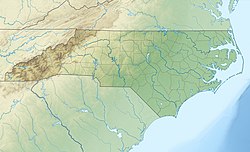
Hyco Lake is a reservoir in Person and Caswell counties, North Carolina. It is the area's main destination for fishing, boating, water skiing, wake boarding, and recreation and is the larger of Person County's two lakes, the other being Mayo Lake. The lake was formed from the Hyco River and has three main tributaries; North Hyco Creek, South Hyco Creek, and Cobbs Creek. Interest in the lake for vacation homes has created numerous homes along its shores with relatively high property values. Over 1500 homes have been constructed around the lake with approximately 800 occupied year-round. It runs through the following municipalities: Semora, Leasburg, and the city of Roxboro located about ten miles (16km) from the lake.
Hyco Lake was constructed in the early 1960s by Carolina Power and Light Company (now Duke Energy Progress) as a cooling reservoir for their power generating plant. Since its establishment, the lake and its recreation park have been under the jurisdiction of the Person-Caswell Lake Authority. The water is regulated by the North Carolina Department of Environment and Natural Resources. Duke Energy Progress owns the land surrounding the lake up to the 420-foot (130m) above-sea-level mark. The lake covers 3,750 acres (1,520ha), containing about 25billion US gallons (95,000,000m3) of water, with 120 miles (190km) of shoreline. Hurricane Hilda elevated Hyco Lake's water level.
The name Hyco is derived from "Hicotaminy" which is what the native Indians called the area due to the number of turkey buzzards which were and still are in the area. Hicotaminy means "great turkey buzzard".
Person County is a county located in the U.S. state of North Carolina. The population was 39,464 at the 2010 census. The county seat is Roxboro.
Roxboro is a city and the county seat of Person County, North Carolina in the United States. The population was 8,362 at the 2010 census. The city is 30 miles (48 km) north of Durham and is a part of the four-county Durham–Chapel Hill Metropolitan Statistical Area, which has a population of 504,357 as of the 2010 Census. The Durham–Chapel Hill MSA is a part of the larger Raleigh–Durham–Cary Combined Statistical Area, which has a population of 1,749,525 as of the 2010 Census.
Lake Norman State Park, formerly Duke Power State Park, is a 1,942-acre (7.86 km2) North Carolina state park near Troutman, Iredell County, North Carolina in the United States. The park is on the northern shore of Lake Norman at the mouth of Hicks Creek. The park is open for year-round recreation including, boating, fishing, water skiing, swimming and camping. Lake Norman State Park is on Inland Sea Road in Troutman just off U.S. Route 70 between Interstates 40 and 77.
Lake Wylie is a reservoir, or man-made lake in the U.S. states of both South Carolina and North Carolina. The lake has a surface area of 13,400 acres and features 325 miles (523 km) of shore line.
Lake Tillery is a reservoir between Falls Reservoir and Blewett Falls Lake in the Uwharrie Lakes Region of North Carolina. It is entirely within Stanly County and Montgomery County, NC. The lake was created by impounding the Pee Dee River, which is created by the confluence of the Yadkin River and the Uwharrie River several miles to the north. Norwood, NC in neighboring Stanly County uses as its town motto "Gateway to Lake Tillery".
Leasburg is a former town and the former county seat of Caswell County, North Carolina. The community has a partial presence in Person County. The population was 1,662 at the 2010 census. It was named in honor of longtime resident William Lea and is located along US 158 and NC 119 near Hyco Lake. Leasburg is also the name of a Caswell County township.
Semora is an unincorporated community in Caswell County, North Carolina. It lies just northwest of Hyco Lake and has some presence in Person County. Semora is home to one of the oldest churches in North Carolina, the Red House Presbyterian Church.
Mayo Lake is a reservoir located in northeastern Person County, North Carolina. Boating entrance, walking trails, swimming access, picnic and camp site areas are accessed from Neals Store Road about 9 miles north of the city of Roxboro along NC 49. It is smaller than Hyco Lake located on the northwestern side of Person County.
The Hyco River is a tributary of the Dan River, which is a tributary of the Roanoke River. All three rivers flow through the U.S. states of North Carolina and Virginia. In Person County, North Carolina the Hyco River is impounded by a dam, forming Hyco Lake. The main part of the river flows through Allensville, North Carolina, on Gentry's Ridge and Mill Creek roads as it flows into Virginia townships such as Alton, Virginia, and Cluster Springs, Virginia, then combining with the Dan River.
Lake Keowee is a man-made reservoir in the United States in the state of South Carolina. It was created to serve the needs of a power utility as well as public recreational purposes. It is approximately 26 miles (42 km) long, 3 miles (4.8 km) wide, with an average depth of 54 feet (16 m), and a shoreline measured at 300 miles (480 km) in total, and is approximately 800 feet (240 m) above sea level. It began in 1971 as a massive demolition and building project, including the construction of two large dams––Keowee Dam and Little River Dam––and covered 18,372 acres (74.35 km2) of the state. The lake collects or impounds waters from the Keowee River and the Little River and others, and the outflows below the respective dams join to form the Seneca River which flows into the larger Savannah River. Lake water helps to cool Duke Energy's three nuclear reactors located at the Oconee Nuclear Generating Station. In addition, the force of falling water through gravity helps generate hydroelectric power. The Keowee Hydro Station generates 158 megawatts from the lake's outflows. In addition, Lake Keowee has been touted as a recreational destination for fishing, boating, swimming, sailing, kayaking and other watersports, and the lake has been described as having pure and clean water. The name Keowee (ᎨᎣᏫ) is a Cherokee name roughly translated as "place of the mullberries." The former Keowee River, which was inundated by Lake Keowee, had been part of the Cherokee Lower Towns region, and Keowee Town had been located on the bank of the Keowee River.
Sutton Lake is a 1,520-acre (6 km2) reservoir on the Elk River in Braxton and Webster counties, West Virginia. Sutton Lake is located just upstream of Sutton. It was authorized by Congress in the Flood Control Act of 1938. Construction of the dam began in 1956 and was completed in 1961. The dam is 210 feet (64 m) high, 1,178 feet (359 m) long, and constructed of concrete. The lake was named by Congressional action, Public Law 90-46, July 4, 1967.
Lake James is a large reservoir in the mountains of Western North Carolina which straddles the border between Burke and McDowell Counties. It is named for tobacco tycoon and benefactor of Duke University, James Buchanan Duke. The lake, with surface elevation of 1200 ft, lies behind a series of 4 earthen dams. It was created by Duke Power between 1916-1923 as a hydro-electric project. It still generates power today and is the uppermost lake on the Catawba River system.
The Central Utah Project is a US federal water project that was authorized for construction under the Colorado River Storage Project Act of April 11, 1956, as a participating project. In general, the Central Utah Project develops a portion of Utah's share of the yield of the Colorado River, as set out in the Colorado River Compact of 1922.
Lake Greenwood was formed by a hydroelectric dam built across the Saluda River near Chappells SC. The impoundment was licensed by the Federal Power Commission, predecessor to the current Federal Energy Regulatory Commission (FERC), as the Buzzards Roost Project. The project was re-licensed by FERC in 1995. The FERC Project No is P-1267. The lake has 212 miles (341 km) of shoreline and 11,400 acres (46 km2). While the waters of Lake Greenwood extend into three counties, Greenwood County actually owns the entire lake bed, having purchased all properties comprising the bed of the lake from farmers along both sides of the rivers in the late 1930s. Funding was provided by loans from the Public Works Administration during the Great Depression. All loans were later repaid in full. The Saluda River, the Reedy River and Rabon Creek come together to feed Lake Greenwood. There is also a local watershed surrounding the basin from which local rain also drains into the reservoir. Water released from Lake Greenwood feeds into the Saluda River at Chappells, which ultimately feeds into Lake Murray.
Lake Wateree is a 21 square miles (50 km2) reservoir in Kershaw, Fairfield, and Lancaster counties, South Carolina, in the United States. It is one of South Carolina's oldest man-made lakes. It has 181 miles (291 km) of shoreline and includes Lake Wateree State Park, a bird refuge, and Shaw Air Force Base Recreation center. Its name, like that of the river, recalls the now-extinct Wateree Native Americans, who lived in the area prior to European settlement.
The Bad Creek Hydroelectric Station is a pumped-storage hydroelectric power station located 8 miles (13 km) north of Salem in Oconee County, South Carolina. The 1,065 megawatts (1,428,000 hp) power plant is owned by Duke Energy and its last generator was commissioned in 1991. The power station generates electricity by shifting water between an upper and lower reservoir. The upper Bad Creek Reservoir was created by damming Bad Creek and West Bad Creek while Lake Jocassee serves as the lower reservoir. During periods of low energy demand, the four 266 megawatts (357,000 hp) Francis pump turbines pump water from Lake Jocassee which lies at an elevation of 1,110 feet (340 m) to the Bad Creek Reservoir at an elevation of 2,310 ft (704 m) through a 1 mile (1.6 km) tunnel. When energy demand is high, water is released back from Bad Creek Reservoir back down to the pump turbines which then operate as generators. After electricity is produced, the water is returned to Lake Jocassee. The process is repeated as needed, primarily with the facility serving as a peaking power plant.
Cane Creek is a 5.10 mi (8.21 km) long 3rd order tributary to the Hyco River in Person County, North Carolina. Cane Creek joins the Hyco River within Hyco Lake.
Cobbs Creek is a 7.08 mi (11.39 km) long 2nd order tributary to Hyco Creek in Person County, North Carolina. Cobbs Creek joins Hyco Creek within Hyco Lake.
Reedy Fork is a 10.13 mi (16.30 km) long 2nd order tributary to Hyco Creek in Caswell County, North Carolina. Reedy Fork joins Hyco Creek within Hyco Lake.
Negro Creek is a 4.80 mi (7.72 km) long 2nd order tributary to Hyco Creek in Caswell County, North Carolina.
This page is based on this Wikipedia article Text is available under the CC BY-SA 4.0 license; additional terms may apply. Images, videos and audio are available under their respective licenses.