Weather forecasting is the application of science and technology to predict the conditions of the atmosphere for a given location and time. People have attempted to predict the weather informally for millennia and formally since the 19th century.

The National Weather Service (NWS) is an agency of the United States federal government that is tasked with providing weather forecasts, warnings of hazardous weather, and other weather-related products to organizations and the public for the purposes of protection, safety, and general information. It is a part of the National Oceanic and Atmospheric Administration (NOAA) branch of the Department of Commerce, and is headquartered in Silver Spring, Maryland, within the Washington metropolitan area. The agency was known as the United States Weather Bureau from 1890 until it adopted its current name in 1970.

The Meteorological Office, abbreviated as the Met Office, is the United Kingdom's national weather service. It is an executive agency and trading fund of the Department for Science, Innovation and Technology and is led by CEO Penelope Endersby, who took on the role as Chief Executive in December 2018 and is the first woman to do so. The Met Office makes meteorological predictions across all timescales from weather forecasts to climate change.

Fleet Numerical Meteorology and Oceanography Center (FNMOC) provides worldwide meteorological and oceanographic data and analysis for the United States Navy and strategic allies of the United States. The center is based out of Monterey, California. FNMOC provides Global and Regional Weather Prediction Charts (WXMAP) and Global Ensemble Weather Prediction Charts (EFS). WxMAP depictions of NAVGEM predictions for side-by-side comparison with NCEP global NWS models (GFS) are also available. FNMOC provides Global and Regional Ocean Wave Prediction Charts (WW3), Global Ensemble Ocean Wave Prediction Charts, and Global Sea Surface Temperature and Sea Surface Anomaly Charts (NCODA). FNMOC provides links to satellite imagery of tropical cyclones (TCWEB) and current tropical storm forecast tracks.

Oceanic and Atmospheric Research (OAR) is a division of the National Oceanic and Atmospheric Administration (NOAA). OAR is also referred to as NOAA Research.
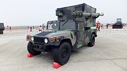
The Army Battle Command System (ABCS) is a digital Command, Control, Communications, Computers and Intelligence (C4I) system for the US Army. It includes a mix of fixed/semi-fixed and mobile networks. It is also designed for interoperability with US and Coalition C4I systems.

The 11th Corps Signal Brigade of the United States Army is an element of Army Forces Command. It is based at Fort Hood, Texas. The unit mascot is the Thunderbird, a hawk-like bird perched upon a globe shooting thunderbolts out of its eyes. Soldiers in this unit call themselves "The Thunderbirds."
Battlespace or battle-space is a term used to signify a military strategy which integrates multiple armed forces for the military theatre of operations, including air, information, land, sea, cyber and outer space to achieve military goals. It includes the environment, factors, and conditions that must be understood to successfully apply combat power, protect the force, or complete the mission. This includes enemy and friendly armed forces, infrastructure, weather, terrain, and the electromagnetic spectrum within the operational areas and areas of interest.
TAMDAR is a weather monitoring system that consists of an in situ atmospheric sensor mounted on commercial aircraft for data gathering. It collects information similar to that collected by radiosondes carried aloft by weather balloons. It was developed by AirDat LLC, which was acquired by Panasonic Avionics Corporation in April 2013 and was operated until October 2018 under the name Panasonic Weather Solutions. It is now owned by FLYHT Aerospace Solutions Ltd.
The FCS Network - Brigade Combat Team (BCT) Network consists of five layers that deliver data to forward-deployed Army units.
The Unified Model is a numerical weather prediction and climate modeling software suite originally developed by the United Kingdom Met Office, and now both used and further developed by many weather-forecasting agencies around the world. The Unified Model gets its name because a single model is used across a range of both timescales and spatial scales. The models are grid-point based, rather than wave based, and are run on a variety of supercomputers around the world. The Unified Model atmosphere can be coupled to a number of ocean models. At the Met Office it is used for the main suite of Global Model, North Atlantic and Europe model (NAE) and a high-resolution UK model (UKV), in addition to a variety of Crisis Area Models and other models that can be run on demand. Similar Unified Model suites with global and regional domains are used by many other national or military weather agencies around the world for operational forecasting.

The Naval Meteorology and Oceanography Command (COMNAVMETOCCOM) or CNMOC, serves as the operational arm of the Naval Oceanography Program. Headquartered at the Stennis Space Center in Mississippi, CNMOC is an echelon three command reporting to United States Fleet Forces Command (USFLTFORCOM). CNMOC's clemency is globally distributed, with assets on larger ships, shore facilities at fleet concentration areas, and larger production centers in the US.
The Integrated Forecasting System (IFS) is a global numerical weather prediction system jointly developed and maintained by the European Centre for Medium-Range Weather Forecasts (ECMWF) based in Reading, England, and Météo-France based in Toulouse. The version of the IFS run at ECMWF is often referred to as the "ECMWF" or the "European model" in North America, to distinguish it from the American Global Forecast System.

The Army will continue the development and fielding of an incremental ground tactical network capability to all Army brigade combat teams. This network is a layered system of interconnected computers and software, radios, and sensors within the Brigade Combat Team (BCT). The BCT network is essential to enable Unified Battle Command and will be delivered to the Army's Brigade Combat Teams in increasing capability increments. The first increment is currently finishing SDD developmental and operational testing and will be delivered to Infantry Brigade Combat Teams in the form of Network Integration Kits (B-kits) with E-IBCT.
Automated Weather Source (AWS) was a partnership and later a corporation founded in 1992 by James Michael "Mike" Bailey and Charles "Topper" Shutt of Montgomery County, Maryland, whose purpose was to create a network of weather stations located at public schools and recreational facilities throughout the Mid-Atlantic region of the United States.

Staff Weather Officers (SWOs) are United States Air Force personnel tasked with providing tactical meteorological support for conventional Army forces.

The United States Army Futures Command (AFC) is a United States Army command, designed as a public-private initiative, that runs modernization projects for the Army. General Mark Milley, in his role as the United States Army Chief of Staff, played a pivotal role in the establishment of the Army Futures Command (AFC). It is headquartered in Austin, Texas, and was first commanded by General John Murray, formerly the Army's G-8; the second and current commander was formerly the Army's G-3/5/7.
The Smart Weapon End-to-End Performance Model (SWEEPM) is a modeling software developed by the United States Army Research Laboratory (ARL), designed to measure the overall effectiveness of all types of munitions. SWEEPM was conceived in 2008 and completed in April 2013.

Fleet Weather Center San Diego (FWC-SD), is an Echelon IV command reporting to Commander Naval Meteorology and Oceanography Command and part of the Information Warfare Community. FWC-SD is located on Naval Air Station North Island in San Diego, California, and consists of approximately 400 civilian, military and contract personnel across the Indo-Pacific who are responsible for delivering meteorology and oceanographic capability to Navy, Joint, and Coalition forces operating in Third, Fifth, and Seventh Fleets.
The Atmospheric Sciences Laboratory (ASL) was a research institution under the U.S. Army Materiel Command that specialized in artillery meteorology, electro-optical climatology, atmospheric optics data, and atmospheric characterization from 1965 to 1992. ASL was one of the seven Army laboratories that merged to form the U.S. Army Research Laboratory (ARL) in 1992.