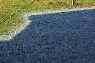
Frost is a thin layer of ice on a solid surface, which forms from water vapor that deposits onto a freezing surface. Frost forms when the air contains more water vapor than it can normally hold at a specific temperature. The process is similar to the formation of dew, except it occurs below the freezing point of water typically without crossing through a liquid state.

Hail is a form of solid precipitation. It is distinct from ice pellets, though the two are often confused. It consists of balls or irregular lumps of ice, each of which is called a hailstone. Ice pellets generally fall in cold weather, while hail growth is greatly inhibited during low surface temperatures.

Snow comprises individual ice crystals that grow while suspended in the atmosphere—usually within clouds—and then fall, accumulating on the ground where they undergo further changes. It consists of frozen crystalline water throughout its life cycle, starting when, under suitable conditions, the ice crystals form in the atmosphere, increase to millimeter size, precipitate and accumulate on surfaces, then metamorphose in place, and ultimately melt, slide or sublimate away.

Lake-effect snow is produced during cooler atmospheric conditions when a cold air mass moves across long expanses of warmer lake water. The lower layer of air, heated by the lake water, picks up water vapor from the lake and rises through colder air. The vapor then freezes and is deposited on the leeward (downwind) shores.
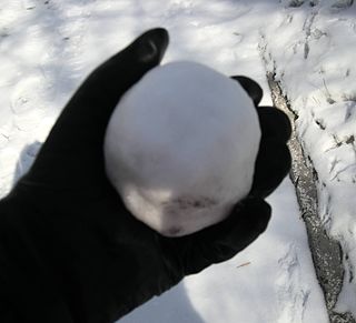
A snowball is a spherical object made from snow, usually created by scooping snow with the hands, and pressing the snow together to compact it into a ball. Snowballs are often used in games such as snowball fights.
Freezing rain is rain maintained at temperatures below freezing by the ambient air mass that causes freezing on contact with surfaces. Unlike a mixture of rain and snow or ice pellets, freezing rain is made entirely of liquid droplets. The raindrops become supercooled while passing through a sub-freezing layer of air hundreds of meters above the ground, and then freeze upon impact with any surface they encounter, including the ground, trees, electrical wires, aircraft, and automobiles. The resulting ice, called glaze ice, can accumulate to a thickness of several centimeters and cover all exposed surfaces. The METAR code for freezing rain is FZRA.
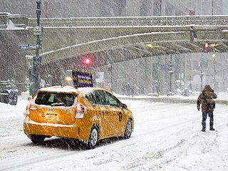
A winter storm is an event in which wind coincides with varieties of precipitation that only occur at freezing temperatures, such as snow, mixed snow and rain, or freezing rain. In temperate continental and subarctic climates, these storms are not necessarily restricted to the winter season, but may occur in the late autumn and early spring as well. A snowstorm with strong winds and other conditions meeting certain criteria is called a blizzard.

Hailuoto is a Finnish island in the northern Baltic Sea and a municipality in Northern Ostrobothnia region. The population of Hailuoto is 951, making it the smallest municipality in Northern Ostrobothnia and the former Oulu Province in terms of population. The municipality covers an area of 205.65 km2 (79.40 sq mi) of which 1.70 km2 (0.66 sq mi) is inland water. The population density is 4.62/km2 (12.0/sq mi). Of all the Finnish sea islands, Hailuoto is the third largest after Fasta Åland and Kimitoön.

Marimo is a rare growth form of Aegagropila linnaei in which the algae grow into large green balls with a velvety appearance.

A snow roller is a rare meteorological phenomenon in which cylindrical snowballs are formed naturally as chunks of snow roll down hill or are blown along the ground by wind, picking up further snow along the way, in much the same way that the large snowballs used in snowmen are made. They can be as small as a tennis ball, but they can also be bigger than a car. Most snow rollers are a few inches or centimeters wide.
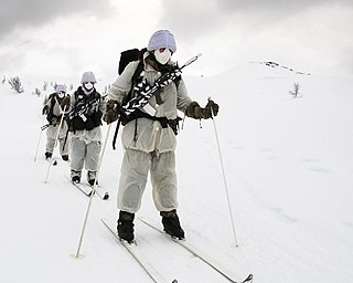
Cold-weather warfare, also known as arctic warfare or winter warfare, encompasses military operations affected by snow, ice, thawing conditions, or cold, both on land and at sea, as well as the strategies and tactics used by military forces in these situations and environments.

A snow squall, or snowsquall, is a sudden moderately heavy snowfall with blowing snow and strong, gusty surface winds. It is often referred to as a whiteout and is similar to a blizzard but is localized in time or in location and snow accumulations may or may not be significant.

Graupel, also called soft hail, hominy snow, or snow pellets, is precipitation that forms when supercooled water droplets in air are collected and freeze on falling snowflakes, forming 2–5 mm (0.08–0.20 in) balls of crisp, opaque rime.
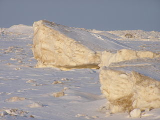
Shelf ice is ice that forms when a portion of a lake surface freezes. It is often then washed upon the shore. The phenomenon is common within the Great Lakes.
The Early Winter 2006 North American storm complex was a severe winter storm that occurred on November 26, 2006, and continued into December 1. It affected much of North America in some form, producing various kinds of severe weather including a major ice storm, blizzard conditions, high winds, extreme cold, a serial derecho and some tornadoes.

It is very rare for snow to fall in the U.S. state of Florida, especially in the central and southern portions of the state. With the exception of the far northern areas of the state, most of the major cities in Florida have never recorded measurable snowfall, though trace amounts have been recorded, or flurries in the air observed few times each century. According to the National Weather Service, in the Florida Keys and Key West there is no known occurrence of snow flurries since the European colonization of the region more than 300 years ago. In Miami, Fort Lauderdale, and Palm Beach there has been only one known report of snow flurries observed in the air in more than 200 years; this occurred in January 1977. In any event, Miami, Fort Lauderdale, and Palm Beach have not seen snow flurries before or since this 1977 event.
Blowing snow is snow lifted from the surface by the wind, at eye level or more, that will reduce visibility. Blowing snow can come from falling snow or snow that already accumulated on the ground but is picked up and blown about by strong winds. It is one of the classic requirements for a blizzard. Its METAR code is BLSN. If the snow remains below 1.8 m (6 ft), it will be called drifting snow. The snow which is being blown about may deposit as snowdrifts.

Classifications of snow describe and categorize the attributes of snow-generating weather events, including the individual crystals both in the air and on the ground, and the deposited snow pack as it changes over time. Snow can be classified by describing the weather event that is producing it, the shape of its ice crystals or flakes, how it collects on the ground, and thereafter how it changes form and composition. Depending on the status of the snow in the air or on the ground, a different classification applies.

A sno-ball is a confection made with finely shaved ice and flavored sugar syrup. Commonly confused with the snow cone, the ice of a sno-ball is fine and fluffy; while a snow cone's ice is coarse, crunchy, and granular. Moreover, whereas in a snow cone the flavored syrup sinks to the bottom of the cup, in a sno-ball the ice absorbs the syrup.

The 2019–20 North American winter was unusually warm for many parts of the United States; in many areas, neutral ENSO conditions controlled the weather patterns, resulting in the sixth-warmest winter on record, and many areas in the Northeastern United States saw one of the least snowy winters in years. In fact, Baltimore and Islip saw no snow in February for the first time. Some notable events still occurred, such as a powerful blizzard that impacted the Western United States in late November, a series of cold shots in January and February, a snowstorm within the Texas Panhandle and a late-season blizzard in the High Plains.

