Igiugig, Alaska

Last updated

Igiugig, Alaska
Igyaraq
St. Nicholas Church, Igiugig, Alaska.jpg
AKMap-doton-Igiugig.PNG
Location of Igiugig, Alaska
Relief map of USA Alaska.png
Red pog.svg
Igiugig, Alaska
North America laea relief location map with borders.jpg
Red pog.svg
Igiugig, Alaska
Coordinates: 59°19′49″N155°54′29″W / 59.33028°N 155.90806°W / 59.33028; -155.90806
Country United States
State Alaska
Borough Lake and Peninsula
Government
  Borough mayor Glen Alsworth, Sr. [1]
   State senator Lyman Hoffman (D) [2]
   State rep. Bryce Edgmon (I)
Area
[3]
  Total22.12 sq mi (57.30 km2)
  Land21.07 sq mi (54.58 km2)
  Water1.05 sq mi (2.71 km2)
Elevation
50 ft (20 m)
Population
 (2020)
  Total68
  Density3.23/sq mi (1.25/km2)
Time zone UTC-9 (Alaska (AKST))
  Summer (DST) UTC-8 (AKDT)
Area code 907
FIPS code 02-34790
Website igiugig.com
Igiugig, Alaska

Igiugig (Central Yupik : Igyaraq) is a census-designated place (CDP) in Lake and Peninsula Borough, Alaska, United States. The population was 68 at the 2020 census, [4] up from 54 in 2010. [5] The village is at the source of the Kvichak River, at the outlet of Lake Iliamna.

Contents

History

The word Igiugig means "Like a throat that swallows water". The village is named for its location at the outlet of Lake Iliamna, where it flows into the Kvichak River. Most of the population is made up of Yupik Eskimos, Aleuts, and Athabascan Indians. [6]

Geography

Igiugig is located at 59°19′49″N155°54′29″W / 59.33028°N 155.90806°W / 59.33028; -155.90806 (59.330327, -155.907926), [7] at the southwest end of Lake Iliamna.

According to the United States Census Bureau, the CDP has a total area of 22.1 square miles (57.3 km2), of which 20.6 square miles (53.3 km2) are land and 1.5 square miles (4.0 km2), or 6.98%, are water. [5]

Demographics

Historical population
CensusPop.Note
1970 36
1980 33−8.3%
1990 330.0%
2000 5360.6%
2010 541.9%
2020 6825.9%
U.S. Decennial Census [8]

Igiugig first appeared on the 1970 U.S. Census as an unincorporated village. It was made a census-designated place (CDP) in 1980.

As of the census [9] of 2000, there were 53 people, 16 households, and 13 families residing in the CDP. The population density was 2.7 inhabitants per square mile (1.0/km2). There were 20 housing units at an average density of 1.0 per square mile (0.39/km2). The racial makeup of the CDP was 16.98% White, 71.70% Native American, and 11.32% from two or more races. 1.89% of the population were Hispanic or Latino of any race.

There were 16 households, out of which 43.8% had children under the age of 18 living with them, 56.3% were married couples living together, 25.0% had a female householder with no husband present, and 18.8% were non-families. 18.8% of all households were made up of individuals, and 6.3% had someone living alone who was 65 years of age or older. The average household size was 3.31 and the average family size was 3.77.

In the CDP, the population was spread out, with 43.4% under the age of 18, 1.9% from 18 to 24, 32.1% from 25 to 44, 17.0% from 45 to 64, and 5.7% who were 65 years of age or older. The median age was 36 years. For every 100 females, there were 76.7 males. For every 100 females age 18 and over, there were 100.0 males.

The median income for a household in the CDP was $21,750, and the median income for a family was $22,250. The per capita income for the CDP was $13,172. None of the families and 6.9% of the population were below the poverty line. All of the people living in poverty are aged 65 or above.

Related Research Articles

<span class="mw-page-title-main">Lake and Peninsula Borough, Alaska</span> Borough in Alaska, United States

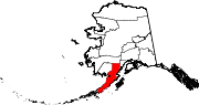
Lake and Peninsula Borough is a borough in the state of Alaska. As of the 2020 census, the population was 1,476, down from 1,631 in 2010. The borough seat of King Salmon is located in neighboring Bristol Bay Borough, although is not the seat of that borough. The most populous community in the borough is the census-designated place of Port Alsworth. With an average of 0.017 inhabitants per square kilometre, the Lake and Peninsula Borough is the second least densely populated organized county-equivalent in the United States; only the unorganized Yukon-Koyukuk Census Area has a lower density.

<span class="mw-page-title-main">Atmautluak, Alaska</span> CDP in Alaska, United States

Atmautluak is a census-designated place (CDP) in Bethel Census Area, Alaska, United States. The population was 277 at the 2010 census, down from 294 in 2000.

<span class="mw-page-title-main">Kipnuk, Alaska</span> CDP in Alaska, United States

Kipnuk is a census-designated place (CDP) in Bethel Census Area, Alaska, United States. At the 2010 census the population was 639, down from 644 in 2000.

<span class="mw-page-title-main">Kongiganak, Alaska</span> CDP in Alaska, United States

Kongiganak is a census-designated place (CDP) in Bethel Census Area, Alaska, United States, and primarily sits on the eastern shore of the Kongiganak River. As of the 2010 census, the population was 439, up from 359 in 2000.

<span class="mw-page-title-main">Kwigillingok, Alaska</span> CDP in Alaska, United States

Kwigillingok is a census-designated place (CDP) in Bethel Census Area, Alaska, United States. The population was 321 at the 2010 census, down from 338 in 2000.

<span class="mw-page-title-main">Tuluksak, Alaska</span> CDP in Alaska, United States

Tuluksak is a census-designated place (CDP) in Bethel Census Area, Alaska, United States. At the 2010 census the population was 373, down from 428 in 2000.

<span class="mw-page-title-main">Tununak, Alaska</span> CDP in Alaska, United States

Tununak(Too-new-nak) is a census-designated place (CDP) in Bethel Census Area, Alaska, United States. At the 2020 census, the population was 411.

<span class="mw-page-title-main">Naknek, Alaska</span> Place in Alaska

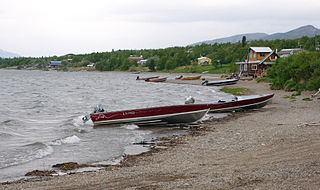
Naknek is a census-designated place located in and the borough seat of Bristol Bay Borough in the U.S. state of Alaska. As of the 2020 census, the population of the CDP was 470, down from 544 in 2010.

<span class="mw-page-title-main">Koliganek, Alaska</span> Census-designated place in Alaska, United States

Koliganek is a census-designated place (CDP) in Dillingham Census Area, Alaska, United States. It is located along the Nushagak River At the 2010 census, the population was 209, up from 182 in 2000.

Togiak is a city in Dillingham Census Area, Alaska, United States. At the 2010 census the population was 817, up from 809 in 2000.

<span class="mw-page-title-main">Twin Hills, Alaska</span> Census-designated place in Alaska, United States

Twin Hills is a census-designated place (CDP) in Dillingham Census Area, Alaska, United States. The population was 74 at the 2010 census, up from 69 in 2000.

<span class="mw-page-title-main">Nanwalek, Alaska</span> Census-designated place in Alaska, United States

Nanwalek, formerly Alexandrovsk and later English Bay, is a census-designated place (CDP) in the Kenai Peninsula Borough, Alaska, United States, that contains a traditional Alutiiq village. The population was 254 at the 2010 census, up from 177 in 2000. There is one school located in the community, attended by 76 students.

<span class="mw-page-title-main">Iliamna, Alaska</span> Census-designated place in Alaska, United States

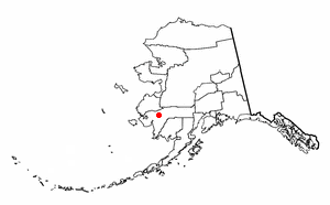
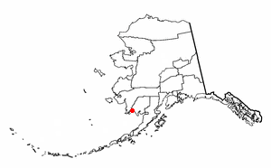
Iliamna is a census-designated place (CDP) in Lake and Peninsula Borough, Alaska, United States. The population was 108 at the 2020 census, slightly down from 109 in 2010.

Kokhanok is a census-designated place (CDP) in Lake and Peninsula Borough, Alaska, United States. At the 2020 census the population was 152, down from 170 in 2000.

<span class="mw-page-title-main">Levelock, Alaska</span> Census-designated place in Alaska, United States

Levelock is a census-designated place (CDP) along the Kvichak River in Lake and Peninsula Borough, Alaska, United States. It was known by the indigenous name of Kivichakh, a variant of Kvichak. At the 2020 census the population was 69, same amount as in 2010.

Newhalen is a city in Lake and Peninsula Borough, Alaska, United States. At the 2020 census, the population was 168.

<span class="mw-page-title-main">Nondalton, Alaska</span> Town in Alaska, United States

Nondalton is a town on the west shore of Six Mile Lake in the Lake and Peninsula Borough, Alaska, United States. At the 2020 census, the population was 133, down from 164 in 2010.

<span class="mw-page-title-main">Pedro Bay, Alaska</span> Census-designated place in Alaska, United States

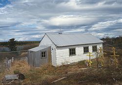
Pedro Bay is a census-designated place (CDP) in Lake and Peninsula Borough, Alaska, United States. The population was 43 as of the 2020 census, slightly up from 42 in 2010.

Pope-Vannoy Landing is a census-designated place (CDP) in the Lake and Peninsula Borough in the U.S. state of Alaska. The population was six at the 2020 census, same amount as in 2010.

<span class="mw-page-title-main">Port Alsworth, Alaska</span> Census-designated place in Alaska, United States

Port Alsworth is a census-designated place (CDP) in Lake and Peninsula Borough, Alaska, United States. It is 165 miles (266 km) by air southwest of Anchorage. The population was 186 at the 2020 census, up from 159 in 2010. It is the most populated community in the borough.

References

  1. 2015 Alaska Municipal Officials Directory. Juneau: Alaska Municipal League. 2015. p. 12.
  2. "Senator Lyman Hoffman". Alaska Senate Majority. Alaskasenate.org. Archived from the original on April 8, 2020. Retrieved November 16, 2019.
  3. "2020 U.S. Gazetteer Files". United States Census Bureau. Retrieved October 29, 2021.
  4. "2020 Census Data - Cities and Census Designated Places" (Web). State of Alaska, Department of Labor and Workforce Development. Retrieved December 5, 2021.
  5. 1 2 "Geographic Identifiers: 2010 Census Summary File 1 (G001), Iguigig CDP, Alaska (revision of 08-05-2013)". American FactFinder. U.S. Census Bureau. Archived from the original on February 13, 2020. Retrieved August 14, 2019.
  6. "Welcome to Igiugig". Igiugig Village Council. Retrieved June 29, 2012.
  7. "US Gazetteer files: 2010, 2000, and 1990". United States Census Bureau. February 12, 2011. Retrieved April 23, 2011.
  8. "U.S. Decennial Census". Census.gov. Retrieved June 6, 2013.
  9. "U.S. Census website". United States Census Bureau . Retrieved January 31, 2008.