Indian Springs, Nevada

Last updated
Indian Springs
Indian Springs Nevada 1.jpg
Clark County Nevada Incorporated Areas Indian Springs highlighted.svg
Location of Indian Springs in Clark County, Nevada
Usa edcp location map.svg
Red pog.svg
Indian Springs
Location in the United States
Coordinates: 36°34′18″N115°40′38″W / 36.57167°N 115.67722°W / 36.57167; -115.67722
Country United States
State Nevada
County Clark
Founded1906;118 years ago (1906)
Named for Native Americans and Spring
Area
[1]
  Total18.04 sq mi (46.72 km2)
  Land18.04 sq mi (46.72 km2)
  Water0.00 sq mi (0.00 km2)
Elevation
3,169 ft (966 m)
Population
 (2020)
  Total912
  Density50.55/sq mi (19.52/km2)
Time zone UTC-8 (PST)
  Summer (DST) UTC-7 (PDT)
ZIP code
89018
Area code(s) 702 and 725
FIPS code 32-35300
GNIS feature ID0847373
Website Indian Springs Town Advisory Board

Indian Springs is an unincorporated town [2] and a census-designated place located on U.S. Route 95 next to Creech Air Force Base in northwestern Clark County and southern Nevada.

Contents

The population was 991 at the 2010 census. [3]

History

The community was named for the fact that Native Americans had settled on the springs near the original town site. [4]

In 1906, Indian Springs became a way station and watering place for the Las Vegas and Tonopah Railroad. The original rail line ran under what is now US 95. The LV&T ceased operation in 1918.

Army Air Forces to Air Force Base

Indian Springs Auxiliary Airfield also known as Indian Springs Field, was rapidly constructed in Nevada by the United States Army Air Forces the month after the Pearl Harbor attack. Indian Springs was immediately entered into service as a training camp for Army Air Force B-25 air-to-air gunnery training, and as a divert field for Las Vegas Army Airfield.

In 1947, Las Vegas AAF was inactivated, and so was Indian Springs.

One year later, Indian Springs was reactivated as Indian Springs Air Force Base by the new United States Air Force, with a new role as a new weapons systems and aircraft research and testing. Among these missions were support for nuclear arms testing at the Nevada Proving Grounds, high-altitude balloon search and retrieval, new gunnery and rocketry systems, and testing of experimental aircraft. For a period of the 1950s and 1960s Indian Springs AFB housed some of the most advanced aircraft and air weapons systems in the world.

In the 1960s, Indian Springs AFB was transferred to the Tactical Air Wing and re-designated as Indian Springs Air Force Auxiliary Field. The Indian Springs mission was focused on monitoring of Nellis range, and became the remote training site of the USAF Thunderbirds elite air demonstration squadron. The 1982 "Diamond Crash" caused the deaths of four Thunderbird pilots and hastened their transition from the T-38A Talon to the F-16C Fighting Falcon.

Creech Air Force Base

Indian Springs Air Force Auxiliary Field was renamed Creech Air Force Base in 2005, in honor of General Wilbur L. "Bill" Creech, a former commander of the Tactical Air Command. Also in the 2000s, Creech AFB began to host the 432d Wing and 432d Air Expeditionary Wing, operating/flying unmanned aerial vehicles, and returning the base to its history as a base of advanced special aircraft development.

The base also hosts the operations of the 556th Test and Evaluation Squadron and 99th Ground Combat Training Squadron, The National Desert Warfare Center, and those of the Air Force Reserve's 78th Reconnaissance Squadron, 91st RS, and Nevada Air National Guard's 232nd Operations Squadron.

"Wild Bill" Williams

George and Belle Lattimer owned a ranch where the Indian Springs Hotel & Casino was located until October 1, 2014 when it was closed by the USAF to expand a security buffer around Creech AFB. [5] In 1906, George Lattimer was bitten by an insect, or perhaps a brown recluse spider, and Belle hitched the wagon to take him into the doctor. A 16-year-old Paiute Indian boy named Coachie Siegmuller was left to watch the ranch. [6]

While they were gone, Siegmuller saw another Paiute named Bill "Wild Bill" Williams approached the ranch. Williams was known as "bad" and Siegmuller was terrified of him. Williams was notorious for exploiting young Paiute men by hiring them out to local ranchers and then pocketing their wages. Williams was there that day to collect some of these wages. Finding no one home, Williams stretched out on the porch and was soon fast asleep. Siegmuller felt he needed to defend the ranch, fetched a rifle from the kitchen, silently crept up on Williams, and shot him dead in the head. [6]

Coachie Siegmuller pleaded guilty to the murder and was sentenced to death. The area's Paiute Reservation, the Las Vegas Indian Colony, threatened to go to war over the death penalty, and to keep the peace Siegmuller was instead sentenced to three years in the Carson City Prison. The Lattimers buried Wild Bill Williams behind the ranch. Dogs kept digging his remains up, so they were buried a few times before staying under. [6]

Demographics

Historical population
CensusPop.Note
2020 912
U.S. Decennial Census [7]

As of the census [8] of 2000, there were 1,302 people, 526 households, and 341 families residing in the census designated place (CDP). The population density was 68.4 inhabitants per square mile (26.4/km2). There were 657 housing units at an average density of 34.5 per square mile (13.3/km2). The racial makeup of the CDP was 88.02% White, 1.15% African American, 2.00% Native American, 1.15% Asian, 0.84% Pacific Islander, 4.22% from other races, and 2.61% from two or more races. Hispanic or Latino of any race were 6.84% of the population.

There were 526 households, out of which 32.1% had children under the age of 18 living with them, 44.3% were married couples living together, 13.1% had a female householder with no husband present, and 35.0% were non-families. 30.2% of all households were made up of individuals, and 9.3% had someone living alone who was 65 years of age or older. The average household size was 2.48 and the average family size was 3.05.

In the CDP the population was spread out, with 29.0% under the age of 18, 8.5% from 18 to 24, 23.4% from 25 to 44, 28.0% from 45 to 64, and 11.1% who were 65 years of age or older. The median age was 37 years. For every 100 females, there were 105.0 males. For every 100 females age 18 and over, there were 108.3 males.

The median income for a household in the CDP was $40,966, and the median income for a family was $40,608. Males had a median income of $35,609 versus $24,286 for females. The per capita income for the CDP was $14,687. About 7.2% of families and 10.7% of the population were below the poverty line, including 13.2% of those under age 18 and 13.5% of those age 65 or over.

Education

Indian Springs has a public library, a branch of the Las Vegas-Clark County Library District. [9]

Climate

Indian Springs experiences a desert climate, typical of southern Nevada. Precipitation is rare throughout the year, and summers are hot, although very low humidity helps temper the effects of the heat. Indian Springs' climate is similar to that of nearby Las Vegas, but with some significant differences. Nighttime temperatures at Indian Springs are much cooler than those in Las Vegas. This is due both to Indian Springs' higher elevation, and the lack of the Urban heat island effect that prevents temperatures in Las Vegas from falling quickly after dark.

Climate data for Indian Springs, Nevada. (data from 1913–2012)
MonthJanFebMarAprMayJunJulAugSepOctNovDecYear
Record high °F (°C)78
(26)
82
(28)
90
(32)
97
(36)
108
(42)
118
(48)
116
(47)
114
(46)
117
(47)
100
(38)
86
(30)
83
(28)
118
(48)
Mean daily maximum °F (°C)55.3
(12.9)
60.7
(15.9)
68.0
(20.0)
78.0
(25.6)
87.7
(30.9)
97.1
(36.2)
103.1
(39.5)
101.2
(38.4)
95.1
(35.1)
81.1
(27.3)
66.1
(18.9)
57.9
(14.4)
79.3
(26.3)
Mean daily minimum °F (°C)23.1
(−4.9)
27.8
(−2.3)
32.7
(0.4)
42.0
(5.6)
49.8
(9.9)
57.2
(14.0)
63.4
(17.4)
61.4
(16.3)
52.8
(11.6)
41.4
(5.2)
29.4
(−1.4)
24.2
(−4.3)
42.1
(5.6)
Record low °F (°C)−5
(−21)
3
(−16)
13
(−11)
21
(−6)
26
(−3)
38
(3)
49
(9)
40
(4)
31
(−1)
21
(−6)
8
(−13)
2
(−17)
−5
(−21)
Average precipitation inches (mm)0.36
(9.1)
0.27
(6.9)
0.26
(6.6)
0.33
(8.4)
0.12
(3.0)
0.11
(2.8)
0.43
(11)
0.29
(7.4)
0.28
(7.1)
0.25
(6.4)
0.31
(7.9)
0.28
(7.1)
3.29
(84)
Average snowfall inches (cm)1.5
(3.8)
0.2
(0.51)
0.4
(1.0)
0.1
(0.25)
0
(0)
0
(0)
0
(0)
0
(0)
0
(0)
0
(0)
0.1
(0.25)
0.4
(1.0)
2.7
(6.9)
Source: The Western Regional Climate Center [10]

See also

Related Research Articles

<span class="mw-page-title-main">Clark County, Nevada</span> County in Nevada, United States

Clark County is a county located in the U.S. state of Nevada. The land area of Clark County is 8,061 square miles (20,880 km2), or roughly the size of New Jersey. As of the 2020 census, the population was 2,265,461. Most of the county population resides in the Las Vegas Census County Divisions, which has 2,196,623 people as of the 2020 Census. It is by far the most populous county in Nevada, and the 11th-most populous county in the United States. It covers 7% of the state's land area but holds 73% of the state's population, making Nevada the most centralized state in the United States.

<span class="mw-page-title-main">Blue Diamond, Nevada</span> Census-designated place in Clark County, Nevada, United States

Blue Diamond is a census-designated place (CDP) in Clark County, Nevada, United States. The population was 268 at the 2020 census.

<span class="mw-page-title-main">Enterprise, Nevada</span> Unincorporated town in Nevada, United States

Enterprise is an unincorporated town in the Las Vegas Valley in Clark County, Nevada, United States. The population was 221,831 at the 2020 U.S. census, up from 14,676 at the 2000 census. It was founded on December 17, 1996. Like other unincorporated towns in the Las Vegas Valley, it was assigned Las Vegas ZIP codes for addressing.

<span class="mw-page-title-main">Moapa, Nevada</span> Census-designated place in Nevada, United States

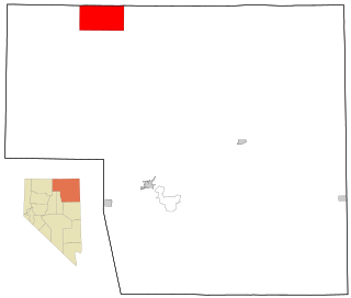
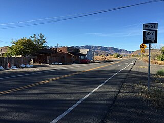
Moapa is an unincorporated town and census-designated place (CDP) in Clark County, Nevada, United States. The population was 1,025 at the 2010 census. It is the largest town in Clark County by land area. Both the second and the third tallest structures in Nevada, the Moapa Entravision Tower and the Moapa Kemp Tower respectively, are located in Moapa.

<span class="mw-page-title-main">Moapa Valley, Nevada</span> Unincorporated town in the State of Nevada, United States

Moapa Valley is an unincorporated town in Clark County, Nevada, United States. As of the 2010 census, it had a population of 6,924. The valley in which the community lies, also named Moapa Valley, is about 40 miles (64 km) long and lies roughly northwest to southeast.

<span class="mw-page-title-main">North Las Vegas, Nevada</span> City in Nevada, United States

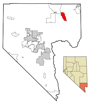
North Las Vegas is a suburban city in Clark County, Nevada, United States, in the Las Vegas Valley. As of the 2020 census it had a population of 262,527, with an estimated population of 280,543 in 2022. The city was incorporated on May 1, 1946. It is the 4th most populous city in the state of Nevada, and the 77th most populous city in the United States.

<span class="mw-page-title-main">Paradise, Nevada</span> Unincorporated town in Nevada, United States

Paradise is an unincorporated town and census-designated place (CDP) in Clark County, Nevada, United States, adjacent to the city of Las Vegas. It was formed on December 8, 1950. Its population was 191,238 at the 2020 census, making it the fifth-most-populous CDP in the United States; if it were an incorporated city, it would be the fifth-largest in Nevada. As an unincorporated town, it is governed by the Clark County Commission with input from the Paradise Town Advisory Board.

<span class="mw-page-title-main">Searchlight, Nevada</span> Unincorporated town in the State of Nevada, United States

Searchlight is an unincorporated town and census-designated place (CDP) in Clark County, Nevada, United States, at the topographic saddle between two mountain ranges. At the 2020 census it had a population of 445.

<span class="mw-page-title-main">Summerlin South, Nevada</span> CDP in Nevada, United States

Summerlin South, also seen on maps as South Summerlin, is a census-designated place (CDP) in Clark County, Nevada, United States, on the western edge of the Las Vegas Valley and adjacent to the Red Rock Canyon National Conservation Area. It is so named because it is a southward extension of the master-planned community of Summerlin. Nearly all of Summerlin South is in ZIP code 89135. The population was 24,085 at the 2010 Census.

<span class="mw-page-title-main">Sunrise Manor, Nevada</span> Census-designated place in Clark County, Nevada, United States

Sunrise Manor is a census-designated place in Clark County, Nevada, United States, located on the western base of Frenchman Mountain, east of Las Vegas. The population was 205,618 at the 2020 census. If Sunrise Manor were to be incorporated, it would be one of the largest cities in Nevada. Sunrise Manor was formed in May 1957.

<span class="mw-page-title-main">Whitney, Nevada</span> Unincorporated town in the State of Nevada, United States

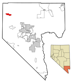
Whitney is an unincorporated town and census-designated place in Clark County, Nevada, United States. The population was 38,585 at the 2010 census.

<span class="mw-page-title-main">Owyhee, Nevada</span> Census-designated place in Nevada, United States

Owyhee is a census-designated place (CDP) in Elko County, Nevada, United States, along the banks of the Owyhee River. The population was 953 at the 2010 census. It is part of the Elko Micropolitan Statistical Area. It is the primary town of the federally recognized Shoshone-Paiute tribe's Duck Valley Indian Reservation, which covers portions of northern Nevada and southern Idaho, and the majority of its population are Native American.

Spanish Springs is a census-designated place (CDP) in Washoe County, Nevada, United States. It is located in the northeastern part of the Reno–Sparks Metropolitan Statistical Area. The population was 15,064 at the 2010 Census.

<span class="mw-page-title-main">Wadsworth, Nevada</span> CDP in Nevada, United States

Wadsworth is a census-designated place (CDP) in Washoe County, Nevada. The population was 834 at the time of the 2010 census. It is part of the Reno–Sparks Metropolitan Statistical Area and located entirely within the Pyramid Lake Indian Reservation. The town was named for General James S. Wadsworth, a Civil War general killed during the Battle of the Wilderness in 1864. It was given this name by Leland Stanford of the Central Pacific Railroad as a favor to General Irvin McDowell, whom Wadsworth had served under during the Civil War.

<span class="mw-page-title-main">Nellis Air Force Base</span> USAF base in Clark County, Nevada

Nellis Air Force Base is a United States Air Force installation in southern Nevada. Nellis hosts air combat exercises such as Exercise Red Flag and close air support exercises such as Green Flag-West flown in "Military Operations Area (MOA) airspace", associated with the nearby Nevada Test and Training Range (NTTR). The base also has the Combined Air and Space Operations Center-Nellis.

<span class="mw-page-title-main">Creech Air Force Base</span> US Air Force base in Clark County, Nevada

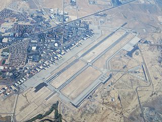
Creech Air Force Base is a United States Air Force (USAF) command and control facility in Clark County, Nevada used "to engage in daily Overseas Contingency Operations …of remotely piloted aircraft systems which fly missions across the globe." In addition to an airport, the military installation has the Unmanned Aerial Vehicle Battlelab, associated aerial warfare ground equipment, and unmanned aerial vehicles of the type used in Afghanistan and Iraq. Creech is the aerial training site for the USAF Thunderbirds and "is one of two emergency divert airfields" for the Nevada Test and Training Range.

<span class="mw-page-title-main">17th Attack Squadron</span> Military unit

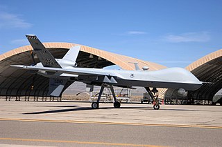
The 17th Attack Squadron is a squadron of the United States Air Force. It is assigned to the 432d Wing, and stationed at Creech Air Force Base in Indian Springs, Nevada. The 17th is equipped with the MQ-9 Reaper.

<span class="mw-page-title-main">Nevada Air National Guard</span> Military unit

The Nevada Air National Guard is the aerial militia of the State of Nevada, United States of America. Along with the Nevada Army National Guard, it is an element of the Nevada National Guard. The units of the Nevada Air National Guard are not in the normal United States Air Force chain of command. They are under the jurisdiction of the Governor of Nevada through the office of the Nevada Adjutant General unless it is federalized by order of the President of the United States.

<span class="mw-page-title-main">Mountain Home Air Force Base</span> US Air Force base near Mountain Home, Idaho, United States

Mountain Home Air Force Base is a United States Air Force (USAF) installation in the western United States. Located in southwestern Idaho in Elmore County, the base is twelve miles (20 km) southwest of Mountain Home, which is forty miles (65 km) southeast of Boise via Interstate 84. The base is also used by the Republic of Singapore Air Force (RSAF), which has a detachment of F-15SG combat aircraft on long term assignment to the base and a squadron composed of RSAF and USAF personnel.

<span class="mw-page-title-main">Robins Air Force Base</span> US Air Force base at Warner Robins, Georgia, United States

Robins Air Force Base is a major United States Air Force installation located in Houston County, Georgia, United States. The base is located just east of the city of Warner Robins, 18 mi (29 km) south-southeast of Macon and approximately 100 mi (160 km) south-southeast of Atlanta, Georgia. The base is named in honor of Brig Gen Augustine Warner Robins, the Air Force's "father of logistics". The base is the single largest industrial complex in Georgia, employing a workforce of over 25,584 civilian, contractor, and military members.

References

  1. "ArcGIS REST Services Directory". United States Census Bureau. Retrieved September 19, 2022.
  2. http://www.clarkcountynv.gov/Depts/admin_services/tlservices/Pages/Indian%20Springs%20Town%20Advisory%20Board.aspx Archived 2015-12-01 at the Wayback Machine Indian Springs Town Board
  3. "Profile of General Population and Housing Characteristics: 2010 Demographic Profile Data (DP-1): Indian Springs CDP, Nevada". United States Census Bureau . Retrieved March 12, 2012.
  4. Federal Writers' Project (1941). Origin of Place Names: Nevada (PDF). W.P.A. p. 15. Archived (PDF) from the original on 2018-04-09.
  5. "Indian Springs Casino Closed". [World Casino Directory]. Retrieved 2014-11-16.
  6. 1 2 3 Earl, Phillip (November 4, 1993). "Indian Springs has interesting history". Henderson Home News, Boulder City News, Green Valley News.
  7. "Census of Population and Housing". Census.gov. Retrieved June 4, 2016.
  8. "U.S. Census website". United States Census Bureau . Retrieved 2008-01-31.
  9. "Nevada Public Libraries". PublicLibraries.com. Retrieved 14 June 2019.
  10. "Seasonal Temperature and Precipitation Information". Western Regional Climate Center. Retrieved August 6, 2013.