
U.S. Route 41, also U.S. Highway 41 (US 41), is a major north–south United States Numbered Highway that runs from Miami, Florida, to the Upper Peninsula of Michigan. Until 1949, the part in southern Florida, from Naples to Miami, was US 94. The highway's southern terminus is in the Brickell neighborhood of Downtown Miami at an intersection with Brickell Avenue (US 1), and its northern terminus is east of Copper Harbor, Michigan, at a modest cul-de-sac near Fort Wilkins Historic State Park at the tip of the Keweenaw Peninsula. US 41 closely parallels Interstate 75 (I-75) from Naples, Florida, all the way through Georgia to Chattanooga, Tennessee.
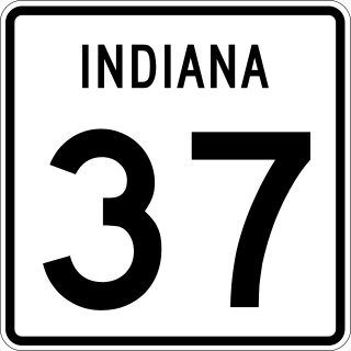
State Road 37 (SR 37) is a major route in the U.S. state of Indiana, running as a four-lane divided highway for 110 miles of its course.

U.S. Route 35 (US 35) is a United States Highway that runs southeast-northwest for approximately 412 miles (663 km) from the western suburbs of Charleston, West Virginia to northern Indiana. Although the highway is physically southeast-northwest, it is nominally north–south. The highway's southern terminus is in Teays Valley, West Virginia, near Scott Depot, at Interstate 64 (I-64). Its northern terminus is near Michigan City, Indiana, at US 20. The West Virginia portion of the highway is mostly expressway, becoming a freeway shortly before it crosses the Ohio River into Ohio. The Ohio portion has been upgraded to a four-lane highway/freeway between the West Virginia state line and Trotwood, west of Dayton.

State Route 141 (SR 141) is a 34.1-mile-long (54.9 km) state highway that runs southwest-to-northeast in the northwest part of the U.S. state of Georgia. It connects the Buckhead area of Atlanta with Cumming. Its routing exists within portions of Fulton, DeKalb, Gwinnett, Forsyth counties.

State Road 1 (SR 1) is a north–south state highway in eastern Indiana, consisting of two segments. Its southern segment begins at U.S. Highway 50 and Interstate 275 in east-central Dearborn County, just east of Lawrenceburg, and ends at Interstate 469 south of Fort Wayne. Its northern segment begins at Interstate 69 on Fort Wayne's north side, and ends at U.S. Route 20 in east-central Steuben County, approximately 6 miles (9.7 km) east of Angola.
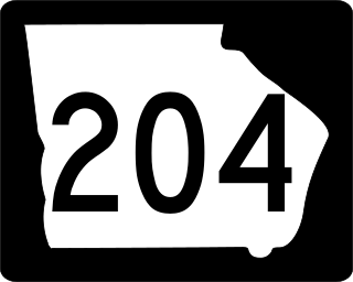
State Route 204 (SR 204) is a 32.4-mile-long (52.1 km) state highway in the east-central part of the U.S. state of Georgia. It runs from a point east of Pembroke and ends in Savannah. Its routing is located within portions of Bryan and Chatham counties.

State Route 154 (SR 154) is a 56.2-mile-long (90.4 km) state highway in the area around Atlanta in the U.S. state of Georgia. It begins in Sharpsburg and ends just to the east of Avondale Estates. The road also runs through portions of Atlanta.
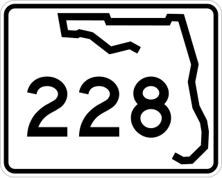
State Road 228 (SR 228) is a 32.532-mile-long (52.355 km) state highway in the northeastern part of the U.S. state of Florida. It exists in two distinct sections, separated by both Baker County Road 228 and Duval CR 228, which are former segments of SR 228.

U.S. Route 30 (US 30) is a road in the United States Numbered Highway System that runs from Astoria, Oregon, to Atlantic City, New Jersey. In Indiana, the route runs from the Illinois state line at Dyer to the Ohio state line east of Fort Wayne and New Haven. The 155.96 miles (250.99 km) of US 30 that lie within Indiana serve as a major conduit. The entire length of U.S. Route 30 in Indiana is included in the National Highway System (NHS). The highway includes four-lane, rural sections, an urbanized, four-lane divided expressway, and several high-traffic, six-lane freeway areas. First designated as a US Highway in 1926, US 30 replaced the original State Road 2 (SR 2) and SR 44 designation of the highway which dated back to the formation of the Indiana State Road system. A section of the highway originally served as part of the Lincoln Highway. Realignment and construction projects have expanded the highway to four lanes across the state, and the road is now part of a long stretch of US 30 from New Lenox, Illinois, to Canton, Ohio, where the road has at least four lanes. There are over 40 traffic signals between I-65 at Merrillville and I-69 at Fort Wayne.

State Route 28 (SR 28) is a 25.7-mile-long (41.4 km) state highway in the U.S. state of Georgia. It exists in two distinct segments separated by the northern segment of South Carolina Highway 28 (SC 28), which connects the two segments. The southern segment is entirely within the Augusta metropolitan area. The northern segment is located in the northeastern corner of the Chattooga River District of the Chattahoochee–Oconee National Forest. SR 28 consists of Georgia's segments of a multi-state Route 28 that includes two segments of SC 28 and one segment of North Carolina Highway 28 (NC 28). The northern segment is a south-to-north highway and the roadway it uses is unnamed. However, the southern segment is a west-to-east highway, and the roads it uses are known as Furys Ferry Road from the Furys Ferry Bridge at the South Carolina state line to the intersection with SR 104 Conn. in Augusta, Washington Road in the northern part of Augusta, John C. Calhoun Expressway, Greene Street, 5th Street, and Broad Street in downtown Augusta, and Sand Bar Ferry Road in the northeastern part of Augusta.

Interstate 94 (I-94) is a part of the Interstate Highway System that runs from Billings, Montana, to Port Huron, Michigan. I-94 enters Indiana from Illinois in the west, in Munster, and runs generally eastward through Hammond, Gary, and Portage, before entering Michigan northeast of Michigan City. The Interstate runs for approximately 45.8 miles (73.7 km) through the state. The landscape traversed by I-94 includes urban areas of Northwest Indiana, wooded areas, and farmland. The section of I-94 between the Illinois state line and Lake Station is named the Frank Borman Expressway.
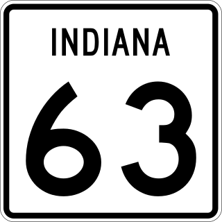
State Road 63 (SR 63) in the U.S. state of Indiana is a north–south route in the western portion of the state. Until mid-2008, it covered a distance of just over 96 miles (154 km), but now is a discontinuous route. For 63 miles (101 km), from the city of Terre Haute until it rejoins U.S. Route 41 (US 41) near Carbondale, it is a four-lane divided highway and replaces US 41 as the major north–south artery in this portion of the state.
U.S. Route 41 (US 41) in the state of Indiana is a north–south US Highway that is parallel to the Illinois state line. It enters the state south of Evansville as a four-lane divided highway passing around Vincennes and traveling north to Terre Haute. In Terre Haute, it is known as 3rd Street. North of Terre Haute, it hooks east and becomes a two-lane surface road. Those wanting to stay on a four-lane divided highway can use State Road 63 to the west. It passes through Rockville, Veedersburg, and Attica before returning to a four-lane divided highway when SR 63 terminates in Warren County. It remains a four-lane divided highway until Lake County, where it becomes a main road known as Indianapolis Boulevard. It overlaps US 12 and US 20 in Hammond and exits Indiana into the South Side of Chicago.

U.S. Route 27 (US 27) is a part of the United States Numbered Highway System that runs from Miami, Florida, to Fort Wayne in the U.S. state of Indiana. In Indiana, it is a state road that enters the state in College Corner, Ohio, and West College Corner. The 117.765 miles (189.524 km) of US 27 that lie within Indiana serve as a major conduit. Most of the highway is listed on the National Highway System. Various sections are a rural two-lane highway or an urbanized four-lane divided highway. The northernmost community along the highway is Fort Wayne in the northeast part of the state. The highway ends at an interchange with Interstate 69 (I-69) north of downtown Fort Wayne after serving the east central and northeast regions of Indiana.
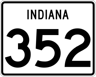
State Road 352 is an east–west state road in the US state of Indiana. The western terminus is at an intersection with Illinois Route 9 and SR 26 and the highway heads north then east passing through towns like Ambia, Boswell, and Oxford, before ending at U.S. Route 52, near Templeton. The road covers a distance of about 20.554 miles (33.078 km), passing through mostly rural areas in Benton and Warren counties.

U.S. Route 33 (US 33) is part of the United States Numbered Highway System that runs from Richmond, Virginia, to Elkhart of the US state of Indiana. In Indiana, it is a state road that enters the state at the Ohio state line between Willshire, Ohio, and Pleasant Mills, Indiana. The 106.217 miles (170.940 km) of US 33 that lie within Indiana serve as a major conduit. All of the highway is listed on the National Highway System. Various sections are rural two-lane highway, urbanized four-lane divided expressway and the Lincoln Highway. The northernmost community along the highway is Elkhart. The highway ends at an interchange in southern Elkhart after serving the northeastern region of Indiana. US 33 passes through farm fields and urban areas.

U.S. Route 150 (US 150) in Indiana is a 176.315-mile-long (283.751 km) east–west highway that travels from the Illinois state line east of Paris, Illinois to Louisville, Kentucky at the Kentucky state line. A section of US 150 from New Goshen to Vincennes travels north–south instead of east–west. US 150 travels concurrently with its parent route, US 50, from Vincennes to Shoals. Between West Terre Haute and Terre Haute, US 150 travels along part of the historic National Road. Also, from Vincennes to New Albany, the route is designated as part of Indiana's Historic Pathways, as it roughly parallels what was then part of the Buffalo Trace.

U.S. Route 231 is the longest numbered highway in Indiana, covering over 284 miles (457 km). It is a main north–south highway in the western part of the state. The southern terminus of US 231 is at the Kentucky state line and the northern terminus is at US 41 just south of St. John. The highway is a mixture of expressway and two-lane roadway. The expressway portions exist mainly in southern Indiana and around the Lafayette area, with the rest mainly being two lanes.
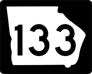
State Route 133 (SR 133) is an 82.8-mile-long (133.3 km) southeast-to-northwest state highway in the southwestern part of the U.S. state of Georgia. It travels through portions of Lowndes, Brooks, Colquitt, Worth, Dougherty, and Lee counties. It connects the Valdosta and Albany areas.

