Iphofen

Last updated
Iphofen
Iphofen BW 19.jpg
Market square with St. Vitus, town hall and Marienbrunnen
DEU Iphofen COA.svg
Location of Iphofen within Kitzingen district
Iphofen in KT.svgCastell
Germany adm location map.svg
Red pog.svg
Iphofen
Bavaria location map.svg
Red pog.svg
Iphofen
Coordinates: 49°42′N10°16′E / 49.700°N 10.267°E / 49.700; 10.267 Coordinates: 49°42′N10°16′E / 49.700°N 10.267°E / 49.700; 10.267
Country Germany
State Bavaria
Admin. region Unterfranken
District Kitzingen
Municipal assoc. Iphofen
Subdivisions22 Gemeindeteile
Government
   Mayor (202026) Dieter Lenzer [1] (FW)
Area
  Total78.01 km2 (30.12 sq mi)
Elevation
250 m (820 ft)
Population
 (2021-12-31) [2]
  Total4,782
  Density61/km2 (160/sq mi)
Time zone UTC+01:00 (CET)
  Summer (DST) UTC+02:00 (CEST)
Postal codes
97346
Dialling codes 09323
Vehicle registration KT
Website www.iphofen.de

Iphofen is a town in the district of Kitzingen in Bavaria, Germany. It has a population of around 4,500. Iphofen is known for its rare complete medieval town wall and other historic buildings as well as for being a location of wine production.

Contents

Geography

Location

Rodelseer Tor Iphofen BW 2.jpg
Rödelseer Tor

Iphofen lies in the southeast of the district of Kitzingen of Bavaria, in the Regierungsbezirk of Unterfranken. It is situated 9 km southeast of Kitzingen on Bundesstraße 8. The town is located about 10 km from the river Main. The nearest city is Würzburg. Iphofen lies at the foot of the Schwanberg, a prominent hill on the northwestern edge of the Mittelgebirge Steigerwald.

Subdivisions

Iphofen has six Stadtteile in addition to the town itself. These are Birklingen  [ de ], Dornheim  [ de ], Hellmitzheim  [ de ], Mönchsondheim  [ de ], Nenzenheim  [ de ] and Possenheim  [ de ]. [3]

Neighbouring communities

Iphofen borders on (from the north, clockwise): Castell, Oberscheinfeld, Markt Bibart, Markt Einersheim, Sugenheim, Willanzheim, Mainbernheim, Rödelsee und Wiesenbronn.

History

Iphofen was first mentioned as a property of the Diocese of Würzburg when it was established in 741/2. Among the 25 churches gifted to the bishop by Karlmann was the royal baptismal church Johannis baptistae at Iphofen. In addition, Würzburg received the tithes from the local royal estate. [4]

In 1293, Iphofen was awarded the status of town. During the 14th and 15th century, Würzburg was able to purchase the rights of other nobles who held a strong position in Iphofen, notably Hohenlohe and the Counts of Castell. The latter held inter alia the patrozinium  [ de ] of St. Vitus, but in 1325/8 sold their properties in Iphofen to Ulrich von Hanau. He in turn sold them to the Bishop of Würzburg in 1331. The patrozinium over St. Vitus passed to the town of Iphofen in 1457. The first phase of construction of the town wall ended in 1349. Another area was incorporated in 1421. [4]

In 1810, Iphofen permanently became a part of the Kingdom of Bavaria. [4]

On 1 January 1972, six independent municipalities were merged with Iphofen. Until 1 July 1972, Iphofen was part of the now defunct Landkreis Scheinfeld  [ de ].

Economy

Iphofen has several local vineyards and is well known for its wine. Local industry includes the Knauf factory which manufactures gypsum boards.

Attractions

See also: List of monuments in Iphofen (German)

The old town is characterized by the medieval/early modern town wall that completely surrounds it. The wall (14th/15th century) features seven towers and four gate houses: Rödelseer Tor  [ de ] (the symbol of Iphofen, 15th century), Mainbernheimer Tor  [ de ] (16th century), Einersheimer Tor  [ de ] and the Pesttor, walled off since 1596. [5]

Catholic parish church St. Vitus St. Veit Gesamt Iphofen.JPG
Catholic parish church St. Vitus
Spitalkirche St. Johannes der Taufer Iphofen Spitalkirche St. Johann Baptist 118.JPG
Spitalkirche St. Johannes der Täufer
Towngate: Mainbernheimer Tor Iphofen, Mainbernheimer Tor DmD-6-75-139-25 van buitenkant foto9 2016-08-06 15.27.jpg
Towngate: Mainbernheimer Tor

Inside the wall, most buildings are historic and the tallest structures are the churches:

The Baroque town hall on the market square dates from 1716-8. It overlooks the square with many half-timbered houses and the Marienbrunnen (fountain with a Baroque statue of Mary). [7]

The Zehntkeller (today a hotel) was the location of the Mönchshof, owned by the Augustinians at Birklingen. It was their refuge after the monastery was destroyed in the Peasants' War of 1525. The cellars then served to store the Zehntwein, i.e. the wine that was the tithe for the Bishop of Würzburg. [7]

Museums

The Geschichtsscheune contains a large model of the town as well as housing sculptures from the 16th and 18th century. [8]

The Knauf Museum, opened in 1983 in an early Baroque building (1688-93) which originally served as an inn, later as the local administrative seat (Amtshof) for the Prince-Bishop of Würzburg and then as the Bavarian Rentamt  [ bar; de; es ]. The museum contains around 200 replicas of famous sculptures from ancient Egypt, Rome and Greece. Changing exhibitions are hosted in the modern annex. [9] [10] [7]

The Kirchenburgmuseum  [ de ] in Mönchsondheim features exhibits on wine growing in Franconia, rural crafts, historic fortified churches (Kirchenburgen), such as the one at Mönchsondheim, and on life in Franconian villages. [11]

Related Research Articles

<span class="mw-page-title-main">Melk</span> Place in Lower Austria, Austria

Melk is a city of Austria, in the federal state of Lower Austria, next to the Wachau valley along the Danube. Melk has a population of 5,257. It is best known as the site of a massive baroque Benedictine monastery named Melk Abbey.

Kitzingen is a Landkreis (district) in Bavaria, Germany. It is bounded by the districts of Schweinfurt, Bamberg, Neustadt (Aisch)-Bad Windsheim and Würzburg.

<span class="mw-page-title-main">Miltenberg</span> Town in Bavaria, Germany

Miltenberg is a town in the Regierungsbezirk of Lower Franconia (Unterfranken) in Bavaria, Germany. It is the seat of the like-named district and has a population of over 9,000.

<span class="mw-page-title-main">Tilman Riemenschneider</span> German sculptor and woodcarver (c.1460–1531)

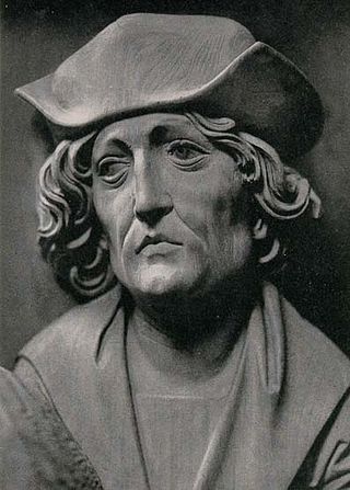
Tilman Riemenschneider was a German sculptor and woodcarver active in Würzburg from 1483. He was one of the most prolific and versatile sculptors of the transition period between late Gothic and Renaissance, a master in stone and limewood.

<span class="mw-page-title-main">Marktbreit</span> Town in Bavaria, Germany

Marktbreit am Main is a town in the district of Kitzingen in the Regierungsbezirk Unterfranken in Bavaria, Germany. It is situated at the most southern point of the Main river. Marktbreit is the birthplace of Alois Alzheimer who first identified the symptoms of what is now known as Alzheimer's disease. With its suburb Gnodstadt, Marktbreit has around 3,700 inhabitants.

<span class="mw-page-title-main">Kitzingen</span> Town in Bavaria, Germany

Kitzingen is a town in the German state of Bavaria, capital of the district Kitzingen. It is part of the Franconia geographical region and has around 21,000 inhabitants. Surrounded by vineyards, Kitzingen County is the largest wine producer in Bavaria. It is said to be Franconia's wine trade center.

<span class="mw-page-title-main">Marienberg Fortress</span>

Marienberg Fortress is a prominent landmark on the left bank of the Main river in Würzburg, in the Franconia region of Bavaria, Germany. The mighty Fortress Marienberg is a symbol of Würzburg and served as a home of the local prince-bishops for nearly five centuries. It has been a fort since ancient times. Most of the current structures originally were built in Renaissance and Baroque styles between the 16th and 18th centuries. After Gustavus Adolphus of Sweden conquered the area in 1631 during the Thirty Years' War, the castle was reconstructed as a Baroque residence. After it ceased to serve as residence of the Bishops of Würzburg, the fortress saw repeated action in the wars of the late 18th and 19th centuries. Festung Marienberg was severely damaged by British bombs in March 1945 and only fully rebuilt in 1990. Today, it houses two museums.

<span class="mw-page-title-main">Rothenburg ob der Tauber</span> Town in Bavaria, Germany

Rothenburg ob der Tauber is a town in the district of Ansbach of Mittelfranken, the Franconia region of Bavaria, Germany. It is well known for its well-preserved medieval old town, a destination for tourists from around the world. It is part of the popular Romantic Road through southern Germany. Today it is one of only three towns in Germany that still have completely intact city walls, the other two being Nördlingen and Dinkelsbühl, both also in Bavaria.

<span class="mw-page-title-main">Buchbrunn</span> Municipality in Bavaria, Germany

Buchbrunn is a municipality in the district of Kitzingen, Lower Franconia, Bavaria, Germany. It is placed in the Bayrische Planungsregion 2.

<span class="mw-page-title-main">Ochsenfurt</span> Town in Bavaria, Germany

Ochsenfurt is a town in the district of Würzburg, in Bavaria, Germany. Ochsenfurt is located on the left bank of the River Main and has around 11,000 inhabitants. This makes it the largest town in Würzburg district.

<span class="mw-page-title-main">Klingenberg am Main</span> Town in Bavaria, Germany

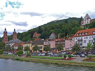
Klingenberg am Main is a town in the Miltenberg district in the Regierungsbezirk of Lower Franconia (Unterfranken) in Bavaria, Germany. It has a population of around 6,200 and is located on both banks of the river Main.

<span class="mw-page-title-main">Lohr am Main</span> Place in Bavaria, Germany

Lohr am Main is a town in the Main-Spessart district in the Regierungsbezirk of Lower Franconia (Unterfranken) in Bavaria, Germany and the seat of the Verwaltungsgemeinschaft of Lohr am Main. It has a population of around 15,000.

<span class="mw-page-title-main">Weinstadt</span> Town in Baden-Württemberg, Germany

Weinstadt is a town in the Rems-Murr district, in the state of Baden-Württemberg, Germany. It is located in the Rems Valley approximately 15 km east of Stuttgart. Its population in 2012 was 25,998.

<span class="mw-page-title-main">Rothenfels</span> Town in Bavaria, Germany

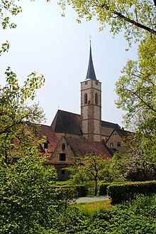
Rothenfels is a town in the Main-Spessart district in the Regierungsbezirk of Lower Franconia (Unterfranken) in Bavaria, Germany and a member of the Verwaltungsgemeinschaft of Marktheidenfeld. With a population of just around 1,000 it is said to be Bavaria’s smallest town.

<span class="mw-page-title-main">Seßlach</span> Town in Bavaria, Germany

Seßlach is a town in the district of Coburg, in northern Bavaria, Germany. It is situated 12 km southwest of Coburg and has a population close to 4,000.

<span class="mw-page-title-main">Castell, Bavaria</span> Municipality in Bavaria, Germany

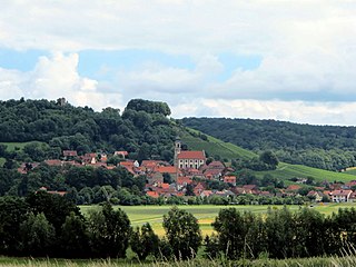
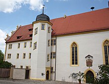
Castell is a municipality in the district of Kitzingen in Bavaria in Germany. It was the seat of the Counts of Castell. Today it is part of the municipal association Wiesentheid. It has around 800 inhabitants.

<span class="mw-page-title-main">Franconia (wine region)</span> Wine-producing region

Franconia is a region for quality wine in Germany situated in the north west of Bavaria in the district of Franconia, and is the only wine region in the federal state of Bavaria. In 2014, vines were grown on 6,176 hectares of land in the region.

<span class="mw-page-title-main">Würzburg</span> Place in Bavaria, Germany

Würzburg is a city in the region of Franconia in the north of the German state of Bavaria. Würzburg is the administrative seat of the Regierungsbezirk Lower Franconia. It spans the banks of the Main River.

<span class="mw-page-title-main">Main Cycleway</span> Bicycle route in Germany

The Main Cycleway is a major German bicycle path running for about 600 km along the River Main in Germany. It starts from either Creußen or Bischofsgrün and ends in Mainz. The General German Bicycle Club (ADFC) rated the trail five stars in 2008, the first path in Germany to receive this award. Approximately 90% of the path is paved and 77% of the route is at least 2.5 metres wide.

<span class="mw-page-title-main">Marienkapelle, Würzburg</span> Church in Würzburg, Germany

The Marienkapelle is a Roman Catholic church located at the Unterer Markt of the town of Würzburg, Bavaria. It was built in the Gothic style in the 14th century. Despite its large size, it is a chapel by status, as it does not have a parish. Today it is administered by the united parishes of the Würzburg Cathedral and the Kollegiatstift Neumünster.

References

  1. Liste der ersten Bürgermeister/Oberbürgermeister in kreisangehörigen Gemeinden, Bayerisches Landesamt für Statistik, 15 July 2021.
  2. "Tabelle 12411-003r Fortschreibung des Bevölkerungsstandes: Gemeinden, Stichtag" (in German). Bayerisches Landesamt für Statistik. June 2022.
  3. "Stadtteile (German)". Iphofen, official town website. Retrieved 15 March 2016.
  4. 1 2 3 "Kulturpfad Grafen zu Castell - Iphofen (German)". Landratsamt Kitzingen. Retrieved 8 March 2016.
  5. "Tore, Türme und Wehranlagen (German)". Iphofen, official town website. Retrieved 15 March 2016.
  6. 1 2 3 4 "Kirchen (German)". Iphofen, official town website. Retrieved 15 March 2016.
  7. 1 2 3 "Einzeldenkmäler (German)". Iphofen, official town website. Retrieved 15 March 2016.
  8. "Geschichtsscheune (German)". Iphofen, official town website. Retrieved 15 March 2016.
  9. "Knauf Museum (German)". Iphofen, official town website. Retrieved 15 March 2016.
  10. "Knauf Museum (German)". Knauf Museum. Retrieved 15 March 2016.
  11. "Kirchenburgmuseum(German)". Iphofen, official town website. Retrieved 15 March 2016.