
Jasper County is a county located in the U.S. state of Illinois. According to the 2020 census, it has a population of 9,287. Its county seat is Newton.

Buffalo Grove is a village in Lake and Cook Counties in the U.S. state of Illinois. A suburb of Chicago, it lies about 30 miles (50 km) northwest of Downtown Chicago. As of the 2020 Census, Buffalo Grove has a population of 43,212. It totals 9.6 square miles (25 km2) of land, with the top three-quarters in Lake County and the bottom quarter in Cook County. Roads in the village such as Lake Cook Road and Illinois Route 83 converge on I-294, which take drivers to O'Hare International Airport 20 miles (32 km) south of Buffalo Grove. A part of the Chicago Metropolitan Area, Buffalo Grove is consistently ranked as one of the best places to live in Illinois and the Midwest, as well as one with the highest school district rankings in the country.
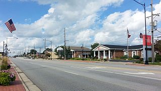
Oak Forest is a city in Cook County, Illinois, United States. The city is out 24 miles (39 km) south-southwest of downtown Chicago in Bremen Township. Per the 2020 census, the population was 27,478.

U.S. Route 41, also U.S. Highway 41 (US 41), is a major north–south United States Numbered Highway that runs from Miami, Florida, to the Upper Peninsula of Michigan. Until 1949, the part in southern Florida, from Naples to Miami, was US 94. The highway's southern terminus is in the Brickell neighborhood of Downtown Miami at an intersection with Brickell Avenue (US 1), and its northern terminus is east of Copper Harbor, Michigan, at a modest cul-de-sac near Fort Wilkins Historic State Park at the tip of the Keweenaw Peninsula. US 41 closely parallels Interstate 75 (I-75) from Naples, Florida, all the way through Georgia to Chattanooga, Tennessee.

The Kankakee River is a tributary of the Illinois River, approximately 133 miles (214 km) long, in the Central Corn Belt Plains of northwestern Indiana and northeastern Illinois in the United States. At one time, the river drained one of the largest wetlands in North America and furnished a significant portage between the Great Lakes and the Mississippi River. Significantly altered from its original channel, it flows through a primarily rural farming region of reclaimed cropland, south of Lake Michigan.
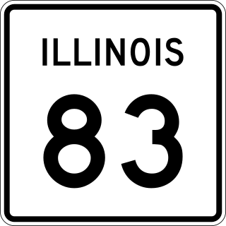
Illinois Route 83 (IL 83) is a 91.73-mile-long (147.63 km) major north–south state highway in northeast Illinois. It stretches from U.S. Route 30 by Lynwood and Dyer, Indiana, north to the Wisconsin border by Antioch at Wisconsin Highway 83 (WIS 83).

Millennium Station is a major commuter rail terminal in the Loop (downtown), Chicago. It is the northern terminus of the Metra Electric District to Chicago's southern suburbs, and the western terminus of the South Shore Line to Gary and South Bend, Indiana.
Alberta Provincial Highway No. 16, commonly referred to as Highway 16, is a major east–west highway in central Alberta, Canada, connecting Jasper to Lloydminster via Edmonton. It forms a portion of the Yellowhead Highway, a major interprovincial route of the Trans-Canada Highway system that stretches from Masset, British Columbia, to Portage la Prairie, Manitoba, near Winnipeg. Highway 16 spans approximately 634 km (394 mi) from Alberta's border with British Columbia in the west to its border with Saskatchewan in the east. As of 2010, all but less than 96 km (60 mi) of the route was divided, with a minimum of two lanes in each direction. It is designated a core route in Canada's National Highway System.
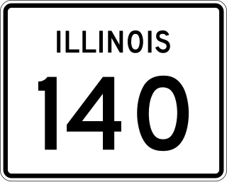
Illinois Route 140 is a 52.05-mile-long (83.77 km) east–west highway with its western terminus at Illinois Route 143 in Alton and its eastern terminus at U.S. Route 40 near Mulberry Grove. It also overlaps IL 111 in Alton and IL 127 in Greenville.

The Embarras River is a 195-mile-long (314 km) tributary of the Wabash River in southeastern Illinois in the United States. The waters of the Embarras reach the Gulf of Mexico via the Wabash, Ohio, and Mississippi Rivers. The river drains a watershed around 1,566,450 acres (6,339.2 km2) in an agricultural region. The name comes from French explorers, who used the term embarras for river obstacles, blockages, and difficulties relating to logjams and the like.

Illinois's 2nd congressional district is a congressional district in the U.S. state of Illinois. Based in the south suburbs of Chicago, the district includes southern Cook county, eastern Will county, and Kankakee county, as well as the city of Chicago's far southeast side.

Kensington/115th Street is a commuter rail station on the far south side of Chicago that serves the Metra Electric Line north to Millennium Station and south to University Park and Blue Island. The station is located at 115th Street and Cottage Grove Avenue in the Pullman & West Pullman, Chicago neighborhoods. It is the last station for Blue Island Branch trains before those split off of the main line for Blue Island. As of 2018, the station is the 37th busiest of Metra's 236 non-downtown stations, with an average of 1,136 weekday boardings. The South Shore Line diverges to Indiana immediately south of this station. It had previously stopped at this station prior to February 15, 2012, with the reconfiguration of the junction to minimize congestion.

The 9th congressional district of Illinois covers parts of Cook, Lake, and McHenry counties as of the 2021 redistricting which followed the 2020 census. It includes all or parts of Chicago, Evanston, Glenview, Skokie, Morton Grove, Niles, Northfield, Prospect Heights, Wilmette, Buffalo Grove, Hawthorn Woods, Wauconda, Island Lake, Long Grove, Lake Barrington, Algonquin Township, Cary, Crystal Lake, Lake in the Hills, Lakewood, Oakwood Hills, Trout Valley, Algonquin, Port Barrington, Barrington Hills, and Fox River Grove. It is anchored in Chicago's North Side, along Lake Michigan, and covers many of Chicago's northern suburbs. Democrat Jan Schakowsky has represented the district since January 1999.

Interstate 94 (I-94) generally runs north–south through the northeastern portion of the US state of Illinois, in Lake and Cook counties. It is signed east–west in Illinois in accordance with its general alignment across the country, with west signage aligned with northbound travel and vice versa. I-94 in Illinois is 61.53 miles (99.02 km) long.

Grove Township is one of eleven townships in Jasper County, Illinois, USA. As of the 2010 census, its population was 618 and it contained 254 housing units. The seat of the township is the hamlet of Gila.

North Muddy Township is one of eleven townships in Jasper County, Illinois, USA. As of the 2010 census, its population was 777 and it contained 328 housing units.

South Muddy Township is one of eleven townships in Jasper County, Illinois, USA. As of the 2010 census, its population was 340 and it contained 137 housing units.

Wade Township is one of eleven townships in Jasper County, Illinois, USA. As of the 2010 census, its population was 4,475 and it contained 2,082 housing units.
95th Street is a major east–west highway on Chicago's South Side and in the southwest suburbs, designated as 9500 South in Chicago's address system. 95th Street is 11 miles (18 km) south of Madison Street.

Pershing Road is an east-west street on the south side of Chicago and in its immediate western suburbs in Cook County, Illinois. It is precisely four miles south of Madison Street, the division point between north and south street numbering, and marks the 3900 South point in the region's street numbering system. Its western segment, more commonly referred to as 39th Street, runs east from a U.S. Route 34 in Lyons to Illinois Route 50 in Cicero. Its eastern segment, officially known as Pershing Road, runs east from a cul-de-sac at 3600 West to Oakwood Boulevard, which continues east ending at U.S. Route 41. All of the eastern segment lies within the city of Chicago.


