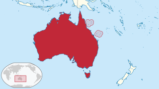
The Coral Sea Islands Territory is an external territory of Australia which comprises a group of small and mostly uninhabited tropical islands and reefs in the Coral Sea, northeast of Queensland, Australia. The only inhabited island is Willis Island. The territory covers 780,000 km2 (301,160 sq mi), most of which is ocean, extending east and south from the outer edge of the Great Barrier Reef and includes Heralds Beacon Island, Osprey Reef, the Willis Group and fifteen other reef/island groups. Cato Island is the highest point in the Territory.

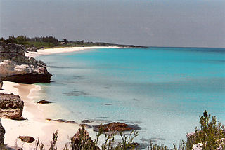
The Turks and Caicos Islands are a British Overseas Territory consisting of the larger Caicos Islands and smaller Turks Islands, two groups of tropical islands in the Lucayan Archipelago of the Atlantic Ocean and northern West Indies. They are known primarily for tourism and as an offshore financial centre. The resident population was 31,458 as of 2012 of whom 23,769 live on Providenciales in the Caicos Islands; July 2020 estimates put the population at 55,926. It is the third largest of the British overseas territories by population.

Anguilla is an island in the Leeward Islands, which lies between the Caribbean Sea in the west and the open Atlantic Ocean in the east. It is a long, flat, dry/wet, scrub-covered coral island, south and east of Puerto Rico and north of the Windward chain. It is separated from the British Virgin Islands by the Anegada Passage. The island has no significant elevations with its terrain consisting entirely of beaches, dunes, and low limestone bluffs.
This article talks about transportation in the Bahamas, a North American archipelagic state in the Atlantic Ocean.

Capricornia Cays is both a national park and a scientific national park in Queensland (Australia), located 486 km and 472 km north of the state capital Brisbane respectively. Collectively they comprise 241 ha of coral cays.
The Berry Islands are a chain of islands and a district of the Bahamas, covering about thirty square miles (78 km2) of the northwestern part of the Out Islands.

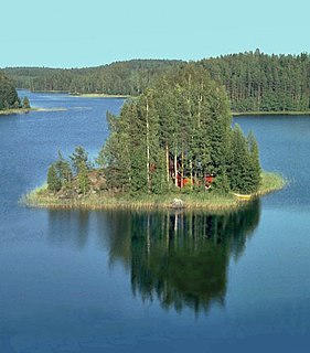
A cay, also spelled caye or key, is a small, low-elevation, sandy island on the surface of a coral reef. Cays occur in tropical environments throughout the Pacific, Atlantic and Indian Oceans.

The Abaco Islands lie in the northern Bahamas, 180 miles off the South Florida coast. They comprise the main islands of Great Abaco and Little Abaco, along with smaller barrier cays. The northernmost are Walker's Cay, and its sister island Grand Cay. To the south, the next inhabited islands are Spanish Cay and Green Turtle Cay, with its settlement of New Plymouth, Great Guana Cay, private Scotland Cay, Man-O-War Cay, and Elbow Cay, with its settlement of Hope Town. Southernmost are Tilloo Cay and Lubbers Quarters. Another of note off Abaco's western shore is onetime Gorda Cay, now a Disney Island and cruise ship stop and renamed Castaway Cay. Also in the vicinity is Moore's Island. On the Big Island of Abaco is Marsh Harbour, the Abacos' commercial hub and the Bahamas' third largest city, plus the resort area of Treasure Cay. Both have airports. A few mainland settlements of significance are Coopers Town and Fox Town in the north and Cherokee and Sandy Point in the south. Administratively, the Abaco Islands constitute seven of the 31 Local Government Districts of the Bahamas: Grand Cay, North Abaco, Green Turtle Cay, Central Abaco, South Abaco, Moore's Island, and Hope Town.
A private island is a disconnected body of land wholly owned by a private citizen or corporation. Although this exclusivity gives the owner substantial control over the property, private islands remain under the jurisdiction of national and sometimes local governments.

Exuma is a district of the Bahamas, consisting of over 365 islands, also called cays.

Castaway Cay is a private island in the Bahamas which serves as an exclusive port for the Disney Cruise Line ships. It is located near Great Abaco Island and was formerly known as Gorda Cay. In 1997, The Walt Disney Company purchased a 99-year land lease for the cay from the Bahamian government, giving the company substantial control over the island.

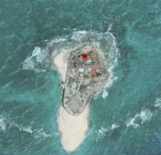
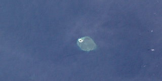
Southwest Cay, also known as Vietnamese: Đảo Song Tử Tây; Pugad Island ; Mandarin Chinese: 南子島/南子岛; pinyin: Nánzi Dǎo, is an islet on the northwestern edge of the Spratly Islands in the South China Sea. It is part of the atoll North Danger Reef, and just 1.75 miles (2.82 km) southwest of Northeast Cay. With an area of 12 hectares, it is the sixth largest of the naturally occurring Spratly Islands, and the second largest of the Vietnamese-occupied islands. Southwest Cay has the archipelago's highest point, at 4 meters above sea level. It was once a breeding place for birds, and was covered with trees and guano; export of guano had been carried out "on a considerable scale".

Green Turtle Cay is one of the barrier islands off mainland Great Abaco, The Bahamas. It can only be reached via ferry from the mainland or boat. There is not an airport on the island. It is considered part of the "Abaco Out Islands" and is 3 miles (4.8 km) long and ½ mile wide. It was named after the once abundant green turtles that inhabited the area. In 1977, Key West, Florida became a sister city to New Plymouth, Green Turtle Cay's village.

Marina Cay is an island of the British Virgin Islands in the Caribbean.
Amboyna Cay, also known as Vietnamese: Đảo An Bang; Malay: Pulau Amboyna Kecil; Datu Kalantiaw Island ; Mandarin Chinese: 安波沙洲; pinyin: Ānbō Shāzhōu, and other names, is an island of the Spratly Islands group in the South China Sea located just outside (SW) of the southwest of Dangerous Ground. It is SW of Barque Canada Reef, south of the London Reefs, and NW of Swallow Reef.
Bramble Cay, also called Maizab Kaur, Massaramcoer or Baramaki, and located at the northeastern edge of Australia and the Torres Strait Islands of Queensland and at the northern end of the Great Barrier Reef, is the northernmost point of land of Australia. It is 55 kilometres (34 mi) southeast of the mouth of the Fly River of Papua New Guinea.

Salt Cay Airport is the public airport serving Salt Cay, the second largest of the Turks Islands in the Turks and Caicos Islands. The facility is also known as Leon Wilson Airport.
