
Fairmount Park is the largest municipal park in Philadelphia and the historic name for a group of parks located throughout the city. Fairmount Park consists of two park sections named East Park and West Park, divided by the Schuylkill River, with the two sections together totalling 2,052 acres (830 ha). Management of Fairmount Park and the entire citywide park system is overseen by Philadelphia Parks & Recreation, a city department created in 2010 from the merger of the Fairmount Park Commission and the Department of Recreation.

Fort Mifflin, originally called Fort Island Battery and also known as Mud Island Fort, was commissioned in 1771 and sits on Mud Island on the Delaware River below Philadelphia, Pennsylvania near Philadelphia International Airport.

Fishtown is a neighborhood in the River Wards section of Philadelphia, Pennsylvania, United States. Located northeast of Center City Philadelphia, its borders are somewhat disputed today due to many factors, but are roughly defined by the triangle created by the Delaware River, Front Street, and York Street. Some newer residents expand the area to Lehigh Avenue to the northeast, while some older residents shrink the area to Norris Street. It is served by the Market–Frankford Line rapid transit subway/elevated line of the SEPTA system. Fishtown was a largely working class Irish Catholic neighborhood, but has recently seen a large influx of young urban professionals and gentrification.

University City is the easternmost portion of West Philadelphia, encompassing several Philadelphia universities. It is situated directly across the Schuylkill River from Center City.
Frankford is a neighborhood in the Northeast section of Philadelphia situated about six miles (10 km) northeast of Center City. Although its borders are vaguely defined, the neighborhood is bounded roughly by the original course of Frankford Creek on the south to Castor Avenue on the northwest and southwest, to Cheltenham Avenue on the north, and to Aramingo Avenue and I-95 on the east. Adjacent neighborhoods are Bridesburg, Juniata, Northwood, Summerdale, and Wissinoming.
Holmesburg began as a Village within Lower Dublin Township, Pennsylvania. It is now a neighborhood in the Northeast section of Philadelphia, Pennsylvania, United States. Holmesburg was named in Honor of Surveyor General of Pennsylvania Thomas Holme, who was a cartographer.

Satterlee General Hospital was the largest Union Army hospital during the American Civil War. Operating from 1862 to 1865 in Philadelphia, Pennsylvania, its physicians and nurses rendered care to thousands of Union soldiers and Confederate prisoners. After its patient population spiked following the battles of Bull Run and Gettysburg, this hospital became the second-largest in the country with 34 wards and hundreds of tents containing 4,500 beds.
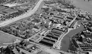
The Frankford Arsenal is a former United States Army ammunition plant located adjacent to the Bridesburg neighborhood of Northeast Philadelphia, Pennsylvania, north of the original course of Frankford Creek.
The Civil War Museum of Philadelphia in Philadelphia, Pennsylvania, claims to be the oldest chartered American Civil War institution in the United States. The museum was founded in 1888 by veteran U.S. Army, Navy, and Marine Corps officers.

The Frankford Avenue Bridge, also known as the Pennypack Creek Bridge, the Pennypack Bridge, the Holmesburg Bridge, and the King's Highway Bridge, erected in 1697 in the Holmesburg section of Northeast Philadelphia, in the U.S. state of Pennsylvania, is the oldest surviving roadway bridge in the United States. The three-span, 73-foot-long (22 m) twin stone arch bridge carries Frankford Avenue, just north of Solly Avenue, over Pennypack Creek in Pennypack Park.
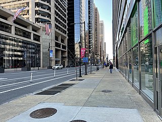
Market Street, originally known as High Street, is a major east–west highway and street in Philadelphia, Pennsylvania, United States. The street is signed as Pennsylvania Route 3 between 38th Street and 15th Street. A short portion of the road continues west from Cobbs Creek Parkway to Delaware County, adjacent to Philadelphia. The street also serves as the dividing line for the "north" and "south" sides of the city. All north-south addresses in the city start at zero at Market Street.

During the American Civil War, the Commonwealth of Pennsylvania played a critical role in the Union, providing a substantial supply of military personnel, equipment, and leadership to the Federal government. The state raised over 360,000 soldiers for the Federal armies. It served as a significant source of artillery guns, small arms, ammunition, armor for the new revolutionary style of ironclad types of gunboats for the rapidly expanding United States Navy, and food supplies. The Phoenixville Iron Company by itself produced well over 1,000 cannons, and the Frankford Arsenal was a major supply depot.
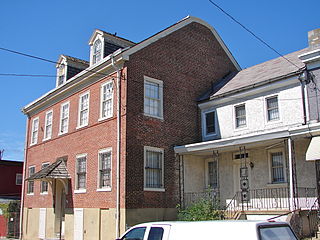
The Historical Society of Frankford is a historical society and museum is a 501(c)3 corporation located in Philadelphia, Pennsylvania. It is located in the Frankford neighborhood of Northeast Philadelphia. It was a founding member of the Pennsylvania Federation of Historical Societies.
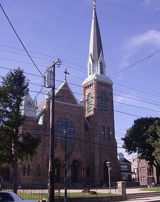
St. Mark's Church is a historic church in the Frankford neighborhood of Philadelphia, Pennsylvania. It was founded in 1832 and continues today.
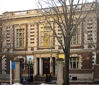
The College of Physicians of Philadelphia is the oldest private medical society in the United States. Founded in 1787 by 24 Philadelphia physicians "to advance the Science of Medicine, and thereby lessen human misery, by investigating the diseases and remedies which are peculiar to our country" and to promote "order and uniformity in the practice of Physick," it has made important contributions to medical education and research. The College hosts the Mütter Museum, a gallery of 19th-century specimens, teaching models, instruments, and photographs, as well as the Historical Medical Library, which is one of the country's oldest medical libraries.

Gov. Reuben Fenton Mansion, also known as Walnut Grove, is a historic home located at Jamestown in Chautauqua County, New York, United States. It is an Italian Villa style residence built in 1863. The home features a four-story tower. It was the home of Reuben Fenton (1819–1885). In 1919, the city of Jamestown acquired the property as a Soldiers and Sailors Memorial. During World War II it was used as a recruitment center. After being abandoned for many decades the city had plans to tear it down, however, a society was formed to help save the building. It has been home to the Fenton History Center since 1964 and is now used as a museum dedicated to the local history of Chautauqua county.

The Philadelphia trolleybus system forms part of the public transportation network serving Philadelphia, in the state of Pennsylvania, United States. It opened on October 14, 1923, and is now the second-longest-lived trolleybus system in the world. One of only four such systems currently operating in the U.S., it presently comprises three lines and is operated by the Southeastern Pennsylvania Transportation Authority (SEPTA), with a fleet of 38 trolleybuses, or trackless trolleys as SEPTA calls them. The three surviving routes serve North and Northeast Philadelphia and connect with SEPTA's Market–Frankford rapid transit line.

Girard Avenue is a major commercial and residential street in Philadelphia. For most of its length it runs east–west, but at Frankford Avenue it makes a 135-degree turn north. Parts of the road are signed as U.S. Route 13 and U.S. Route 30.


