

The Joint Surveillance System (JSS) is a joint United States Air Force and Federal Aviation Administration system for the atmospheric air defense of North America. It replaced the Semi Automatic Ground Environment (SAGE) system in 1983.
The Joint Surveillance System (JSS) is a joint United States Air Force and Federal Aviation Administration system for the atmospheric air defense of North America. It replaced the Semi Automatic Ground Environment (SAGE) system in 1983.
The JSS consists of long range surveillance radars, primarily operated and maintained by the Federal Aviation Administration (FAA), but providing communication and radar data to both FAA and United States Air Force control centers.
FAA equipment is primarily a mixture of Long Range Air Route Surveillance Radars (ARSR) of various types, although some use legacy AN/FPS radars. They are co-located with UHF ground-air-ground (G/A/G) transmitter/receiver (GATR) facilities at many locations. Fourteen sites have VHF radios as well. The GATR facility provides radio access to fighters and Airborne early warning and control (AEW&C) aircraft from the Sector Operations Control Centers. The JSS has been enhanced under the FAA/Air Force Radar Replacement Program with 44 ARSR-4/FPS-130 radars to replace some of the many previous long-range radars. This provides common, high-performance, unattended radars. The ARSR-4/FPS-130 is a 3-D long range radar with an effective detection range of some 250 miles and has been fully integrated with JSS at all joint use sites.
These radars are generally unattended except for periodic FAA maintenance crews which visit the sites as necessary. Hence, the 117 was also known as "minimally attended radar" (MAR).
The USAF Air Combat Command portion of the JSS is composed of three Continental United States (CONUS) Sector Operations Control Centers (SOCC) equipped with Battle Control System-Fixed (BCS-F) displays. Three of the SOCCs are located in the Continental United States (CONUS) at the following locations:
A SOCC is located in Alaska at Elmendorf AFB, in Hawaii at Wheeler Field and two in Canada at CFB North Bay, Ontario. The mission of the SOCC network is peacetime air sovereignty and surveillance. Wartime functions are available if necessary. The SOCCs accept data from multiple sensors, automatically process this data and display data for detection, tracking and identification of air targets, and the assignment and direction of interceptor aircraft to ensure peacetime air sovereignty.
Each SOCC functions as the primary command and control center in each NORAD region during crisis or attack as long as they are capable.
CONUS SOCCs receive data from 46 JSS radar sites. Radar sites of the Alaska Radar System feeds data to Elmendorf AFB, Alaska and two radar sites supply data for the SOCC at Hickam Field, Hawaii. Radars from the North Warning System network in Canada feed data to two Canadian SOCCs located at CFB North Bay, Ontario.
Command and control can be transitioned to the E-3A Airborne early warning and control (AEW&C) for survivability as the tactical situation warrants. In peacetime, six of these aircraft are assigned to co-operate with the JSS. ROCC information is also passed to the North American Air Defense Command (NORAD) Combat Operations Center (COC) in Colorado Springs, Colorado.
| Site Number | NORAD-ID | Name | State | Radar Type | Location | USAF Sector | FAA Sector | Notes |
|---|---|---|---|---|---|---|---|---|
| QPC | Haleyville | AL | AN/FPS-67B | 34°24′56″N087°32′23″W / 34.41556°N 87.53972°W | EADS | ASO Southern | Radar developed by Raytheon for SAGE system. [1] | |
| MGM | Montgomery | AL | ARSR-1D | 32°12′42″N086°10′06″W / 32.21167°N 86.16833°W | EADS | ASO Southern | In rural area, 13.2 miles (21.2 km) southeast of Montgomery. | |
| QXR | Z-237 | Russellville | AR | AN/FPS-64A | 35°24′10″N092°59′39″W / 35.40278°N 92.99417°W | WADS | ASW Southwest | Former ADCOM SAGE radar site, still uses the FPS-64A. |
| TXK | Texarkana | AR | AN/FPS-67B | 33°21′35″N093°55′22″W / 33.35972°N 93.92278°W | WADS | ASW Southwest | Replaced ADCOM SAGE Texarkana AFS M-91 site | |
| PHX | Z-247 | Humboldt Mountain, Phoenix ARSR | AZ | ARSR-1E | 33°58′53″N111°47′53″W / 33.98139°N 111.79806°W | AWP WESTERN PACIFIC | Opened 1958 at Forest Ranger Lookout site. | |
| J-29A | Ajo | AZ | ARSR-4 | 32°25′52″N112°56′42″W / 32.43111°N 112.94500°W | WADS | ASW Southwest | Opened 2000 at former ADCOM Ajo AFS site, replaced J-29 near Phoenix | |
| QXP | Seligman | AZ | ARSR-3 | 35°21′10″N112°56′59″W / 35.35278°N 112.94972°W | WADS | AWP Western Pacific | Remote site on top of mountain peak. | |
| J-83 | Z-33 | Crescent City | CA | 41°33′33″N124°05′10″W / 41.55917°N 124.08611°W | AWP Western Pacific | Former ADCOM Klamath AFS, Closed 1995, replaced by J-83A | ||
| J-83A | Rainbow Ridge | CA | ARSR-4 | 40°23′39″N124°09′58″W / 40.39417°N 124.16611°W | WADS | AWP Western Pacific | Replaced J-83 and J-34. Remote site on top of mountain peak. | |
| J-34 | Z-37 | Point Arena | CA | 38°53′35″N123°32′40″W / 38.89306°N 123.54444°W | AWP Western Pacific | Former ADCOM SAGE Point Arena AFS, closed 1995. Replaced by J-83A | ||
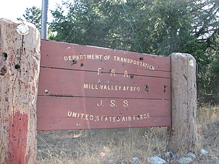
| QMV | Z-38 | Mill Valley | CA | ARSR-4 | 37°55′26″N122°35′51″W / 37.92389°N 122.59750°W | WADS | AWP Western Pacific | Former ADCOM SAGE Mill Valley AFS, inactivated 1980. Now FAA site. |
| J-32 | Z-236 | Paso Robles | CA | ARSR-4 | 35°23′41″N120°21′15″W / 35.39472°N 120.35417°W | WADS | AWP Western Pacific | FAA site since 1960. Former USAF SAGE site Z-236, replacing Cambria AFS, Became JSS site in 1980 |
| J-31 | Z-39 | San Pedro | CA | 33°44′46″N118°20′10″W / 33.74611°N 118.33611°W | AWP Western Pacific | Former ADCOM San Pedro Hill AFS inactivated 1995. JSS site closed, replaced by Navy ARSR-4 site J-36A on San Clemente Island. | ||
| J-36A | San Clemente Island (USN) | CA | ARSR-4 | 32°53′03″N118°27′03″W / 32.88417°N 118.45083°W | WADS | AWP Western Pacific | New site established in late 1990s located on very remote location. | |
| J-30 | Z-76 | Mount Laguna | CA | ARSR-4 | 32°52′34″N116°24′54″W / 32.87611°N 116.41500°W | WADS | AWP Western Pacific | Replaced ADCOM Mount Laguna AFS inactivated 1991. Second ARSR-4 installation |
| J-35 | Vandenberg AFB | CA | ARSR-4 | 34°35′13″N120°35′41″W / 34.58694°N 120.59472°W | WADS | USAF JSS site (not used by the FAA) | ||
| DNV | Z-212 | Denver | CO | ARSR-1D | 39°35′39″N104°41′35″W / 39.59417°N 104.69306°W | WADS | ANM Northwest Mountain | Opened in 1963 by FAA, was data tied-into the ADCOM SAGE network. |
| GJC | Z-215 | Grand Junction | CO | ARSR-2 | 39°38′19″N108°45′45″W / 39.63861°N 108.76250°W | WADS | ANM Northwest Mountain | Opened in 1963 by FAA, was data tied-into the ADCOM SAGE network. |
| TCO | Z-222 | Trinidad | CO | ARSR-2 | 37°32′49″N104°00′50″W / 37.54694°N 104.01389°W | WADS | ANM Northwest Mountain | Opened in 1963 by FAA, was data tied-into the ADCOM SAGE network. |
| J-04 | Z-327 | Whitehouse NOLF | FL | ARSR-4 | 30°20′45″N081°52′25″W / 30.34583°N 81.87361°W | EADS | ASO Southern | Replaced ADCOM M-114 SAGE site at NAS Jacksonville inactivated 1981. |
| J-05 | Z-211 | Patrick AFB | FL | 28°12′50″N080°35′57″W / 28.21389°N 80.59917°W | ASO Southern | Former ADCOM SAGE site, inactivated 1988. Used until 1996 by FAA. | ||
| J-05A | Melbourne | FL | ARSR-4 | 28°05′03″N080°47′53″W / 28.08417°N 80.79806°W | WADS | ASO Southern | Replaced J-05 with new ARSR-4 installation. | |
| J-06 | Z-210 | Richmond | FL | ARSR-1F | 25°37′24″N080°24′16″W / 25.62333°N 80.40444°W | ASO Southern | Former ADCOM Richmond AFS, closed 1992, destroyed by Hurricane Andrew | |
| J-06A | Tamiami | FL | ARSR-4 | 25°38′50″N080°30′19″W / 25.64722°N 80.50528°W | EADS | ASO Southern | Replaced destroyed J-06 by FAA at new location with ARSR-4 radar. | |
| J-07 | Z-209 | NAS Key West | FL | ARSR-4 | 24°35′04″N081°41′21″W / 24.58444°N 81.68917°W | EADS | ASO Southern | ADCOM SAGE site closed 1979, now joint-use Navy/FAA radar |
| J-09 | Z-330 | Fort Lonesome | FL | 27°38′44″N082°07′58″W / 27.64556°N 82.13278°W | ASO Southern | Opened in 1980 replacing ADCOM SAGE site M-129 at MacDill AFB. Closed 1998 | ||
| J-09A | Fort Green | FL | ARSR-4 | 27°42′02″N082°00′25″W / 27.70056°N 82.00694°W | EADS | ASO Southern | In agricultural area 32.9 miles (52.9 km) east-southeast of Tampa. | |
| J-10 | Z-333 | Cross City | FL | ARSR-4 | 29°44′38″N083°00′03″W / 29.74389°N 83.00083°W | EADS | ASO Southern | New site opened in 1980 replaced ADCOM SAGE Cross City AFS TM-200. |
| J-11 | Z-198 | Tyndall AFB | FL | ARSR-4 | 30°04′33″N085°36′39″W / 30.07583°N 85.61083°W | EADS | ASO Southern | Opened in 1983, replaced ADCOM TM-198 site on the base. |
| QHN | Ashburn | GA | ARSR-1E | 31°41′45″N083°45′01″W / 31.69583°N 83.75028°W | EADS | ASO Southern | In rural location, 25.2 miles (40.6 km) east-northeast of Albany, GA | |
| QNK | Lincolnton | GA | ARSR-3 | 33°45′35″N082°28′01″W / 33.75972°N 82.46694°W | EADS | ASO Southern | Replaced ADCOM SAGE site at Aiken AFS, South Carolina (SM-159) | |
| QJO | Arlington | IA | ARSR-3 | 42°46′06″N091°36′55″W / 42.76833°N 91.61528°W | WADS | ACE Central | In rural location, 41.7 miles (67.1 km) east-northeast of Waterloo, IA | |
| QVA | Ashton | ID | ARSR-2 | 44°33′45″N111°26′41″W / 44.56250°N 111.44472°W | WADS | ANM Northwest Mountain | Opened 1963. On Sawtell Peak 2.3 miles (3.7 km) south-southwest of Yellowstone National Park Airport, ID [2] | |
| BOI | Z-223 | Boise | ID | ARSR-2 | 44°26′33″N116°08′13″W / 44.44250°N 116.13694°W | WADS | ANM Northwest Mountain | Opened in 1963 by FAA. Located atop Snowbank Mountain. Began feeding information into the ADCOM SAGE network in 1963. |
| JOL | Elwood | IL | ARSR-3 | 41°25′22″N088°03′30″W / 41.42278°N 88.05833°W | EADS | AGL Great Lakes | In rural location, 7.2 miles (11.6 km) south of Joilet, IL | |
| Z-63 | Hanna City | IL | ARSR | 40°41′56″N089°49′33″W / 40.69889°N 89.82583°W | EADS | AGL Great Lakes | FAA site since 1969, former Hanna City AFS [3] | |
| IND | Indianapolis | IN | ARSR-1E | 39°44′46″N086°17′05″W / 39.74611°N 86.28472°W | EADS | AGL Great Lakes | In urban area, 2.3 miles (3.7 km) north of Indianapolis International Airport; 7102 Howard St, Indianapolis, IN 46241 | |
| QTZ | La Grange | IN | ARSR-1E | 41°37′52″N085°24′53″W / 41.63111°N 85.41472°W | EADS | AGL Great Lakes | Located in suburbs, 1 mile (1.6 km) south of La Grange, IN. | |
| GCK | Z-226 | Garden City | KS | ARSR-2 | 37°39′51″N100°52′18″W / 37.66417°N 100.87167°W | WADS | ACE Central | FAA site since 1964 in highly agricultural area, was data tied-into the ADCOM SAGE network. 21.3 miles (34.3 km) south of Garden City, KS. |
| QBZ | Oskaloosa | KS | ARSR-2 | 39°13′19″N095°14′46″W / 39.22194°N 95.24611°W | WADS | ACE Central | In rural area, 17.3 miles (27.8 km) north of Lawrence, KS. | |
| J-14 | Z-248 | Lake Charles AFS | LA | 30°11′05″N093°10′30″W / 30.18472°N 93.17500°W | ASW Southwest | Former ADCOM SAGE site at former Lake Charles AFB. Closed in the 1990s and moved to J-14A | ||
| J-14A | Lake Charles | LA | ARSR-4 | 30°21′38″N093°30′41″W / 30.36056°N 93.51139°W | WADS | ASW Southwest | New site located in rural area 23.5 miles (37.8 km) east-northeast of former site. | |
| J-13 | Z-246 | Slidell | LA | ARSR-4 | 30°20′53″N089°46′46″W / 30.34806°N 89.77944°W | EADS | ASW Southwest | Former ADCOM SAGE site, on north side of Lake Pontchartrain, 32.5 miles (52.3 km) north-northeast of New Orleans |
| QHA | Cummington | MA | AN/FPS-66B | 42°28′29″N072°58′05″W / 42.47472°N 72.96806°W | EADS | ANE New England | Located atop Bryant Mountain. Using ADCOM SAGE radar. | |
| J-53 | Z-10 | North Truro | MA | ARSR-4 | 42°02′03″N070°03′15″W / 42.03417°N 70.05417°W | EADS | ANE New England | On former ADCOM North Truro AFS closed in 1994. |
| J-54 | Z-110 | Bucks Harbor | ME | ARSR-4 | 44°37′46″N067°23′43″W / 44.62944°N 67.39528°W | EADS | ANE New England | On former ADCOM Bucks Harbor AFS closed in 1979 |
| J-63 | Caribou | ME | ARSR-4 | 46°53′09″N067°58′17″W / 46.88583°N 67.97139°W | EADS | ANE New England | Former Army Nike IFC L-58C of Loring AFB Defense Area. It was run by personnel from the 2192nd Communication Squadron. [4] | |
| CPV | Coopersville | MI | AN/FPS-66 | 43°02′44″N085°59′32″W / 43.04556°N 85.99222°W | EADS | AGL Great Lakes | Using ADCOM SAGE Radar | |
| J-58 | Z-34 | Empire | MI | ARSR-4 | 44°48′07″N086°03′05″W / 44.80194°N 86.05139°W | EADS | AGL Great Lakes | Former ADCOM Empire AFS. Became a USAF-FAA joint-use site in 1964, USAF inactivated 1978 |
| J-62 | Z-397 | Canton | MI | ARSR-4 | 42°16′36″N083°28′27″W / 42.27667°N 83.47417°W | EADS | AGL Great Lakes | First, was a temporary data-tie (Z-61 radar change-out). Now a permanent data-tie site in the JSS, replacing Port Austin AFS (Z-61/J-57). |
| QJE | Minneapolis | MN | ARSR-1E | 44°45′09″N093°13′40″W / 44.75250°N 93.22778°W | WADS | AGL Great Lakes | Located 10.8 miles (17.4 km) south-southwest of Minneapolis-Saint Paul International Airport in urban area. Address is 13591 Harwell Path Apple Valley, MN 55124 | |
| J-60 | Z-306 | Nashwauk | MN | ARSR-4 | 47°23′51″N093°10′13″W / 47.39750°N 93.17028°W | WADS | AGL Great Lakes | New FAA/USAF JSS radar site; replaced Finland AFS, MN (Z-69) and Baudette AFS, MN (Z-132). |
| QJC | Tyler | MN | ARSR-2 | 44°11′37″N096°12′15″W / 44.19361°N 96.20417°W | WADS | AGL Great Lakes | In rural area of southwest Minnesota, 154.7 miles (249.0 km) west-southwest of Minneapolis. | |
| STL | St. Louis | MO | ARSR-1E | 38°42′03″N090°23′26″W / 38.70083°N 90.39056°W | WADS | ACE Central | In urban area, address is 2310 Ashby Rd St Louis, MO 63114 | |
| QMH | Newport | MS | ARSR-3 | 32°56′51″N089°50′41″W / 32.94750°N 89.84472°W | EADS | ASO Southern | In very rural area | |
| J-77 | Z-147 | Malmstrom AFB | MT | 47°30′05″N111°12′11″W / 47.50139°N 111.20306°W | ANM Northwest Mountain | ADCOM site closed 1996, Moved to J-77A. | ||
| J-77A | Bootlegger Ridge | MT | ARSR-4 | 47°36′49″N111°17′25″W / 47.61361°N 111.29028°W | WADS | ANM Northwest Mountain | Replacement JSS site for Malmstrom AFB radar site (Z-147 / J-77); Bootlegger Ridge ARSR-4 site is about 7 miles northeast of Great Falls. | |
| J-78 | Z-179 | Lakeside (Kalispell) | MT | ARSR-4 | 48°00′41″N114°21′54″W / 48.01139°N 114.36500°W | WADS | ANM Northwest Mountain | Located at former ADCOM Kalispell AFS. |
| QRL | Benson | NC | ARSR-1E | 35°30′40″N078°32′56″W / 35.51111°N 78.54889°W | EADS | ASO Southern | FAA long-range radar site. Also known as Raleigh. Once considered as the JSS replacement for the ADCOM SAGE Fort Fisher AFS, NC (Z-115). | |
| QRM | Charlotte | NC | ARSR-1 | 35°36′39″N081°14′18″W / 35.61083°N 81.23833°W | EADS | ASO Southern | In rural area, 10.2 miles (16.4 km) southeast of Hickory, NC | |
| J-02 | Z-115 | Fort Fisher | NC | ARSR-4 | 33°58′38″N077°54′56″W / 33.97722°N 77.91556°W | EADS | ASO Southern | Fort Fisher AFS was an active ADCOM site until 1988; FAA site at former GATR facility. |
| J-75 | Z-303 | Finley | ND | ARSR-4 | 47°31′42″N097°54′03″W / 47.52833°N 97.90083°W | WADS | AGL Great Lakes | Opened November 1979 at new JSS site, replacing the original Finley AFS, ND (Z-29). [Located at old GATR site, ~ a mile or so WNW of the former USAF radar site.] |
| J-76 | Z-300 | Watford City | ND | ARSR-4 | 47°40′44″N103°46′50″W / 47.67889°N 103.78056°W | WADS | AGL Great Lakes | New FAA/USAF JSS radar site; replaced Fortuna AFS, ND (Z-27), Minot AFS, ND (Z-28), & Opheim AFS, MT (Z-26). Site is located at the former Alexander, ND, gap-filler radar site, Z-177B / Z-28E. |
| QHO | Z-71 | Omaha | NE | ANFPS-67A | 41°21′37″N96°1′30″W / 41.36028°N 96.02500°W | WADS | ACE Central | FAA site since 1968, former Omaha Air Force Station |
| NPL | Z-217 | North Platte | NE | ARSR-2 | 40°49′58″N100°44′53″W / 40.83278°N 100.74806°W | WADS | ACE Central | FAA site since 1963, Former ADCOM SAGE site Z-217 |
| J-51 | Z-63 | Gibbsboro | NJ | ARSR-4 | 39°49′29″N074°57′15″W / 39.82472°N 74.95417°W | EADS | AEA Eastern | Former ADCOM Gibbsboro AFS. USAF site closed 1984 |
| GAL | Z-221 | Gallup | NM | ARSR-2 | 36°04′33″N108°51′37″W / 36.07583°N 108.86028°W | WADS | ASW Southwest | Opened 1963 by FAA. Former ADCOM SAGE site Z-221. Also known as Farmington, NM; located above Washington Pass, north of Gallup. |
| QWC | Z-234 | Mesa Rica | NM | ARSR-1E | 35°14′15″N104°12′16″W / 35.23750°N 104.20444°W | WADS | ASW Southwest | Former ADCOM SAGE site Z-234. |
| J-28 | Z-245 | Silver City | NM | 32°59′21″N108°57′38″W / 32.98917°N 108.96056°W | ASW Southwest | Closed 1990s Located atop Brushy Mountain. Part of the 1972 Southern Air Defense System. Now replaced by new ARSR-4 JSS site at Deming, NM (J-28A). | ||
| J-28A | Deming | NM | ARSR-4 | 32°29′30″N107°09′59″W / 32.49167°N 107.16639°W | WADS | ASW Southwest | Replaced JSS site at Silver City, NM (Z-245 / J-28). | |
| BTM | Z-214 | Battle Mountain | NV | ARSR-2 | 40°24′11″N116°52′04″W / 40.40306°N 116.86778°W | WADS | AWP Western Pacific | Located on top of Mount Lewis, south of Battle Mountain. Earlier known as Elko. |
| J-52 | Z-315 | Riverhead | NY | ARSR-4 | 40°52′43″N072°41′14″W / 40.87861°N 72.68722°W | EADS | AEA Eastern | 'New' FAA/USAF JSS radar site; replaced Montauk AFS, LI, NY (Z-45). |
| J-55 | Z-312 | Remsen | NY | ARSR-4 | 43°20′43″N075°14′56″W / 43.34528°N 75.24889°W | EADS | AEA Eastern | New FAA/USAF JSS radar site; replaced Watertown AFS, NY (Z-49). Also called 'Starr Hill. |
| J-56 | Z-309 | Dansville | NY | ARSR-1E | 42°38′18″N077°39′10″W / 42.63833°N 77.65278°W | EADS | AEA Eastern | Replaced Lockport AFS, NY (Z-21). |
| QDB | Brecksville | OH | ARSR-1E | 41°18′08″N081°41′01″W / 41.30222°N 81.68361°W | EADS | AGL Great Lakes | Located 13.7 miles (22.0 km) south of Cleveland. | |
| QWO | London | OH | ARSR-1E | 39°50′46″N083°28′54″W / 39.84611°N 83.48167°W | EADS | AGL Great Lakes | Located 3.3 miles (5.3 km) southwest of London, OH. | |
| OEX | Oklahoma City | OK | ARSR-4 | 35°24′11″N097°37′42″W / 35.40306°N 97.62833°W | WADS | ASW Southwest | FAA ARSR-4 Training Site. Located about a mile west of the Will Rogers World Airport. | |
| QVN | Fossil | OR | ARSR-3 | 44°57′37″N119°57′06″W / 44.96028°N 119.95167°W | WADS | ANM Northwest Mountain | On remote mountaintop, 138.3 miles (222.6 km) east-southeast of Portland, OR | |
| J-81 | Z-345 | Salem | OR | ARSR-4 | 44°55′22″N123°34′25″W / 44.92278°N 123.57361°W | WADS | ANM Northwest Mountain | Former ADCOM SAGE site. Also known as Laurel Mtn. and Dallas, OR. New FAA/USAF JSS radar site; replaced Mount Hebo AFS, OR (Z-100). FPS-90 came from Keno AFS, OR (Z-180); modified to FPS-116. First operational JSS site in the 25th NORAD Region, 1 May 1979, as OL AJ / 25th ADS. |
| QCF | Clearfield | PA | ARSR-3 | 41°04′13″N078°33′01″W / 41.07028°N 78.55028°W | EADS | AEA Eastern | Located 6.1 miles (9.8 km) west of Clearfield, PA in rural area. | |
| J-61 | Trevose | PA | ARSR-1 | 40°08′03″N074°59′13″W / 40.13417°N 74.98694°W | AEA Eastern | Temporary data-tie (during the Gibbsboro AFS {Z-63} JSS radar change-out). Then became a 'permanent' replacement for Z-63 until Gibbsboro re-opened with its ARSR-4 and closed in mid 1990s. | ||
| J-03 | Z-324 | Jedburg | SC | ARSR-4 | 33°04′11″N080°13′14″W / 33.06972°N 80.22056°W | EADS | ASO Southern | Replaced North Charleston AFS, SC (Z-113). |
| QOJ | Z-235 | Joelton | TN | ARSR-1E | 36°20′10″N086°51′41″W / 36.33611°N 86.86139°W | EADS | ASO Southern | Former ADCOM Joelton AFS closed in 1961 and taken over by FAA. |
| QYB | Z-233 | Memphis | TN | ARSR-1 | 34°51′10″N089°45′57″W / 34.85278°N 89.76583°W | EADS | ASO Southern | Former ADCOM SAGE Site Z-233. |
| QYS | Rogers | TX | ARSR-1E | 30°56′38″N097°16′07″W / 30.94389°N 97.26861°W | WADS | ASW Southwest | In rural area, 2.7 miles (4.3 km) west-northwest of Rogers, TX | |
| J-27 | Z-244 | El Paso | TX | 31°40′51″N106°11′50″W / 31.68083°N 106.19722°W | WADS | ASW Southwest | Located in Horizon City, TX. Activated in 1963 part of Southern Air Defense System. Closed in 1997, replaced by new ARSR-4 JSS sites at Eagle Peak, TX (J-27A) and at Deming, NM (J-28A). | |
| J-27A | Eagle Peak | TX | ARSR-4 | 30°55′13″N105°05′09″W / 30.92028°N 105.08583°W | WADS | ASW Southwest | New site opened in late 1990s replacing J-27, 101.1 miles (162.7 km) SE of El Paso, TX in remote location on top of mountain. | |
| J-15 | Z-240 | Ellington AFB | TX | 29°36′56″N095°10′23″W / 29.61556°N 95.17306°W | WADS | ASW Southwest | ADCOM SAGE site closed in 1979. FAA took over, closed 1997. Now replaced by new ARSR-4 JSS site at Morales, TX (J-15A). | |
| FTW | Z-231 | Keller | TX | ARSR-1D | 32°56′40″N097°13′13″W / 32.94444°N 97.22028°W | WADS | ASW Southwest | Also known as Fort Worth. Opened in 1960s, still using ARSR-1D. |
| J-15A | Morales | TX | ARSR-4 | 29°20′29″N096°52′18″W / 29.34139°N 96.87167°W | WADS | ASW Southwest | Replaced Ellington ANGB, TX, radar site (Z-240/J-15), 111.3 miles (179.1 km) north-northeast of Corpus Christi, TX | |
| J-26 | Z-242 | Odessa | TX | 32°33′15″N102°25′40″W / 32.55417°N 102.42778°W | ASW Southwest | Closed 1995, replaced by new ARSR-4 JSS site at King Mountain, TX (J-26A). | ||
| J-26A | King Mountain | TX | ARSR-4 | 31°17′06″N102°16′24″W / 31.28500°N 102.27333°W | WADS | ASW Southwest | Replaced JSS site at Odessa / Andrews, TX (Z-243/J-26); located in remote West Texas. | |
| J-16 | Z-242 | Oilton | TX | ARSR-4 | 27°29′56″N098°58′10″W / 27.49889°N 98.96944°W | WADS | ASW Southwest | Opened in 1972 as part of the Southern Air Defense System (SADS); Later ADCOM site 630th RADS OL-B, inactivated 31 December 1977. |
| J-25 | Z-339 | Sonora | TX | ARSR-3 | 30°28′16″N100°33′29″W / 30.47111°N 100.55806°W | ASW Southwest | Former ADCOM SAGE site, closed 1995, Now replaced by Rocksprings, TX, ARSR-4 JSS site (J-25A). | |
| J-25A | Rocksprings | TX | ARSR-4 | 30°02′48″N100°16′04″W / 30.04667°N 100.26778°W | WADS | ASW Southwest | Replaced JSS Site at Sonora, TX (J-25). | |
| CDR | Z-216 | Cedar City | UT | ARSR-2 | 37°35′35″N112°51′49″W / 37.59306°N 112.86361°W | WADS | ANM Northwest Mountain | Opened in 1962 by FAA |
| SLC | Z-213 | Francis Peak | UT | ARSR-1E | 41°01′58″N111°50′18″W / 41.03278°N 111.83833°W | WADS | ANM Northwest Mountain | Opened in 1962 by FAA. Also called "Salt Lake City" |
| QHZ | Horicon | WI | ARSR-2 | 43°26′45″N088°29′32″W / 43.44583°N 88.49222°W | EADS | AGL Great Lakes | In central Wisconsin in primarily agricultural area. | |
| QBN | Binns Hall | VA | ARSR-3 | 37°22′58″N076°59′55″W / 37.38278°N 76.99861°W | EADS | AEA Eastern | Once considered as the JSS replacement for Cape Charles AFS, VA (Z-56). | |
| J-01 | Z-321 | NAS Oceana | VA | ARSR-4 | 36°49′38″N076°00′49″W / 36.82722°N 76.01361°W | EADS | AEA Eastern | Former ADCOM SAGE site, now FAA/USAF/Navy JSS radar site; replaced Cape Charles AFS, VA (Z-56). |
| J-50 | Z-318 | The Plains | VA | ARSR-3 | 38°52′57″N077°42′10″W / 38.88250°N 77.70278°W | EADS | AEA Eastern | Opened in 1980. Replaced the ADCOM radar site at Fort Meade, MD (Z-227) and the FAA radar site at Suitland, MD. |
| J-79 | Z-151 | Mica Peak | WA | ARSR-4 | 47°34′26″N117°04′52″W / 47.57389°N 117.08111°W | WADS | ANM Northwest Mountain | Former ADCOM Mica Peak AFS (SM-151), deactivated in July 1975. Site transferred to FAA. |
| J-80 | Z-44 | Makah | WA | ARSR-4 | 48°22′18″N124°40′30″W / 48.37167°N 124.67500°W | WADS | ANM Northwest Mountain | Former ADCOM Makah AFS (P-44), closed in 1982. Now USAF/FAA JSS site. |
| QSI | Z-224 | Lovell | WY | ARSR-2 | 44°49′01″N107°54′08″W / 44.81694°N 107.90222°W | WADS | ANM Northwest Mountain | Located on Medicine Mountain. Earlier known as Cody. |
| LSK | Z-219 | Lusk | WY | ARSR-2 | 42°35′38″N104°35′18″W / 42.59389°N 104.58833°W | WADS | ANM Northwest Mountain | Opened in 1963 by FAA |
| RKS | Z-218 | Rock Springs | WY | ARSR-2 | 41°26′05″N109°07′03″W / 41.43472°N 109.11750°W | WADS | ANM Northwest Mountain | Opened in 1962 by FAA |
Point Arena Air Force Station is a closed United States Air Force General Surveillance Radar station. It is located 3.7 miles (6.0 km) east of Point Arena, California. It was closed in 1998 by the Air Force, and turned over to the Federal Aviation Administration (FAA).
Empire Air Force Station is a former United States Air Force Aerospace Defense Command (ADC) long range radar site located 0.7 miles (1.1 km) south-southeast of Empire, Michigan, in Empire Township. It was closed in 1978 by the Air Force, and turned over to the Federal Aviation Administration (FAA).
Ground Equipment Facility J-33 is a Federal Aviation Administration (FAA) radar station of the Joint Surveillance System's Western Air Defense Sector (WADS) with an Air Route Surveillance Radar (ARSR-4). The facility was previously a USAF general surveillance radar station during the Cold War.

Finley Air Force Station is a closed United States Air Force General Surveillance Radar station. It is located 1.5 miles (2.4 km) west-northwest of Finley, North Dakota. It was closed in 1979 by the Air Force, and turned over to the Federal Aviation Administration (FAA).

Barter Island LRRS Airport is a public/military airport located near the city of Kaktovik on Barter Island, in the North Slope Borough, located 312 miles (502 km) east of Point Barrow, Alaska. The airport is owned by the North Slope Borough. It is also known as Barter Island Airport or Kaktovik Airport. The acronym LRRS stands for Long Range Radar Site or Long Range Radar Station.
Bedford Air Force Station is a closed United States Air Force General Surveillance Radar station. It is located 12.7 miles (20.4 km) north of Bedford, Virginia. It was closed in 1975.
North Charleston Air Force Station is a closed United States Air Force General Surveillance Radar station. It is located in the City of North Charleston, South Carolina. It was closed in 1980.

Joelton Air Force Station is a closed United States Air Force General Surveillance Radar station. It is located 8.3 miles (13.4 km) west of Goodlettsville, Tennessee. It was closed in 1960.

Kirksville Air Force Station is a closed United States Air Force General Surveillance Radar station. It is located 7.1 miles (11.4 km) north of Kirksville, Missouri. It was closed by the Air Force in 1968. Today the radar site is used by the Federal Aviation Administration (FAA) as a Joint Surveillance System (JSS) site.
Dauphin Island Air Force Station is a closed United States Air Force General Surveillance Radar station. It is located 1.9 miles (3.1 km) east of Dauphin Island, Alabama, near historic Fort Gaines (Alabama). It was closed in 1980.
Finland Air Force Station is a closed United States Air Force General Surveillance Radar station. It is located 2.8 miles (4.5 km) north of Finland, Minnesota. It was closed in 1980.

Ajo Air Force Station is a closed United States Air Force General Surveillance Radar station. It is located 6.4 miles (10.3 km) northwest of Ajo, Arizona. It was closed in 1969 by the Air Force, and the radar site turned over to the Federal Aviation Administration (FAA).
Boron Air Force Station is a closed United States Air Force General Surveillance Radar station. It is located 6.8 miles (10.9 km) northeast of Boron, California. It was closed by the Air Force in 1975 and turned over to the Federal Aviation Administration (FAA). The radar site is still operated by the FAA as part of the Joint Surveillance System (JSS).

Mount Laguna Air Force Station is a closed United States Air Force General Surveillance Radar station. It is located 24.3 miles (39.1 km) north-northeast of Tecate, California. It was closed in 1981 by the Air Force, and turned over to the Federal Aviation Administration (FAA).
Lake Charles Air Force Station is a closed United States Air Force General Surveillance Radar station. It is located 3.8 miles (6.1 km) southeast of Lake Charles, Louisiana. It was closed in 1995 by the Air Force, and turned over to the Federal Aviation Administration (FAA).
Mica Peak Air Force Station is a closed United States Air Force General Surveillance Radar station. It is located atop Mica Peak, 6.3 miles (10.1 km) east-northeast of Mica, Washington. It was closed in 1975 by the Air Force, and turned over to the Federal Aviation Administration (FAA).

Kalispell Air Force Station is a closed United States Air Force General Surveillance Radar station. It is located 13.3 miles (21.4 km) south of Kalispell, Montana near the community of Lakeside.
Makah Air Force Station is a closed United States Air Force General Surveillance Radar station. It is located 2.4 miles (3.9 km) south of Neah Bay, Washington. It was closed in 1988 by the Air Force, and turned over to the Federal Aviation Administration (FAA).
Fort Lawton Air Force Station is a closed United States Air Force General Surveillance Radar station. It is located on Fort Lawton in the Magnolia neighborhood of northwest Seattle, Washington. The Air Force inactivated its unit in 1963; while the site remained under Army control until 1974. Today the Federal Aviation Administration (FAA) operates the site as part of the Joint Surveillance System (JSS).
FYQ-93 was a computer system used from 1983 to 2006, and built for the Joint Surveillance System (JSS) by the Hughes Aircraft Company. The system consisted of a fault tolerant central computer complex using a two string concept that interfaced with many display consoles and interfaced with external radars to provide a region-sector display of air traffic.
![]() This article incorporates public domain material from the Air Force Historical Research Agency
This article incorporates public domain material from the Air Force Historical Research Agency