Kailua-Kona, Hawaii

Last updated
Kailua-Kona
Kailua-Kona (Hawaii County)
Kona Mauka.jpg
Kailua-Kona from Holualoa
Hawaii County Hawaii Incorporated and Unincorporated areas Kailua Highlighted.svg
Location in Hawaii County and the state of Hawaii
USA Hawaii location map.svg
Red pog.svg
Kailua-Kona
Coordinates: 19°39′0″N155°59′39″W / 19.65000°N 155.99417°W / 19.65000; -155.99417
Area
[1]
  Total19.19 sq mi (49.71 km2)
  Land13.80 sq mi (35.73 km2)
  Water5.40 sq mi (13.98 km2)
Elevation
7 ft (2 m)
Population
 (2020)
  Total19,713
  Density1,428.79/sq mi (551.66/km2)
Time zone UTC−10 (Hawaii–Aleutian)
ZIP code
96740
Area code 808
FIPS code 15-23000
GNIS feature ID365355

Kailua-Kona is an unincorporated community and census-designated place (CDP) in Hawaii County, Hawaii, United States. It's most commonly referred to simply as Kona (a name it shares with the district to which it belongs), but also as Kona Town, and occasionally as Kailua (a name it shares with a community on the windward side of Oʻahu), thus its less frequent use. Kailua-Kona is the second-largest settlement on the island of Hawaii (after Hilo) and the largest on the island's west side, where it is the center of commerce and the tourist industry. Kailua-Kona is served by Kona International Airport, just to the north in the adjacent CDP of Kalaoa. [2] The population was 19,713 at the 2020 census, up from 11,975 at the 2010 census.

Contents

Kailua-Kona was the closest major settlement to the epicenter of the 2006 Kiholo Bay earthquake.

Kailua-Kona's boundaries were altered significantly for the 2020 census. The eastern portion of Kailua-Kona became part of the neighboring Holualoa CDP, while the western portion of Holualoa became part of Kailua-Kona.

History

King Kamehameha's court at Kailua-Kona, receiving Otto von Kotzebue in 1816 Entrevue de l'expedition de M. Kotzebue avec le roi Tammeamea dans l'ile d'Ovayhi, Iles Sandwich.jpg
King Kamehameha's court at Kailua-Kona, receiving Otto von Kotzebue in 1816

The community was established by King Kamehameha I to be his seat of government when he was chief of Kona before he consolidated rule of the archipelago in 1795. It was later designated as the capital of the newly unified Kingdom of Hawaiʻi. The capital was later moved to Lāhainā, and then to Honolulu.

Royal fishponds at Kaloko-Honokōhau National Historical Park were the hub of unified Hawaiian culture. The town later functioned as a retreat of the Hawaiian royal family. Up until the late 1900s, Kailua-Kona was primarily a small fishing village. [3] :58 In the late 20th and early 21st centuries, the region has undergone a real estate and construction boom fueled by tourism and investment.

In 2014, the Pālamanui Community Forest preserve was created in Kailua-Kona with a goal of preserving and protecting the native trees of Hawai’i. [4]

Geography

Kailua-Kona is located at 19°39′0″N155°59′39″W / 19.65000°N 155.99417°W / 19.65000; -155.99417 (19.649973, −155.994028), [5] along the shoreline of Kailua Bay and up the southern slope of Hualālai volcano. There are no major rivers or streams in Kailua-Kona or on the Kona side of Hawaii. [3] :26

According to the United States Census Bureau, the Town has a total area of 39.9 square miles (103.3 km2), of which 35.6 square miles (92.3 km2) are land and 4.2 square miles (11.0 km2), or 10.67%, are water. [6]

Kailua-Kona is bordered to the north by Kalaoa, to the south by Holualoa, and to the west by the Pacific Ocean from Kailua Bay in the south to Honokohau Bay in the north. The Kailua-Kona postal code is 96740 (post office boxes – 96745).

Climate

Kailua-Kona has a tropical, semi-arid climate (Köppen BSh) with warm temperatures year-round, typical of its latitude in the tropics. It is the warmest place in the United States of America in January on average. The coolest month is February, with an average high temperature of 81.2 °F (27.3 °C), while the warmest is August, with an average high of 86.9 °F (30.5 °C). In addition to being the warmest place in the United States in January, it is also the city with the highest record low in the United States with an all-time low temperature of 56 °F (13 °C). Humidity is generally between 50% and 70%.[ citation needed ] Kailua-Kona is generally dry, with an average annual precipitation of 18.93 inches (481 mm). Mornings are typically clear, while thermal clouds created in the day raise the temperature during the day. [3] :26


Climate data for Kailua Kona, Hawaii (1981–2010 normals)
MonthJanFebMarAprMayJunJulAugSepOctNovDecYear
Record high °F (°C)90
(32)
90
(32)
91
(33)
90
(32)
92
(33)
92
(33)
93
(34)
95
(35)
94
(34)
94
(34)
92
(33)
89
(32)
95
(35)
Mean daily maximum °F (°C)81.6
(27.6)
81.2
(27.3)
82.2
(27.9)
83.0
(28.3)
83.5
(28.6)
85.0
(29.4)
86.0
(30.0)
86.9
(30.5)
86.8
(30.4)
86.0
(30.0)
84.2
(29.0)
82.5
(28.1)
84.1
(28.9)
Mean daily minimum °F (°C)68.2
(20.1)
68.0
(20.0)
70.0
(21.1)
70.6
(21.4)
71.6
(22.0)
73.6
(23.1)
74.1
(23.4)
75.1
(23.9)
74.6
(23.7)
74.1
(23.4)
71.8
(22.1)
69.4
(20.8)
71.8
(22.1)
Record low °F (°C)56
(13)
58
(14)
58
(14)
60
(16)
64
(18)
62
(17)
65
(18)
58
(14)
57
(14)
57
(14)
62
(17)
60
(16)
56
(13)
Average precipitation inches (mm)2.41
(61)
1.50
(38)
1.78
(45)
1.36
(35)
2.00
(51)
0.97
(25)
0.70
(18)
1.39
(35)
0.84
(21)
1.34
(34)
1.28
(33)
2.82
(72)
18.39
(468)
Source: WRCC/NCDC [7] [8]

Vog can cover parts of the Kona coast from time to time depending on the activity of the Kilauea volcano and the island winds. Kailua-Kona is located on the leeward side of the Hualalai Volcano, sheltering the town from wind and rain. [3] :58

Demographics

Historical population
CensusPop.Note
2000 9,893
2010 11,97521.0%
2020 19,71364.6%
U.S. Decennial Census [9]

2000 Census data

Kailua from southern shore Kona Makai.jpg
Kailua from southern shore

As of the census [10] of 2000, there were 9,870 people, 3,537 households, and 2,429 families residing in Kailua-Kona. The population density was 278.0 inhabitants per square mile (107.3/km2). There were 4,322 housing units at an average density of 121.7 per square mile (47.0/km2). The racial makeup of the City was 38.7% White, 0.5% Black or African American, 0.5% Native American, 18.3% Asian, 13.2% Pacific Islander, 1.9% from other races, and 27.07% from two or more races. 10.2% of the population were Hispanic or Latino of any race.

There were 3,537 households, out of which 35.0% had children under the age of 18 living with them, 49.6% were married couples living together, 13.6% had a female householder with no husband present, and 31.3% were non-families. 22.6% of all households were made up of individuals, and 7.2% had someone living alone who was 65 years of age or older. The average household size was 2.78 and the average family size was 3.26.

In Kailua-Kona the population was spread out, with 27.3% under the age of 18, 9.0% from 18 to 24, 28.8% from 25 to 44, 24.9% from 45 to 64, and 10.0% who were 65 years of age or older. The median age was 36 years. For every 100 females, there were 98.8 males. For every 100 females age 18 and over, there were 95.8 males.

The median income for a household in the city was $40,874, and the median income for a family was $46,657. Males had a median income of $30,353 versus $26,471 for females. The per capita income for the CDP was $20,624. 10.8% of the population and 6.5% of families were below the poverty line. Out of the total population, 11.9% of those under the age of 18 and 3.9% of those 65 and older were living below the poverty line.

Economy

Kailua Inn Shopping Village Kona Inn Shopping Village, Sunset, Kailua-Kona, Hawaii (4548894603).jpg
Kailua Inn Shopping Village

Kailua-Kona saw an economic downturn during the 2008 national financial crisis but in the early 2010s has seen significant growth and economic development. [11] Tourism also saw a downturn in the late 2000s but has since seen some resurgence. [12] Visitor air arrivals alone increased about 160% from 2010 to 2017. [13]

The University of Hawaii held its first classes at the new Hawaii Community College Palamanui Campus in 2015. [14] [15] [16]

Since the early 2000s the Kona side had seen significant amounts of vog from Puʻu ʻŌʻō and Kīlauea, but that changed in May 2018 when Kilauea largely ceased its emissions. Kailua-Kona's air is clearer than it has been in decades. [17]

Attractions and events

Kailua-Kona is the host of the annual Ironman World Championship triathlon, [18] the annual Kona Coffee Festival, and the Hawaiian International Billfish Tournament.

Kona coffee is the variety of Coffea arabica cultivated on the slopes of Hualālai and Mauna Loa in the North and South Kona Districts. The Kona Historical Society manages two coffee related historical sites: the Kona Coffee Living History Farm and the H.N. Greenwell Store Museum just south of Kailua-Kona. [19]

Ali'i Drive along Kailua Bay KailuaBay1.jpg
Ali'i Drive along Kailua Bay

Ali'i Drive, Kailua's oceanfront downtown street, starts at Kailua-Kona Pier. It has also been given the designation as a Hawaii Scenic Byway called the "Royal Footsteps Along the Kona Coast". [20] This byway features archaeological sites that have survived for hundreds of years.

North of the pier is the Kamakahonu royal residence and Ahuʻena Heiau, and nearby now stands the King Kamehameha's Kona Beach Hotel. Another royal residence is Huliheʻe Palace, used by members of the Hawaiian royal family until 1914. [21] The Historic Kona Inn and other shops are on the street.

Churches on the drive include Mokuaikaua Church, Hawaiʻi's first Christian church (the congregation began in 1820), Saint Michael the Archangel Catholic Church, and Living Stones Church, a historical structure built after Mokuaikaua and used as a Christian Missionary landing location in the 1800-1900. Parks include La'aloa Bay (also known as Magic Sands or White Sands Beach) and Kahaluʻu Bay, a popular snorkeling location.

Old Airport Beach, north of Kailua Old Airport Beach Morning, near Kailua-Kona, Hawaii.jpg
Old Airport Beach, north of Kailua

Boat tours that allow tourists to swim with dolphins, watch whales, and fish in the ocean usually depart from Honokohau Harbor.

Media

Kailua-Kona is served by television station KLEI and by the newspaper West Hawaii Today, which is owned by Canadian publisher Black Press Media (Black Press Group Ltd.)—also known simply as Black Press—whose headquarters are in Surrey, British Columbia, Canada. [22]

Education

The Hawaii Department of Education operates public schools. Kealakehe Elementary School, Kahakai Elementary School, Kealakehe Intermediate School, and Kealakehe High School are in the Kailua CDP. [23]

The University of the Nations, a Youth With A Mission training center, is in Kailua-Kona. [24]

Notable residents

Related Research Articles

<span class="mw-page-title-main">Hawaii (island)</span> Largest of the Hawaiian islands

Hawaii is the largest island in the United States, located in the eponymous state of Hawaii. It is the southeasternmost of the Hawaiian Islands, a chain of volcanic islands in the North Pacific Ocean. With an area of 4,028 square miles (10,430 km2), it has 63% of the Hawaiian archipelago's combined landmass. However, it has only 13% of the archipelago's population. The island of Hawaiʻi is the third largest island in Polynesia, behind the north and south islands of New Zealand.

<span class="mw-page-title-main">Hawaii County, Hawaii</span> County in Hawaii, United States

Hawaii County is a county in the U.S. state of Hawaii in the Hawaiian Islands. It is coextensive with the Island of Hawaii, often called the "Big Island" to distinguish it from the state as a whole. The 2020 Census population was 200,629. The county seat is Hilo. There are no incorporated cities in Hawaii County. The Hilo Micropolitan Statistical Area includes all of Hawaii County. Hawaii County has a mayor–council form of government. In terms of geography, Hawaii County is the most expansive county in the state and the most southerly county in the United States.

<span class="mw-page-title-main">Captain Cook, Hawaii</span> Census-designated place in United States

Captain Cook is a census-designated place (CDP) in Hawaiʻi County, Hawaiʻi, in the United States, located in the District of South Kona. The community, within the land division of Kealakekua, is so named because the post office for the area was located in the Captain Cook Coffee Co. during the early 1900s. As of the 2010 census the CDP population was 3,429, up from 3,206 at the 2000 census. As of March 2022, a resolution was under consideration to rename the town to "Kaʻawaloa", meaning "long landing place".

<span class="mw-page-title-main">Hawi, Hawaii</span> Census-designated place in Hawaii, United States

Hawi (Hawaiian: Hāwī; pronounced [hɐː'viː] is a census-designated place in Hawaiʻi County, Hawaii. The population was 2,268 at the time of the 2020 United States Census.

<span class="mw-page-title-main">Holualoa, Hawaii</span> Census-designated place in Hawaii, United States

Holualoa is a census-designated place (CDP) in the North Kona District of Hawaii County, Hawaii, United States. The population was 8,538 at the 2010 census, up from 6,107 at the 2000 census.

<span class="mw-page-title-main">Honalo, Hawaii</span> Census-designated place in Hawaii, U.S.

Honalo is a census-designated place (CDP) in Hawaiʻi County, Hawaiʻi, United States. The population was 2,423 at the 2010 census, up from 1,987 at the 2000 census.

<span class="mw-page-title-main">Honaunau-Napoopoo, Hawaii</span> Census-designated place in Hawaii, U.S.

Hōnaunau-Nāpōʻopoʻo is a census-designated place (CDP) in Hawaiʻi County, Hawaii, United States. The population was 2,416 at the 2020 census.

<span class="mw-page-title-main">Kalaoa, Hawaii</span> Census-designated place in Hawaii, U.S.

Kalaoa is a census-designated place (CDP) in Hawaiʻi County, Hawaiʻi, United States. The population was 9,644 as of the 2010 census, up from 6,794 residents at the 2000 census.

<span class="mw-page-title-main">Waikoloa Village, Hawaii</span> Census-designated place in Hawaii, U.S.

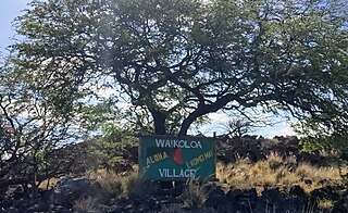
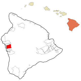
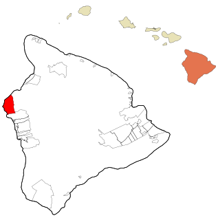
Waikōloa Village is a census-designated place (CDP) in Hawaiʻi County, Hawaii, United States. The population was 6,362 at the 2010 census, up from 4,806 at the 2000 census. The name Waikoloa is used by the local post office.

<span class="mw-page-title-main">Hualālai</span> Active volcano in the Hawaiian Islands

Hualālai is an active volcano on the island of Hawaiʻi in the Hawaiian Islands. It is the westernmost, third-youngest and the third-most active of the five volcanoes that form the island of Hawaiʻi, following Kīlauea and the much larger Mauna Loa. Its peak stands 8,271 feet (2,521 m) above sea level. Hualālai is estimated to have risen above sea level about 300,000 years ago. Despite maintaining a very low level of activity since its last eruption in 1801, and being unusually inactive for the last 2,000 years, Hualālai is still considered active, and is expected to erupt again sometime in the next 100 years. The relative unpreparedness of the residents in the area caused by the lull in activity would worsen an eruption's consequences.

<span class="mw-page-title-main">Kona International Airport</span> Airport on Hawaiʻi Island

Ellison Onizuka Kona International Airport at Keāhole is the primary airport on the Island of Hawaiʻi, located in Kailua-Kona, Hawaii, United States. The airport serves leeward (western) Hawaiʻi island, including the resorts in North Kona and South Kohala. It is one of two international airports serving Hawaiʻi island, the other being Hilo International Airport on the windward (eastern) side.

<span class="mw-page-title-main">St. Michael the Archangel Church (Kailua-Kona, Hawaii)</span>

Saint Michael the Archangel Catholic Church is a parish of the Roman Catholic Church of Hawaiʻi in the United States. Located in Kailua-Kona on the Big Island of Hawaiʻi, 75-5769 Ali'i Drive, coordinates 19°38′13″N155°59′28″W. The church falls under the jurisdiction of the Diocese of Honolulu and its bishop. On June 17, 1839, Kamehameha III declared religious freedom in the Kingdom in the Edict of Toleration. A mission named after Saint Michael the Archangel was founded in 1840, the first Catholic Church on the island. The first services were in a small grass hut. Governor John Adams Kuakini gave the land South of Mokuʻaikaua Church to the Catholic mission in 1841. The present church was completed in 1850 under Father Joachim Merechel. He was buried inside the church in 1859. In 1940 Father Benno Evers constructed a grotto of coral from Kailua Bay over the site of the original well.

Hualalai Academy, was a K-12 college preparatory school, it was the first accredited private, independent, K-12 school in the Districts of North and South Kona on the Big Island of Hawaiʻi.

The Hawaiʻi Belt Road is a modern name for the Māmalahoa Highway and consists of Hawaiʻi state Routes 11, 19, and 190 that encircle the Island of Hawaiʻi. The southern section, between Hilo and Kailua-Kona is numbered as Route 11. The section between Hilo and Waimea is Route 19. Between Waimea and Kailua-Kona, the road is split in two: the original "mauka" route and a "makai" Route 19, completed in 1975, which serves as access to the Kona and Kohala Coast resorts. In the Hawaiian language, mauka means "towards the mountain" and makai means "towards the sea". These terms are commonly used in travel directions.

<span class="mw-page-title-main">Kealakehe High School</span> High school in Hawaiʻi

Kealakehe High School is a public high school located in Kailua, Hawaii County, Hawaii, United States. It has the largest geographic school attendance boundary in the state and covers a geographic district 40 miles (64 km) wide, encompassing the communities of Kailua-Kona, Hōlualoa, Waikōloa, and Puakō. The school motto is "Harmony and unity through dynamic education and community for everyone, every time."

<span class="mw-page-title-main">Keahole Point</span> Historic Place in Hawaii County, Hawaii

Keāhole Point is the westernmost point of the island of Hawaii. The Kona International Airport was moved here from directly north of the town of Kailua-Kona in 1970, when the previous smaller airstrip was converted into the Old Kona Airport State Recreation Area. The name comes from Ke ʻāhole since the ʻāhole fish was found nearby.

<span class="mw-page-title-main">Holualoa Bay</span> Historic Place in Hawaii County, Hawaii

Hōlualoa Bay is a historic area between Kailua-Kona and Keauhou Bay in the Kona District of the Big Island of Hawaiʻi. The community now called Hōlualoa is uphill from this bay. The name means "long slide" in the Hawaiian Language, from the long trail that went from a forest on the slopes of Hualālai, to a site where the logs were made into canoes into this bay where a large royal building complex was built over several centuries.

<span class="mw-page-title-main">Kona District, Hawaii</span> District on the Big Island of Hawaii

Kona is a moku or district on the Big Island of Hawaiʻi in the State of Hawaii, known for its Kona coffee and the Ironman World Championship Triathlon. In the administration of Hawaiʻi County, the moku of Kona is divided into North Kona District and South Kona District. "Kona" sometimes refers to its largest town, Kailua-Kona. Other towns in Kona include Kealakekua, Keauhou, Holualoa, Hōnaunau and Honalo.

<span class="mw-page-title-main">Golf clubs and courses in Hawaii</span>

There are 75 golf courses in Hawaii.

References

  1. "2020 U.S. Gazetteer Files". United States Census Bureau. Retrieved December 18, 2021.
  2. "Kalaoa CDP, Hawaii Archived 2009-07-23 at the Wayback Machine ." U.S. Census Bureau . Retrieved on May 21, 2009.
  3. 1 2 3 4 Doughty, Andrew. Hawaii the Big Island Revealed: The Ultimate Guidebook, 4th ed. Lihuʻe: Wizard. ISBN   978-0-9717279-4-6. ISBN   0-9717279-4-5.
  4. "Pālamanui Dry Forest Preserve – Hawaii Forest Institute" . Retrieved 2024-04-05.
  5. "US Gazetteer files: 2010, 2000, and 1990". United States Census Bureau. 2011-02-12. Retrieved 2011-04-23.
  6. "Geographic Identifiers: 2010 Demographic Profile Data (G001): Kailua Town (Hawaii County), Hawaii". American Factfinder. U.S. Census Bureau. Retrieved May 30, 2017.[ dead link ]
  7. "Station Name: HI KAILUA KONA KE-AHOLE AP". National Oceanic and Atmospheric Administration. Retrieved 2013-04-02.
  8. "Monthly Normals Kailua Kona Int'l AP, Hawaii". WRCC/NCDC. Archived from the original on September 22, 2012. Retrieved August 31, 2011.
  9. "Census of Population and Housing". Census.gov. Retrieved June 4, 2016.
  10. "U.S. Census website". United States Census Bureau . Retrieved 2008-01-31.
  11. "Hawaii's Big Island economy improving despite tourism slowdown". Pacific Business News. 26 September 2014. Archived from the original on 3 January 2015. Retrieved 3 January 2015.
  12. "Archived copy" (PDF). Archived (PDF) from the original on 2015-01-03. Retrieved 2015-01-03.{{cite web}}: CS1 maint: archived copy as title (link)
  13. Chun, Jennifer. "Annual Visitor Research Reports". State of Hawaii, Hawaii Tourism Authority. Archived from the original on April 20, 2019. Retrieved April 19, 2019.
  14. Gill, Lorin (August 25, 2015). "University of Hawaii's New $27M Kona campus begins first classes". Pacific Business News. Archived from the original on August 31, 2015. Retrieved April 16, 2019.
  15. "Palamanui may offer marine science degree". West Hawaii Today. 9 May 2014. Archived from the original on 3 January 2015. Retrieved 3 January 2015.
  16. "UH heads lay out vision for Hawaii Community College — Palamanui". West Hawaii Today. Archived from the original on 31 December 2014. Retrieved 3 January 2015.
  17. Armstrong, Jason (January 2, 2019). "Big Island: The VOG I Gone - For The First Time in Decades". Civil Beat. Archived from the original on April 16, 2019. Retrieved April 16, 2019.
  18. "Ironman World championships". Ironman.com. Archived from the original on 2016-05-18. Retrieved 2016-05-22.
  19. "Kona Historical Society-Preserving Kona's Stories". Kona Historical Society. Archived from the original on April 20, 2019. Retrieved April 19, 2019.
  20. "Hawaii Scenic Byway – Royal Footsteps Along the Kona Coast". Archived from the original on 2011-10-25. Retrieved 2012-04-05.
  21. Kona Historical Society, 1997, A Guide to Old Kona, University of Hawaii Press, ISBN   978-0-8248-2010-7
  22. "Official website". West Hawaii Today . Archived from the original on July 5, 2015. Retrieved June 13, 2015.
  23. "Kailua CDP, Hawaii Archived 2009-06-04 at the Wayback Machine ." U.S. Census Bureau . Retrieved on May 21, 2009.
  24. "University of the Nations Kona looking to expand: Updated master plan proposes 62-acre addition". 15 March 2021.