
Ahuimanu or ʻĀhuimanu is a census-designated place (CDP) in the City & County of Honolulu, Hawaii, United States, on the island of Oahu. In Hawaiian ʻāhui-manu means "cluster of birds".

ʻAiea is a census-designated place (CDP) located in the City and County of Honolulu, Hawaii, United States. As of the 2010 Census, the CDP had a total population of 9,338.
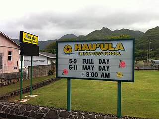
Hauʻula is a census-designated place and rural community in the Koʻolauloa District on the island of Oʻahu, City & County of Honolulu. In Hawaiian, hauʻula means "red hau". There is a small commercial center. As of the 2020 census, the CDP population was 4,018.

Kaʻaʻawa is a small community and census-designated place (CDP) located in the windward district of Koʻolauloa, City & County of Honolulu on the island of Oʻahu, Hawaiʻi, United States. As of the 2010 Census, the total population for Kaʻaʻawa was 1,379. In Hawaiian, kaʻaʻawa means "the wrasse (fish)". From the Hawaiian spelling Kaʻaʻawa it is seen that each a is pronounced separately and distinctly, set apart by the two ʻokinas: or.

Hawaiʻi Kai, also known as Maunalua or Koko Marina, is a largely residential area located in the City & County of Honolulu, in the East Honolulu CDP, on the island of Oʻahu. Hawaiʻi Kai is the largest of several communities at the eastern end of the island. The area was largely developed by Henry J. Kaiser around the ancient Maunalua fishpond and wetlands area known as Kuapā. Hawaiʻi Kai or Koko Marina was dredged from Kuapā Pond starting around 1959. Dredging not only transformed the shallow coastal inlet and wetlands into a marine embayment, but was accompanied by considerable filling and clearing of the pond margins. In 1961, Kaiser-Aetna entered into a lease agreement with the land owner, the Bernice Pauahi Bishop Estate, to develop the 521 acre (2.11 km2) fishpond into residential tracts with a marina and channels separated by fingers of land and islands upon which house lots and commercial properties would be laid out and developed. Nearly all of the low-lying lands surrounding the marina have since been developed, and neighborhoods now extend back into the several valleys and up the separating ridges.

Neal Shaw Blaisdell served as Mayor of Honolulu from 1955 to 1969 as a member of the Hawaii Republican Party. As chief executive of the City and County of Honolulu, Hawaii, he oversaw one of the largest construction booms in city and county history, working closely with Governor John A. Burns. Blaisdell was the sitting mayor when Hawaii became the 50th U.S. state on August 21, 1959.

The Hawaii State Department of Education (HIDOE) is a statewide public education system in the United States. The school district can be thought of as analogous to the school districts of other cities and communities in the United States, but in some manners can also be thought of as analogous to the state education agencies of other states. As the official state education agency, the Hawaiʻi State Department of Education oversees all 258 public schools and 37 charter schools and over 13,000 teachers in the State of Hawaiʻi, serving approximately 167,649 students statewide.
ʻĀina Haina is an unincorporated town of the City & County of Honolulu in the state of Hawaiʻi of the United States. Located on the island of Oʻahu, ʻĀina Haina is a residential community developed around Kalanianaole Highway east of Waikīkī and Diamond Head. ʻĀina Haina was named after local dairyman and owner of Hind-Clarke Dairy, Robert Hind. ʻĀina Haina in the Hawaiian language means "Hind's Land". A main street is a loop named Hind Drive for him. ʻĀina Haina has two elementary schools and a shopping center.
Kaimukī is a residential neighborhood in Honolulu, Hawaii, United States.

Kalihi is a neighborhood of Honolulu on the island of Oʻahu in Hawaiʻi, United States. Split by Likelike Highway, it is flanked by Liliha, Chinatown, and Downtown Honolulu to the east and Mapunapuna, Moanalua, and Salt Lake to the west.
Saint Anthony Catholic Church in Honolulu is a parish in the West Honolulu Vicariate Forane of the Roman Catholic Diocese of Honolulu.

Henry J. Kaiser High School is a WASC-accredited, four-year public high school located in the U.S. state of Hawaiʻi in the East Honolulu community of Hawaiʻi Kai.
Honolulu Waldorf School, established in 1961, is a coeducational, independent school serving more than 300 children from early childhood through middle school located on the island of Oahu in the State of Hawaii. It previously included high school levels.

Mōʻiliʻili, Hawaii is a neighborhood of Honolulu CDP, City and County of Honolulu, Hawaii, on the island of Oahu. Its name means “pebble lizard” in Hawaiian.

Kapālama, now often called Pālama, is a neighborhood of Honolulu, Hawaii. It is often combined with the adjacent Kalihi and referred to as a single entity, Kalihi–Pālama.

James Campbell National Wildlife Refuge is a National Wildlife Refuge on the island of Oʻahu, Hawaii. It was established in 1976 to permanently protect an ecologically-intact unit and to provide habitat for native and migratory fauna and native flora. It established critical habitat for Hawaii's four endangered waterbirds, the ʻalae kea, koloa maoli, ʻalae ʻula, and āeʻo and many migratory seabirds, endangered and native plant species, and the endangered Hawaiian monk seal and green sea turtle. It also provides increased wildlife-dependent public uses and flood control within the refuge and the local community.

East Honolulu is a census-designated place (CDP) located in Honolulu County, Hawaii, United States. As of the 2020 Census, the CDP had a population of 50,922, making it the 2nd most populated CDP in Hawaii, behind Honolulu.
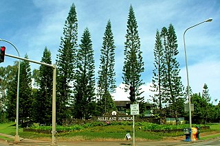
Mililani Mauka is a census-designated place (CDP) in Honolulu County, Hawaii on the island of Oʻahu, Hawaii, United States. As of the 2020 census, the CDP had a population of 21,075.

Haleʻākala, later renamed ʻAikupika, and then the Arlington Hotel, was a historic structure in Honolulu, Hawaii, which was the home of various prominent Hawaiians, and later became a hotel, and the initial headquarters of the American military forces involved in the overthrow of the Kingdom of Hawaii.

Pearl Harbor National Memorial is a unit of the National Park System of the United States on the island of Oahu, Hawaii. The John D. Dingell, Jr. Conservation, Management, and Recreation Act removed the site from the World War II Valor in the Pacific National Monument on March 12, 2019, and made it a separate national memorial. It has an area of 21.3 acres (0.086 km2).