Demographics
Kaingaroa is in an SA1 statistical area which covers 35.42 km2 (13.68 sq mi). [1] The SA1 area is part of the larger Karikari Peninsula statistical area. [2]
Historical population| Year | Pop. | ±% p.a. |
|---|
| 2006 | 159 | — |
|---|
| 2013 | 189 | +2.50% |
|---|
| 2018 | 183 | −0.64% |
|---|
| Source: [3] |
The SA1 statistical area had a population of 183 at the 2018 New Zealand census, a decrease of 6 people (−3.2%) since the 2013 census, and an increase of 24 people (15.1%) since the 2006 census. There were 63 households, comprising 93 males and 90 females, giving a sex ratio of 1.03 males per female. The median age was 50.3 years (compared with 37.4 years nationally), with 36 people (19.7%) aged under 15 years, 21 (11.5%) aged 15 to 29, 99 (54.1%) aged 30 to 64, and 27 (14.8%) aged 65 or older.
Ethnicities were 86.9% European/Pākehā, 27.9% Māori, 1.6% Pacific peoples, and 1.6% other ethnicities. People may identify with more than one ethnicity.
Of those people who chose to answer the census's question about religious affiliation, 55.7% had no religion, 34.4% were Christian, 1.6% had Māori religious beliefs and 3.3% had other religions.
Of those at least 15 years old, 15 (10.2%) people had a bachelor or higher degree, and 27 (18.4%) people had no formal qualifications. The median income was $26,600, compared with $31,800 nationally. 15 people (10.2%) earned over $70,000 compared to 17.2% nationally. The employment status of those at least 15 was that 75 (51.0%) people were employed full-time, 27 (18.4%) were part-time, and 6 (4.1%) were unemployed. [3]

Murupara is a town located in the Whakatāne District and Bay of Plenty Region of New Zealand's North Island. The town is situated in an isolated part of the region between the Kaingaroa Forest and Te Urewera protected area, on the banks of the Rangitaiki River, 65 kilometres southeast of Rotorua. Indigenous Māori also make up over 90% of the total population.

Māhia Peninsula is located on the east coast of New Zealand's North Island, in the Hawke's Bay region, between the towns of Wairoa and Gisborne.

Colville, a small town in the north of the Coromandel Peninsula in the North Island of New Zealand, lies 26 kilometres north of Coromandel in Colville Bay on the Hauraki Gulf, and is the northernmost town of any note on the peninsula. North of Colville, 28 kilometres of rough road lead to the small settlement of Port Jackson, close to the peninsula's northwesternmost point, Cape Colville and 20 km to Port Charles on the northeastern side.

The Far North District is the northernmost territorial authority district of New Zealand, consisting of the northern part of the Northland Peninsula in the North Island. It stretches from North Cape and Cape Reinga / Te Rerenga Wairua in the north, down to the Bay of Islands, the Hokianga and the town of Kaikohe.

Taupō District is a territorial authority district in New Zealand. It covers 6,333 km² of land, and a further 610 km² of lake area, including Lake Taupō, New Zealand's largest lake, and Lake Rotoaira. The district stretches from the small town of Mangakino in the northwest to the Tongariro National Park in the south, and east into the Kaingaroa Forest. The district's population is largely located in the two main centres, Taupō and Tūrangi.

Oropi is a rural settlement located in the Bay of Plenty region of the North Island of New Zealand. It is located 20 kilometres south of Tauranga and 43 kilometres north of Rotorua. It has been suggested that the word Oropi is the Māori language equivalent of Europe. This is derived from the 1860s when government forces were based in the area at the time of the Battle of Gate Pā.

Reporoa is a rural community in Rotorua Lakes within the Waikato region of New Zealand's North Island.
Rahotu is a community in the west of Taranaki, in the North Island of New Zealand. It is located on State Highway 45, 16 kilometres north of Ōpunake and 11 km south of Warea.

Galatea is a settlement in the Whakatāne District in the Bay of Plenty region of the North Island of New Zealand.

Herekino is a locality in Northland, New Zealand. It lies 26 km south west of Kaitaia. The Herekino Harbour, also called the Herekino River, is an estuary and inlet from the Tasman Sea to the west. The Herekino Forest, which contains a stand of large kauri, is to the north, and the Tauroa Peninsula lies to the north west.
Pamapuria is a locality in Northland, New Zealand. It lies on State Highway 1 about 10 km east of Kaitaia.
Whatuwhiwhi is a settlement at the northern end of Tokerau Beach, on the Karikari Peninsula of Northland, New Zealand. To the south is Doubtless Bay.

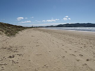
The Karikari Peninsula on the east coast of the far north of Northland, New Zealand, is between Rangaunu Harbour to the west, and Doubtless Bay to the southeast. It is a right-angled land mass of two relatively distinct parts. The rocky northern part, which has an east–west orientation and is approximately 17 km long, was originally an island but is now connected to the mainland by a low sandy tombolo approximately 11 km long, which has a north–south orientation. The spiritually significant Puwheke sits high above the north-facing beaches.

Coroglen is a locality in the Coromandel Peninsula, New Zealand. It lies on State Highway 25, 18 kilometres south of Whitianga and 26 kilometres north west of Tairua. The "Tapu-Coroglen Road", a windy gravel road, connects it across the Coromandel Range with Tapu on the west coast of the peninsula.
Rawhiti is a small beachfront town about 27km from Russell in the Bay of Islands of New Zealand.

Hūkerenui is a settlement in Northland, New Zealand. State Highway 1 passes through the area. Kawakawa is northwest, and Hikurangi is southeast.

Waiotahe is a beach, settlement and rural community in the Ōpōtiki District and Bay of Plenty Region of New Zealand's North Island, near the mouth and lowermost stretch of the Waiotahe River.
Honikiwi is a locality in the Ōtorohanga District and Waikato region of New Zealand. It is northwest of Ōtorohanga.
Kaingaroa, also called Kaingaroa Forest or Kaingaroa Village, is a small town southeast of Rotorua within the Bay of Plenty region of New Zealand's North Island. The town is the headquarters of Kaingaroa Forest.
Tokerau Beach is a settlement on the northwestern side of Doubtless Bay on the Karikari Peninsula of Northland, New Zealand.
