Kenn, Somerset

Last updated

Kenn
Kenn church.jpg
Somerset UK location map.svg
Red pog.svg
Kenn
Location within Somerset
Population431 (2011) [1]
OS grid reference ST415695
Unitary authority
Ceremonial county
Region
Country England
Sovereign state United Kingdom
Post town CLEVEDON
Postcode district BS21
Dialling code 01275
Police Avon and Somerset
Fire Avon
Ambulance South Western
UK Parliament
List of places
UK
England
Somerset
51°25′03″N2°50′25″W / 51.4174°N 2.8402°W / 51.4174; -2.8402

Kenn is a small village and civil parish in the county of Somerset, England. It falls within the area of the North Somerset unitary authority. It lies on the B3133 road near Clevedon in the North Somerset Levels. The parish has a population of 431. [1]

Contents

History

The parish was part of the Winterstoke Hundred. [2]

In the 19th century, Kenn was described as follows: "The village is small and situated in marshy ground. It formerly belonged to the Kenns, one of whom was the nonjuring bishop, composer of the 'Morning Hymn'; he was one of the seven prelates sent to the Tower by James II. The soil is loamy with subsoil clay. The vicarial tithes have been commuted for a rent-charge of £90. The living is a perpetual curacy in the diocese of Bath and Wells, in the patronage of the Vicar of Yatton. The church is a stone structure partially rebuilt in 1861. In the interior are several ancient monuments, among which is that of Christopher Kenn. The register dates from 1543." [3]

Kenn is notable as the site in 1830 of the last public hangings in the UK to be carried out at the scene of the crime. Three arsonists (William Wall, John Rowley and Richard Clarke) who had set fire to a local farmer's hay were hanged, another three being transported to Tasmania. [4]

Governance

The parish council has responsibility for local issues, including setting an annual precept (local rate) to cover the council’s operating costs and producing annual accounts for public scrutiny. The parish council evaluates local planning applications and works with the local police, district council officers, and neighbourhood watch groups on matters of crime, security, and traffic. The parish council's role also includes initiating projects for the maintenance and repair of parish facilities, such as the village hall or community centre, playing fields and playgrounds, as well as consulting with the district council on the maintenance, repair, and improvement of highways, drainage, footpaths, public transport, and street cleaning. Conservation matters (including trees and listed buildings) and environmental issues are also of interest to the council.

The parish falls within the unitary authority of North Somerset which was created in 1996, as established by the Local Government Act 1992. It provides a single tier of local government with responsibility for almost all local government functions within their area including local planning and building control, local roads, council housing, environmental health, markets and fairs, refuse collection, recycling, cemeteries, crematoria, leisure services, parks, and tourism. They are also responsible for education, social services, libraries, main roads, public transport, Trading Standards, waste disposal and strategic planning, although fire, police and ambulance services are provided jointly with other authorities through the Avon Fire and Rescue Service, Avon and Somerset Constabulary and the South Western Ambulance Service.

North Somerset's area covers part of the ceremonial county of Somerset but it is administered independently of the non-metropolitan county. Its administrative headquarters are in the town hall in Weston-super-Mare. Between 1 April 1974 and 1 April 1996, it was the Woodspring district of the county of Avon. [5] Before 1974 that the parish was part of the Long Ashton Rural District. [6]

The parish is represented in the House of Commons of the Parliament of the United Kingdom as part of the North Somerset constituency. It elects one Member of Parliament (MP) by the first past the post system of election, currently Liam Fox of the Conservative Party.

Geography

Nearby is the Kenn Church, Kenn Pier & Yew Tree Farm SSSI, a geological Site of Special Scientific Interest which is listed in the Geological Conservation Review because it consists of a complex sequence of Pleistocene sediments, including coarse glacial outwash gravels at the base overlain by a complex sequence of interglacial freshwater, estuarine and marine sands. The sequence is then capped by aeolian (windblown) coversands and Holocene silts. [7]

Religious sites

The Church of St John The Evangelist has a Norman tower, with much of the rest of the church dating from around 1300. It has been designated as a Grade II* listed building. [8]

Related Research Articles

<span class="mw-page-title-main">Avon (county)</span> Former non-metropolitan and ceremonial county in England

Avon was a non-metropolitan and ceremonial county in the west of England that existed between 1974 and 1996. The county was named after the River Avon, which flows through the area. It was formed from the county boroughs of Bristol and Bath, together with parts of the administrative counties of Gloucestershire and Somerset.

<span class="mw-page-title-main">North Somerset</span> District in England

North Somerset is a unitary authority in the ceremonial county of Somerset, England. The council is based in Weston-super-Mare, the area's largest town. The district also contains the towns of Clevedon, Nailsea and Portishead, along with a number of villages and surrounding rural areas. Some southern parts of the district fall within the Mendip Hills, a designated Area of Outstanding Natural Beauty.

<span class="mw-page-title-main">Yatton</span> Human settlement in England

Yatton is a village and civil parish within the unitary authority of North Somerset, which falls within the ceremonial county of Somerset, England. It is located 11 miles (18 km) south-west of Bristol. Its population in 2011 was 7,552. The parish includes Claverham, a small village which was originally a farming hamlet.

<span class="mw-page-title-main">Backwell</span> Village in Somerset, England

Backwell is a village and civil parish in the unitary authority of North Somerset and in 2011 had a population of 4,589. The village lies about 7 miles (11 km) southwest of Bristol, south of the A370 to Weston-super-Mare. The parish includes the hamlets of Backwell Common, Backwell Green, and Backwell Farleigh, and the districts of Backwell West Town and Downside.

<span class="mw-page-title-main">Long Ashton</span> Human settlement in England

Long Ashton is a village and civil parish in Somerset, England. It falls within the unitary authority of North Somerset and is one of a number of large villages just outside the boundary of city of Bristol urban area. The parish has a population of 6,044. The parish includes the hamlet of Yanley, and the residential area of Leigh Woods.

<span class="mw-page-title-main">Barrow Gurney</span> Human settlement in England

Barrow Gurney is a village and civil parish in Somerset, England, situated in the unitary authority of North Somerset on the B3130, midway between the A38 and A370 near the Long Ashton bypass and Bristol Airport, 5 miles (8.0 km) south west of Bristol city centre. The civil parish includes Barrow Common, and has a population of 349.

<span class="mw-page-title-main">Flax Bourton</span> Human settlement in England

Flax Bourton is a village and civil parish in Somerset, England. The parish, with a population of 715, is situated within the unitary authority of North Somerset, on the edge of Nailsea Moor on the A370 road 5 miles (8.0 km) south west of Bristol city centre.

<span class="mw-page-title-main">Tickenham</span> Human settlement in England

Tickenham is a village and civil parish near Clevedon and Nailsea in North Somerset, England. The parish has a population of 910. It has a primary school, a village hall and a garden centre, but no shops, although it formerly had a post office.

<span class="mw-page-title-main">Easton in Gordano</span> Village in Somerset, England

Easton in Gordano is a village in Somerset, England, about 4+12 miles (7 km) northwest of Bristol city centre. It is part of the civil parish of Pill and Easton-in-Gordano and within the unitary authority of North Somerset. In 2011 the population of the parish was 4,828.

<span class="mw-page-title-main">Kingston Seymour</span> Human settlement in England

Kingston Seymour is a small village and civil parish with royal status in Somerset, England. It is situated within the unitary authority of North Somerset, between Clevedon and Weston-super-Mare on the North Somerset Levels. The parish has a population of 388.

<span class="mw-page-title-main">Clapton in Gordano</span> Human settlement in England

Clapton in Gordano is a village and civil parish in Somerset, England. It is situated within the unitary authority of North Somerset on the southern side of the Gordano Valley, immediately adjacent to the M5 motorway. The parish has a population of 348. There is a village football club, Clapton in Gordano FC. They currently run two sides with a view to continue progressing throughout the leagues. Their home ground is currently Clapton Lane, Portishead.

<span class="mw-page-title-main">Weston in Gordano</span> Human settlement in England

Weston in Gordano is a village and civil parish in Somerset, England. It is situated in the middle of the Gordano valley on the north side, and in the Unitary Authority of North Somerset, on the road between Clevedon and Portishead. The parish has a population of 301.

<span class="mw-page-title-main">Walton in Gordano</span> Human settlement in England

Walton in Gordano is a village and civil parish in North Somerset, England. It is situated in a small valley at the side of the south-western end of the Gordano Valley, about a mile from Clevedon. The parish has a population of 273.

<span class="mw-page-title-main">Brockley, Somerset</span> Human settlement in England

Brockley is a village and civil parish in Somerset, England. The parish is within the unitary authority of North Somerset, about 3 miles (4.8 km) south of Nailsea, and includes the village of Chelvey. According to the 2011 census it had a population of 277.

<span class="mw-page-title-main">Burrington, Somerset</span> Human settlement in England

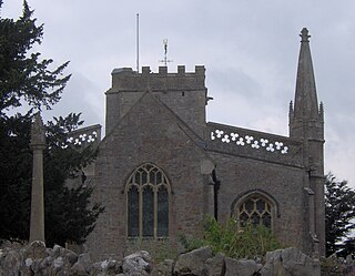
Burrington is a small village and civil parish in Somerset, England. It is situated in the unitary authority of North Somerset, 5 miles (8.0 km) north east of Axbridge and about 10 miles (16 km) east of Weston-super-Mare. The parish includes the hamlets of Bourne and Rickford and has a population of 464.

<span class="mw-page-title-main">Hutton, Somerset</span> Human settlement in England

Hutton is a village and civil parish in Somerset, England. The parish, which has a population of 2,582, is within the unitary authority of North Somerset and located on the western edge of the Mendip Hills, close to Weston-super-Mare.

<span class="mw-page-title-main">Loxton, Somerset</span> Human settlement in England

Loxton is a village and civil parish in Somerset, England. It is close to the M5 motorway in the unitary authority of North Somerset. The parish includes the village of Christon and has a population of 214.

<span class="mw-page-title-main">Cleeve, Somerset</span> Human settlement in England

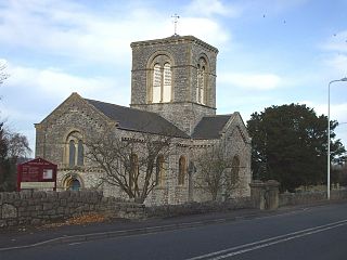
Cleeve is a village and civil parish in the ceremonial county of Somerset, England. It is situated within the unitary authority of North Somerset, 9 miles (14 km) south west of Bristol and has a population of 902.

<span class="mw-page-title-main">Winscombe and Sandford</span> Human settlement in England

Winscombe and Sandford is a civil parish in Somerset, England. It includes the villages of Winscombe and Sandford. The parish has a population of 4,546.

<span class="mw-page-title-main">Wraxall and Failand</span> Human settlement in England

Wraxall and Failand, formerly just Wraxall is a civil parish in the North Somerset district, in the ceremonial county of Somerset, England. It includes the villages of Wraxall and Failand. In 2011 it had a population of 2,302. On 1 October 1996 the parish was renamed from "Wraxall" to "Wraxall and Failand".

References

  1. 1 2 "2011 Census Profile". North Somerset Council. Archived from the original (Excel) on 4 January 2014. Retrieved 4 January 2014.
  2. "Somerset Hundreds". GENUKI. Retrieved 9 September 2011.
  3. National Gazetteer of Great Britain and Ireland (1868) Transcribed by Colin Hinson, 2003
  4. Lilly, Derek B. & Lilly, Jane S. (1994). The Kenn Hangings of 1830: The Full Story. Weston-super-Mare: H. Galloway. ISBN   1-873931-23-9
  5. "The Avon (Structural Change) Order 1995". HMSO. Archived from the original on 30 January 2008. Retrieved 9 December 2007.
  6. "Long Ashton RD". A vision of Britain Through Time. University of Portsmouth. Retrieved 4 January 2014.
  7. English Nature citation sheet for the site (accessed 13 July 2006)
  8. Historic England. "CHURCH OF ST JOHN THE EVANGELIST (Grade II*) (1136680)". National Heritage List for England . Retrieved 1 January 2019.