Related Research Articles
St. George's Independent School was founded in 1959 and now has campuses in Collierville, Germantown, and Memphis, Tennessee.

Adelphia is an unincorporated community located in northern Howell Township, Monmouth County, in the U.S. state of New Jersey. The area is served as United States Postal Service ZIP code 07710. The community borders Freehold Township, and residents who reside in Adelphia use a Freehold mailing address.
Porter is an unincorporated community in Montgomery County in Southeastern Texas within the Houston–The Woodlands–Sugar Land metropolitan area. In 2010, its population was estimated at 25,769. Porter is north of the Kingwood area of Houston.

East Springfield is a census-designated place (CDP) in northwestern Salem Township, Jefferson County, Ohio, United States. It has a post office with the ZIP code 43925. It lies along State Route 43, 16 miles (26 km) northwest of the county seat of Steubenville and 17 miles (27 km) southeast of Carrollton. The community is part of the Weirton–Steubenville, WV-OH Metropolitan Statistical Area.

Limestone is an unincorporated community on the western border of Washington County and the eastern border of Greene County in the northeastern part of the U.S. state of Tennessee. Its zip code is 37681. Limestone is part of the Johnson City Metropolitan Statistical Area, which is a component of the Johnson City-Kingsport-Bristol, TN-VA Combined Statistical Area – commonly known as the "Tri-Cities" region.
Mohawk is an unincorporated community in western Greene County, eastern Tennessee, located 15 miles (24 km) west of the town of Greeneville. Its post office has the zip code 37810.

Bordersville is a predominantly African American community on Farm to Market Road 1960 in northeast Harris County, Texas, United States. The community, located less than one half-mile from George Bush Intercontinental Airport, has about 80% of its territory in the City of Houston and the rest in an unincorporated area.

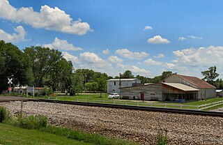
Strawberry Plains is an unincorporated community and census-designated place (CDP) in Jefferson, Knox, and Sevier counties in the State of Tennessee, United States. Before 2010, it was treated by the United States Census Bureau as a census county division. It is included in both the Knoxville Metropolitan Statistical Area and the Morristown Metropolitan Statistical Area.

Knox County Schools is the school district that operates all public schools in Knox County, Tennessee.
Oil Springs is an unincorporated community in Johnson County, Kentucky, United States. It lies along Route 40 west of the city of Paintsville, the county seat of Johnson County. It has a post office with the ZIP code 41238.
Rockvale is an unincorporated community and census-designated place in Rutherford County, Tennessee. The ZIP Code for Rockvale is 37153.
Tutor Key is an unincorporated community in Johnson County, Kentucky, United States about 4.5 miles northeast of Paintsville. Tutor Key was originally known as Mingo.
Staffordsville is an unincorporated community in Johnson County, Kentucky, United States. The community was originally named Frew and the first post office was established on July 14, 1882, with Millard F. Rule as postmaster but in 1893, postmistress Jessie Stafford changed the post office's name to "Staffordsville" in order to honor her family. Staffordsville's ZIP code is 41256.
Wittensville is an unincorporated community in Johnson County, Kentucky, United States. Wittensville's ZIP code is 41274. It has a United States Postal Service, which stands besides a Dollar General which was constructed in June 2019. It also has an East Kentucky Realty estate agency.
Speedwell is an unincorporated community in Claiborne County, Tennessee.

Flintstone is an unincorporated community in Walker County, Georgia, United States. Located in northwestern Georgia, Flintstone lies approximately 12 miles south of Chattanooga, Tennessee, 120 miles northwest of Atlanta, 135 miles southeast of Nashville, Tennessee, and 150 miles northeast of Birmingham, Alabama. Although Flintstone is unincorporated, it has a post office, with the ZIP code of 30725; the ZCTA for ZIP Code 30725 had a population of 3,456 at the 2000 census.
Unionville is an unincorporated community and census-designated place (CDP) in Bedford County, Tennessee. It's population was 1,394 as of the 2020 census. Unionville has a post office with ZIP code 37180.
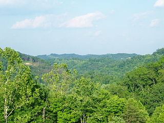
South Knoxville is the section of Knoxville, Tennessee, United States, that lies south of the Tennessee River. It is concentrated along Chapman Highway, Alcoa Highway, Maryville Pike, Sevierville Pike, and adjacent roads, and includes the neighborhoods of Lindbergh Forest, Island Home Park, Old Sevier, South Haven, Vestal, Lake Forest, South Woodlawn and Colonial Village. South Knoxville is connected to Downtown Knoxville via four vehicle bridges: the James C. Ford Memorial Bridge, the Gay Street Bridge, the Henley Bridge, by some incorrectly called the Henley Street Bridge, and the J. E. "Buck" Karnes Bridge. Parts of South Knoxville were annexed by Knoxville in 1917.
Cunningham is an unincorporated community in Montgomery County, Tennessee, United States. It is located approximately 9.5 miles south of downtown Clarksville, at the intersection of State Route 13 and State Route 48. Cunningham has a post office, with ZIP code 37052.
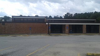
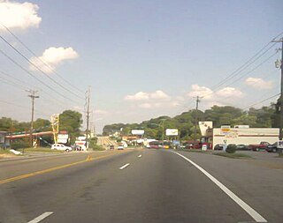
Carter is an unincorporated community in eastern Knox County, Tennessee. It is included in the Knoxville Metropolitan Statistical Area.
References
Municipalities and communities of Knox County, Tennessee, United States | ||
|---|---|---|
| City |  | |
| Town | ||
| CDP | ||
| Other communities | ||
| Footnotes | ‡This populated place also has portions in an adjacent county or counties | |