
The Vaal River is the largest tributary of the Orange River in South Africa. The river has its source near Breyten in Mpumalanga province, east of Johannesburg and about 30 kilometres (19 mi) north of Ermelo and only about 240 kilometres (150 mi) from the Indian Ocean. It then flows westwards to its conjunction with the Orange River southwest of Kimberley in the Northern Cape. It is 1,458 kilometres (906 mi) long, and forms the border between Mpumalanga, Gauteng and North West Province on its north bank, and the Free State on its south.

KwaZulu-Natal is a province of South Africa that was created in 1994 when the Zulu bantustan of KwaZulu and Natal Province were merged. It is located in the southeast of the country, with a long shoreline on the Indian Ocean and sharing borders with three other provinces and the countries of Mozambique, Eswatini and Lesotho. Its capital is Pietermaritzburg, and its largest city is Durban. It is the second-most populous province in South Africa, with slightly fewer residents than Gauteng.

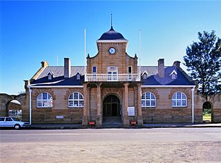
Ladysmith is a city in the Uthukela District of KwaZulu-Natal, South Africa. It lies 230 kilometres (140 mi) north-west of Durban and 365 kilometres (227 mi) south-east of Johannesburg. Important industries in the area include food processing, textiles, and tyre production.

The Tugela River is the largest river in KwaZulu-Natal Province, South Africa. With a total length of 531 km (330 mi), it is one of the most important rivers of the country.

The Natalia Republic was a short-lived Boer republic founded in 1839 after a Voortrekker victory against the Zulus at the Battle of Blood River. The area was previously named Natália by Portuguese sailors, due to its discovery on Christmas. The republic came to an end in 1843 when British forces annexed it to form the Colony of Natal. After the British annexation of the Natalia Republic, most local Voortrekkers trekked northwest into Transorangia, later known as the Orange Free State, and the South African Republic.
Utrecht is a town in the foothills of the Balele Mountains, in the northwestern corner of KwaZulu-Natal, South Africa. Newcastle, Kwazulu-Natal's third-largest urban centre, is 50 km from Utrecht. Utrecht has a population of approximately 32,000.
Mont-aux-Sources is a mountain in Southern Africa, forming one of the highest portions of the Drakensberg Range. It is mostly within Lesotho, with parts in the KwaZulu-Natal and Free State provinces of South Africa.

The Umfolozi River is a river in KwaZulu-Natal, a province of South Africa. It is formed by the confluence of the Black and White Umfolozi Rivers near the southeastern boundary of the Hluhluwe-Umfolozi Game Reserve. The isiZulu name imFolozi is generally considered to describe the zigzag course followed by both tributaries, though other explanations have been given.

Windsor Dam was originally built to control flooding of Ladysmith, in KwaZulu-Natal by the Klip River, but silt buildup quickly reduced its efficiency. The Windsor Dam was commissioned in 1950, has a capacity of 772 cubic metres (27,300 cu ft), and a surface area of 0.826 square kilometres (0.319 sq mi), the dam wall is 17 metres (56 ft) high.
Blood River is situated in KwaZulu-Natal, South Africa. This river has its sources in the hills south-east of Utrecht; leaving the highlands it is joined by two important tributaries that originate in the Schurveberg, after which it flows meandering through a sandy plain. The Blood River is a tributary of the Buffalo River, which is a tributary of the Tugela River which it joins from the north-east.

The Zulu Kingdom, sometimes referred to as the Zulu Empire or the Kingdom of Zululand, was a monarchy in Southern Africa. During the 1810s, Shaka established a modern standing army that consolidated rival clans and built a large following which ruled a wide expanse of Southern Africa that extended along the coast of the Indian Ocean from the Tugela River in the south to the Pongola River in the north.
Tugela Ferry is a town on the northern bank of the Tugela River, in central KwaZulu-Natal, South Africa. During the apartheid era it formed part of the KwaZulu homeland, and at present it is included in the Umzinyathi District Municipality. The town's name commemorates the ferry which once operated here before a steel bridge was constructed.

The Kilburn Dam, an earth-fill type dam and part of the Tugela-Vaal Water Project and Drakensberg Pumped Storage Scheme, is located 500 metres (1,600 ft) lower than the Sterkfontein Dam, on the Mnjaneni River, near Bergville, KwaZulu-Natal, province of South Africa. The dam was commissioned in 1981, has a capacity of 36,700 cubic metres (1,300,000 cu ft), and a surface area of 207 hectares, the dam wall is 48 metres (157 ft) high. The main purpose of the dam assembly is to serve for the generation of hydro-electricity and its hazard potential has been ranked high (3).
Qedusizi Dam, previously known as the Mt Pleasant Dam, is a composite type dam with a roller-compacted concrete (RCC) or 'rollcrete' spillway and earth-fill embankments. It is located on the Klip River in KwaZulu-Natal, South Africa upstream of the town of Ladysmith. Site preparation began in 1994, was completed in 1997 and serves mainly as a flood attenuation and control dam to reduce flooding in the town of Ladysmith. The town is located in a loop of the Klip River and was established there primarily for defense reasons in 1847 by Boers before being annexed by the British. It has experienced numerous floods ever since.

The Bushman's River is an east to north-easterly flowing tributary of the Tugela River, in the KwaZulu-Natal province of South Africa. It rises in the Drakensberg Mountain range, with its upper catchment in the Giant's Castle Game Reserve, north of the Giant's Castle promontory. It feeds the Wagendrift Dam and then flows past the town of Estcourt to join the Tugela River near the town of Weenen.
The Bloukrans River (KwaZulu-Natal) originates in the Emangosini foothills of the Njesuthi Drakensberg, in the KwaZulu-Natal province of South Africa. It proceeds in a north-easterly direction, passing the village of Frere, until it joins the Tugela River. The river and its tributaries are mostly undammed, though limited irrigation occurs from its upper reaches. Its original Dutch name Blaauwekrans referred to bluish cliff faces present in the area.

The Buffalo River is the largest tributary of the Tugela River in South Africa. With a total length of 426 km (265 mi), its source is in Majuba Hill, "Hill of Doves" in Zulu language, located northeast of Volksrust, close to the Mpumalanga / KwaZulu-Natal border. It follows a southerly route into KwaZulu-Natal past Newcastle then turns southeast past Rorke's Drift, before joining the Tugela River at Ngubevu near Nkandla. During the nineteenth century it formed part of the boundary between the Colony of Natal and Zululand.

Spion Kop is a mountain in the province of KwaZulu-Natal, South Africa. It is located near the town of Ladysmith, 27 km to the WSW and about 2.5 km to the north of the Spioenkop Dam, a reservoir for the waters of the Tugela River.

The Wilge River is a tributary of the Vaal River in central South Africa. This river is important as part of the Tugela-Vaal Water Transfer Scheme where water is transferred from the Tugela River basin to the Vaal River basin.

In April 2022, days of heavy rain across KwaZulu-Natal in southeastern South Africa led to deadly floods. Particularly hard-hit were areas in and around Durban. At least 435 people died across the province, with an unknown number of people missing as of April 22. Several thousand homes were damaged or destroyed. Critical infrastructure, including major roads, transportation, communication, and electrical systems, were also impacted by the flooding, and this damage greatly hampered recovery and relief efforts. It is one of the deadliest disasters in the country in the 21st century, and the deadliest storm since the 1987 floods. The floods have caused more than R17 billion in infrastructure damage. A national state of disaster was declared.

