
The Province of Natal, commonly called Natal, was a province of South Africa from May 1910 until May 1994. Its capital was Pietermaritzburg. During this period rural areas inhabited by the black African population of Natal were organized into the bantustan of KwaZulu, which was progressively separated from the province, becoming partially autonomous in 1981. Of the white population, the majority were English-speaking people of British descent, causing Natal to become the only province to vote "No" to the creation of a republic in the referendum of 1960, due to very strong monarchist, anti-republican, pro-British Commonwealth, and secessionist sentiment. In the latter part of the 1980s, Natal was in a state of violence that only ended with the first non-racial election in 1994.

The N12 Southern Bypass is a section of the Johannesburg Ring Road that forms a beltway around the city of Johannesburg, South Africa, as part of the N12. The freeway was the last section of the Ring Road to be built, with the final section opening in 1986. As part of the old South African Freeways, It was initially called the N13.
The Diocese of Christ the King is a diocese of the Anglican Church of Southern Africa in the southern part of Gauteng province, South Africa.
The Dutch Corps Monument is a provincial heritage site in Kliprivier in the KwaZulu-Natal district of South Africa. The monument was designed by Gerard Moerdijk. The monument was vandalized and destroyed in 2014.
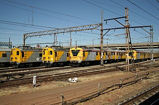
Metrorail Gauteng is a network of commuter rail services in Gauteng province in South Africa, serving the Johannesburg and Pretoria metro areas. It is operated by Metrorail, a division of the Passenger Rail Agency of South Africa (PRASA).

The South African Railways Class 10 4-6-2 of 1904 was a steam locomotive from the pre-Union era in Transvaal Colony.

Johannes Hermanus Michiel 'Jan' Kock was a Boer general and politician.
The R550 is a Regional Route in Gauteng, South Africa that connects Johannesburg South with Devon via Katlehong and Nigel.

Danskraal is a historic site some 5 km north-east of Ladysmith in the former Kliprivier district, said to be the place where the Voortrekkers camped a week before the famous Battle of Blood River on 16 December 1838 and where the first vow was taken which led to the Day of the Covenant. The name means 'village of dancing'; it was here that the Voortrekker commando was entertained with ceremonial dances by the Zulus of Matowan or Nodotta.
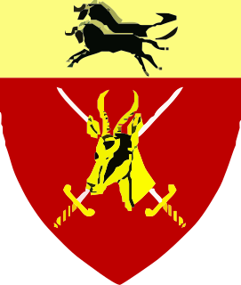
Natal Command was a Command of the South African Army. It was headquartered in Durban, South Africa. By the 1980s, it was responsible for the security of the region, forming the primary level of command for military operations in support of the Police. It also provided logistic, administrative and service support to units and formations operating in its area of responsibility.
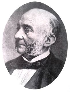
Francis William Reitz Sr. MLC MLA was an influential member of both houses of the Parliament of the Cape of Good Hope.
Weenen is a settlement in KwaZulu-Natal, South Africa.
M7 is a metropolitan route in the Greater Johannesburg metropolitan area. The road connects Thokoza and the southern suburbs of Alberton with suburbs to the west of the Johannesburg CBD.
The M38 is a short metropolitan route in Johannesburg, South Africa. It connects Southgate with Tulisa Park via Ridgeway.


