Kloetinge

Last updated
Kloetinge
Village
Kloetinge - panoramio.jpg
Kloetinge wapen.svg
2010-NL-P09-Zeeland-positiekaart-gemnamen.jpg
Red pog.svg
Kloetinge
Location in the province of Zeeland in the Netherlands
Netherlands location map.svg
Red pog.svg
Kloetinge
Kloetinge (Netherlands)
Coordinates: 51°29′55″N3°54′48″E / 51.49861°N 3.91333°E / 51.49861; 3.91333 Coordinates: 51°29′55″N3°54′48″E / 51.49861°N 3.91333°E / 51.49861; 3.91333
Country Netherlands
Province Zeeland
Municipality Goes
Area
[1]
  Total7.77 km2 (3.00 sq mi)
Elevation
[2]
0.5 m (1.6 ft)
Population
 (2021) [1]
  Total3,440
  Density440/km2 (1,100/sq mi)
Time zone UTC+1 (CET)
  Summer (DST) UTC+2 (CEST)
Postal code
4481 [1]
Dialing code 0113

Kloetinge is a village in the Dutch province of Zeeland. It is located in the municipality of Goes, on the eastern side of the city.

Contents

History

The village was first mentioned in 1216 as Clotinge, and means "settlement with a height". [3] Kloetinge is a circular village which developed on a terp (artificial living hill) with an adjacent market square with drinking well for cattle. The motte-and-bailey castle of the Lords of Kloetinge was located on the eastern side of the market. The original village was destroyed in 1572 by the Geuzen. [4]

The Dutch Reformed church was built between 1275 and 1300 to replace a wooden church. The church was enlarged and modified several times. The tower was restored in 1956, and the church between 1969 and 1973. The former town hall and clergy house were built in 1881 and designed by the same architect. In 1968, the clergy house was incorporated into the town hall. In 1984, the building was converted into an apartment building. [4]

The grist mill Oostmolen was built in 1704. Until the 1960s, it formed a single building with the residential home of the miller. In 1998, the wind mill became owned by a foundation, and is regularly in service. [5]

Kloetinge was home to 696 people in 1840. [6] In 1927, a railway station was built on the Goes to Wemeldinge railway. It closed in 1934. [7] Kloetinge was a separate municipality until 1970, when it was merged with Goes. [8]

Sports

Kloetinge is home to football club VV Kloetinge. [9]

Related Research Articles

Sas van Gent Small city in Zeeland, Netherlands

Sas van Gent is a town in the Netherlands. It is located in the Dutch province of Zeeland. It is a part of the municipality of Terneuzen and lies about 30 km south of Vlissingen on the border with Belgium.

Oudelande Village in Zeeland, Netherlands

Oudelande is a village in the Dutch province of Zeeland. It is a part of the municipality of Borsele, and lies about 19 km southeast of Middelburg.

s-Heer Arendskerke Village in Zeeland, Netherlands

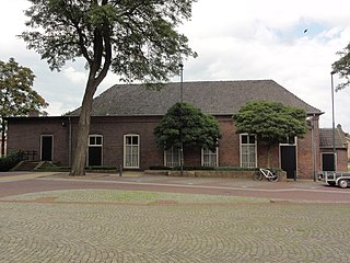
's-Heer Arendskerke is a village in the municipality of Goes in the south-western Netherlands.

Zonnemaire Village in Zeeland, Netherlands

Zonnemaire is a village in the Dutch province of Zeeland. It is a part of the municipality of Schouwen-Duiveland, and lies about 19 kilometres (12 mi) southwest of Hellevoetsluis.

Oosterland, Zeeland Village in Zeeland, Netherlands

Oosterland is a village in the south-west Netherlands. It is located in the municipality of Schouwen-Duiveland, Zeeland, about 22 km south of Hellevoetsluis.

Kerkwerve Village in Zeeland, Netherlands

Kerkwerve is a village in the Dutch province of Zeeland. It is a part of the municipality of Schouwen-Duiveland, and lies about 24 km southwest of Hellevoetsluis.

Ellemeet Village in Zeeland, Netherlands

Ellemeet is a village in the Dutch province of Zeeland. It is a part of the municipality of Schouwen-Duiveland, and lies about 26 km west of Hellevoetsluis.

Wissenkerke Village in Zeeland, Netherlands

Wissenkerke is a village in the Dutch province of Zeeland. It is a part of the municipality of Noord-Beveland, and lies about 20 km northeast of Middelburg.

Sint-Annaland Village in Zeeland, Netherlands

Sint-Annaland is a village in the Dutch province of Zeeland. It is a part of the municipality of Tholen, and lies about 18 km northwest of Bergen op Zoom.

s-Heerenhoek Village in Zeeland, Netherlands

's-Heerenhoek is a village in the Dutch province of Zeeland. It is a part of the municipality of Borsele, and lies about 12 km east of Middelburg.

s-Gravenpolder Village in Zeeland, Netherlands

's-Gravenpolder is a village in the Dutch province of Zeeland. It is a part of the municipality of Borsele, and lies about 21 kilometres east of Middelburg.

s-Heer Abtskerke Village in Zeeland, Netherlands

's-Heer Abtskerke is a village in the Dutch province of Zeeland. It is a part of the municipality of Borsele, and lies about 19 km east of Middelburg.

Hoedekenskerke Village in Zeeland, Netherlands

Hoedekenskerke is a village in the Dutch province of Zeeland. It is a part of the municipality of Borsele, and lies about 22 km east of Middelburg.

Kattendijke Village in Zeeland, Netherlands

Kattendijke is a village in the Dutch province of Zeeland. It is located in the municipality of Goes on the Oosterschelde about 5 km northeast of the city of Goes.

Bath, Netherlands Village in Zeeland, Netherlands

Bath is a small village and a former municipality in the Dutch province of Zeeland, lying on the north shore of the Western Scheldt. It is now located in the municipality of Reimerswaal, about 10 km southwest of Bergen op Zoom.

Waarde Village in Zeeland, Netherlands

Waarde is a village in the Dutch province of Zeeland. It is located in the municipality of Reimerswaal, about 4 km southeast of Kruiningen.

Wemeldinge Village in Zeeland, Netherlands

Wemeldinge is the oldest village in the Zuid-Beveland area of the Dutch province of Zeeland. It is located in the municipality of Kapelle, about 4 km northwest of Yerseke. It is located within the Eastern Scheldt national park.

Wijlre Village in Limburg, Netherlands

Wijlre is a village in the Dutch province of Limburg. It is located in the municipality of Gulpen-Wittem.

Maarheeze Village in North Brabant, Netherlands

Maarheeze is a village in the Dutch province of North Brabant. It is located in the municipality of Cranendonck, about 15 km southeast of Eindhoven, near the Belgian and the German borders.

Zeeland, North Brabant Village in North Brabant, Netherlands

Zeeland is a village in the Dutch province of North Brabant. It is located in the former municipality of Landerd, about 5 km northeast of Uden.

References

  1. 1 2 3 "Kerncijfers wijken en buurten 2021". Central Bureau of Statistics. Retrieved 19 April 2022.
  2. "Postcodetool for 4481AA". Actueel Hoogtebestand Nederland (in Dutch). Het Waterschapshuis. Retrieved 19 April 2022.
  3. "Kloetinge - (geografische naam)". Etymologiebank (in Dutch). Retrieved 19 April 2022.
  4. 1 2 Piet van Cruyningen & Ronald Stenvert (2003). Kloetinge (in Dutch). Zwolle: Waanders. ISBN   90-400-8830-6 . Retrieved 19 April 2022.
  5. "Oostmolen". Molen database (in Dutch). Retrieved 19 April 2022.
  6. "Kloetinge". Plaatsengids (in Dutch). Retrieved 19 April 2022.
  7. "halte Kloetinge". Stationweb (in Dutch). Retrieved 19 April 2022.
  8. Ad van der Meer and Onno Boonstra, "Repertorium van Nederlandse gemeenten", KNAW, 2006. "KNAW > Publicaties > Detailpagina". Archived from the original on 2007-02-20. Retrieved 2009-12-03.
  9. "Dit zijn de indelingen van het Zeeuwse amateurvoetbal". Omroep Zeeland (in Dutch). Retrieved 19 April 2022.