
St. Francois County is a county located in the Lead Belt region in the U.S. state of Missouri. As of the 2020 census, the population was 66,922. The largest city and county seat is Farmington. The county was officially organized on December 19, 1821. It was named after the St. Francis River. The origin of the river's name is unclear. It might refer to St. Francis of Assisi. Another possibility is that Jacques Marquette, a Jesuit who explored the region in 1673, named the river for the Jesuit missionary Francis Xavier. Marquette had spent some time at the mission of St. François Xavier before his voyage and, as a Jesuit, was unlikely to have given the river a name honoring the Franciscans.

Iron County is a county located in the Lead Belt region in the U.S. state of Missouri. As of the 2020 census, the population was 9,537. The largest city and county seat is Ironton. Iron County was officially organized on February 17, 1857, and was named after the abundance of iron ore found within its borders.
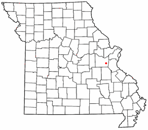
Bucyrus is an unincorporated community in central Texas County, Missouri, United States. It is located on Route 17, approximately three miles northwest of Houston. The ZIP Code for Bucyrus is 65444.

Valles Mines is an unincorporated community in southern Jefferson County, Missouri, United States. It is located approximately seven miles south of De Soto. It is located on Missouri Route V less than one mile west of U.S. Route 67. Joachim Creek flows past the north side of the community. The ZIP Code for Valles Mines is 63087.
Lonedell is an unincorporated community in southeastern Franklin County, Missouri, United States. It is at the intersection of Route 30 and routes N and FF and approximately eight miles east of St. Clair. The Little Meramac River flows just south of the community.

French Village is an unincorporated community in eastern St. Francois County, Missouri, United States. It is located approximately ten miles east of Bonne Terre and has a population of 1,226. The ZIP Code for French Village is 63036.
Doe Run is an unincorporated community and census-designated place in St. Francois County, Missouri, United States. It is located on Routes 221 and B, approximately three miles southwest of Farmington.

Pilot Knob is located in the Arcadia Valley of Iron County, Missouri, between the towns of Ironton and Pilot Knob. Pilot Knob, so named because of its distinctive shape and prominent position, reaches an elevation of 1,470 feet (450 m) rising 581 feet (177 m) above the Arcadia Valley floor and has a large deposit of iron ore in its upper regions. Pilot Knob is a peak in the St. Francois Mountains.
Knob Creek is a stream in Iron and St. Francois counties in the U.S. state of Missouri. It is a tributary of Stouts Creek.
Musco Creek is a stream in Madison and St. Francois counties in the U.S. state of Missouri. It is a tributary of the Little Saint Francis River.
Silver Mine is an unincorporated community in northwest Madison County, in the U.S. state of Missouri.
Bain Hill is a summit in St. Francois County, Missouri. It has a peak elevation of 1,106 feet (337 m). The hill rises to the east of and about 200 feet above the Little St. Francis River. Knob Lick lies about four miles to the west and Mine La Motte is about five miles to the south in Madison County.
Buck Mountain is a summit in southern St. Francois County in the U.S. state of Missouri. Buck Mountain has an elevation of 1,529 feet (466 m). The mountain lies east of Missouri Route V about six miles northeast of Pilot Knob and about six miles southwest of Doe Run.
Libertyville is an unincorporated community in southeastern St. Francois County, in the U.S. state of Missouri. The community is located on Missouri Route DD, east of Knob Lick and north of Mine La Motte. The village is situated at the headwaters of the Little Saint Francis River.
Oak Mountain is a summit in the southwestern corner of St. Francois County in the U.S. state of Missouri. The summit has an elevation of 1,631 feet (497 m). The peak is on a north-south trending ridge that extends south into Iron County and the city of Pilot Knob lies just southwest of the mountain. The community of Middlebrook is to the northwest and Iron Mountain Lake is to the north. The source area of Knob Creek is on the west flank of the mountain.
Pine Mountain is a summit in St. Francois County in the U.S. state of Missouri. The summit has an elevation of 1,499 feet (457 m). The mountain is about 3.5 miles south of Bismarck along Missouri Route N. The peak rises just south of the confluence of Indian Creek with the St. Francis River.

Syenite is an unincorporated community in southern St. Francois County, in the U.S. state of Missouri. The community lies on Missouri Route DD, west of U.S. Route 67. Knob Lick lies approximately 1.5 miles to the east and the St. Francis River valley is to the north and west. Knob Lick Mountain lies about one mile to the south-southeast.
Wills Branch is a stream in Madison and St. Francois counties in the U.S. state of Missouri. It is a tributary of the Little St. Francis River.
Summit is an unincorporated community in eastern Washington County, in the U.S. state of Missouri.
The Little St. Francis River is a stream in eastern St. Francois and northeastern Madison counties of southeastern Missouri. It is a tributary of the St. Francis River.


