The City of Kodiak (Alutiiq: Sun'aq) is the main city and one of seven communities on Kodiak Island in Kodiak Island Borough, Alaska. All commercial transportation between the island's communities and the outside world goes through this city via ferryboat or airline. As of the 2020 census, the population of the city is 5,581, down from 6,130 in 2010.[5] It is the tenth-largest city in Alaska.
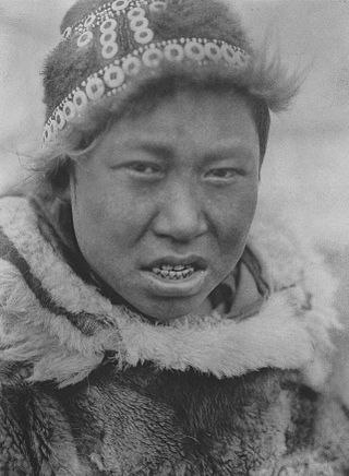
Inhabited by Alutiiq natives for over 7,000 years, Kodiak was settled in 1792 by subjects of the Russian crown. Originally named Paul's Harbor, it was the capital of Russian Alaska. Russian harvesting of the area's sea otter pelts led to the near extinction of the animal in the following century and led to wars with and enslavement of the natives for over 150 years. The city has experienced two natural disasters in the 20th century: a volcanic ashfall from the 1912 eruption of Novarupta and a tsunami from the 1964 Alaska earthquake.
After the Alaska Purchase by the United States in 1867, Kodiak became a commercial fishing center which continues to be the mainstay of its economy. A lesser economic influence includes tourism, mainly by those seeking outdoor adventure trips. Salmon, halibut, the unique Kodiak bear, elk, Sitka deer (black tail), and mountain goats attract hunting tourists as well as fishermen to the Kodiak Archipelago. The Alaska Department of Fish and Game maintains an office in the city and a website to help hunters and fishermen obtain the proper permits and learn about the laws specific to the Kodiak area.
The city has four public elementary schools, a middle and high school, as well as a branch of the University of Alaska. An antenna farm at the summit of Pillar Mountain above the city historically provided communication with the outside world before fiber optic cable was run. Transportation to and from the island is provided by ferry service on the Alaska Marine Highway as well as local commercial airlines.
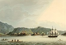
The Russian sloop of war Neva visits Kodiak, Alaska in 1805
The first Europeans to sight Kodiak Island were the explorers Vitus Bering and Aleksei Chirikov, during the 1741 Second Kamchatka Expedition.[9][10] In the early 1750s the Russian fur trading merchant and explorer Stepan Glotov met a Kodiak Islander in the Aleutian Islands, who told him about the island. On his next voyage Glotov sailed to Kodiak Island, arriving in 1763.[11] The Russians called the island Kad’yak (Кадьяк), after the Alutiiq word qikertaq.[12] Several other Russians made fur hunting voyages to Kodiak Island in the 1770s.[13] In 1778 the British captain James Cook explored the area and wrote of "Kodiak" in his journals.[14] In 1779 the Spanish explorers Arteaga y Bazán and Bodega y Quadra reached Afognak in the Kodiak Archipelago.[15]
In 1792, the Russian Shelikhov-Golikov Company chief manager Alexander Baranov moved the post at Three Saints Bay (established in 1784) to a new site in Paul's Harbor (Свято-Павловской гавани, Svyato-Pavlovskoy Gavani). This developed as the nucleus of modern Kodiak.[16]:7 Baranov considered Three Saints Bay a poor location because it was too indefensible. The relocated settlement was first named Pavlovskaya Gavan (Павловская гавань – Paul's Harbor).[17][18]
A warehouse was built in what became one of the key posts of the Shelikhov-Golikov Company, a precursor of the Russian-American Company and a center for harvesting the area's vast population of sea otters for their prized pelts. The warehouse still stands as the Baranov Museum. Because the First Native cultures revered this animal and would never harm it, the Russians had wars with and enslaved the Aleuts during this era.
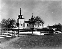
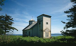
Eastern Orthodox missionaries settled on the island by the end of the 18th century, continuing European settlement of the island. They held the liturgy in native Tlingit from 1800.
The capital of Russian America was moved to Novoarkhangelsk (modern-day Sitka) in 1804. The Russian-American Company was established in 1799 as a joint-stock company by decree of Emperor Paul to continue the harvest of sea otter and other fur-bearing animals and establish permanent settlements. By the mid-19th century, the sea otter was almost extinct and 85% of the First Native population had disappeared from exposure to European diseases and violence.
Kodiak was severely impacted by the 1912 eruption of Novarupta.[19] Though situated 160 miles (260km) southeast of the eruption center, the town was covered with 1 foot (30cm) of ash over a short period of time.[19] Townspeople sheltered in the U.S. Revenue Cutter Manning which was docked nearby.[19][20]
As Kodiak was incorporated in 1941, the U.S. feared attack from Japanese during World War II, and turned the town into a fortress. Roads, the airport, Fort Abercrombie, and gun fortifications improved the island's infrastructure. When Alaska became a state in 1959, government assistance in housing, transportation, and education added additional benefits.[21]
Street of Kodiak in 1965
In March 1964, a tectonic tsunami struck the city during the 1964 Alaska earthquake with 30-foot (9.1m) waves that killed 15 people and caused $11 million in damage. Some areas near Kodiak were permanently raised by 30 feet (9.1m). It wiped out the neighboring Native villages of Old Harbor and Kaguyak. The Standard Oil Company, the Alaskan King Crab Company, and much of the fishing fleet were also destroyed.[22]
Kodiak, sometime shortly after 1900
Panorama of Kodiak, 1908
Alaska Commercial Company buildings in Kodiak, June 1908
Alaska Commercial Company Superintendent's residence, 1908
Warehouse and wharf in Kodiak, June 1908
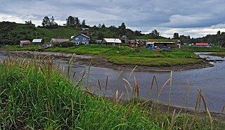
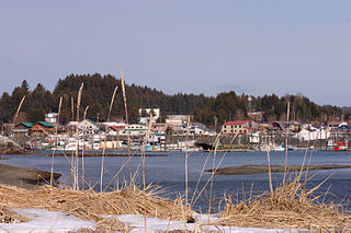
Kodiak Harbor, July 2009
Geography
Kodiak is located on the eastern shore of Kodiak Island. According to the United States Census Bureau, the city has a total area of 4.9 square miles (12.6km2), divided into 3.5sqmi (9.0km2) of land and 1.4sqmi (3.6km2) (28.66%) of water.
Climate
Kodiak has a subpolar oceanic climate (Cfc) with cold winters and mild summers. Precipitation is heavy year-round, though markedly less in the summer months, when the Aleutian Low is at its weakest.
↑ Mean monthly maxima and minima (i.e. the highest and lowest temperature readings during an entire month or year) calculated based on data at said location from 1991 to 2020.
↑ Records for Kodiak have been kept at the Kodiak Airport since January 1931 and at an undisclosed location from September 1913 to December 1930. For more information, see ThreadEx
Kodiak first appeared on the 1880 U.S. Census as the village of Saint Paul (not to be confused with the city of St. Paul located in the Aleutian Islands). It reported a population of 288, of which 253 were Alaskan Creoles (a mixture of Russian and Native Alaskans), 20 Whites and 15 Aleuts. In 1890, it would report as "Kadiak" (the then-spelling). In 1900, it returned as "Kadiak Settlement." From 1910 onwards, it reported as Kodiak, and would formally incorporate in 1940.
As of the census of 2000, there were 6,334 people, 1,996 households, and 1,361 families residing in the city. The population density was 706.8/km2 (1,832.7/mi2). There were 2,255 housing units at an average density of 251.6 persons/km2 (652.5 persons/mi2). The racial makeup of the city was 46.4% White, 0.7% African American, 10.5% Native American, 31.7% Asian, 0.9% Pacific Islander, 4.4% from other races, and 5.4% from two or more races. 8.5% of the population were Hispanic or Latino of any race. At the 2020 Census, the population had declined to 5,581.
There were 1,996 households, out of which 40.2% had children under the age of 18 living with them, 52.1% were married couples living together, 10.3% had a woman whose husband does not live with her, and 31.8% were non-families. 24.2% of all households were made up of individuals, and 5.4% had someone living alone who was 65 years of age or older. The average household size was 3.10 and the average family size was 3.64.
In the city, the population was spread out, with 29.1% under the age of 18, 8.7% from 18 to 24, 32.2% from 25 to 44, 23.1% from 45 to 64, and 6.8% who were 65 years of age or older. The median age was 34 years. For every 100 females, there were 114.3 males. For every 100 females age 18 and over, there were 120.6 males.
The median income for a household in the city was $55,142, and the median income for a family was $60,484. Males had a median income of $37,074 versus $30,049 for females. The per capita income for the city was $21,522. 7.4% of the population and 3.7% of families were below the poverty line. Out of the total people living in poverty, 8.4% were under the age of 18 and 0.0% were 65 or older.
Kodiak is an important environmental asset, which affects the fishing industry, particularly salmon fishing. Its wild game is coveted by hunters worldwide for the Kodiak bear and other game animals; there are strict laws governing fishing and hunting activities as well as hiking near spawning streams. Both the Department and the city maintain websites and publish brochures in order to help communicate these strictly enforced laws. All of the city's hotels and businesses have these materials in prominent areas for guests, and licenses can be purchased in the city's main sporting goods store and online.
North Pacific Regional Fisheries Training Center (NPRFTC)
Marine Safety Detachment Kodiak
Naval Engineering Support Unit (NESU) Detachment Kodiak
Electronic Systems Support Detachment Kodiak (ESD)
Community events
Customers line up in front of the Orpheum Theater
The city of Kodiak is home to a number of annual events that draw locals and people from off-island. The most well-known of these is Kodiak Crab Festival. Organized by the Kodiak Chamber of Commerce, the event takes place over Memorial Day weekend. It includes a county fair-style main event, with carnival rides, food and game booths, and group activities. In addition, a number of events are organized over the three-day weekend that include a kayak race, a marathon, an ultra-marathon, a 9.2-mile (14.8km) mountain run called the Pillar Mountain Run and others.
The official Pardoning of the Crab was added to The Kodiak Crab Fest in 2019. A crab is given a crab themed name, and then saved from the crab pot by a special guest, and then goes to live at the Kodiak Fisheries Research Center Aquarium.
2019: Sheldon, pardoned by US Senator Dan Sullivan (R-AK).[30]2020: Unknown. 2021: Lenny Crabitz, pardoned by Kodiak City Manager Mike Tvenge.[31]
Education
The Kodiak Island Borough School District operates four elementary schools, one middle school and one high school (Kodiak High School) serving the town of Kodiak and the immediate area surrounding the city of Kodiak. A further 6 schools serve rural sites in the district and are operated as k-12 schools.[32]
Kodiak Airport attracts both local and regional airlines, air taxis, and charter floatplanes and helicopters which provide transportation to residents and tourists traveling on and off the island. The Alaska Marine Highway provides further transportation via two ferries, MV Tustumena and MV Kennicott. These ships can carry 211 and 748 passengers, respectively, and serve routes between Kodiak, Homer, and Whittier, although the ferry system no longer takes passengers to Seward. Floatplane and bush plane companies regularly take tourists to remote areas and wilderness lodges both on the various islands of the Kodiak Archipelago and the Katmai coast for bear viewing, hunting, and hikes. The city business community also has a fleet of privately owned taxis as well as kayaks, mountain bikes, and all-terrain vehicles (ATVs) for rent.
Health care
Kodiak has robust primary care, led by Kodiak Area Native Association, a Tribal Health Organization with HRSA support that sees Native and Non-Native persons around the island, and Kodiak Community Health Center with smaller primary care practices in Kodiak. Specialty medical services are intermittently available at Kodiak Area Native Association and at Providence Kodiak Island Medical Center. Hospital and emergency care are provided at Providence Kodiak Island Medical Center, the only hospital on Kodiak Island. Individuals located in the smaller surrounding communities are cared for in small village clinics and, when critically ill, may be airlifted into Kodiak via helicopter or air ambulance due to remoteness and lack of roads.
Energy
Most electrical energy for the city is provided from the Terror Lake Hydroelectric Generating Station owned by the Kodiak Electrical Association. Substantial amounts of energy are also provided by wind turbines and by diesel generators. There are six wind turbines that supply up to 1.5 MW each and have a blade length of 38.5 meters and overall height of 118.5 meters.
In popular culture
In 2012, rapper Pitbull was involved in an advertising campaign with Walmart, in which the Walmart store that received the most Facebook "likes" from June 18 to July 15, 2012, would have Pitbull visit and put on a show there. An orchestrated internet campaign urged people to vote for the most remote location imaginable, Kodiak, resulting in a sizable lead for that store.[33] The enthusiasm for voting for Kodiak was also a reference to the lyrics of Pitbull's song "Give Me Everything", in which he rhymes "Kodak" with "Kodak". Walmart confirmed that Kodiak won.[34] Pitbull visited on July 30, where he received a Key to the City from mayor Branson and then made an appearance before a crowd of hundreds at the Coast Guard base.[35]
Czech carmaker Škoda Auto named their new SUV the Škoda Kodiaq, after the Alaskan brown bear, and in tribute Kodiak was renamed Kodiaq for one day (May 6, 2016).[37] In a spelling change also intended to honor the indigenous Alutiiq,[37] the city was renamed with a number of signs changed across town,[37] including the port facilities and city limits. The letter Q is a common ending for nouns in the Alutiiq language.[38]
The film The Guardian (2006) is partially set in Kodiak, but was not filmed there.[39]
Related Research Articles
From 1732 to 1867, the Russian Empire laid claim to northern Pacific Coast territories in the Americas. Russian colonial possessions in the Americas are collectively known as Russian America. It consisted mostly of present-day Alaska in the United States, but also included the outpost of Fort Ross in California, and three forts in Hawaii, including Russian Fort Elizabeth. Russian Creole settlements were concentrated in Alaska, including the capital, New Archangel (Novo-Arkhangelsk), which is now Sitka.
The Yupik are a group of Indigenous or Aboriginal peoples of western, southwestern, and southcentral Alaska and the Russian Far East. They are related to the Inuit and Iñupiat. Yupik peoples include the following:
The City of Unalaska is the main population center in the Aleutian Islands. The city is in the Aleutians West Census Area, a regional component of the Unorganized Borough in the U.S. state of Alaska. Unalaska is located on Unalaska Island and neighboring Amaknak Island in the Aleutian Islands off mainland Alaska. The population was 4,254 at the 2020 census, which is 81% of the entire Aleutians West Census Area. Unalaska is the second largest city in the Unorganized Borough, behind Bethel.
Ninilchik is a census-designated place (CDP) in Kenai Peninsula Borough, Alaska, United States. At the 2010 census the population was 883, up from 772 in 2000.
Seldovia is a city in Kenai Peninsula Borough, Alaska, United States. Its population was 255 at the 2010 census, down from 286 in 2000. It is located along Kachemak Bay southwest of Homer. There is no road system connecting the town to other communities, so all travel to Seldovia is by airplane or boat.
Seward is an incorporated home rule city in Alaska, United States. Located on Resurrection Bay, a fjord of the Gulf of Alaska on the Kenai Peninsula, Seward is situated on Alaska's southern coast, approximately 120 miles (190 km) by road from Alaska's largest city, Anchorage.
Akhiok is a second-class city in Kodiak Island Borough, Alaska, United States. Akhiok is Kodiak's southernmost village. The population was 63 at the 2020 census. Akhiok, which does not have a post office, is a rural location in postal code 99615 that belongs to Kodiak. The village is sometimes called Alitak, after a nearby bay.
Karluk is a census-designated place (CDP) in Kodiak Borough, Kodiak Island, Alaska, United States. The population was 37 at the 2010 census, up from 27 in 2000.
Old Harbor is a city in Kodiak Island Borough, Alaska, United States. At the 2010 census the population was 218, down from 237 in 2000.
Ouzinkie, is a hamlet on Spruce Island in Kodiak Island Borough, Alaska, United States. At the 2010 census the population was 161, down from 225 in 2000.
Chignik is a city in Lake and Peninsula Borough, Alaska, United States. It is two hundred and fifty miles southwest of Kodiak. At the 2020 census the population was 97, up from 91 in 2010.
Chenega is a census-designated place (CDP) on Evans Island in the Chugach Census Area in the U.S. state of Alaska. Located in Prince William Sound, the CDP consists of the Chugach Alutiiq village of Chenega Bay, which was established only after the Good Friday earthquake destroyed the original community on Chenega Island to the north. As of the 2020 census, the population of the CDP was 59, largely Alaska Natives; as of 2021, the population of Chenega is estimated at 49. Chenega Bay is in the Chugach School District and has one school, Chenega Bay Community School, serving approximately 16 students from preschool through high school.
Alaska Natives are the Indigenous peoples of Alaska and include Alaskan Creoles, Iñupiat, Yupik, Aleut, Eyak, Tlingit, Haida, Tsimshian, and a number of Northern Athabaskan cultures. They are often defined by their language groups. Many Alaska Natives are enrolled in federally recognized Alaska Native tribal entities, who in turn belong to 13 Alaska Native Regional Corporations, who administer land and financial claims.
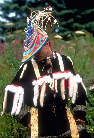
The Alutiiq people, also called by their ancestral name Sugpiaq, as well as Pacific Eskimo or Pacific Yupik, are one of eight groups of Alaska Natives that inhabit the southern-central coast of the region.
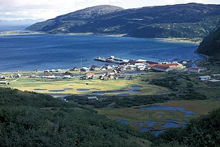
Kodiak Island is a large island on the south coast of the U.S. state of Alaska, separated from the Alaska mainland by the Shelikof Strait. The largest island in the Kodiak Archipelago, Kodiak Island is the second largest island in the United States and the 80th largest island in the world, with an area of 3,595.09 sq mi (9,311.2 km2), slightly larger than Cyprus. It is 160 km long and in width ranges from 16 to 97 kilometers. Kodiak Island is the namesake for Kodiak Seamount, which lies off the coast at the Aleutian Trench. The largest community on the island is the city of Kodiak, Alaska.
Afognak is an island in the Kodiak Archipelago 5 km (3.1 mi) north of Kodiak Island in the U.S. state of Alaska. It is 43 miles (69 km) long from east to west and 23 miles (37 km) wide from north to south and has a land area of 1,812.58 km2 (699.84 sq mi), making it the 18th largest island in the United States. The coast is split by many long, narrow bays. The highest point is 2,546 feet (776 m).
Afognak (; also Agw'aneq in Alutiiq was an Alutiiq village on the island of Afognak in Kodiak Island Borough, Alaska, United States. It was located on Afognak Bay on the southwest coast of the island, three miles north of Kodiak Island. The site is now within the CDP of Aleneva.
Sitkalidak Island is an island in the western Gulf of Alaska in the Kodiak Island Borough of the state of Alaska, United States. It lies just off the southeast shore of Kodiak Island, across the Sitkalidak Strait from the city of Old Harbor. The island has a land area of 300 square kilometers (120 sq mi) and no resident population.
The Alutiiq language is a close relative to the Central Alaskan Yup'ik language spoken in the western and southwestern Alaska, but is considered a distinct language. It has two major dialects:
Woody Island is located in Chiniak Bay, 2.6 miles (4.2 km) east of Kodiak, Alaska. It was originally settled by the native Alutiiq people who called themselves Tangirnarmiut, "the people of Tangirnaq." They inhabited and used Woody Island for thousands of years. The Russians established an agricultural colony on Woody Island in 1792. It was officially designated Wood Island in 1894 by the US Post Office and was the primary coastal settlement for commerce and trade for many years. The first road in Alaska was built on Woody Island. Aside from the Aleut presence, the island has gone through four periods of occupation by non-natives, and is largely unoccupied today. The island is approximately 2.8 miles long from north to south and 1.8 miles wide and 13 miles in circumference.
This page is based on this Wikipedia article Text is available under the CC BY-SA 4.0 license; additional terms may apply. Images, videos and audio are available under their respective licenses.