
Kiboga District is a district in the Buganda Region of Uganda. The town of Kiboga is the site of the district headquarters.

Mubende is a district in the Central Region of Uganda. The town of Mubende is the site of the district headquarters. The district was reduced in size in July 2005 with the creation of the Mityana District and reduced again in 2019 with the creation of Kassanda District.

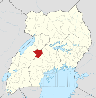
Hoima District is a district in Western Uganda. Like most other Ugandan districts, it is named after its main municipal centre, Hoima.

Kibaale District, is a district in the Western Region of Uganda. The district headquarters are in the town of Kibaale.

Soroti is a city in Eastern Region of Uganda. It is the main City, commercial, and administrative center in curved out of Soroti District, one of the nine administrative districts in the Teso sub-region. Soroti City was immediately approved for operationalization ahead of schedule by the Parliament of Uganda in the Financial Year 2020/2021
The Luweero Triangle, sometimes spelled Luwero Triangle, is an area of Uganda north of the capital Kampala, where, in 1981, Yoweri Museveni started the guerrilla war that propelled him and his National Resistance Movement into power in 1986.
Kiboga is a town in the Buganda Region of Uganda. It is the main municipal, administrative, and commercial center of Kiboga District, and the district headquarters are located there.
Kibaale is a town in the Western Region of Uganda. It is the main municipal, administrative, and commercial center of Kibaale District, and the district headquarters are located there.

Nakaseke District is a district in Central Uganda. It is named after Nakaseke, the largest town in the district. However, the district headquarters are located at Butalangu.
Mubende Regional Referral Hospital, commonly known as Mubende Hospital is a hospital in the town of Mubende, in the Central Region of Uganda. It is the referral hospital for the districts of Mubende, Mityana, Kiboga, and Kyankwanzi.
Kyankwanzi District is the northernmost district in the Buganda Region of Uganda and Buganda Kingdom, bordering Bunyoro. The district headquarters are in Butemba Town.
Bukomero is a town in Ssingo County, Kiboga District, in the Central Region of Uganda.
Kiboga General Hospital, also Kiboga Hospital, Kiboga Main Hospital or Kiboga District Hospital, is a hospital in the Central Region of Uganda.
The Myanzi–Kassanda–Bukuya–Kiboga Road is a road in Uganda, connecting the towns of Myanzi, Kassanda and Bukuya in Mubende District, to Kiboga in Kiboga District.
Bukuya is a town in the Mubende District in the Central Region of Uganda.
The Mityana–Kalangaalo–Bukuya–Kiboga Road is a road in Uganda, connecting the towns of Mityana, and Kalangaalo in Mityana District, Bukuya in Mubende District, to Kiboga in Kiboga District.
The Mityana–Sekanyonyi–Busunju Road is a road in Uganda, connecting the towns of Mityana, Sekanyonyi and Busunju in Mityana District.
Lwamata is a town in Ssingo County, Kiboga District, in the Central Region of Uganda.
Letshego Microfinance Uganda,, whose official name is Letshego Uganda Limited, is a Tier IV microfinance institution in Uganda.
Kakumiro District is a district in the Western Region of Uganda.

