| LaGrange | |
|---|---|
| Ghost town | |
 Tippecanoe County's location in Indiana | |
 LaGrange Location in Tippecanoe County | |
| Coordinates: 40°22′28″N87°05′24″W / 40.37444°N 87.09000°W Coordinates: 40°22′28″N87°05′24″W / 40.37444°N 87.09000°W | |
| Country | United States |
| State | Indiana |
| County | Tippecanoe |
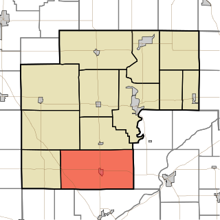
| Township | Shelby |
| Time zone | Eastern (EST) (UTC-5) |
| • Summer (DST) | EDT (UTC-4) |
| ZIP code | 47906 |
| Area code(s) | 765 |
LaGrange was a small town, now extinct, in Shelby Township, Tippecanoe County, in the U.S. state of Indiana.

Shelby Township is one of thirteen townships in Tippecanoe County, Indiana, United States. As of the 2010 census, its population was 2,352 and it contained 920 housing units.

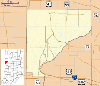
Tippecanoe County is a county located in the west central portion of the U.S. state of Indiana about 22 miles east of the Illinois state line. As of the 2010 census, the population was 172,780. The county seat and largest city is Lafayette. It was created in 1826 from Wabash County portion of New Purchase and unorganized territory.

In the United States, a state is a constituent political entity, of which there are currently 50. Bound together in a political union, each state holds governmental jurisdiction over a separate and defined geographic territory and shares its sovereignty with the federal government. Due to this shared sovereignty, Americans are citizens both of the federal republic and of the state in which they reside. State citizenship and residency are flexible, and no government approval is required to move between states, except for persons restricted by certain types of court orders. Four states use the term commonwealth rather than state in their full official names.