La Saline, Missouri

Last updated

La Saline is an abandoned village located in Beauvais Township in Sainte Genevieve County, Missouri, United States. La Saline is located approximately six miles south of Sainte Genevieve. [1]

Contents

Etymology

La Saline is French and refers to the two natural salt springs found in the area, which also gave name to the nearby creek and its tributaries called Saline Creek or Saline River. The French colonials knew Saline Creek as La Rivière de la Saline or La Petite Rivière de la Saline. The Spanish referred to the creek and its tributaries as Las Salinas. There were two settlements, La Grande Saline and La Petite Saline, with the former being the larger of the two. La Grande Saline was usually simply referred to as La Saline, and sometimes as Old Saline. [2] [3]

History

In 1541, Spanish explorer De Soto had sent Hernando de Silvera and Pedro Moreno from Capaha, with Indian guides, to obtain a supply of salt from a saline stream to the north, presumably the Saline Creek in Ste. Genevieve County. [4] [5]

Later, during the French colonial period, both French and Illinois Indians came to the site of La Saline to get their salt.

The settlement of the Saline River began in the early 1700s. In 1715, a small party of French were reported to be making salt at La Saline. The early encampment at La Saline was temporary, but over time became permanent. [6] Two settlements grew up along the Saline: the Grande Saline, located near the mouth of the creek, and the Petite Saline, located at the upper end of the creek, along a tributary. The purpose of the settlement was the manufacturing of salt which was used for meat preservation, skin tanning, and fur processing. Water from the salt springs was boiled in ovens the French built; when the water boiled away, the salt remained. Spanish Colonial authorities also set up a post at La Saline in 1788. [7] By 1800, French and Americans (Kentuckians) extracting salt from the Saline had set up four or five furnaces used for boiling off the salt for extraction, earning La Saline the name 'La Saline Ensanglantèe' (The Bloody Saline). These men were sending approximately thirty-five hundred barrels of salt to New Orleans each year. [8] As well as producing salt, La Saline’s location along the Mississippi River meant that it served as a lead-shipping point. Lead from Mine la Motte, opened in the 1720s, came by animal or cart over ridge roads and then down the Saline River Valley to its mouth at La Saline to be loaded on Mississippi River boats. [9]

In the early 19th century salt was being produced in southern Illinois along the Ohio River, making salt production in La Saline decline. In 1822, some seventeen workers were still using 100-150 kettles to extract salt, but by 1825, all production had ceased. As a village without any economic base and with efforts to make it a district post having failed, La Saline depopulated. [10]

Population

The earliest inhabitants of La Saline were French colonialists who worked to produce salt. Eventually, Americans poured in to produce salt as well. In the 1797 census, Americans dominated with twenty-eight households. Five other nationalities were represented: French, French Canadian, Creole, Irish and Scottish. Four different religions were identified: Anglican (twenty-three households), Catholic (eleven households), Presbyterian (five households), and Anabaptist (two households). In 1804 La Saline was reported to have had 59 inhabitants. The population was always small, with a temporary and diverse population comprising more single men than families. [11]

Layout

La Saline was an unplanned French village, which simply grew up amorphously without any spatial coordination. Typical of such villages were a small number of cabins scattered along a creek and road with corn plots surrounding gardens. There were no surveyed boundaries to separate tracts of land. As the main economic activity was salt-extraction and not agriculture, large tracts of farmland was not usual. [12]

Geography

La Saline was located on the Mississippi River at the mouth of Saline Creek, opposite of Kaskaskia Island, roughly six miles south of Sainte Genevieve. [13] [14]

Related Research Articles

<span class="mw-page-title-main">Ste. Genevieve County, Missouri</span> County in Missouri, United States

Sainte Genevieve County, often abbreviated Ste. Genevieve County, is a county located in the eastern portion of the U.S. state of Missouri. As of the 2020 census, the population was 18,479. The largest city and county seat is Ste. Genevieve. The county was officially organized on October 1, 1812, and is named after the Spanish district once located in the region, after Saint Genevieve, patroness of Paris, France.

<span class="mw-page-title-main">Longtown, Missouri</span> Village in Missouri, United States

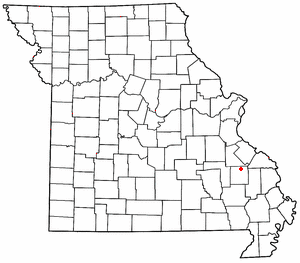
Longtown is a village in Union Township in Perry County, Missouri, United States. The population was 90 at the 2020 census.

<span class="mw-page-title-main">Mine La Motte, Missouri</span> Census-Designated Place in Missouri, United States

Mine La Motte is an unincorporated community and census-designated place in Madison County, Missouri, United States. It is located approximately six miles north of Fredericktown.

<span class="mw-page-title-main">Jackson Township, Ste. Genevieve County, Missouri</span> Civil Township in Missouri, United States

Jackson Township is a subdivision of Ste. Genevieve County, Missouri, in the United States of America, and is one of the five townships located in Ste. Genevieve County.

Henry Platte was an American minister who served as the first native Catholic priest in what is now the State of Missouri in the United States. He was curé of the Church of Ste. Genevieve in Ste. Genevieve, Missouri in 1815, and pastor from 1816 until his death from yellow fever in 1822.

<span class="mw-page-title-main">Fenwick Settlement, Missouri</span> Abandoned village in Missouri, United States

Fenwick Settlement is an abandoned village in Perry County, Missouri, United States. The community was named after the Fenwick family, who were early settlers on the left bank of the Mississippi River in the Spanish Illinois Country.

<span class="mw-page-title-main">Union Township, Perry County, Missouri</span> Township in the US state of Missouri

Union is one of the eight townships located in Perry County, Missouri, in the United States of America.

<span class="mw-page-title-main">Bois Brule Bottom</span> Alluvial floodplain in the American state of Missouri

The Bois Brule Bottom is an alluvial floodplain in Bois Brule Township in Perry County, Missouri stretching between Bois Brule Creek to the west and the Mississippi River to the east.

<span class="mw-page-title-main">New Bourbon, Missouri</span> Abandoned village in Missouri, United States

New Bourbon is an abandoned village located in Ste. Genevieve Township in Ste. Genevieve County, Missouri, United States. New Bourbon is located approximately two and one-half miles south of Ste. Genevieve.

St. Michel is an abandoned village located in Madison County, Missouri, United States. St. Michel is now incorporated into Fredericktown.

<span class="mw-page-title-main">Central Township, Perry County, Missouri</span> Township in the US state of Missouri

Central Township is one of the eight townships located in Perry County, Missouri, United States.

<span class="mw-page-title-main">Saline Township, Perry County, Missouri</span> Township in the US state of Missouri

Saline Township is one of the eight townships located in Perry County, Missouri, in the United States of America.

<span class="mw-page-title-main">Le Grand Champ Bottom</span>

Le Grand Champ is an alluvial floodplain, also called a bottom, extending along the Mississippi River in Ste. Genevieve County, Missouri.

<span class="mw-page-title-main">Cinque Hommes Creek</span> River in Missouri, United States

Cinque Hommes Creek is a tributary of the Mississippi River flowing through Perry County, Missouri.

<span class="mw-page-title-main">Saline Creek (Mississippi River tributary)</span> River in Missouri, United States

Saline Creek is a creek that rises in western Ste. Genevieve County and flows east briefly passing through a portion of northern Perry County before emptying into an offshoot of the Mississippi River north of St. Mary across from Kaskaskia Island.

<span class="mw-page-title-main">Beauvais Township, Ste. Genevieve County, Missouri</span> Civil Township in Missouri, United States

Beauvais Township is a subdivision of Ste. Genevieve County, Missouri, in the United States of America, and is one of the five townships located in Ste. Genevieve County.

<span class="mw-page-title-main">River aux Vases (Mississippi River tributary)</span> River in Missouri, United States

River aux Vases is a creek that rises in Union Township in western Ste. Genevieve County, Missouri and flows into the Mississippi River about two miles north of St. Marys, Missouri.

<span class="mw-page-title-main">Saline Township, Ste. Genevieve County, Missouri</span> Civil Township in Missouri, United States

Saline Township is a subdivision of Ste. Genevieve County, Missouri, in the United States of America, and is one of the five townships located in Ste. Genevieve County.

<span class="mw-page-title-main">Union Township, Ste. Genevieve County, Missouri</span> Civil Township in Missouri, United States

Union Township is a subdivision of Ste. Genevieve County, Missouri, in the United States of America, and is one of the five townships located in Ste. Genevieve County.

<span class="mw-page-title-main">Ste. Genevieve Township, Ste. Genevieve County, Missouri</span> Civil Township in Missouri, United States

Ste. Genevieve Township is a subdivision of Ste. Genevieve County, Missouri, in the United States of America, and is one of the five townships located in Ste. Genevieve County.

References

  1. Landmarkhunter.com
  2. André Pénicaut (1988). Fleur de Lys and Calumet. ISBN   9780817304140.
  3. Dr. Elizabeth M. Scott, Excavations and Research at Ste. Genevieve, Missouri http://lilt.ilstu.edu/emscot2/history.html Archived 2012-06-09 at the Wayback Machine
  4. State Historical Society of Missouri: Ste. Genevieve County http://shs.umsystem.edu/manuscripts/ramsay/ramsay_sainte_genevieve.html
  5. André Pénicaut (1988). Fleur de Lys and Calumet. ISBN   9780817304140.
  6. William E. Foley (1989). The Genesis of Missouri: From Wilderness Outpost to Statehood . University of Missouri Press. p.  24. ISBN   9780826207272. la saline missouri.
  7. Dr. Elizabeth M. Scott, Excavations and Research at Ste. Genevieve, Missouri http://lilt.ilstu.edu/emscot2/history.html Archived 2012-06-09 at the Wayback Machine
  8. William E. Foley (1989). The Genesis of Missouri: From Wilderness Outpost to Statehood . University of Missouri Press. p.  24. ISBN   9780826207272. la saline missouri.
  9. André Pénicaut (1988). Fleur de Lys and Calumet. ISBN   9780817304140.
  10. Walter A. Schroeder (2002). Opening the Ozarks: A Historical Geography of Missouri's Ste. Genevieve District, 1760-1830. ISBN   9780826263063.
  11. Walter A. Schroeder (2002). Opening the Ozarks: A Historical Geography of Missouri's Ste. Genevieve District, 1760-1830. ISBN   9780826263063.
  12. Walter A. Schroeder (2002). Opening the Ozarks: A Historical Geography of Missouri's Ste. Genevieve District, 1760-1830. ISBN   9780826263063.
  13. André Pénicaut (1988). Fleur de Lys and Calumet. ISBN   9780817304140.
  14. Dr. Elizabeth M. Scott, Excavations and Research at Ste. Genevieve, Missouri http://lilt.ilstu.edu/emscot2/history.html Archived 2012-06-09 at the Wayback Machine

37°54′25″N89°58′41″W / 37.907°N 89.978°W / 37.907; -89.978