Related Research Articles

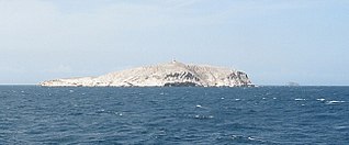
Isla de Aves, or Aves Island, is a Federal Dependency of Venezuela. It has been the subject of numerous territorial disputes with the United States, neighboring independent islands, such as Dominica, and European mother countries of surrounding dependent islands, such as the Netherlands, or the United Kingdom.

The Bolivarian Republic of Venezuela is a federation made up of twenty-three states, a Capital District and the Federal Dependencies, which consist of many islands and islets in the Caribbean Sea. Venezuela also claims the Guayana Esequiba territory which comprises six districts in the independent nation of Guyana.

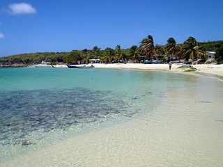
The Federal Dependencies of Venezuela encompass most of Venezuela's offshore islands in the Caribbean Sea and the Gulf of Venezuela, excluding those islands that form the State of Nueva Esparta and some Caribbean coastal islands that are integrated with nearby states. These islands, with a total area of 342 square kilometres, are sparsely populated – according to the preliminary results of the 2011 Census only 2,155 people live there permanently, with another hundred from Margarita Island who live there seasonally to engage in fishing. Local government is officially under the authority of Central government in Caracas, although de facto power is often held by the heads of the sparse and somewhat isolated communities that decorate the territories.


The following is an alphabetical list of topics related to Venezuela.

The Islas Los Frailes are an archipelago of rock islets with sparse scrub vegetation belonging to the Federal dependencies of Venezuela, part of Venezuela.

William Henry Phelps Jr. was a Venezuelan ornithologist and businessman.

Alfredo Armas Alfonzo was a Venezuelan writer, critic, editor and historian, well known throughout Latin America. He was a master of the modern fable, a precursor of what soon would be called magical realism.

The Los Roques Archipelago is a federal dependency of Venezuela consisting of approximately 350 islands, cays, and islets in a total area of 40.61 square kilometers. The archipelago is located 128 kilometers (80 mi) directly north of the port of La Guaira, in the Caribbean Sea.

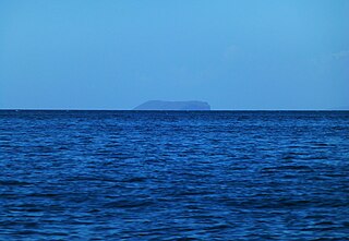
La Tortuga Island is an uninhabited island of Venezuela, the largest in the Federal Dependencies of Venezuela. It is part of a group of islands that include the Tortuguillos and Cayo Herradura. Isla La Tortuga has an area of 156 km2 (60 sq mi).
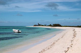
The Las Aves Archipelago is a pristine archipelago in the Caribbean Sea, and is part of the Federal Dependencies of Venezuela. It is located north of the Venezuelan states of Aragua and Carabobo, between the Dutch island Bonaire in the west, and the Los Roques Archipelago in the east, at 12°00′N67°40′W. The prime economic importance of the islands lies in fishing. "Las Aves" translates to "The Birds" in English.
The Los Hermanos Archipelago is a chain of seven rocky barren islets that is part of the Federal Dependencies of Venezuela, at 11°45′N64°25′W.
Cerro Sarisariñama is a tepui, a flat-topped mountain in Jaua-Sarisariñama National Park at the far south-west of Bolívar State, Venezuela, near the border with Brazil. Its altitude range is between 300 m (980 ft) and 2,350 m (7,710 ft). The name of the mountain originates from the tale of local Ye'kuana Indians about an evil spirit living in caves up in the mountain and devouring human flesh with a sound "Sari... sari...".

Blanquilla is an island, one of the Federal Dependencies of Venezuela, located in the southeastern Caribbean Sea about 293 km northeast of Caracas. It is a popular location for divers, as well as famous for its white sand beaches, for which it is named. The island's wildlife include local cacti and iguana. The island is also home to feral donkeys and goats. Its reefs are notable for their black coral, which is used for jewelry and other crafts. The island is formed by the Aves Ridge, a seafloor feature which protrudes above water to the north, forming several other islands. The island has an area of around 64.53 km2
The Los Monjes islands is a federal dependency of Venezuela are located to the northwest 80 kilometres of the Gulf of Venezuela, 34.8 kilometres off the coast of Guajira Peninsula at the border between Colombia and the Venezuelan state of Zulia.
Los Testigos Islands are a group of islands in the southeastern Caribbean Sea. They are a part of the Dependencias Federales of Venezuela.
Patos Island is a small uninhabited island in the northwestern Gulf of Paria. The island is a part of the Dependencias Federales of Venezuela.
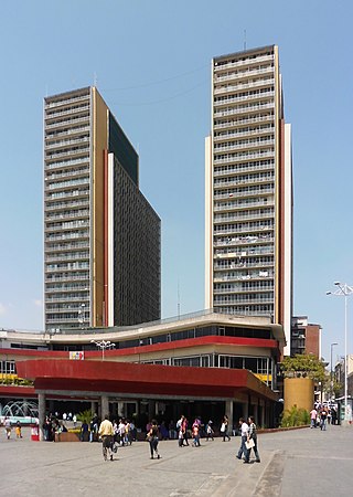
The Centro Simón Bolívar Towers TCSB also known as the Towers of Silence is a building with a pair of 32-story towers, each measuring 103 meters in height, in El Silencio district, Caracas, Venezuela. Built during the time of the presidency of Marcos Pérez Jiménez, the TCSB was opened to the public on December 6, 1954.
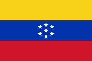
The United States of Venezuela was the official name of Venezuela, adopted in its 1864 constitution under the Juan Crisóstomo Falcón government. This remained the official name until 1953, when the constitution of that year renamed it the Republic of Venezuela. In 1999 under newly elected president Hugo Chávez and his modification to the Constitution, Venezuela's official name became the Bolivarian Republic of Venezuela.
References
- ↑ Vila, Marco Aurelio. 1967: Aspectos geográficos de las Dependencias Federales. Corporación Venezolana de Fomento. Caracas. 115p.
- ↑ Cervigon, Fernando. 1995: Las Dependencias Federales. Academia Nacional de la Historia. Caracas. 193p.
- ↑ Hernández Caballero, Serafín (Editor). 1998: Gran Enciclopedia de Venezuela. Editorial Globe, C.A. Caracas. 10 volúmenes. ISBN 980-6427-00-9 ISBN 980-6427-10-6