Xin an county gazzette (新安縣志, published in AD 1819, did not have any description of Lai chi kok, therefore, we did not have detail information of earlier history of the region. [original research?]
Lai Chi Kok literally means "lychee corner", referring to a seashore named after a type of fruit tree native to southern China. However, some historians such as Leung Ping Wah suggsted the original name of the region was Lai Tsai Kuok (孺仔脚), literally mean the footprint of the youngest son. The river once separated Cheung Sha Wan from Lai Chi Kok Bay, and a river from Butterfly Valley separated Cheung Sha Wan from Lai Chi Kok. At the innermost area of Lai Chi Kok Bay, namely present-day Lai King Hill Road, is a settlement called Kau Wa Keng.
The Qing government had set up a customs station in Lai Chi Kok, to collect customs duties after ceding Hong Kong Island and Kowloon Peninsula to the British.[3] After the lease of the New Territories, the British reclaimed Lai Chi Kok for military use. A torpedo storage facility was also erected on the west point of Lai Chi Kok Bay, an area near Kwai Chung.
At the time of the 1911 census, the population of Lai Chi Kok was 173.[4]
Lai Chi Kok is in Primary One Admission (POA) School Net 40. Within the school net are multiple aided schools (operated independently but funded with government money) and two government schools: Fuk Wing Street Government Primary School and Li Cheng Uk Government Primary School.[6]
Kowloon is an urban area in Hong Kong comprising the Kowloon Peninsula and New Kowloon. With a population of 2,019,533 and a population density of 43,033/km2 (111,450/sq mi) in 2006, it is the most populous area in Hong Kong, compared with Hong Kong Island and the rest of the New Territories. The peninsula's area is about 47 km2 (18 sq mi).
The Tsuen Wan line is one of the ten lines of the metro network in Hong Kong's MTR. It is indicated in red on the MTR map.
Mei Foo is a Hong Kong MTR station located in Mei Foo Sun Chuen, Lai Chi Kok, New Kowloon. It is the only interchange station between the Tsuen Wan line and the Tuen Ma line, situated between Lai Chi Kok and Lai King stations on the Tsuen Wan line and Nam Cheong and Tsuen Wan West stations on the Tuen Ma line. Mei Foo station's colour is blue.
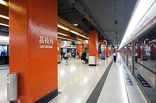
Lai Chi Kok is a rapid transit station on the Tsuen Wan line of the Hong Kong MTR system, between Cheung Sha Wan and Mei Foo stations. It was opened on 17 May 1982.
Mei Foo Sun Chuen or simply Mei Foo is a large private housing estate in Lai Chi Kok, Kowloon, Hong Kong. Mei Foo Sun Chuen was the first large scale private housing estate in Hong Kong and at the time of completion, the 99-tower complex was considered the largest private housing development in the world, accommodating some 70,000 – 80,000 people in 13,500 apartments. It is considered to be one of the world's largest privately financed residential condominium projects.
Sham Shui Po District is one of 18 districts of Hong Kong. It is the second poorest district in Hong Kong, with a predominantly working-class population of 405,869 in 2016 and the lowest median household income of all districts. Sham Shui Po has long been home to poorer new immigrants from mainland China. It also saw the birth of public housing in Hong Kong, as the government sought to resettle those displaced by a devastating fire in its slums. Sham Shui Po also hosted a Vietnamese refugee camp during the influx of migration in the aftermath of the Vietnam War.
Cheung Sha Wan is an area between Lai Chi Kok and Sham Shui Po in New Kowloon, Hong Kong. It is mainly residential to the north and south, with an industrial area in between. Administratively it is part of Sham Shui Po District, which also includes Lai Chi Kok.
Jordan Road is a road in Jordan, Kowloon, Hong Kong. It spans from the West Kowloon Highway in West Kowloon, through Kwun Chung and Ferry Point to Gascoigne Road and is a major east–west road in southern Kowloon.
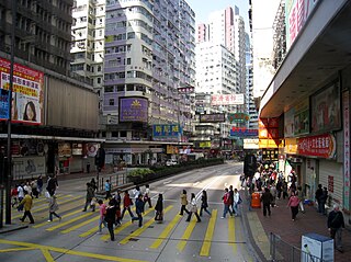
Lai Chi Kok Road is a road in western Kowloon, Hong Kong. It links Lai Chi Kok to Mong Kok, via Tai Kok Tsui, Sham Shui Po and Cheung Sha Wan. It starts from a junction with Nathan Road near Pioneer Centre in the south and ends near Mei Foo Sun Chuen. The road is bidirectional except the section at Lai Chi Kok, between the junction with Butterfly Valley Road and Mei Foo Sun Chuen, where it serves New Territories-bound traffic only. The Kowloon-bound traffic uses Cheung Sha Wan Road, separated by the flyover of Kwai Chung Road. The road once hosted shipyards, fish, meat and vegetable wholesale markets, which were moved closer to the coast after extensive reclamation.
Lai Chi Kok Bridge is a Hong Kong bridge that carries the Kwai Chung Road, part of Route 5, linking Kowloon to Kwai Chung, New Territories.
Kwai Chung Road is a throughway in Kwai Chung of the New Territories in Hong Kong. It is one of the busiest roads in Hong Kong. The Transport Department has classified it as a trunk road.
Tonkin Street is a street between Sham Shui Po and Cheung Sha Wan of New Kowloon in Hong Kong. It runs northeast to southwest and crosses many major roads in the Cheung Sha Wan area. After extensive reclamation in West Kowloon during the 1990s, an extension Tonkin Street West (東京街西) was built.
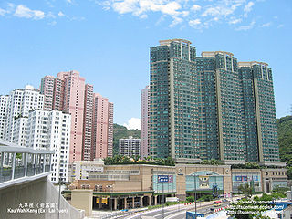
Kau Wa Keng, or Kau Wah Keng or Kau Wa Kang, is a village and valley in Lai King, Kowloon, Hong Kong. It is located near the reclaimed Lai Chi Kok Bay in New Kowloon. Three rivers in the valley once joined at the bay and formed a beach at the estuary. Kau Wah Keng is the former site of Lai Chi Kok Amusement Park, which was closed in 1997.
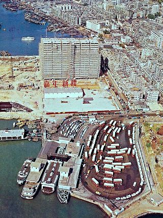
Jordan Road Ferry Pier or Ferry Point (1924–1998) is a demolished pier originally located at Jordan Road, Jordan, Hong Kong.
Fortune City One is one of the two shopping centres of City One, Sha Tin, New Territories, Hong Kong. It is owned by Cheung Kong Holdings. It is connected to nearly apartments and another shopping centre in City One, Fortune City One Plus, just across the street, by bridges.
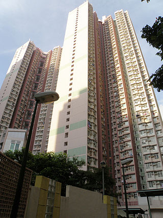
Wah Lai Estate is a public housing estate in Lai Chi Kok, Kowloon, Hong Kong. It consists of a total of two residential blocks completed in 2001.
Nob Hill is a private housing estate in Lai Chi Kok, Kowloon, Hong Kong, located at the former site of Lai Chi Kok Amusement Park, together with Wah Lai Estate and Lai Yan Court. It has three residential blocks and a shopping centre. It was jointly developed by Cheung Kong Holdings and Far East Hotels and Entertainment in 2002.
Mei Foo Ferry Pier was a ferry pier in Mei Foo Sun Chuen, Lai Chi Kok, Kowloon, Hong Kong, located outside Block 6 of the estate.
This page is based on this Wikipedia article Text is available under the CC BY-SA 4.0 license; additional terms may apply. Images, videos and audio are available under their respective licenses.