Lakeside, Virginia

Last updated

Lakeside, Virginia
VAMap-doton-Lakeside.PNG
Location of Lakeside, Virginia
Coordinates: 37°36′39″N77°28′33″W / 37.61083°N 77.47583°W / 37.61083; -77.47583
CountryFlag of the United States.svg  United States
State Flag of Virginia.svg  Virginia
County Flag of Henrico County, Virginia.png Henrico
Area
  Total4.4 sq mi (11.4 km2)
  Land4.3 sq mi (11.2 km2)
  Water0.08 sq mi (0.2 km2)
Elevation
177 ft (54 m)
Population
 (2020)
  Total12,203
  Density2,800/sq mi (1,100/km2)
Time zone UTC−5 (Eastern (EST))
  Summer (DST) UTC−4 (EDT)
ZIP code
23228
Area code 804
FIPS code 51-43464 [1]
GNIS feature ID1499637 [2]

Lakeside is a census-designated place (CDP) in Henrico County, Virginia, United States. It is an inner suburb of Richmond, Virginia. The population was 12,203 at the 2020 census. [3]

Contents

Geography

Lakeside is located at 37°36′39″N77°28′33″W / 37.61083°N 77.47583°W / 37.61083; -77.47583 (37.610695, 77.475747). [4]

According to the United States Census Bureau, the CDP has a total area of 4.4 square miles (11.4 km2), of which 4.3 square miles (11.2 km2) is land and 0.077 square miles (0.2 km2), or 1.58%, is water. [5]

Demographics

Historical population
CensusPop.Note
1970 11,137
1980 12,28910.3%
1990 12,081−1.7%
2000 11,157−7.6%
2010 11,8496.2%
2020 12,2033.0%
U.S. Decennial Census [6] [3]

As of the census [1] of 2000, there were 11,157 people, 4,982 households, and 2,909 families residing in the CDP. The population density was 2,657.1 people per square mile (1,025.7/km2). There were 5,177 housing units at an average density of 1,232.9/sq mi (475.9/km2). The racial makeup of the CDP was 86.16% White, 8.75% African American, 0.61% Native American, 1.43% Asian, 0.07% Pacific Islander, 1.22% from other races, and 1.76% from two or more races. Hispanic or Latino of any race were 2.45% of the population.

There were 4,982 households, out of which 24.1% had children under the age of 18 living with them, 42.1% were married couples living together, 12.8% had a female householder with no husband present, and 41.6% were non-families. 33.9% of all households were made up of individuals, and 12.0% had someone living alone who was 65 years of age or older. The average household size was 2.19 and the average family size was 2.80.

In the CDP, the population was spread out, with 20.2% under the age of 18, 6.7% from 18 to 24, 34.2% from 25 to 44, 21.3% from 45 to 64, and 17.6% who were 65 years of age or older. The median age was 38 years. For every 100 females, there were 87.3 males. For every 100 females age 18 and over, there were 83.8 males.

The median income for a household in the CDP was $40,641, and the median income for a family was $47,398. Males had a median income of $32,378 versus $27,343 for females. The per capita income for the CDP was $22,242. About 6.2% of families and 8.0% of the population were below the poverty line, including 15.1% of those under age 18 and 4.6% of those age 65 or over.

Related Research Articles

<span class="mw-page-title-main">Rock Creek, Alabama</span> CDP in Alabama, United States

Rock Creek is a census-designated place in Jefferson County, Alabama, United States. Its location is northwest of Hueytown. At the 2020 census, the population was 1,471. This area was damaged by an F5 tornado on April 8, 1998. An EF2 tornado struck northwest from here on January 23, 2012.

<span class="mw-page-title-main">Willow Valley, Arizona</span> Census-designated place in Arizona, United States

Willow Valley is an unincorporated community and census-designated place (CDP) in Mohave County, Arizona, United States. The population was 1,059 as of the 2020 census.

<span class="mw-page-title-main">North Sarasota, Florida</span> Census-designated place in Florida, United States

North Sarasota is a census-designated place (CDP) in Sarasota County, Florida, United States. The population was 6,982 at the 2010 census. It is part of the Bradenton–Sarasota–Venice Metropolitan Statistical Area.

<span class="mw-page-title-main">Shorewood–Tower Hills–Harbert, Michigan</span> Census-designated place & unincorporated communities in Michigan, United States

Shorewood–Tower Hills–Harbert is a census-designated place (CDP) composed of several small unincorporated communities in Chikaming Township of Berrien County in the U.S. state of Michigan. The population was 1,249 at the 2020 census. The CDP is limited to Chikaming Township, although some of the communities extend into southern Lake Township. All of the communities are located either upon or just east of the dunes on the shore of Lake Michigan. Most of the communities lie west of Interstate 94, although the CDP includes a small area east of the freeway up to Sawyer. The township is a popular resort destination.

<span class="mw-page-title-main">Mehlville, Missouri</span> CDP in Missouri, United States

Mehlville is a census-designated place (CDP) in south St. Louis County, Missouri, United States, an area locally known as "South County". It is an inner-ring suburb of St. Louis, and part of the Greater St. Louis metropolitan area.

<span class="mw-page-title-main">Lakeside, Montana</span> Unincorporated community in Montana, United States

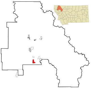
Lakeside is an unincorporated area and census-designated place (CDP) in Flathead County, Montana, United States. The population was 2,669 at the 2010 census, up from 1,679 in 2000.

<span class="mw-page-title-main">Sciotodale, Ohio</span> Census-designated place in Ohio, United States

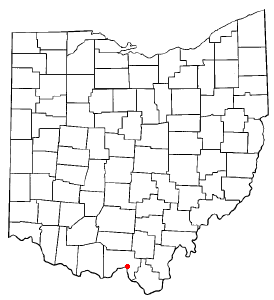
Sciotodale is a census-designated place (CDP) in Scioto County, Ohio, United States. The population was 1,081 at the 2010 census.

<span class="mw-page-title-main">Russellton, Pennsylvania</span> Census-designated place in Pennsylvania, United States

Russellton is a census-designated place (CDP) in Allegheny County, Pennsylvania, United States. The population was 1,330 at the 2020 census.

<span class="mw-page-title-main">Madisonburg, Pennsylvania</span> Census designated place in Pennsylvania, United States

Madisonburg is an unincorporated community and census-designated place (CDP) in Miles Township, Centre County, Pennsylvania, United States. It is part of the State College, Pennsylvania Metropolitan Statistical Area. The population was 168 at the 2010 census.

New Kingstown is a census-designated place (CDP) in Silver Spring Township, Cumberland County, Pennsylvania, United States. The population was 495 at the 2010 census. It is part of the Harrisburg–Carlisle metropolitan statistical area.

<span class="mw-page-title-main">Garden View, Pennsylvania</span> Census-designated place in Pennsylvania, United States

Garden View is a census-designated place (CDP) in Lycoming County, Pennsylvania, United States. The population was 2,503 at the 2010 census. It is part of the Williamsport Metropolitan Statistical Area.

<span class="mw-page-title-main">Cherryvale, South Carolina</span> CDP in South Carolina, United States

Cherryvale is a census-designated place (CDP) in Sumter County, South Carolina, United States. The population was 2,461 at the 2000 census. It is included in the Sumter, South Carolina Metropolitan Statistical Area.

<span class="mw-page-title-main">Low Moor, Virginia</span> Census-designated place in Virginia, United States

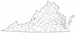
Low Moor is a census-designated place (CDP) in Alleghany County, Virginia. The population was 258 at the 2010 census.

<span class="mw-page-title-main">Chamberlayne, Virginia</span> Census-designated place in Virginia

Chamberlayne is a census-designated place (CDP) in Henrico County, Virginia, United States. The population was 5,581 at the 2020 census.

<span class="mw-page-title-main">Dumbarton, Virginia</span> Census-designated place in Virginia

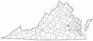
Dumbarton is a census-designated place (CDP) in Henrico County, Virginia, United States. The population was 7,879 at the 2010 census.

<span class="mw-page-title-main">East Highland Park, Virginia</span> Census-designated place in Virginia

East Highland Park is a census-designated place (CDP) in Henrico County, Virginia, in the United States. The population was 15,131 at the 2020 census.

Wyndham is a census-designated place (CDP) in Henrico County, Virginia, United States, in the West End area outside of Richmond. The population was 9,785 at the 2010 census. The CDP is named for Wyndham, a planned community there. It is an affluent suburb of Richmond, Virginia.

<span class="mw-page-title-main">Sudley, Virginia</span> Census-designated place in Virginia, United States

Sudley is a census-designated place (CDP) in Prince William County, Virginia, United States. As of the 2010 census, Sudley comprises what in the 2000 census were the Sudley and West Gate CDPs. Sudley's population including West Gate was 16,203 at the 2010 census, and excluding West Gate was 7,719 at the 2000 census.

<span class="mw-page-title-main">Yorkshire, Virginia</span> CDP in Virginia, United States

Yorkshire is a census-designated place (CDP) in Prince William County, Virginia, United States. It is an annex of Manassas, Virginia. The population was 6,732 at the 2000 census.

<span class="mw-page-title-main">Stanaford, West Virginia</span> Census-designated place in West Virginia, United States

Stanaford is a census-designated place (CDP) and coal town in Raleigh County, West Virginia, United States. The population was 1,350 at the 2010 census.

References

  1. 1 2 "U.S. Census website". United States Census Bureau . Retrieved January 31, 2008.
  2. "US Board on Geographic Names". United States Geological Survey. October 25, 2007. Retrieved January 31, 2008.
  3. 1 2 "2020 Census Data". United States Census Bureau. Retrieved August 8, 2023.
  4. "US Gazetteer files: 2010, 2000, and 1990". United States Census Bureau. February 12, 2011. Retrieved April 23, 2011.
  5. "Geographic Identifiers: 2010 Demographic Profile Data (G001): Lakeside CDP, Virginia". United States Census Bureau . Retrieved August 6, 2012.
  6. "Census of Population and Housing". Census.gov. Retrieved June 4, 2015.