Lambton Shores

Last updated

Lambton Shores
Municipality of Lambton Shores
Grand Bend 2.JPG
Grand Bend
Lambton locator map 2021.svg
Red pog.svg
Lambton Shores
Canada Southern Ontario location map 2.png
Red pog.svg
Lambton Shores
Coordinates: 43°11′N81°54′W / 43.183°N 81.900°W / 43.183; -81.900
CountryFlag of Canada (Pantone).svg  Canada
ProvinceFlag of Ontario.svg  Ontario
County Lambton
Formed2001
Government
  MayorDoug Cook
  Federal riding Lambton—Kent—Middlesex
  Prov. riding Lambton—Kent—Middlesex
Area
[1]
  Land331.20 km2 (127.88 sq mi)
Population
 (2016) [1]
  Total10,631
  Density32.1/km2 (83/sq mi)
Time zone UTC-5 (EST)
  Summer (DST) UTC-4 (EDT)
Postal Code
N0N 1J 0-9/N0M
Area code(s) 519 and 226
Website www.lambtonshores.ca

Lambton Shores is a municipality in Lambton County, Ontario, Canada, that is on the southern shores of Lake Huron.

Contents

History

Lambton Shores was formed in 2001 when the Township of Bosanquet was amalgamated with the town of Forest, and the villages of Arkona, Grand Bend and Thedford.

Climate

Lambton Shores is one of the more southerly municipalities in Canada, and therefore receives relatively warmer temperatures. It has an average high of 26 °C (79 °F) in July and −1 °C (30 °F) in January. As for precipitation, it receives an average of 87 millimetres (3.4 in) of rain in July and an average of 45 centimetres (18 in) of snow in January.

Climate data for Thedford (1981−2010, extremes 1882–present [note 1] )
MonthJanFebMarAprMayJunJulAugSepOctNovDecYear
Record high °C (°F)17.8
(64.0)
22.0
(71.6)
28.0
(82.4)
31.1
(88.0)
33.3
(91.9)
38.0
(100.4)
38.9
(102.0)
38.3
(100.9)
37.8
(100.0)
32.5
(90.5)
26.1
(79.0)
19.0
(66.2)
38.9
(102.0)
Mean daily maximum °C (°F)−0.9
(30.4)
0.0
(32.0)
5.1
(41.2)
12.2
(54.0)
18.9
(66.0)
24.5
(76.1)
26.6
(79.9)
25.6
(78.1)
21.9
(71.4)
14.7
(58.5)
7.7
(45.9)
1.3
(34.3)
13.2
(55.8)
Daily mean °C (°F)−4.2
(24.4)
−3.8
(25.2)
0.7
(33.3)
7.1
(44.8)
13.1
(55.6)
18.7
(65.7)
21.0
(69.8)
20.2
(68.4)
16.4
(61.5)
10.2
(50.4)
4.3
(39.7)
−1.6
(29.1)
8.5
(47.3)
Mean daily minimum °C (°F)−7.5
(18.5)
−7.6
(18.3)
−3.7
(25.3)
1.9
(35.4)
7.2
(45.0)
12.7
(54.9)
15.4
(59.7)
14.6
(58.3)
10.8
(51.4)
5.6
(42.1)
0.9
(33.6)
−4.5
(23.9)
3.8
(38.8)
Record low °C (°F)−33
(−27)
−34.5
(−30.1)
−30
(−22)
−16.7
(1.9)
−6.7
(19.9)
−1.1
(30.0)
1.1
(34.0)
1.5
(34.7)
−2.8
(27.0)
−10
(14)
−20.6
(−5.1)
−26.7
(−16.1)
−34.5
(−30.1)
Average precipitation mm (inches)73.8
(2.91)
57.6
(2.27)
57.6
(2.27)
78.9
(3.11)
80.9
(3.19)
76.4
(3.01)
87.2
(3.43)
79.7
(3.14)
103.0
(4.06)
94.3
(3.71)
89.5
(3.52)
84.5
(3.33)
963.3
(37.93)
Average rainfall mm (inches)29.1
(1.15)
23.7
(0.93)
35.3
(1.39)
74.7
(2.94)
80.9
(3.19)
76.4
(3.01)
87.2
(3.43)
79.7
(3.14)
103.0
(4.06)
92.9
(3.66)
77.8
(3.06)
42.9
(1.69)
803.4
(31.63)
Average snowfall cm (inches)44.7
(17.6)
33.9
(13.3)
22.3
(8.8)
4.2
(1.7)
0.0
(0.0)
0.0
(0.0)
0.0
(0.0)
0.0
(0.0)
0.0
(0.0)
1.4
(0.6)
11.7
(4.6)
41.7
(16.4)
159.9
(63.0)
Average precipitation days (≥ 0.2 mm)14.510.812.813.412.810.911.110.912.415.015.114.5153.9
Average rainy days (≥ 0.2 mm)4.63.47.312.612.810.911.110.912.414.912.76.8120.1
Average snowy days (≥ 0.2 cm)10.68.36.31.50.00.00.00.00.00.383.09.038.8
Source: Environment Canada [2] [3]

Communities

The main communities in Lambton Shores are Arkona, Forest, Grand Bend, Port Franks and Thedford. Smaller communities include Cedarview, Glendale Beach, Kettle and Stoney Point, Ipperwash Beach, Lake Valley Grove, Jericho, Jura, Kinnaird, Northville, Ravenswood, Southcott Pines, Springvale, Sunnidale, Walden Place and Walker Woods. The administrative offices of the township are located in Thedford.

Arkona

Arkona is a community located in the municipality of Lambton Shores in southwestern Ontario near the Lambton Middlesex county line, situated beside the Ausable River, on Former Kings Highway 79 (now Lambton County Road 79), Arkona is roughly halfway between Thedford, and Watford.

Arkona, Ontario, Canada Arkona, Ontario, Canada.jpg
Arkona, Ontario, Canada

Forest

Forest, Ontario, Canada Forest ON.JPG
Forest, Ontario, Canada

Forest is situated on what was once dense forest. When the Grand Trunk Railway was built through where the town now sits, the station was named for the dense forest. Hickory Creek, which meanders through the town, provided water for the station in those days when wood and water were essential to the operation of steam locomotives.

Grand Bend

Main Street in Grand Bend 12 Main Street, Grand Bend.JPG
Main Street in Grand Bend

The settlement began in the 1830s when a group of English and Scottish settlers bought lots from the Canada Company, a land development firm. One of the original settlers, Benjamin Brewster gave his name to the village after he and his business partner David Smart secured rights to dam the Ausable River and started a sawmill in 1832. The villagers were mainly the families of the millhands and fisherman. Their homesteads were situated on the south side of the present village.

Thedford

Thedford, Ontario, Canada Thedford ON.JPG
Thedford, Ontario, Canada

Thedford is a small community in northwestern Lambton County, Ontario Canada, situated 8 km south of Kings Highway 21, along Lambton CR 79 (Former Kings Highway 79). The community began in the 1860s when farmer Nelson Southworth, a native of Vermont, agreed to donate land for the construction of a Grand Trunk Railway station, with the condition that he would be able to name it. Southworth chose the name "Thetford", as a way of honouring Thetford, Vermont, a community in his home state in the United States. A local clerk's poor hand writing was mistaken for the current spelling, which is how it first appeared on official records. The Thedford Raiders Hockey Team once held the World Record for Longest Continuous Hockey Game, which was also a fundraiser for juvenile diabetes. A plaque at the entrance of the town heralds it as the "Onion Capital of Canada".

A designated place within the municipality of Lambton Shores, Thedford had a population of 822 in the Canada 2006 Census.

Thedford telephone numbers start with 519-296.

Demographics

In the 2021 Census of Population conducted by Statistics Canada, Lambton Shores had a population of 11,876 living in 5,303 of its 7,211 total private dwellings, a change of 11.7% from its 2016 population of 10,631. With a land area of 330.57 km2 (127.63 sq mi), it had a population density of 35.9/km2 (93.0/sq mi) in 2021. [4]

Canada census – Lambton Shores community profile
2021 2016 2011
Population11,876 (+11.7% from 2016)10,631 (-0.2% from 2011)10,656 (-4.4% from 2006)
Land area330.57 km2 (127.63 sq mi)331.20 km2 (127.88 sq mi)331.08 km2 (127.83 sq mi)
Population density35.9/km2 (93/sq mi)32.1/km2 (83/sq mi)32.2/km2 (83/sq mi)
Median age56.8 (M: 55.6, F: 57.6)54.7 (M: 53.6, F: 55.4)52.4 (M: 51.6, F: 53.3)
Private dwellings7,211 (total)  5,303 (occupied)7008 (total) 6880 (total) 
Median household income$80,000$67,264
References: 2021 [5] 2016 [6] 2011 [7] earlier [8] [9]
Historical population
YearPop.±%
1996 10,874    
2001 10,571−2.8%
2006 11,150+5.5%
2011 10,656−4.4%
2016 10,631−0.2%
[10] [7] [1]

Media

Lambton Shores has two radio stations:

90.5 myFM Exeter/Grand Bend Local News

Lambton Shores has two newspapers:

See also

Notes

  1. Long term records have been recorded at various climate stations in or nearby Lambton Shores since 1882

Related Research Articles

<span class="mw-page-title-main">St. Clair, Ontario</span> Township in Ontario, Canada

St. Clair is a township in southwestern Ontario, Canada, immediately south of Sarnia in Lambton County, along the eastern shores of the St. Clair River.

<span class="mw-page-title-main">Lambton County</span> County in Ontario, Canada

Lambton County is a county in Southwestern Ontario, Canada. It is bordered on the north by Lake Huron, which is drained by the St. Clair River, the county's western border and part of the Canada-United States border. To the south is Lake Saint Clair and Chatham-Kent. Lambton County's northeastern border follows the Ausable River and Parkhill Creek north until it reaches Lake Huron at the beach community of Grand Bend. The county seat is in the Town of Plympton-Wyoming.

<span class="mw-page-title-main">Forest, Ontario</span> Community in Ontario, Canada

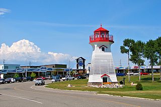
Forest is a community in Lambton Shores, Ontario, Canada, near Sarnia and Lake Huron in Lambton County. It has a population of 2,876 and a land area of 5.26 square kilometres (2.03 sq mi).

Bosanquet is a former township of Lambton County in Ontario, Canada located northeast of Sarnia.

<span class="mw-page-title-main">Grand Bend</span> Place in Ontario, Canada

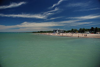
Grand Bend is a community located on the shores of Lake Huron in Southwestern Ontario, Canada. It is part of the Municipality of Lambton Shores in Lambton County.

<span class="mw-page-title-main">Ausable River (Lake Huron)</span> River in Ontario, Canada

The Ausable River is a river in southwestern Ontario Canada which empties into Lake Huron at Port Franks, Ontario. The Ausable's initial source is in a moraine near the community of Staffa, Ontario located in the municipality of West Perth, Ontario at a point 334 metres (1,096 ft) above sea level. Although the river has a total measured length of over 240 kilometres (150 mi), because of its meandering course, the mouth in actuality is only 64 kilometres (40 mi) from its source near Staffa. The Ausable drains 1,142 square kilometers (441 sq mi) of land, and falls 158 metres (518 ft) in elevation from source to outlet.

<span class="mw-page-title-main">Southwold, Ontario</span> Township in Ontario, Canada

Southwold is a township in Elgin County, in Ontario, Canada, located on the north shore of Lake Erie. It is a rich agricultural zone producing predominantly corn and soybeans. It is part of the London census metropolitan area.

<span class="mw-page-title-main">Lambton—Kent—Middlesex (federal electoral district)</span> Federal electoral district in Ontario, Canada

Lambton—Kent—Middlesex is a federal electoral district in Ontario, Canada, that has been represented in the House of Commons of Canada since 1997.

<span class="mw-page-title-main">Terrace Bay</span> Township in Ontario, Canada

Terrace Bay is a township in Thunder Bay District in northern Ontario, Canada, located on the north shore of Lake Superior east of Thunder Bay along Highway 17. The name originates from a series of lake terraces formed as the water level in Lake Superior lowered following the latest ice age.

<span class="mw-page-title-main">Bonfield, Ontario</span> Township in Ontario, Canada

Bonfield is a township in northeastern Ontario, Canada, on the Mattawa River in Nipissing District.

<span class="mw-page-title-main">Plympton–Wyoming</span> Town in Ontario, Canada

Plympton–Wyoming is a town in the Canadian province of Ontario, located in Lambton County immediately east of Sarnia. It is the seat of the Lambton County Council.

<span class="mw-page-title-main">North Middlesex, Ontario</span> Municipality in Middlesex County, Ontario, Canada

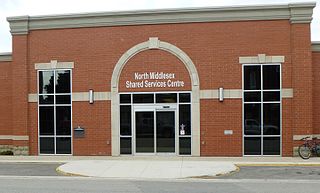
North Middlesex is a municipality in Middlesex County, Ontario, Canada.

<span class="mw-page-title-main">Port Franks, Ontario</span> Place in Ontario, Canada

Port Franks is a small Southern Ontario community in the municipality of Lambton Shores, Lambton County in southwestern Ontario, Canada. It is located along Kings Highway 21 near Pinery Provincial Park, about 8 kilometres (5.0 mi) north of Thedford, Ontario. Archaeological evidence suggests that human habitation and use of this site date back thousands of years, and that locally obtained flint was manufactured at the so-called 'flint chipping beds' in the vicinity long before the period of European contact with First Nations peoples in the Great Lakes Basin.

<span class="mw-page-title-main">Arkona, Ontario</span>

Arkona is a community located in the municipality of Lambton Shores in southwestern Ontario near the Lambton–Middlesex county line, situated beside the Ausable River, on Former Kings Highway 79, Arkona is roughly halfway between Thedford, and Watford.

<span class="mw-page-title-main">Algonquin Highlands</span> Township in Ontario, Canada

Algonquin Highlands is a township located in Haliburton County, Ontario, Canada. It has a population of 2,351. The northeastern section of the township is included in Algonquin Provincial Park.

<span class="mw-page-title-main">Warwick, Ontario</span> Township in Ontario, Canada

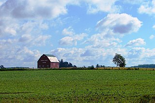
Warwick is a rural township in Lambton County, Ontario, Canada, with a population (2016) of 3,692.

<span class="mw-page-title-main">Brooke-Alvinston</span> Municipality in Ontario, Canada

Brooke-Alvinston is a township municipality in the Canadian province of Ontario, located within Lambton County. It was formed on January 1, 2001, when the Township of Brooke was amalgamated with the Village of Alvinston.

Beach O' Pines is a private gated community located on the shores of Lake Huron in Lambton County, Ontario, Canada. It is located immediately outside of the community of Grand Bend, Ontario, and is bordered to the northwest by Lake Huron, the southwest by the Pinery Provincial Park, the northeast by the subdivision of Southcott Pines, and the southeast by the Old Ausable Channel, Highway #21, and the subdivision of Huron Woods.

<span class="mw-page-title-main">Rock Glen Conservation Area</span>

Rock Glen Conservation Area is a suburban conservation area located in the town of Arkona, in the municipality of Lambton Shores, Ontario, Canada. The conservation area is owned and maintained by the Ausable Bayfield Conservation Authority (ABCA). The former "Ausable River Conservation Authority" was Ontario's first conservation authority, created in 1946. The Bayfield River watershed and smaller streams were added in 1971. Local municipalities and the Province of Ontario formed "Ausable Bayfield Conservation Authority" (ABCA) to prevent the loss of important local ecosystems, to protect life and property through flood management, and to build a healthier natural environment on a watershed scale. Rock Glen Conservation Area is situated in a transition zone between the Carolinian forest zone to the south, and the Great Lakes, in Lambton Shores, Ontario, Canada. On the conservation area grounds is the Arkona Lions Museum and Information Centre; which houses a collection of Devonian period fossils and Aboriginal artifacts found in the local area.

The Old Ausable Channel is a self-contained waterway in Lambton County, Ontario, Canada that runs through the Pinery Provincial Park and the community of Grand Bend. It is a 14 kilometre long river channel that was isolated from the Ausable River by the digging of canals for drainage in the late nineteenth century. Part of the Pinery Provincial Park's rare oak savanna, the channel is an important part of the region's ecosystem.

References

  1. 1 2 3 "Census Profile, 2016 Census: Lambton Shores, Municipality". Statistics Canada . Retrieved June 17, 2019.
  2. "Thedford, Ontario". Canadian Climate Normals 1981–2010. Environment Canada. Archived from the original on 2020-07-17. Retrieved February 8, 2014.
  3. "Long Term Climate Extremes for Lambton Shores Area (Virtual Station ID: VSON46V)". Daily climate records (LTCE). Environment Canada. Archived from the original on November 12, 2021. Retrieved November 12, 2021.
  4. "Population and dwelling counts: Canada, provinces and territories, census divisions and census subdivisions (municipalities), Ontario". Statistics Canada. February 9, 2022. Retrieved March 31, 2022.
  5. "2021 Community Profiles". 2021 Canadian Census . Statistics Canada. February 4, 2022. Retrieved 2023-10-19.
  6. "2016 Community Profiles". 2016 Canadian Census . Statistics Canada. August 12, 2021. Retrieved 2018-12-28.
  7. 1 2 "2011 Community Profiles". 2011 Canadian Census . Statistics Canada. March 21, 2019. Retrieved 2012-08-08.
  8. "2006 Community Profiles". 2006 Canadian Census . Statistics Canada. August 20, 2019.
  9. "2001 Community Profiles". 2001 Canadian Census . Statistics Canada. July 18, 2021.
  10. Statistics Canada: 1996, 2001, 2006 census