Fairfax County, officially the County of Fairfax, is a county in the Commonwealth of Virginia. With a population of 1,150,309 as of the 2020 census, it the most populous county in Virginia, the most populous jurisdiction in the Washington metropolitan area, and the most populous location in the Washington–Baltimore combined statistical area. The county seat is Fairfax; however, because it is an independent city under Virginia law, the city of Fairfax is not part of the county.

Arlington County, or simply Arlington, is a county in the U.S. state of Virginia. The county is located in Northern Virginia on the southwestern bank of the Potomac River directly across from Washington, D.C., the national capital.

Chantilly is a census-designated place (CDP) in western Fairfax County, Virginia. The population was 24,301 as of the 2020 census. Chantilly is named after an early-19th-century mansion and farm, which in turn took the name of an 18th-century plantation that was located in Westmoreland County, Virginia. The name "Chantilly" originated in France with the Château de Chantilly, about 28 miles north of Paris.

McLean is an unincorporated community and census-designated place in Fairfax County, Virginia, United States. The population of the community was 50,773 at the 2020 census. It is located between the Potomac River and Vienna within the Washington metropolitan area.

Tysons, also known as Tysons Corner, is a census-designated place (CDP) in Fairfax County, Virginia, United States, spanning from the corner of SR 123 and SR 7. It is part of the Washington metropolitan area and located in Northern Virginia between McLean and Vienna along the I-495.
Northern Virginia, locally referred to as NOVA or NoVA, comprises several counties and independent cities in the Commonwealth of Virginia in the United States. The region radiates westward and southward from Washington, D.C., the nation's capital, and has a population of 3,257,133 people as of 2023 U.S. Census Bureau estimates, representing of a third of the state's total population. It is the most populous region in both Virginia and the regional Washington metropolitan area.

The George Washington Memorial Parkway, colloquially the G.W. Parkway, is a 25-mile-long (40 km) limited-access parkway that runs along the south bank of the Potomac River from Mount Vernon, Virginia, northwest to McLean, Virginia, and is maintained by the National Park Service (NPS). It is located almost entirely within Virginia, except for a short portion of the parkway northwest of the Arlington Memorial Bridge that passes over Columbia Island within the District of Columbia.

State Route 123 or Virginia State Route 123 is a primary state highway in the U.S. state of Virginia. The state highway runs 29.27 miles (47.11 km) from U.S. Route 1 in Woodbridge north to the Chain Bridge across the Potomac River into Washington from Arlington. It goes by five local names. From its southern terminus to the Occoquan River Bridge, it is known as Gordon Boulevard. From the Occoquan River Bridge to the city of Fairfax it is known as Ox Road. From Fairfax until it enters the Town of Vienna, it is known as Chain Bridge Road. Then, as it passes through the Town of Vienna, it is known as Maple Avenue. After leaving the Town of Vienna, the name reverts to Chain Bridge Road, and continues this way until the intersection with I-495 in Tysons. Between Tysons and the George Washington Memorial Parkway, it is known as Dolley Madison Boulevard. After crossing over the George Washington Memorial Parkway, the name once again reverts to Chain Bridge Road and continues this way until the end of the road, at Chain Bridge. SR 123 is a partial circumferential highway in Northern Virginia that connects Woodbridge in eastern Prince William County with the independent city of Fairfax and the Fairfax County communities of Vienna, Tysons, and McLean, the last being the home of the National Counterterrorism Center and the Central Intelligence Agency. The state highway also connects all of the major highways that radiate from Washington, including Interstate 95 (I-95), I-66, US 29, US 50, SR 267, and the George Washington Memorial Parkway. Furthermore, SR 123 crosses another pair of circumferential highways, I-495 and the Fairfax County Parkway, and SR 7, a major northwest–southeast highway through Northern Virginia. The state highway is a part of the National Highway System for its entire length.

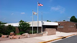
McLean High School is a public high school within the Fairfax County Public Schools in McLean, Virginia. In 2022, U.S. News & World Report rated McLean the 157th-best U.S. public high school, and third-best in Virginia.

Langley High School is a public high school within the Fairfax County Public Schools in McLean, Virginia, United States.
Claude Moore Colonial Farm, originally Turkey Run Farm, was a U.S. park in Virginia re-creating and re-enacting life on a tenant farm circa 1771. The park closed permanently on December 21, 2018. The National Park Service was subsequently said to be in the process of planning the future of the park and its facilities
John Tilghman "Til" Hazel Jr. was an American attorney and real-estate developer in Northern Virginia who is credited with developing several portions of Fairfax County, Virginia, into major commercial and residential areas from the 1960s through the present. He was instrumental in the large-scale development of Tysons, Virginia, which became one of the country's first significant edge cities.

On January 25, 1993, outside of CIA Headquarters campus in Langley, Virginia, Pakistani national Mir Aimal Kansi shot and killed two CIA employees in their cars as they were waiting at a stoplight and wounded three others.
McDonough Bolyard Peck, Inc. (MBP) is a construction management company headquartered in Fairfax, Virginia. It provides construction management services such as cost estimating, value engineering, constructability review, CPM scheduling, inspection, building information modeling, and facilities management. The firm is also active in many forms of Alternative Disputes Resolution (ADR). The firm serves private and governmental owners, designers, contractors, developers and attorneys on a wide range of transportation, building, plant, environmental and utilities projects.

The George Bush Center for Intelligence is the headquarters of the Central Intelligence Agency, located in the unincorporated community of Langley in Fairfax County, Virginia, United States, near Washington, D.C.
Turner-Fairbank Highway Research Center is a U.S. Department of Transportation facility located in McLean, Virginia. The center carries out research studies and was renamed after Francis Turner in 1983. It had been known as the Fairbank Highway Research Station for Herbert S. Fairbank, an official at FHWA's predecessor, the Bureau of Public Roads. It is located adjacent to the Central Intelligence Agency headquarters.
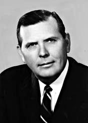
M.T. Broyhill and Sons Corporation was a brick-and-mortar housing company based around Washington, D.C. Broyhill and Sons successfully capitalized on the post World War II housing boom to become the largest builder of brick-and-mortar homes in the United States during the 1950s. By 1953, Broyhill and Sons was building 3,000 homes a year when the company also become the biggest customer of General Electric appliances. The company was owned by M.T. Broyhill, and sons Marvin Broyhill and Joel Broyhill whom become congressmen of Virginia for 11 terms, from 1953 to 1974.
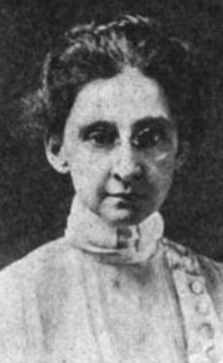
Florence Calvert Thorne was an American labour activist and long-time member of the American Federation of Labor, where she established vital statistics reporting that would go on to inform New Deal social programs.
The following is a timeline of the history of the unincorporated community and census-designated place (CDP) of McLean, Virginia, USA.