Leona, Texas

Last updated

Leona, Texas
Leona Texas Post Office 2019.jpg
Leona, Texas Post Office
TXMap-doton-Leona.PNG
Location of Leona, Texas
Leon County Leona.svg
Coordinates: 31°9′17″N95°58′33″W / 31.15472°N 95.97583°W / 31.15472; -95.97583
Country United States
State Texas
County Leon
Area
[1]
  Total2.22 sq mi (5.76 km2)
  Land2.22 sq mi (5.76 km2)
  Water0.00 sq mi (0.00 km2)
Elevation
341 ft (104 m)
Population
 (2010)
  Total175
  Estimate 
(2019) [2]
180
  Density80.97/sq mi (31.26/km2)
Time zone UTC-6 (Central (CST))
  Summer (DST) UTC-5 (CDT)
ZIP code
75850
Area code 903
FIPS code 48-42340 [3]
GNIS feature ID1361095 [4]

Leona is a city in Leon County, Texas, United States. The population was 175 at the 2010 census.

Contents

Geography

Leona is located at 31°9′17″N95°58′33″W / 31.15472°N 95.97583°W / 31.15472; -95.97583 (31.154763, –95.975703). [5]

According to the United States Census Bureau, the city has a total area of 2.2 square miles (5.7 km2), all of it land.

Demographics

Historical population
CensusPop.Note
1970 96
1980 16571.9%
1990 1787.9%
2000 1811.7%
2010 175−3.3%
2019 (est.)180 [2] 2.9%
U.S. Decennial Census [6]

As of the census [3] of 2000, there were 181 people, 71 households, and 48 families residing in the city. The population density was 83.2 inhabitants per square mile (32.1/km2). There were 91 housing units at an average density of 41.8 per square mile (16.1/km2). The racial makeup of the city was 83.43% White, 13.81% African American, 0.55% Asian, and 2.21% from two or more races. Hispanic or Latino of any race were 2.21% of the population.

There were 71 households, out of which 32.4% had children under the age of 18 living with them, 57.7% were married couples living together, 8.5% had a female householder with no husband present, and 31.0% were non-families. 31.0% of all households were made up of individuals, and 16.9% had someone living alone who was 65 years of age or older. The average household size was 2.55 and the average family size was 3.22.

In the city, the population was spread out, with 29.3% under the age of 18, 7.7% from 18 to 24, 26.0% from 25 to 44, 18.8% from 45 to 64, and 18.2% who were 65 years of age or older. The median age was 36 years. For every 100 females, there were 101.1 males. For every 100 females age 18 and over, there were 88.2 males.

The median income for a household in the city was $30,000, and the median income for a family was $37,083. Males had a median income of $27,500 versus $20,000 for females. The per capita income for the city was $17,725. About 4.8% of families and 11.2% of the population were below the poverty line, including 9.8% of those under the age of 18 and 16.7% of those 65 or over.

Education

The City of Leona is served by the Centerville Independent School District.

Notable people

Related Research Articles

<span class="mw-page-title-main">Belleair Bluffs, Florida</span> City in Florida, United States

Belleair Bluffs is a city in Pinellas County, Florida, United States. The population was 2,031 at the 2010 census.

<span class="mw-page-title-main">Lakeside, Iowa</span> City in Iowa, United States

Lakeside is a city in Buena Vista County, Iowa, United States. The population was 700 at the time of the 2020 census. It is the most densely populated city in Iowa.

<span class="mw-page-title-main">Rembrandt, Iowa</span> City in Iowa, United States

Rembrandt is a city in Buena Vista County, Iowa, United States. The population was 209 at the time of the 2020 census.

<span class="mw-page-title-main">Lewis, Iowa</span> City in Iowa, United States

Lewis is a city in Cass County, Iowa, United States, along the East Nishnabotna River. The population was 357 at the time of the 2020 census.

<span class="mw-page-title-main">Meriden, Iowa</span> City in Iowa, United States

Meriden is a city in Cherokee County, Iowa, United States. The population was 161 at the time of the 2020 census.

<span class="mw-page-title-main">Emerson, Iowa</span> City in Iowa, United States

Emerson is a city in Mills County, Iowa, United States. The population was 403 at the time of the 2020 census.

<span class="mw-page-title-main">Uniontown, Kansas</span> City in Kansas, United States

Uniontown is a city in Bourbon County, Kansas, United States. As of the 2020 census, the population of the city was 293.

<span class="mw-page-title-main">Leona, Kansas</span> City in Doniphan County, Kansas

Leona is a city in Doniphan County, Kansas, United States. As of the 2020 census, the population of the city was 41.

<span class="mw-page-title-main">Fruitport, Michigan</span> Village in Michigan, United States

Fruitport is a village in Muskegon County in the U.S. state of Michigan. The population was 1,093 at the 2010 census. The community is located within Fruitport Charter Township.

<span class="mw-page-title-main">Wolf Lake, Minnesota</span> City in Minnesota, United States

Wolf Lake is a city in Becker County, Minnesota, United States. The population was 71 at the 2020 census.

<span class="mw-page-title-main">Lake Bronson, Minnesota</span> City in Minnesota, United States

Lake Bronson is a city in Kittson County, Minnesota, United States. The population was 178 at the 2020 census. Lake Bronson State Park is nearby.

<span class="mw-page-title-main">Deer Creek, Minnesota</span> City in Minnesota, United States

Deer Creek is a city in Otter Tail County, Minnesota, United States. The population was 330 at the 2020 census.

<span class="mw-page-title-main">Lengby, Minnesota</span> City in Minnesota, United States

Lengby is a city in Polk County, Minnesota, United States. It is part of the Grand Forks ND-MN Metropolitan Statistical Area. The population was 92 at the 2020 census.

<span class="mw-page-title-main">Throop, New York</span> Town in New York, United States

Throop is a town in Cayuga County, New York, United States. The town is at the northern city line of Auburn and is in the Finger Lakes region of New York. The population was 1,990 at the 2010 census. The town is named after former New York Governor Enos T. Throop, a resident of Cayuga County.

<span class="mw-page-title-main">McFarlan, North Carolina</span> Town in North Carolina, United States

McFarlan is a town in Anson County, North Carolina, United States. The population was 95 at the 2020 census. The town was named after Alan McFarland, a railroad official.

<span class="mw-page-title-main">Calypso, North Carolina</span> Town in North Carolina, United States

Calypso is a town in Duplin County, North Carolina, United States. The population was 538 at the 2010 census.

<span class="mw-page-title-main">Nome, North Dakota</span> City in North Dakota, United States

Nome is a city in Barnes County, North Dakota, United States. The population was 51 at the 2020 census. Nome was founded in 1901.

<span class="mw-page-title-main">Millerstown, Pennsylvania</span> Borough in Pennsylvania, United States

Millerstown is a borough in northern Perry County, Pennsylvania, United States, located 29 miles (47 km) northwest of Harrisburg and 29 miles (47 km) southwest of Selinsgrove. The population was 688 at the 2020 Census. The borough is part of the Harrisburg–Carlisle Metropolitan Statistical Area.

<span class="mw-page-title-main">Oilton, Texas</span> CDP in Texas, United States

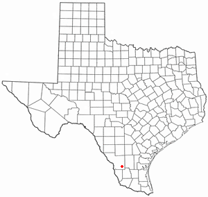
Oilton is a census-designated place (CDP) in Webb County, Texas, United States. The population was 152 at the 2010 census. The community is within the boundary of Webb Consolidated Independent School District and is home to the Oilton Elementary School.

<span class="mw-page-title-main">Mills Township, Bond County, Illinois</span> Township in Illinois, United States

Mills Township is one of nine townships in Bond County, Illinois, US. As of the 2020 census, its population was 473 and it contained 219 housing units.

References

  1. "2019 U.S. Gazetteer Files". United States Census Bureau. Retrieved August 7, 2020.
  2. 1 2 "Population and Housing Unit Estimates". United States Census Bureau. May 24, 2020. Retrieved May 27, 2020.
  3. 1 2 "U.S. Census website". United States Census Bureau . Retrieved January 31, 2008.
  4. "US Board on Geographic Names". United States Geological Survey. October 25, 2007. Retrieved January 31, 2008.
  5. "US Gazetteer files: 2010, 2000, and 1990". United States Census Bureau. February 12, 2011. Retrieved April 23, 2011.
  6. "Census of Population and Housing". Census.gov. Retrieved June 4, 2015.