Likasi

Last updated
Likasi
Ville de Likasi
Democratic Republic of the Congo adm location map.svg
Red pog.svg
Likasi
Location in the Democratic Republic of the Congo
Coordinates: 10°58′53″S26°44′00″E / 10.98139°S 26.73333°E / -10.98139; 26.73333
Country Flag of the Democratic Republic of the Congo.svg DR Congo
Province Haut-Katanga Province
Communes Kikula, Likasi, Panda, Shituru
Government
  MayorHenri Mungoma [1]
Area
   City 245 km2 (95 sq mi)
Elevation
1,318 m (4,324 ft)
Population
 (2015) [2]
   City 635,463
  Density2,600/km2 (6,700/sq mi)
   Urban
[3]
495,000
Time zone UTC+2 (Central Africa Time)
Climate Cwa

Likasi (formerly official names: Jadotville (French) and Jadotstad (Dutch)) is a city in Haut-Katanga Province, in the south-east of the Democratic Republic of Congo.

Contents

Demographics

View of Jadotville (Likasi), circa 1930. Likasi-congo-c1930.jpg
View of Jadotville (Likasi), circa 1930.

Likasi has a population of around 635,000 (2015). [2] During the 1990s the United Nations set up feeding centres and refugee centres in and around Likasi to assist with the refugees fleeing ethnic violence in Shaba, [4] whose arrival had increased the population of the town some 41,000. [5]

History

Open cut mine Shinkolobwe by Likasi in the 1920s, men with wheelbarrows pushing ore while an overseer looks on ("Chalux" 1925). Shinkolobwe.jpg
Open cut mine Shinkolobwe by Likasi in the 1920s, men with wheelbarrows pushing ore while an overseer looks on ("Chalux" 1925).

Shinkolobwe mine, 20 km west of Likasi (then called Jadotville), was described by a 1943 Manhattan Project intelligence report as the most important deposit of uranium yet discovered in the world. The uranium from this mine was used to build the atomic bombs used in Hiroshima and Nagasaki in 1945. [6] In 1961, during the United Nations intervention in the Katanga conflict, a company of Irish UN troops deployed to Jadotville fought valiantly, but was besieged and eventually surrendered to troops loyal to the Katangese Prime Minister Moïse Tshombe. [7] [8]

Economy

Interior of a factory in Jadotville, Belgian Congo circa 1942 Interior of a factory at Jadotville Shituru, Belgian Congo.jpg
Interior of a factory in Jadotville, Belgian Congo circa 1942

Likasi remains a centre for industry, especially mining, [9] and is a transport hub for the surrounding region. There are mines and refineries supplied by nearby deposits of copper and cobalt. [10] A $17 million crushing plant was installed in nearby Kamatanda that became operational at the start of 2019. The crushed ore is fed to the Heap Leach Unit in Panda, then the copper-containing solution is taken to the electrolysis room at the Shituru Factories in Likasi, where high-quality copper electrodes are produced. [11] There is also an abandoned gold mine in Likasi, which has been commercially depleted but is still dug by artisanal miners.[ citation needed ]

Transport

Likasi is served by a station on the national railway system. The trains are mostly cargo trains and not passenger trains.[ citation needed ]

Climate

Likasi has a humid subtropical climate (Köppen: Cwa).

Climate data for Likasi
MonthJanFebMarAprMayJunJulAugSepOctNovDecYear
Daily mean °C (°F)21.4
(70.5)
21.5
(70.7)
21.5
(70.7)
20.9
(69.6)
18.6
(65.5)
16.2
(61.2)
15.9
(60.6)
18.1
(64.6)
21.3
(70.3)
22.8
(73.0)
22.3
(72.1)
21.7
(71.1)
20.2
(68.4)
Average precipitation mm (inches)212
(8.3)
205
(8.1)
214
(8.4)
62
(2.4)
6
(0.2)
0
(0)
0
(0)
0
(0)
8
(0.3)
65
(2.6)
177
(7.0)
226
(8.9)
1,175
(46.2)
Source: Climate-Data.org [12]

See also

Notes

  1. "HENRI MUNGOMA installé officiellement comme nouveau maire de la ville de LIKASI" (video) (in French). RCK TV - Likasi. 27 January 2023.
  2. 1 2 caid.cd/index.php/donnees-par-villes/ville-de-likasi/?domaine=fiche
  3. PopulationStat.com
  4. ACC/SCN Secretariat with Shoham, Jeremy (8 December 1993) "Current Situation: 11. Shaba Region, Zaire" Archived 2011-05-24 at the Wayback Machine Refugee Nutrition Information System (RNIS), No. 2 - Report on the Nutrition Situation of Refugee and Displaced Populations United Nations Administrative Committee on Coordination, Sub-committee on Nutrition, Geneva
  5. ACC/SCN Secretariat with Shoham, Jeremy (17 October 1994) "Current Situation: 11. Shaba/Kasai Regions, Zaire" Archived 2011-05-24 at the Wayback Machine Refugee Nutrition Information System (RNIS), No. 7 - Report on the Nutrition Situation of Refugee and Displaced Populations United Nations Administrative Committee on Coordination, Sub-committee on Nutrition, Geneva
  6. Hogg, Jonny; Ferreira-Marques, Clara (19 February 2013). ""Triangle of death" looms over Congo's mining heartlands". Reuters . Retrieved 8 February 2024.
  7. Byrne, Ciaran (27 July 2016). "The True Story of the Heroic Battle That Inspired the New Netflix Film The Siege of Jadotville". Time Magazine . Retrieved 8 February 2024.
  8. McNalley, Frank (15 May 2019). "Five Irish soldiers took their own lives after Jadotville siege". Irish Times . Retrieved 8 February 2024.
  9. Harding, Andrew (27 March 2009)"Slowdown blights DR Congo economy" BBC News, accessed 27 March 2009
  10. Rorison, Sean (2008) "Likasi" Congo: Democratic Republic and Republic Bradt Travel Guides, Chalfont St. Peter, England, pp. 143-145 ISBN   1-84162-233-8
  11. Dolay Tshimanga (16 April 2019), "Le nouveau visage de Gécamines", Business et Finances (in French), Likasi, retrieved 2021-09-13
  12. "Climate:Likasi". Climate-Data.org. Retrieved 10 April 2014.

10°59′S26°44′E / 10.983°S 26.733°E / -10.983; 26.733

Related Research Articles

<span class="mw-page-title-main">Katanga Province</span> Former province in DR Congo

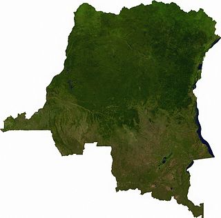
Katanga was one of the four large provinces created in the Belgian Congo in 1914. It was one of the eleven provinces of the Democratic Republic of the Congo between 1966 and 2015, when it was split into the Tanganyika, Haut-Lomami, Lualaba, and Haut-Katanga provinces. Between 1971 and 1997, its official name was Shaba Province.

<span class="mw-page-title-main">Moïse Tshombe</span> Congolese politician and secessionist leader (1919–1969)

Moïse Kapenda Tshombe was a Congolese businessman and politician. He served as the president of the secessionist State of Katanga from 1960 to 1963 and as prime minister of the Democratic Republic of the Congo from 1964 to 1965.

<span class="mw-page-title-main">Lubumbashi</span> Second-largest city in the Democratic Republic of the Congo

Lubumbashi is the second-largest city in the Democratic Republic of the Congo, located in the country's southeasternmost part, along the border with Zambia. The capital and principal city of the Haut-Katanga Province, Lubumbashi is the center of mining in the region, acting as a hub for many of the country's largest mining companies. No definite population figures are available, but the population of the city's urban area is estimated to be around 2,584,000 in 2021.

<span class="mw-page-title-main">Goma</span> Provincial capital and city in North Kivu, DR Congo

Goma is the capital of North Kivu Province in the eastern region of the Democratic Republic of the Congo (DRC). It is located on the northern shore of Lake Kivu, next to the Rwandan city of Gisenyi. It is part of the Albertine Rift, the western branch of the East African Rift System, and lies only 13–18 km (8.1–11.2 mi) south of the active Nyiragongo Volcano. Encompassing approximately 75.72 square kilometers, the city has an estimated population of nearly 2 million people according to the 2022 census, while the 1984 estimate placed the number at 80,000.

<span class="mw-page-title-main">Kolwezi</span> Provincial capital and city in Lualaba, DR Congo

Kolwezi or Kolwesi is the capital city of Lualaba Province in the south of the Democratic Republic of the Congo, west of Likasi. It has an airport and a railway to Lubumbashi. Just outside of Kolwezi there is the static inverter plant of the HVDC Inga-Shaba. The population is approximately 573,000.

<i>Union Minière du Haut-Katanga</i> Belgian mining company

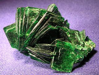
The Union Minière du Haut-Katanga was a Belgian mining company which controlled and operated the mining industry in the copperbelt region in the modern-day Democratic Republic of the Congo between 1906 and 1966.

<span class="mw-page-title-main">Shinkolobwe</span> Former mine in the Democratic Republic of the Congo

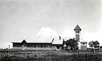
Shinkolobwe, or Kasolo, or Chinkolobew, or Shainkolobwe, was a radium and uranium mine in the Haut-Katanga Province of the Democratic Republic of the Congo (DRC), located 20 km (12.4 mi) west of Likasi, 20 km (12.4 mi) south of Kambove, and about 145 km (90.1 mi) northwest of Lubumbashi.

The Forrest Group is a group of companies founded around the mining industry in 1922. As of 2018, the Forrest Group is active primarily in Central and East Africa. It is owned by George Arthur Forrest, a Belgian entrepreneur of New Zealand descent.

<span class="mw-page-title-main">State of Katanga</span> 1960–1963 unrecognised state in Africa

The State of Katanga, also known as the Republic of Katanga, was a breakaway state that proclaimed its independence from Congo-Léopoldville on 11 July 1960 under Moise Tshombe, leader of the local Confédération des associations tribales du Katanga (CONAKAT) political party. The new Katangese state did not enjoy full support throughout the province and was constantly plagued by ethnic strife in its northernmost region. It was dissolved in 1963 following an invasion by United Nations Operation in the Congo (ONUC) forces, and reintegrated with the rest of the country as Katanga Province.

<span class="mw-page-title-main">Index of Democratic Republic of the Congo–related articles</span>

Articles related to the Democratic Republic of the Congo include:

<span class="mw-page-title-main">Shaba I</span> Historical military conflict

Shaba I was a conflict in Zaire's Shaba (Katanga) Province lasting from 8 March to 26 May 1977. The conflict began when the Front for the National Liberation of the Congo (FNLC), a group of about 2,000 Katangan Congolese soldiers who were veterans of the Congo Crisis, the Angolan War of Independence, and the Angolan Civil War, crossed the border into Shaba from Angola. The FNLC made quick progress through the region because of the sympathizing locals and the disorganization of the Zairian military. Travelling east from Zaire's border with Angola, the rebels reached Mutshatsha, a small town near the key mining town of Kolwezi.

This is a history of Katanga Province and the former independent State of Katanga, as well as the history of the region prior to colonization.

<span class="mw-page-title-main">Kambove</span>

Kambove is a town in the Haut-Katanga Province of the Democratic Republic of the Congo.

<span class="mw-page-title-main">Musonoi Mine</span> Mine near Kolwezi, DRC

The Musonoi mine is a set of open-cut pits near Kolwezi from which copper and other metals have been extracted since the 1940s. The mining complex is located in the Lualaba Province of the Democratic Republic of the Congo. Kolwezi is about 320 kilometres (200 mi) northwest from Lubumbashi, the provincial capital.

<span class="mw-page-title-main">Kambove mines</span> Group of copper mines near Kambove, Democratic Republic of the Congo

The Kambove mines are a group of active or abandoned copper mines near Kambove in the Democratic Republic of the Congo. They were originally established by the Union Minière du Haut-Katanga under Belgian rule.

<span class="mw-page-title-main">Shituru</span>

Shituru is a town that is now a commune of the city of Likasi in Haut-Katanga province, Democratic Republic of the Congo. It is also the location of a copper mine, smelter and hydrometallurgical plant that was operated by the state-owned Gécamines.

The Etoile Mine is an open-pit copper mine on the outskirts of Lubumbashi in Katanga Province of the Democratic Republic of the Congo (DRC). Chemaf owns the license. Chemaf is 95% owned by Shalina Resources and 5% by the DRC government.

The following is a timeline of the history of the city of Lubumbashi, Democratic Republic of the Congo.

<span class="mw-page-title-main">Katangese Gendarmerie</span> Military of the State of Katanga

The Katangese Gendarmerie, officially the Katangese Armed Forces, was the paramilitary force of the unrecognized State of Katanga in Central Africa from 1960 to 1963. The forces were formed upon the secession of Katanga from the Republic of the Congo with help from Belgian soldiers and former officers of the Force Publique. Belgian troops also provided much of the early training for the Gendarmerie, which was mainly composed of Katangese but largely led by Belgians and later European mercenaries.

<span class="mw-page-title-main">Kamatanda</span>

Kamatanda is a region just north of Likasi in the Haut-Katanga Province of the Democratic Republic of the Congo. It gives its name to an open-pit copper mine, a railway junction, an abandoned airport and a residential area of Likasi.