
Bandera County is a county in the U.S. state of Texas. It is located in the Hill Country and its county seat is Bandera. Bandera county was settled be German and Polish emigrants in the mid 1800s. Many residents are descendants of those same emigrants.

In the United States, a farm-to-market road or ranch-to-market road is a state highway or county road that connects rural or agricultural areas to market towns. These are better-quality roads, usually a highway, that farmers and ranchers use to transport products to market towns or distribution centers. Historically used throughout the country, today the term is primarily associated with a large state-maintained highway system in Texas.

Texas state highways are a network of highways owned and maintained by the U.S. state of Texas. The Texas Department of Transportation (TxDOT) is the state agency responsible for the day-to-day operations and maintenance of the system. Texas has the largest state highway system, followed closely by North Carolina's state highway system. In addition to the nationally numbered Interstate Highways and U.S. Highways, the highway system consists of a main network of state highways, loops, spurs, and beltways that provide local access to the other highways. The system also includes a large network of farm to market roads that connect rural areas of the state with urban areas and the rest of the state highway system. The state also owns and maintains some park and recreational roads located near and within state and national parks, as well as recreational areas. All state highways, regardless of classification, are paved roads. The Old San Antonio Road, also known as the El Camino Real, is the oldest highway in the United States, first being blazed in 1691. The length of the highways varies from US 83's 893.4 miles (1,437.8 km) inside the state borders to Spur 200 at just 0.05 miles long.

Ranch to Market Road 1431 is a 66.702-mile (107.346 km) ranch to market road in Texas, United States, that connects [[Texas Austin with rural areas of Central Texas.

Ranch to Market Road 620 is a ranch to market road in Travis and Williamson counties in Texas, United States, that is maintained by the Texas Department of Transportation (TxDOT). The 27.1-mile (43.6 km) road begins at SH 71 in Bee Cave in Travis County west of Austin passing along southeastern Lake Travis, western Austin, and several suburban communities west and north of Austin before ending at Bus. I-35-L in Round Rock in Williamson County. The road has major intersections with I-35, US 183, and SH 45.
{[short description|State road in Travis County, Texas, United States}}

Ranch Road 1 is a 6.587-mile (10.6 km) state road in Gillespie and Blanco counties, in the central region of Texas, United States. It begins at U.S. Route 290 in Stonewall, running along the Pedernales River through Lyndon B. Johnson National Historical Park, the late President Lyndon Johnson's former ranch, and through Lyndon B. Johnson State Park and Historic Site, before terminating at US 290 near Hye. The road, designated in 1963, is the only road in the state that the Texas Department of Transportation (TxDOT) has designated as a "Ranch Road". In the earliest days of the state highway system, the route was a part of State Highway 20, and was later part of US 290 before that highway was relocated to the south.
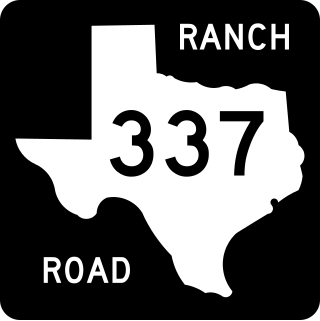
Ranch to Market Road 337 (RM 337) is a ranch-to-market road in Real and Bandera counties in Texas, United States, that connects Texas State Highway 55 (SH 55) in Camp Wood with Texas State Highway 16 (SH 16) in Medina. Passing through the canyonland of the Texas Hill Country northwest of San Antonio, the route is noted for its scenery. RM 337 was designated in 1945 between Camp Wood and Leakey in Real County. It was extended eastward several times in the 1950s and 1960s, reaching its present length in 1975.

Ranch to Market Road 187 (RM 187) is an 81.9-mile (131.8 km) Ranch to Market Road located in Zavala, Uvalde, Bandera, and Kerr counties in the US state of Texas. The route passes through the cities of Sabinal, Utopia, and Vanderpool. The road helps connect several small south Texas ranches to major highways. RM 187 was first designated in 1945, and was extended three times during the 1940s. As of 2012, it is the longest Ranch to Market Road in the state of Texas.
This page is based on this
Wikipedia article Text is available under the
CC BY-SA 4.0 license; additional terms may apply.
Images, videos and audio are available under their respective licenses.

