List of World Heritage in Danger

Last updated

Countries with World Heritage Sites in danger. Number of sites indicated by colour:
.mw-parser-output figure[typeof="mw:File/Thumb"] .image-key>ol{margin-left:1.3em;margin-top:0}.mw-parser-output figure[typeof="mw:File/Thumb"] .image-key>ul{margin-top:0}.mw-parser-output figure[typeof="mw:File/Thumb"] .image-key li{page-break-inside:avoid;break-inside:avoid-column}@media(min-width:300px){.mw-parser-output figure[typeof="mw:File/Thumb"] .image-key,.mw-parser-output figure[typeof="mw:File/Thumb"] .image-key-wide{column-count:2}.mw-parser-output figure[typeof="mw:File/Thumb"] .image-key-narrow{column-count:1}}@media(min-width:450px){.mw-parser-output figure[typeof="mw:File/Thumb"] .image-key-wide{column-count:3}}
.mw-parser-output .plainlist ol,.mw-parser-output .plainlist ul{line-height:inherit;list-style:none;margin:0;padding:0}.mw-parser-output .plainlist ol li,.mw-parser-output .plainlist ul li{margin-bottom:0}
.mw-parser-output .legend{page-break-inside:avoid;break-inside:avoid-column}.mw-parser-output .legend-color{display:inline-block;min-width:1.25em;height:1.25em;line-height:1.25;margin:1px 0;text-align:center;border:1px solid black;background-color:transparent;color:black}.mw-parser-output .legend-text{}
Six or more sites
Five sites
Four sites
Three sites
Two sites
One site World Heritage in Danger. Map of countries.svg
Countries with World Heritage Sites in danger. Number of sites indicated by colour:
  •   Six or more sites
  •   Five sites
  •   Four sites
  •   Three sites
  •   Two sites
  •   One site
The Church of the Nativity, traditionally thought to be the birthplace of Jesus, is one of several sites to have been designated as a World Heritage Site and World Heritage in Danger in the same year. In 2019 it was removed from the danger list. Nativity Grotto Star.jpg
The Church of the Nativity, traditionally thought to be the birthplace of Jesus, is one of several sites to have been designated as a World Heritage Site and World Heritage in Danger in the same year. In 2019 it was removed from the danger list.

The List of World Heritage in Danger is compiled by the United Nations Educational, Scientific and Cultural Organization (UNESCO) through the World Heritage Committee according to Article 11.4 of the World Heritage Convention, [nb 1] which was established in 1972 to designate and manage World Heritage Sites. Entries in the list are threatened World Heritage Sites for the conservation of which major operations are required and for which "assistance has been requested". [1] The list is intended to increase international awareness of the threats and to encourage counteractive measures. [2] Threats to a site can be either proven imminent threats or potential dangers that could have adverse effects on a site.

Contents

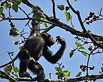
In the case of natural sites, ascertained dangers include the serious decline in the population of an endangered or other valuable species or the deterioration of natural beauty or scientific value of a property caused by human activities such as logging, pollution, settlement, mining, agriculture and major public works. Ascertained dangers for cultural properties include serious deterioration of materials, structure, ornaments or architectural coherence and the loss of historical authenticity or cultural significance. Potential dangers for both cultural and natural sites include development projects, armed conflicts, insufficient management systems or changes in the legal protective status of the properties. In the case of cultural sites, gradual changes due to geology, climate or environment can also be potential dangers. [3]

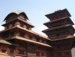
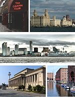
Before a property is inscribed on the List of World Heritage in Danger, its condition is assessed and a potential programme for corrective measures is developed in cooperation with the State Party involved. The final decision about inscription is made by the committee. Financial support from the World Heritage Fund may be allocated by the committee for listed properties. The state of conservation is reviewed on a yearly basis, after which the committee may request additional measures, delete the property from the list if the threats have ceased or consider deletion from both the List of World Heritage in Danger and the World Heritage List. [3] Of the three former UNESCO World Heritage Sites, the Dresden Elbe Valley and the Liverpool Maritime Mercantile City were delisted after placement on the List of World Heritage in Danger while the Arabian Oryx Sanctuary was directly delisted. [4] [5] Some sites have been designated as World Heritage Sites and World Heritage in Danger in the same year, such as the Church of the Nativity, traditionally considered to be the birthplace of Jesus.

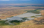
In some cases, danger listing has sparked conservation efforts and prompted the release of funds, resulting in a positive development for sites such as the Galápagos Islands and Yellowstone National Park, both of which have subsequently been removed from the List of World Heritage in Danger. Despite this, the list itself and UNESCO's implementation of it have been the focus of criticism. [6] [7] In particular, States Parties and other stakeholders of World Heritage Sites have questioned the authority of the Committee to declare a site in danger without their consent. [8] Until 1992, when UNESCO set a precedent by placing several sites on the danger list against their wishes, States Parties would have submitted a programme of corrective measures before a site could be listed. [9] Instead of being used as intended, the List of World Heritage in Danger is perceived by some states as a black list and according to Christina Cameron, Professor at the School of Architecture, Canada Research Chair on Built Heritage, University of Montreal, has been used as political tool to get the attention of States Parties. [10] [11] The International Union for Conservation of Nature (IUCN) notes that UNESCO has referenced the List of World Heritage in Danger (without actually listing the site) in a number of cases where the threat could be easily addressed by the State Party. [12] The Union also argues that keeping a site listed as endangered over a long period is questionable and that other mechanisms for conservation should be sought in these cases. [13]
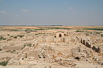
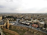
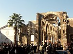
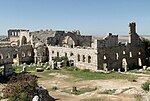
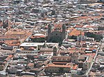
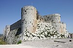
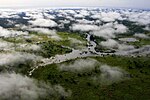
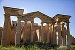
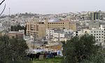
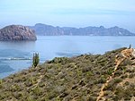
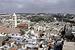
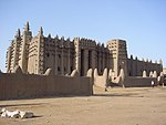
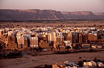
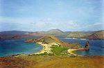
As of April 2024, there are 56 entries (16 natural, 40 cultural) on the List of World Heritage in Danger. Arranged by the UNESCO regions, 23 of the listed sites are located in the Arab States, 14 in Africa, 6 in Latin America and the Caribbean, 6 in Asia and the Pacific, and 7 in Europe and North America. The majority of the endangered natural sites (11) are located in Africa. [14] [15] The list encompasses sites that have been identified as facing threats to their integrity, which could stem from natural disasters, armed conflict, neglect, pollution, unsustainable tourism, or other dangers. Among the sites, the impacts of armed conflict are evident in countries like Syria, with several sites including the Ancient City of Aleppo and the Ancient Villages of Northern Syria marked as endangered due to the Syrian Civil War. In Africa, the Democratic Republic of the Congo sees multiple listings due to threats like military conflict and environmental degradation affecting its national parks. [16]

Currently listed sites

Table legend
Name: as listed by the World Heritage Committee [17]
Location: at city or provincial level and country name, with coordinates; column sorts by state [nb 2]
Criteria: the site was listed under
Area: in hectares and acres if provided by UNESCO
Year (WHS): the year the site was inscribed on the World Heritage List
Endangered: the year the site appeared on the List of World Heritage in Danger
Reason: threats to the site which prompted UNESCO to list it as in danger
  * Trans-border site
NameImageLocation Criteria Area
ha (acre)
Year (WHS)EndangeredReasonRefs
Abu Mena Abu Mena Ancient Monastery 04.JPG Abusir,
Flag of Egypt.svg Egypt
30°50′30″N29°39′50″E / 30.84167°N 29.66389°E / 30.84167; 29.66389 (Abu Mena)
Cultural:
(iv)
182 (450)19792001–Cave-ins in the area caused by the clay at the surface, which becomes semi-liquid when met with "excess water" [18] [19]
[20]
Air and Ténéré Natural Reserves Arakao1.jpg Arlit Department,
Flag of Niger.svg Niger
18°17′N8°0′E / 18.283°N 8.000°E / 18.283; 8.000 (Air and Ténéré Natural Reserves)
Natural:
(vii), (ix), (x)
7,736,000 (19,120,000)19911992–Military conflict and civil disturbance in the region as well as a reduction of wildlife population and degradation of the vegetation cover [21] [22]
Ancient City of Aleppo Aleppo skyline 2011-01-08 (02).jpg Aleppo Governorate, Flag of Syria.svg  Syria
36°14′N37°10′E / 36.233°N 37.167°E / 36.233; 37.167 (Ancient City of Aleppo)
Cultural:
(iii), (iv)
350 (860)19862013– Syrian Civil War, currently held by the government. Bombings continue threatening the site. [23]
Ancient City of Bosra Bosra pano Syria.jpg Daraa Governorate, Flag of Syria.svg  Syria
32°31′5″N36°28′54″E / 32.51806°N 36.48167°E / 32.51806; 36.48167 (Ancient City of Bosra)
Cultural:
(i), (iii), (vi)
19802013– Syrian Civil War, held by the government. [24]
Ancient City of Damascus The Jupiter temple in Damascus.jpg Damascus Governorate, Flag of Syria.svg  Syria
33°30′41″N36°18′23″E / 33.51139°N 36.30639°E / 33.51139; 36.30639 (Ancient City of Damascus)
Cultural:
(i), (ii), (iii), (iv), (vi)
86 (210)19792013– Syrian Civil War, rebel gunfire and mortar shelling, mainly from adjacent Jobar suburb endangers foundations. [25]
Ancient Villages of Northern Syria Church of Saint Simeon Stylites 17.jpg Flag of Syria.svg  Syria
36°20′3″N36°50′39″E / 36.33417°N 36.84417°E / 36.33417; 36.84417 (Ancient Villages of Northern Syria)
Cultural:
(iii), (iv), (v)
12,290 (30,400)20112013– Syrian Civil War, some held by rebels. Reports of looting and demolitions by Islamist groups. [26]
Archaeological Site of Cyrene Cyrene8.jpg Jebel Akhdar,
Flag of Libya.svg Libya
32°49′30″N21°51′30″E / 32.82500°N 21.85833°E / 32.82500; 21.85833 (Archaeological Site of Cyrene)
Cultural:
(ii), (iii), (vi)
19822016– Libyan Civil War, presence of armed groups, already incurred and potential further damage. [27] [28]
Archaeological Site of Leptis Magna Leptis Magna Arch of Septimus Severus.jpg Khoms,
Flag of Libya.svg Libya
32°38′18″N14°17′35″E / 32.63833°N 14.29306°E / 32.63833; 14.29306 (Archaeological Site of Leptis Magna)
Cultural:
(i), (ii), (iii)
19822016– Libyan Civil War, presence of armed groups, already incurred and potential further damage. [28] [29]
Archaeological Site of Sabratha Theatre, Sabratha.JPG Sabratha,
Flag of Libya.svg Libya
32°48′19″N12°29′6″E / 32.80528°N 12.48500°E / 32.80528; 12.48500 (Archaeological Site of Sabratha)
Cultural:
(iii)
19822016– Libyan Civil War, presence of armed groups, already incurred and potential further damage. [28] [30]
Ashur (Qal'at Sherqat) Flickr - The U.S. Army - www.Army.mil (218).jpg Salah ad Din,
Flag of Iraq.svg Iraq
35°27′24″N43°15′45″E / 35.45667°N 43.26250°E / 35.45667; 43.26250 (Ashur)
Cultural:
(iii), (iv)
70 (170)20032003–A planned reservoir that would have partially flooded the site was suspended in the wake of the Iraq War by the new administration; lack of adequate protection. [31] [32]
Chan Chan Archaeological Zone Chanchan fishnet ruins.JPG La Libertad,
Flag of Peru.svg Peru
8°6′40″S79°4′30″W / 8.11111°S 79.07500°W / -8.11111; -79.07500 (Chan Chan Archaeological Zone)
Cultural:
(i), (iii)
600 (1,500)19861986–Natural erosion [33] [34]
City of Potosí Potosi Zentrum.JPG Potosí, Bandera de Bolivia (Estado).svg  Bolivia

19°35′1″S65°45′11″W / 19.58361°S 65.75306°W / -19.58361; -65.75306

Cultural:
(ii), (iv), (vi)
11,810 (29,200)19872014–Continued mining has left the mountain porous and unstable, causing portions of the summit to collapse, also the target of future mining by the Bolivian Mining Corp. Recommendations to preserve the site have not been followed through. [35]
Coro and its Port Calle en Coro 2.JPG Falcón,
Flag of Venezuela.svg Venezuela
11°25′N69°40′W / 11.417°N 69.667°W / 11.417; -69.667 (Coro and its Port)
Cultural:
(iv), (v)
107 (260)19932005–Damage to a great number of structures due to heavy rain between November 2004 and February 2005 as well as the construction of a new monument, a beach walkway and an entrance gate to the city in the buffer zone which could have considerable impact on the value of the site [36] [37]
Crac des Chevaliers and Qal’at Salah El-Din Krak des Chevaliers 14.jpg Homs and Latakia Governorates, Flag of Syria.svg  Syria
34°46′54″N36°15′47″E / 34.78167°N 36.26306°E / 34.78167; 36.26306 (Crac des Chevaliers and Qal’at Salah El-Din)
Cultural:
(ii), (iv)
9 (22)20062013– Syrian Civil War, once held by Al-Nusra Front and other Islamist groups, reclaimed by Syrian Arab Army and Hezbollah fighters. Reports of damages and looting caused by Islamist groups was released by the government. [38]
Cultural Landscape and Archaeological Remains of the Bamiyan Valley
BigBuddha.jpg
Bamyan,
Flag of the Taliban.svg Afghanistan
34°49′55″N67°49′36″E / 34.83194°N 67.82667°E / 34.83194; 67.82667 (Cultural Landscape and Archaeological Remains of the Bamiyan Valley)
Cultural:
(i), (ii), (iii), (iv), (vi)
159 (390)20032003–Fragile conservation state due to abandonment, military action and dynamite explosions; causing dangers such as risk of collapse of Buddha niches, further deterioration of cave murals, looting and illicit excavations. [39] [40]
East Rennell Dugout canoe Rennell.jpg Rennell and Bellona Province,
Flag of the Solomon Islands.svg Solomon Islands
11°40′59″S160°10′59″E / 11.68306°S 160.18306°E / -11.68306; 160.18306 (East Rennell)
Natural:
(ix)
37,000 (91,000)19982013–Damage to the site due to logging and its effect on the local ecosystem [41]
Everglades National Park Everglades.jpg Florida,
Flag of the United States.svg United States
25°19′N80°56′W / 25.317°N 80.933°W / 25.317; -80.933 (Everglades National Park)
Natural:
(viii), (ix), (x)
592,920 (1,465,100)19791993–2007, 2010–Damage due to Hurricane Andrew and deterioration of water flow and quality due to agricultural and urban development (1993); continued degradation of the site resulting in a loss of marine habitat and decline in marine species (2010) [42] [43]
[44]
Fortifications on the Caribbean Side of Panama: Portobelo-San Lorenzo Portobelo Ruins and bay.jpg Colón Province,
Flag of Panama.svg Panama
9°33′14″N79°39′21″W / 9.55389°N 79.65583°W / 9.55389; -79.65583 (Fortifications on the Caribbean Side of Panama: Portobelo-San Lorenzo)
Cultural:
(i), (iv)
19802012–Environmental factors, lack of maintenance and urban development [45] [46]
Garamba National Park Garamba National Park overhead.jpg Orientale,
Flag of the Democratic Republic of the Congo.svg Democratic Republic of the Congo
4°0′N29°15′E / 4.000°N 29.250°E / 4.000; 29.250 (Garamba National Park)
Natural:
(vii), (x)
500,000 (1,200,000)19801984–1992, 1996–Reduction of northern white rhinoceros population (1984); poaching of two white rhinos, killing of three rangers and no plan for corrective measures by the authorities (1996) [47] [48]
[49]
Hatra thr lHDr.jpg Nineveh Governorate,
Flag of Iraq.svg Iraq
35°35′17″N42°43′6″E / 35.58806°N 42.71833°E / 35.58806; 42.71833 (Hatra)
Cultural:
(ii), (iii), (iv), (vi)
324 (800)19852015–Damage inflicted to the property by armed groups [50]
Hebron Hebron172.JPG Hebron Governorate,
Flag of Palestine.svg Palestine
31°31′27″N35°6′32″E / 31.52417°N 35.10889°E / 31.52417; 35.10889 (Hebron/Al-Khalil Old Town)
Cultural:
(ii), (iv), (vi)
20.6 (51)20172017– [51]
Historic Centre of Odesa Operniy-5.jpg Odesa,
Flag of Ukraine.svg  Ukraine
46°29′11.22″N30°44′29.81″E / 46.4864500°N 30.7416139°E / 46.4864500; 30.7416139 (Historic Centre of Odesa)
Cultural:
(ii), (iv)
20232023– Russo-Ukrainian War [52] [53]
Kyiv: Saint-Sophia Cathedral and Related Monastic Buildings, Kyiv Pechersk Lavra Kijow - Sobor Madrosci Bozej 01.jpg Kyiv,
Flag of Ukraine.svg  Ukraine
Cultural:
(i), (ii), (iii), (iv)
19902023– Russo-Ukrainian War [54]
L'viv – the Ensemble of the Historic Centre Lvov Galitsija.jpg Lviv,
Flag of Ukraine.svg  Ukraine
Cultural:
(ii), (v)
19982023– Russo-Ukrainian War [54]
Historic Centre of Shakhrisyabz Kok-Gumbaz.JPG Qashqadaryo Region,
Flag of Uzbekistan.svg Uzbekistan
39°3′0″N66°50′0″E / 39.05000°N 66.83333°E / 39.05000; 66.83333 (Historic Centre of Shakhrisyabz)
Cultural:
(iii), (iv)
240 (590)20002016–Destruction of buildings in its medieval neighbourhoods and continuing urban development. [55] [56]
Historic Centre of Vienna Wien Rathaus hochauflosend.jpg
Vienna, Flag of Austria.svg Austria
48°12′N16°22′E / 48.200°N 16.367°E / 48.200; 16.367 (Vienna)
Cultural:
(ii), (iv), (vi)
371 (920)20012017–New high-rise projects [57]
Historic Town of Zabīd
Mosque in Zabid.jpg
Al Hudaydah,
Flag of Yemen.svg Yemen
14°12′N43°19′E / 14.200°N 43.317°E / 14.200; 43.317 (Historic Town of Zabīd)
Cultural:
(ii), (iv), (vi)
19932000–Deteriorating state of historic buildings, inscribed on request of the State Party [58] [59]
Islands and Protected Areas of the Gulf of California
Golfo 001.JPG
Baja California, Baja California Sur, Sonora, Sinaloa and Nayarit,
Flag of Mexico.svg  Mexico
27°38′N112°33′W / 27.633°N 112.550°W / 27.633; -112.550 (Islands and Protected Areas of the Gulf of California)
Natural:
(vii), (ix), (x)
688,558 (1,701,460)20052019–Imminent extinction of the vaquita, an endemic porpoise in the gulf [60] [61]
Kahuzi-Biega National Park
Kahuzi gorilla.jpg
South Kivu
and Maniema,
Flag of the Democratic Republic of the Congo.svg Democratic Republic of the Congo
2°30′S28°45′E / 2.500°S 28.750°E / -2.500; 28.750 (Kahuzi-Biega National Park)
Natural:
(x)
600,000 (1,500,000)19801997–Deforestation, hunting as well as war and civil strife [62] [63]
Lake Turkana National Parks
LakeTurkanaSouthIsland.jpg
Flag of Kenya.svg Kenya
3°3′8″N36°30′13″E / 3.05222°N 36.50361°E / 3.05222; 36.50361 (Lake Turkana National Parks)
Natural:
(viii), (x)
161,485 (399,040)19972018–Impact of Ethiopia's Gilgel Gibe III Dam on the lake's flow and ecosystem [64] [65]
Landmarks of Ancient Kingdom of Saba
Jemen1988-022 hg.jpg

Marib, Flag of Yemen.svg Yemen
15°25′36.76″N45°20′6.82″E / 15.4268778°N 45.3352278°E / 15.4268778; 45.3352278 (Landmarks of the Ancient Kingdom of Saba)
Cultural:
(iii), (iv)
375.29 (927.4)20232023–Threats of destruction caused by the Yemeni Civil War. [66] [67]
Manovo-Gounda St Floris National Park Bamingui-Bangoran,
Flag of the Central African Republic.svg Central African Republic
9°0′N21°30′E / 9.000°N 21.500°E / 9.000; 21.500 (Manovo-Gounda St Floris National Park)
Natural:
(ix), (x)
1,740,000 (4,300,000)19881997–Illegal grazing and poaching, deteriorating security situation [68] [69]
Minaret and Archaeological Remains of Jam Jam Qasr Zarafshan.jpg Ghōr,
Flag of the Taliban.svg Afghanistan
34°23′48″N64°30′58″E / 34.39667°N 64.51611°E / 34.39667; 64.51611 (Minaret and Archaeological Remains of Jam)
Cultural:
(ii), (iii), (iv)
70 (170)20022002–Lack of legal protection, lack of protection measure or management plan, poor condition of the site [70] [71]
Medieval Monuments in Kosovo Srednjovekovni spomenici na kosovu.jpg Flag of Serbia.svg  Serbia
42°39′40″N20°15′56″E / 42.66111°N 20.26556°E / 42.66111; 20.26556 (Medieval Monuments in Kosovo)
Cultural:
(ii), (iii), (iv)
2.88 (7.1)20042006– March Pogrom, lack of legal protection and management; political instability and insecurity. [72] [73]
Mount Nimba Strict Nature Reserve Voa Guinea chimpanzee picking 30jan08.jpg Lola Prefecture,
Flag of Cote d'Ivoire.svg Côte d'Ivoire*
Flag of Guinea.svg Guinea*
7°36′N8°23′W / 7.600°N 8.383°W / 7.600; -8.383 (Mount Nimba Strict Nature Reserve)
Natural:
(ix), (x)
18,000 (44,000)19811992–Iron ore mining concession on part of the World Heritage Site and influx of large number of refugees on the Guinean part of the site [74] [75]
Nan Madol: Ceremonial Centre of Eastern Micronesia Nan madol.jpg Temwen Island,
Flag of the Federated States of Micronesia.svg Micronesia
6°50′23″N158°19′51″E / 6.83972°N 158.33083°E / 6.83972; 158.33083 (Nan Madol: Ceremonial Centre of Eastern Micronesia)
Cultural:
(i), (iii), (iv), (vi)
76.7 (190)20162016–Continuing siltation of waterways contributing to overgrowth and undermining existing structures. [76] [77]
Niokolo-Koba National Park River gambia Niokolokoba National Park.gif Tambacounda Region
and Kédougou Region,
Flag of Senegal.svg Senegal
13°0′N12°40′W / 13.000°N 12.667°W / 13.000; -12.667 (Niokolo-Koba National Park)
Natural:
(x)
913,000 (2,260,000)19812007–Degradation of property, low mammal population, management problems and impact of a proposed dam on the Gambia River [78] [79]
Okapi Wildlife Reserve Epulu Okapi Reserve.jpg Orientale,
Flag of the Democratic Republic of the Congo.svg Democratic Republic of the Congo
2°0′N28°30′E / 2.000°N 28.500°E / 2.000; 28.500 (Okapi Wildlife Reserve)
Natural:
(x)
1,372,625 (3,391,830)19961997–Looting of park facilities and killing of elephants as a result of an armed conflict in the area [80] [81]
Old City of Jerusalem and its Walls Old City (Jerusalem).jpg Cultural:
(ii), (iii), (vi)
19811982–Uncontrolled urban development, general deterioration of the state of conservation due to tourism and lack of maintenance. [82] [83] [84]
Old City of Sana'a
San'a03 flickr.jpg
Sana'a Governorate,
Flag of Yemen.svg Yemen
15°21′20″N44°12′29″E / 15.35556°N 44.20806°E / 15.35556; 44.20806 (Sana'a)
Cultural:
(iv), (v), (vi)
19862015–Yemeni Civil War [85]
Old Town of Ghadamès Libya Ghadames Old Town Rooftop View.JPG Ghadames,
Flag of Libya.svg Libya
30°08′00″N9°30′00″E / 30.13333°N 9.50000°E / 30.13333; 9.50000 (Old Town of Ghadamès)
Cultural:
(v)
19862016– Libyan Civil War, presence of armed groups, already incurred and potential further damage. [28] [86]
Old Towns of Djenné Great Mosque of Djenne 1.jpg Djenné,
Flag of Mali.svg Mali
13°54′23″N4°33′18″W / 13.90639°N 4.55500°W / 13.90639; -4.55500 (Old Towns of Djenné)
Cultural:
(iii), (iv)
19882016–Regional insecurity, deteriorating state of the historic town, urbanization and erosion. [87] [88]
Palestine: Land of Olives and Vines – Cultural Landscape of Southern Jerusalem, Battir Batir.JPG
Battir, Flag of Palestine.svg Palestine
31°43′11″N35°7′50″E / 31.71972°N 35.13056°E / 31.71972; 35.13056 (Palestine: Land of Olives and Vines – Cultural Landscape of Southern Jerusalem, Battir)
Cultural:
(iv)(v)
349 (860)20142014–The Israeli West Bank barrier "may isolate farmers from fields they have cultivated for centuries". [89] [90]
Old Walled City of Shibam
Shibam Wadi Hadhramaut Yemen.jpg
Hadhramaut Governorate,
Flag of Yemen.svg Yemen
15°55′37″N48°37′36″E / 15.92694°N 48.62667°E / 15.92694; 48.62667 (Shibam)
Cultural:
(iii), (iv), (v)
19822015–Potential threat from the armed conflict, compounding safeguarding and management problems already observed at the site [85]
Rainforests of the Atsinanana
Andohahela NP.jpg
Eastern Madagascar,
Flag of Madagascar.svg Madagascar
14°28′S49°42′E / 14.467°S 49.700°E / -14.467; 49.700 (Rainforests of the Atsinanana)
Natural:
(ix), (x)
479,660 (1,185,300)20072010– Illegal logging and hunting of endangered lemurs [91] [92]
Rachid Karami International Fair
TripoliLebanonFair OscarNiemeyer LebanonPavilion-RomanDeckert14102018.jpg

Tripoli, Flag of Lebanon.svg  Lebanon
34°26′22″N35°49′33″E / 34.4395°N 35.8259°E / 34.4395; 35.8259 (Rachid Karami International Fair)
Cultural:
(ii)(iv)
72 (180)20232023–Threatened by lack of funds for maintenance due to the Lebanese liquidity crisis, urban development, and "its alarming state of conservation". [93] [94]
Río Plátano Biosphere Reserve Rio platano.jpg La Mosquitia,
Flag of Honduras.svg Honduras
15°44′40″N84°40′30″W / 15.74444°N 84.67500°W / 15.74444; -84.67500 (Río Plátano Biosphere Reserve)
Natural:
(vii), (viii), (ix), (x)
19821996–2007, 2011–Logging, fishing and land occupation; poaching and the reduced capacity of the state to manage the site; largely due to the deterioration of law and to the presence of drug traffickers [95] [96]
Rock-Art Sites of Tadrart Acacus Tadrart Acacus 1.jpg Fezzan,
Flag of Libya.svg Libya
24°50′N10°20′E / 24.833°N 10.333°E / 24.833; 10.333 (Rock-Art Sites of Tadrart Acacus)
Cultural:
(iii)
19852016– Libyan Civil War, presence of armed groups, already incurred and potential further damage. [28] [97]
Samarra Archaeological City The spiral minaret in Samarra.jpg Salah ad Din,
Flag of Iraq.svg Iraq
34°12′N43°52′E / 34.200°N 43.867°E / 34.200; 43.867 (Samarra Archaeological City)
Cultural:
(ii), (iii), (iv)
15,058 (37,210)20072007–Security situation following the Iraq War and lack of state control for protection or management of the site [98] [99]
Selous Game Reserve TZ Selous Game Reserve Aeroview.JPG Coast, Morogoro, Lindi, Mtwara and Ruvuma Regions,

Flag of Tanzania.svg  Tanzania, 9°0′0″S37°24′0″E / 9.00000°S 37.40000°E / -9.00000; 37.40000

Natural:
(ix), (x)
5,120,000 (12,700,000)19822014–Exploration and extraction of minerals, large infrastructure projects [100]
Site of Palmyra Temple of Bel, Palmyra 15.jpg Homs Governorate, Flag of Syria.svg  Syria
34°33′15″N38°16′0″E / 34.55417°N 38.26667°E / 34.55417; 38.26667 (Site of Palmyra)
Cultural:
(i), (ii), (iv)
0.36 (0.89)19802013– Syrian Civil War, captured by the notoriously iconoclastic Islamic State terrorist organization (ISIS). [101]
Timbuktu Timbuktu Mosque Sankore.jpg Timbuktu,
Timbuktu Region,
Flag of Mali.svg  Mali
16°46′24″N2°59′58″W / 16.77333°N 2.99944°W / 16.77333; -2.99944 (Timbuktu)
Cultural:
(ii), (iv), (v)
19882012–Threat of destruction by the Islamist groups like Al-Qaeda in Islamic Maghreb, Ansar Dine and Boko Haram. Some monuments are now pillaged and destroyed. [102] [103]
Tomb of Askia Askia.jpg Gao,
Gao Region,
Flag of Mali.svg  Mali
16°17′23″N0°02′40″W / 16.28972°N 0.04444°W / 16.28972; -0.04444 (Tomb of Askia)
Cultural:
(ii), (iii), (iv)
4.24 (10.5)20042012–Damaged by Islamist groups like Al-Qaeda in Islamic Maghreb and Ansar Dine. Reported destroyed by Ansar Dine when they captured Timbuktu. [103] [104]
Tropical Rainforest Heritage of Sumatra Man of the woods.JPG Sumatra,
Flag of Indonesia.svg Indonesia
02°30′S101°30′E / 2.500°S 101.500°E / -2.500; 101.500 (Tropical Rainforest Heritage of Sumatra)
Natural:
(vii), (ix), (x)
2,595,124 (6,412,690)20042011–Poaching, illegal logging, agricultural encroachment, and plans to build roads through the site [105] [106]
Virunga National Park Nyiragongo2004.jpg North Kivu
and Orientale,
Flag of the Democratic Republic of the Congo.svg  Democratic Republic of the Congo
0°55′N29°10′E / 0.917°N 29.167°E / 0.917; 29.167 (Virunga National Park)
Natural:
(vii), (viii), (x)
800,000 (2,000,000)19791994–Deforestation and poaching as a result of the influx of refugees due to the Rwandan Civil War [107] [108]
Roșia Montană Mining Landscape
Rosia Montana Roman Gold Mines 2011 - Galleries-4.jpg
Alba County,
Flag of Romania.svg Romania
46°18′22″N23°7′50″E / 46.30611°N 23.13056°E / 46.30611; 23.13056 (Islands and Protected Areas of the Gulf of California)
Cultural:
(ii), (iii), (iv)
314.42 (776.9)20212021–Threats posed by plans to resume mining which would damage a major part of the inscribed Mining Landscape [109] [110]

Previously listed sites

There are a number of sites that were previously listed as being in danger, but they were later removed from the list after improvements in management and conservation. The Everglades National Park was listed from 1993 to 2007 and again since 2010; the Río Plátano Biosphere Reserve was listed from 1996 to 2007 and again since 2011. Both are therefore included in the list of currently listed sites (above).

  Delisted altogether as a World Heritage Site
  Partial de-listing off the World Heritage List
NameImageLocation Criteria Area
ha (acre)
Year (WHS)EndangeredReasonRefs
Angkor Angkor Wat.jpg Siem Reap Province, Flag of Cambodia.svg Cambodia
13°26′N103°50′E / 13.433°N 103.833°E / 13.433; 103.833 (Angkor)
Cultural:
(i), (ii), (iii), (iv)
19921992–2004Inscription initially limited to a three-year period (1993–1995) during which effective legal protection, boundary and buffer zones were to be established and international conservation efforts were to be monitored and coordinated; at the time of inscription, Cambodia was UN-controlled following the civil war in the 1980s. [111] [112]
[113]
Bagrati Cathedral and Gelati Monastery Bagrati cathedral, georgia.jpg Imereti,
Flag of Georgia.svg Georgia
42°15′44″N42°42′59″E / 42.26222°N 42.71639°E / 42.26222; 42.71639 (Bagrati Cathedral and Gelati Monastery)
Cultural:
(iv)
7.87 (19.4)19942010–2017Major reconstruction project that will lead to irreversible interventions. The boundaries of the site was modified in 2017. [nb 3] Bagrati Cathedral was removed from the list of World Heritage Sites after its reconstruction. However, Gelati Monastery remained on the list. [114] [115] [116]
Bahla Fort Bahla Fort.jpg Bahla, Flag of Oman.svg Oman
22°58′N57°18′E / 22.967°N 57.300°E / 22.967; 57.300 (Bahla Fort)
Cultural:
(iv)
19871988–2004Degradation of earth structures of the fort and of the oasis of Bahla [117] [118]
[119] [120]
Bam and its Cultural Landscape BAM IR2726.JPG Kerman,
Flag of Iran.svg Iran
29°07′01″N58°22′07″E / 29.11694°N 58.36861°E / 29.11694; 58.36861 (Bam and its Cultural Landscape)
Cultural:
(ii), (iii), (iv), (v)
20042004–2013Following the damage due to the 2003 Bam earthquake [121] [122] [123]
Belize Barrier Reef Reserve System 'Brain' coral.JPG Belize, Stann Creek and Toledo
Flag of Belize.svg Belize
17°19′N87°32′W / 17.317°N 87.533°W / 17.317; -87.533 (Belize Barrier Reef Reserve System)
Natural:
(vii), (ix), (x)
96,300 (238,000)19962009–2018Mangrove cutting and excessive development [124] [125] [126]
Birthplace of Jesus: Church of the Nativity and the Pilgrimage Route, Bethlehem Birthplace of Jesus.jpg
Bethlehem, Flag of Palestine.svg Palestine
31°42′16″N35°12′27″E / 31.70444°N 35.20750°E / 31.70444; 35.20750 (Birthplace of Jesus: Church of the Nativity and the Pilgrimage Route, Bethlehem)
Cultural:
(iv), (vi)
2.98 (7.4)20122012–2019Damage due to water leaks [127] [128] [129]
Butrint Butrint, Albania.jpg Sarandë District, Flag of Albania.svg Albania
39°45′N20°1′E / 39.750°N 20.017°E / 39.750; 20.017 (Butrint)
Cultural:
(iii)
3,980 (9,800)19921997–2005Damages due to management and conservation [130] [131]
[132]
Cologne Cathedral
Cologne Cathedral.jpg
North Rhine-Westphalia, Flag of Germany.svg Germany
50°56′29″N6°57′29″E / 50.94139°N 6.95806°E / 50.94139; 6.95806 (Cologne Cathedral)
Cultural:
(i), (ii), (iv)
19962004–2006High-rise building plan near the cathedral threatening to inflict damage to the integrity of the property; delisted [nb 3] after the building plan was halted and a buffer zone introduced [133] [134]
[135]
Comoé National Park NationalparkComoe5.jpg Zanzan,
Flag of Cote d'Ivoire.svg Côte d'Ivoire
9°10′N3°40′W / 9.167°N 3.667°W / 9.167; -3.667 (Comoé National Park)
Natural:
(ix), (x)
1,150,000 (2,800,000)19832003–2017Civil unrest, poaching and lack of effective management mechanisms [136] [137]
Djoudj National Bird Sanctuary CormoransDjoudj.JPG Biffeche, Flag of Senegal.svg Senegal
16°30′N16°10′W / 16.500°N 16.167°W / 16.500; -16.167 (Djoudj National Bird Sanctuary)
Natural:
(vii), (x)
16,000 (40,000)19811984–1988, 2000–2006Long term threat by construction plan for a down-stream dam (1984); delisted [nb 3] (1988) as water supply to the park was insured by the construction of a sluice and a management plan was being prepared; relisted [nb 4] (2000) due to environmental and economical threats posed by the introduced species Salvinia molesta and Pistia stratiotes as well as issues with water management in the park [48] [138]
[139] [140]
[141] [142]
Dresden Elbe Valley Dresden-Altstadt von der Marienbruecke-II.jpg Saxony, Flag of Germany.svg Germany
51°3′N13°49′E / 51.050°N 13.817°E / 51.050; 13.817 (Dresden Elbe Valley)
Cultural:
(ii), (iii), (iv), (v)
1,930 (4,800)20042006–2009Construction plans for the Waldschlösschen Bridge in the core area of the cultural landscape; removed from the list of World Heritage Sites in 2009 after construction commenced at the end of 2007 [143] [144]
Dubrovnik Dubrovnik1.jpg Dubrovnik-Neretva County, Flag of Croatia.svg Croatia
42°38′25″N18°06′30″E / 42.64028°N 18.10833°E / 42.64028; 18.10833 (Dubrovnik)
Cultural:
(i), (iii), (iv)
97 (240)19791991–1998 Croatian War of Independence [145] [146]
[147]
Fort and Shalamar Gardens in Lahore Alamgiri Gate at Lahore Fort.jpeg Punjab,
Flag of Pakistan.svg Pakistan
31°35′25″N74°18′35″E / 31.59028°N 74.30972°E / 31.59028; 74.30972 (Fort and Shalamar Gardens in Lahore)
Cultural:
(i), (ii), (iii)
19812000–2012Destruction of historic water tanks in 1999 to widen a road and deteriorating perimeter walls of the Garden, listed on request of the Pakistan government [148] [149]
Galápagos Islands Galapagos.jpg Galápagos Province, Flag of Ecuador.svg Ecuador
0°40′S90°30′W / 0.667°S 90.500°W / -0.667; -90.500 (Galápagos Islands)
Natural:
(vii), (viii), (ix), (x)
14,066,514 (34,759,110)19782007–2010Various threats including insufficient prevention of possibilities for the introduction of alien species, insufficient resource allocation for conservation agencies and park management, presence of a large number of illegal immigrants, rapid uncontrolled growth of tourism, fishing over-capacity and sports fishing [150] [151]
[152] [153]
Group of Monuments at Hampi
Virupaksha Temple,Hampi.JPG
Bellary district, Flag of India.svg India
15°20′6″N76°27′43″E / 15.33500°N 76.46194°E / 15.33500; 76.46194 (Group of Monuments at Hampi)
Cultural:
(i), (iii), (iv)
19861999–2006Partial construction of two cable-suspended bridges within the protected archaeological areas of Hampi threatening the integrity and authenticity of the site [154] [155]
[156]
Historical Monuments of Mtskheta Svetitskhoveli1.jpg Mtskheta-Mtianeti,
Flag of Georgia.svg Georgia
41°50′32″N44°43′16″E / 41.84222°N 44.72111°E / 41.84222; 44.72111 (Historical Monuments of Mtskheta)
Cultural:
(iii), (iv)
19942009–2016Deterioration of stonework and frescoes, mismanagement and urban development [157] [158]
Humberstone and Santa Laura Saltpeter Works Humberstone.jpg Tarapacá,
Flag of Chile.svg Chile
20°12′30″S69°47′40″W / 20.20833°S 69.79444°W / -20.20833; -69.79444 (Humberstone and Santa Laura Saltpeter Works)
Cultural:
(ii), (iii), (iv)
20052005–2019Fragile nature of structures due to lack of maintenance for 40 years; also damage, vandalism and some dismantling; looting [159] [160] [161]
Ichkeul National Park Parcichkeul3.jpg Bizerta, Flag of Tunisia.svg Tunisia
37°10′N9°40′E / 37.167°N 9.667°E / 37.167; 9.667 (Ichkeul National Park)
Natural:
(x)
12,600 (31,000)19801996–2006Construction of dams limiting the freshwater flow to the area and causing an increased salinity of the lake and the marshes as well as a decrease in the number of migrating bird populations [162] [163]
[164]
Iguaçu National Park Foz de Iguacu 27 Panorama Nov 2005.jpg Paraná State, Flag of Brazil.svg Brazil
25°41′S54°26′W / 25.683°S 54.433°W / -25.683; -54.433 (Iguaçu National Park)
Natural:
(vii), (x)
170,086 (420,290)19861999–2001Illegally opened road ("Estrada do Colono", Portuguese for "Settler's Road") through the park, dams on the Iguazu River and helicopter flights. [165] [166]
[167]
Kathmandu Valley Basantapurpalace.JPG Kathmandu Valley, Flag of Nepal.svg   Nepal
27°42′14″N85°18′31″E / 27.70389°N 85.30861°E / 27.70389; 85.30861 (Kathmandu Valley)
Cultural:
(iii), (iv), (vi)
167 (410)19792003–2007Partial or substantial loss of the traditional elements of six out of seven monument zones and resulting general loss of authenticity and integrity of the whole property. [168] [169]
[170]
Liverpool – Maritime Mercantile City
Liverpool Montage.jpg
Liverpool
England,
Flag of the United Kingdom.svg United Kingdom
53°24′24″N2°50′40″W / 53.40667°N 2.84444°W / 53.40667; -2.84444 (Liverpool – Maritime Mercantile City)
Cultural:
(ii), (iii), (iv)
136 (340)20042012–2021Due to the proposed redevelopment of historic docklands known as Liverpool Waters, (including Bramley-Moore Dock stadium of Everton F.C.). Removed of World Heritage status in July 2021, due to the continued progress of the developments. [171] [172] [173]
Los Katíos National Park Giant anteater (4531346746).jpg Antioquia and Chocó, Flag of Colombia.svg Colombia
7°40′0″N77°0′0″W / 7.66667°N 77.00000°W / 7.66667; -77.00000 (Los Katíos National Park)
Natural:
(ix), (x)
72,000 (180,000)19942009–2015Deforestation, illegal fishing and hunting. Removed following significant improvements to Park management [174]
Manas Wildlife Sanctuary
Hanging bridge from bottom.jpg
Assam, Flag of India.svg India
26°30′N91°51′E / 26.500°N 91.850°E / 26.500; 91.850 (Manas Wildlife Sanctuary)
Natural:
(vii), (ix), (x)
39,100 (97,000)19851992–2011Poaching, damage to the park's infrastructure and decrease in the population of some species particularly the Indian rhinoceros following an invasion by militants of the Bodo tribe in 1992 [175] [176]
[177]
Natural and Culturo-Historical Region of Kotor 20090719 Crkva Gospa od Zdravlja Kotor Bay Montenegro.jpg Bay of Kotor, Kotor and surrounding territory, Flag of Montenegro.svg Montenegro
42°29′N18°42′E / 42.483°N 18.700°E / 42.483; 18.700 (Natural and Culturo-Historical Region of Kotor)
Cultural:
(i), (ii), (iii), (iv)
19791979–2003Damage following the earthquake from 15 April 1979 [178] [179]
[180]
Ngorongoro Conservation Area Ngorongoro Crater Overview.jpg Arusha Region, Flag of Tanzania.svg Tanzania
3°11′S35°32′E / 3.183°S 35.533°E / -3.183; 35.533 (Ngorongoro Conservation Area)
Natural:
(iv), (vii), (viii), (ix), (x)
19781984–1989Declining conservation status [181] [182]
[183]
Plitvice Lakes National Park Plitvicer Seen 1.jpg Lika-Senj County, Flag of Croatia.svg Croatia
44°53′N15°37′E / 44.883°N 15.617°E / 44.883; 15.617 (Plitvice Lakes National Park)
Natural:
(vii), (viii), (ix)
19,200 (47,000)19791992–1997Potential threat due to the Croatian War of Independence [184] [185]
[186]
Rice Terraces of the Philippine Cordilleras Banaue Philippines Batad-Rice-Terraces-02.jpg Ifugao,
Flag of the Philippines.svg Philippines
16°55′N121°3′E / 16.917°N 121.050°E / 16.917; 121.050 (Rice Terraces of the Philippine Cordilleras)
Cultural:
(iii), (iv), (v)
500,000 (1,200,000)19952001–2012Absence of systematic monitoring programme or a comprehensive management plan [187] [188]
Royal Palaces of Abomey Abomey-Konigspalast3.jpg Zou Department, Flag of Benin.svg Benin
7°11′26″N1°59′36″E / 7.19056°N 1.99333°E / 7.19056; 1.99333 (Royal Palaces of Abomey)
Cultural:
(iii), (iv)
48 (120)19851985–2007General state of deterioration due to the elements and inappropriate restoration which are in conflict with the authenticity of the site [189] [190]
[191] [192]
Ruins of Kilwa Kisiwani and Ruins of Songo Mnara
GreatMosque.jpg
Kilwa District,
Flag of Tanzania.svg Tanzania
8°57′28″S39°31′22″E / 8.95778°S 39.52278°E / -8.95778; 39.52278 (Ruins of Kilwa Kisiwani and Ruins of Songo Mnara)
Cultural:
(iii)
19812004–2014Continuing deterioration of the site due to various agents such as erosion or plants [193] [194]
Rwenzori Mountains National Park Rwenzori mountains FP.jpg Bundibugyo, Kabarole and Kasese District, Flag of Uganda.svg Uganda
0°13′N29°55′E / 0.217°N 29.917°E / 0.217; 29.917 (Rwenzori Mountains National Park)
Natural:
(vii), (ix)
99,600 (246,000)19941999–2004Security situation and lack of monitoring of a major part of the park [165] [195]
[196]
Salonga National Park La riviere Lulilaka, parc national de Salonga, 2005.jpg Équateur
and Bandundu Province,
Flag of the Democratic Republic of the Congo.svg Democratic Republic of the Congo
2°S21°E / 2°S 21°E / -2; 21 (Salonga National Park)
Natural:
(vii), (ix)
3,600,000 (8,900,000)19841999–2021Poaching and housing construction. Removed from the list in danger due to improvements in its state of conservation. [197] [198]
[165] [199]
Sangay National Park Ecuador SanguayNationalPark.JPG Chimborazo, Morona-Santiago and Tungurahua Province, Flag of Ecuador.svg Ecuador
1°50′S78°20′W / 1.833°S 78.333°W / -1.833; -78.333 (Sangay National Park)
Natural:
(vii), (viii), (ix), (x)
271,925 (671,940)19831992–2005Heavy poaching, illegal livestock grazing, encroachment and potential threat through a road construction project [200] [201]
[202]
Simien National Park Semien Mountains 02.jpg Amhara Region,
Flag of Ethiopia.svg Ethiopia
13°11′N38°4′E / 13.183°N 38.067°E / 13.183; 38.067 (Simien National Park)
Natural:
(vii), (x)
22,000 (54,000)19781996–2017Deterioration of population of Walia ibex [203] [204]
Srebarna Nature Reserve Srebarna-Lake.jpg Srebarna, Silistra Province, Flag of Bulgaria.svg Bulgaria
44°06′50″N27°04′40″E / 44.11389°N 27.07778°E / 44.11389; 27.07778 (Srebarna Nature Reserve)
Natural:
(x)
638 (1,580)19831992–2003Prevention of seasonal flooding and agricultural use causing a decline or disappearance of the water and passerine bird populations [205] [206]
[207]
Timbuktu Timbuktu Mosque Sankore.jpg Circle and Region of Tombouctou, Flag of Mali.svg Mali
16°46′24″N2°59′58″W / 16.77333°N 2.99944°W / 16.77333; -2.99944 (Timbuktu)
Cultural:
(ii), (iv), (v)
19881990–2005Threat of sand encroachment [208] [209]
[210]
Tipasa Tipasa remain 2.JPG Tipaza Province, Flag of Algeria.svg Algeria
36°35′39″N2°26′36″E / 36.59417°N 2.44333°E / 36.59417; 2.44333 (Tipasa)
Cultural:
(iii), (iv)
52 (130)19822002–2006Inadequate maintenance affecting the integrity of the site and its buffer zone [211] [212]
[213]
Tombs of Buganda Kings at Kasubi Kampala Kasubi Tombs.jpg Kampala District,
Flag of Uganda.svg Uganda
0°19′45″N32°33′12″E / 0.32917°N 32.55333°E / 0.32917; 32.55333 (Tombs of Buganda Kings at Kasubi)
Cultural:
(i), (iii), (iv), (vi)
27 (67)20012010–2023Destruction of the Muzibu Azaala Mpanga, the main building of the site, by fire in March 2010. Removed from the list of World Heritage in Danger in 2023 after the structure was rebuilt. [214] [215] [216]
Walled City of Baku with Shirvanshah's Palace and Maiden Tower Qiz qalasi 2013.JPG Baku, Flag of Azerbaijan.svg Azerbaijan
40°21′59″N49°50′7″E / 40.36639°N 49.83528°E / 40.36639; 49.83528 (Baku)
Cultural:
(iv)
20002003–2009Damage sustained during the 2000 Baku earthquake, urban development and inadequate conservation efforts [217]
Wieliczka Salt Mine Wieliczka-saltmine-kinga.jpg Wieliczka, Wieliczka County, Lesser Poland Voivodeship, Flag of Poland.svg Poland
49°58′45″N20°03′50″E / 49.97917°N 20.06389°E / 49.97917; 20.06389 (Wieliczka Salt Mine)
Cultural:
(iv)
969 (2,390)19781989–1998Humidity problem [183] [218]
[219]
Yellowstone National Park
YellowstonefallJUN05.JPG
Wyoming, Montana, and Idaho, Flag of the United States.svg United States
44°30′N110°50′W / 44.500°N 110.833°W / 44.500; -110.833 (Yellowstone National Park)
Natural:
(vii), (viii), (ix), (x)
898,349 (2,219,870)19781995–2003Ascertained dangers to Yellowstone cutthroat trout as well as sewage leakage and waste contamination in parts of the park; potential threats to water quantity and quality, past and proposed mining activities, a proposed control programme to eradicate brucellosis in the bison herds [220] [221]
[222]

See also

Notes

  1. Full title: Convention concerning the protection of the World Cultural and Natural Heritage
  2. The Jerusalem site is not associated with a state by UNESCO and sorts as "Jerusalem".
  3. 1 2 3 From the List of World Heritage in Danger
  4. On the List of World Heritage in Danger

    Related Research Articles

    <span class="mw-page-title-main">World Heritage Committee</span> Body selecting UNESCO World Heritage Sites

    The World Heritage Committee is a committee of the United Nations Educational, Scientific and Cultural Organization that selects the sites to be listed as UNESCO World Heritage Sites, including the World Heritage List and the List of World Heritage in Danger, defines the use of the World Heritage Fund and allocates financial assistance upon requests from States Parties. It comprises representatives from 21 state parties that are elected by the General Assembly of States Parties for a four-year term. These parties vote on decisions and proposals related to the World Heritage Convention and World Heritage List.

    References

    Citations

    1. "Convention concerning the protection of the World Cultural and Natural Heritage" (PDF). UNESCO. Retrieved 10 December 2010.
    2. "List of World Heritage in Danger". UNESCO. Retrieved 10 December 2010.
    3. 1 2 "Operational Guidelines for the Implementation of the World Heritage Convention" (PDF). UNESCO. January 2008. Retrieved 10 December 2010.
    4. "Oman's Arabian Oryx Sanctuary: first site ever to be deleted from UNESCO's World Heritage List". UNESCO. Retrieved 10 December 2010.
    5. "Dresden is deleted from UNESCO's World Heritage List". UNESCO. Retrieved 10 December 2010.
    6. Chape, Spalding & Jenkins 2008 , p. 87
    7. Timothy & Nyaupane 2009 , p. 83
    8. IUCN 2009 , pp. 2–3
    9. Chape, Spalding & Jenkins 2008 , p. 86
    10. Thorsell, J. W.; Sawyer, Jacqueline (1992). World heritage 20 years later (illustrated ed.). IUCN. p. 23. ISBN   978-2-8317-0109-7 . Retrieved 5 September 2011.
    11. IUCN 2009 , p. 0
    12. IUCN 2009 , pp. 18–19
    13. IUCN 2009 , pp. 19–20
    14. "List of World Heritage in Danger". UNESCO. Retrieved 10 July 2019.
    15. "World Heritage List Statistics". UNESCO. Retrieved 10 July 2019.
    16. Centre, UNESCO World Heritage. "UNESCO World Heritage Centre - List of World Heritage in Danger". UNESCO World Heritage Centre. Retrieved 2 April 2024.
    17. "List of World Heritage in Danger". UNESCO. Retrieved 10 December 2010.
    18. "Abu Mena". UNESCO. Retrieved 28 May 2010.
    19. "Abu Mena–Threats to the Site (2001)". UNESCO. Retrieved 27 August 2010.
    20. 25th session 2001 , p. 134
    21. "Air and Ténéré Natural Reserves". UNESCO. Retrieved 28 May 2010.
    22. 16th session 1992 , p. 29
    23. "Ancient City of Aleppo". UNESCO . Retrieved 17 August 2011.
    24. "Ancient City of Bosra". UNESCO . Retrieved 17 August 2011.
    25. "Ancient City of Damascus". UNESCO . Retrieved 17 August 2011.
    26. "Ancient Villages of Northern Syria". UNESCO . Retrieved 17 August 2011.
    27. "Archaeological Site of Cyrene". UNESCO. Retrieved 17 July 2016.
    28. 1 2 3 4 5 "Libya's five World Heritage sites put on List of World Heritage in Danger". UNESCO. 13 July 2016. Retrieved 17 July 2016.
    29. "Archaeological Site of Leptis Magna". UNESCO. Retrieved 17 July 2016.
    30. "Archaeological Site of Sabratha". UNESCO. Retrieved 17 July 2016.
    31. "Ashur (Qal'at Sherqat)". UNESCO. Retrieved 28 May 2010.
    32. 27th session 2003 , pp. 123–124
    33. "Chan Chan Archaeological Zone". UNESCO. Retrieved 28 May 2010.
    34. "World Heritage Committee: Tenth session" (PDF). UNESCO. p. 6. Retrieved 26 June 2011.
    35. "City of Potosí". whc.unesco.org. Retrieved 30 March 2018.
    36. "Coro and its Port". UNESCO. Retrieved 28 May 2010.
    37. 29th session 2005 , pp. 102–103
    38. "Crac des Chevaliers and Qal'at Salah El-Din". UNESCO . Retrieved 17 August 2011.
    39. "Cultural Landscape and Archaeological Remains of the Bamiyan Valley". UNESCO. Retrieved 28 May 2010.
    40. 27th session 2003 , pp. 122–123
    41. "World Heritage Committee inscribes East Rennell on the List of World Heritage in Danger". World Heritage Committee. UNESCO. Retrieved 13 August 2013.
    42. "Everglades National Park". UNESCO. Retrieved 28 May 2010.
    43. "World Heritage Committee: Seventeenth session" (PDF). UNESCO. pp. 20–21. Retrieved 26 June 2011.
    44. 34th session 2010 , pp. 82–83
    45. "Fortifications on the Caribbean Side of Panama: Portobelo-San Lorenzo". UNESCO. Retrieved 27 October 2012.
    46. "Panamanian fortifications inscribed on List of World Heritage in Danger". UNESCO. Retrieved 27 October 2012.
    47. "Garamba National Park". UNESCO. Retrieved 28 May 2010.
    48. 1 2 8th session 1984 , p. 18
    49. 20th session 1996 , p. 32
    50. "The Iraqi site of Hatra added to the List of World Heritage in Danger". World Heritage Committee. UNESCO. Retrieved 14 July 2015.
    51. "World Heritage Committee inscribes new site and approves extension of existing site on UNESCO's World Heritage List". UNESCO. Retrieved 7 July 2017.
    52. "Historic Centre of Odesa". UNESCO. Retrieved 25 January 2023.
    53. "Odesa inscribed on UNESCO's World Heritage List in the face of threats of destruction". UNESCO. 25 January 2023. Retrieved 25 January 2023.
    54. 1 2 "Ukraine: UNESCO sites of Kyiv and L'viv are inscribed on the List of World Heritage in Danger". UNESCO World Heritage Centre. Archived from the original on 17 September 2023. Retrieved 17 September 2023.
    55. "Historic Centre of Shakhrisyabz". UNESCO. Retrieved 17 July 2016.
    56. "Historic Centre of Shakhrisyabz, Uzbekistan, added to List of World Heritage in Danger". UNESCO. 13 July 2016. Retrieved 17 July 2016.
    57. "Historic Centre of Vienna inscribed on List of World Heritage in Danger". UNESCO. Retrieved 6 July 2017.
    58. "Historic Town of Zabid". UNESCO. Retrieved 3 December 2010.
    59. 24th session 2000 , pp. 26–27
    60. "Islands and Protected Areas of the Gulf of California". UNESCO. Retrieved 8 July 2019.
    61. "The Islands and Protected Areas of the Gulf of California (Mexico) inscribed on the List of World Heritage in Danger". UNESCO. Retrieved 8 July 2019.
    62. "Kahuzi-Biega National Park". UNESCO. Retrieved 28 May 2010.
    63. 21st session 1997 , pp. 19–20
    64. "Lake Turkana National Parks". UNESCO. Retrieved 30 June 2018.
    65. "Lake Turkana National Parks (Kenya) inscribed on List of World Heritage in Danger". UNESCO. Retrieved 30 June 2018.
    66. "Landmarks of the Ancient Kingdom of Saba, Marib". UNESCO. Retrieved 25 January 2023.
    67. "Landmarks of Ancient Kingdom of Saba, Marib (Yemen) added to UNESCO's World Heritage List". UNESCO. Retrieved 25 January 2023.
    68. "Manovo-Gounda St Floris National Park". UNESCO. Retrieved 28 May 2010.
    69. 21st session 1997 , pp. 18–19
    70. "Minaret and Archaeological Remains of Jam". UNESCO. Retrieved 28 May 2010.
    71. "World Heritage Committee: Twenty-sixth session" (PDF). UNESCO. p. 55. Retrieved 26 June 2011.
    72. "Medieval Monuments in Kosovo". UNESCO. Retrieved 3 December 2010.
    73. 30th session 2006 , pp. 157–158
    74. "Mount Nimba Strict Nature Reserve". UNESCO. Retrieved 28 May 2010.
    75. 16th session 1992 , pp. 26–28
    76. "Nan Madol: Ceremonial Centre of Eastern Micronesia". UNESCO. Retrieved 18 July 2016.
    77. "Four sites inscribed on UNESCO's World Heritage List". UNESCO. 15 July 2016. Retrieved 18 July 2016.
    78. "Niokolo-Koba National Park". UNESCO. Retrieved 28 May 2010.
    79. 31st session 2007 , pp. 41–43
    80. "Okapi Wildlife Reserve". UNESCO. Retrieved 28 May 2010.
    81. 21st session 1997 , p. 19
    82. "Old City of Jerusalem and its Walls". UNESCO. Retrieved 28 May 2010.
    83. "World Heritage Committee: Sixth session" (PDF). UNESCO. pp. 10–12. Retrieved 26 June 2011.
    84. "UNESCO replies to allegations". UNESCO. 15 July 2011. Retrieved 20 October 2011.
    85. 1 2 "Yemen's Old City of Sana'a and Old Walled City of Shibam added to List of World Heritage in Danger". World Heritage Committee. UNESCO. Retrieved 15 July 2015.
    86. "Old Town of Ghadamès". UNESCO. Retrieved 17 July 2016.
    87. "Old Towns of Djenné". UNESCO. Retrieved 17 July 2016.
    88. "Mali's Old Towns of Djenné on List of World Heritage in Danger". UNESCO. 13 July 2016. Retrieved 17 July 2016.
    89. "Palestine: Land of Olives and Vines – Cultural Landscape of Southern Jerusalem, Battir". UNESCO. Retrieved 25 February 2015.
    90. "Palestine: Land of Olives and Vines - Cultural Landscape of Southern Jerusalem, Battir, inscribed on World Heritage List and on List of World Heritage in Danger". UNESCO. Retrieved 25 February 2015.
    91. "Rainforests of the Atsinanana". UNESCO. Archived from the original on 3 September 2011. Retrieved 28 May 2010.
    92. 34th session 2010 , pp. 57–58
    93. "Rachid Karami International Fair-Tripoli". UNESCO. Retrieved 25 January 2023.
    94. "The Rachid Karameh International Fair of Tripoli (Lebanon) inscribed on UNESCO's World Heritage List". UNESCO. Retrieved 25 January 2023.
    95. "Río Plátano Biosphere Reserve". UNESCO. Retrieved 25 June 2011.
    96. 20th session 1996 , p. 29
    97. "Rock-Art Sites of Tadrart Acacus". UNESCO. Retrieved 17 July 2016.
    98. "Samarra Archaeological City". UNESCO. Retrieved 28 May 2010.
    99. 31st session 2007 , pp. 152–153
    100. "Selous Game Reserve". UNESCO World Heritage Centre. Retrieved 30 March 2018.
    101. "Site of Palmyra". UNESCO . Retrieved 17 August 2011.
    102. "Timbuktu". UNESCO. Retrieved 27 October 2012.
    103. 1 2 "Heritage sites in northern Mali placed on List of World Heritage in Danger". UNESCO. Retrieved 27 October 2012.
    104. "Tomb of Askia". UNESCO. Retrieved 27 October 2012.
    105. "Tropical Rainforest Heritage of Sumatra". UNESCO. Retrieved 25 June 2011.
    106. "Danger listing for Indonesia's Tropical Rainforest Heritage of Sumatra". UNESCO. Retrieved 26 July 2011.
    107. "Virunga National Park". UNESCO. Retrieved 28 May 2010.
    108. "World Heritage Committee: Eighteenth session" (PDF). UNESCO. pp. 21, 51. Retrieved 26 June 2011.
    109. "Roșia Montană Mining Landscape". UNESCO. Retrieved 28 July 2021.
    110. "Cultural sites in Africa, Arab Region, Asia, Europe, and Latin America inscribed on UNESCO's World Heritage List". UNESCO. Retrieved 28 July 2021.
    111. "Angkor". UNESCO. Retrieved 28 May 2010.
    112. 16th session 1992 , pp. 37–38, annex VI
    113. 28th session 2004 , pp. 66–67
    114. "Bagrati Cathedral and Gelati Monastery". UNESCO. Retrieved 3 December 2010.
    115. 34th session 2010 , pp. 130–133
    116. "Gelati Monastery, Georgia, removed from UNESCO's List of World Heritage in Danger". UNESCO. Retrieved 13 July 2017.
    117. "Bahla Fort". UNESCO. Retrieved 26 June 2010.
    118. "World Heritage Committee: Twelfth session" (PDF). UNESCO. p. 19. Retrieved 28 May 2010.
    119. 28th session 2004 , p. 64
    120. "World Heritage Committee: Eleventh session" (PDF). UNESCO. p. 7. Archived from the original (PDF) on 5 February 2012. Retrieved 26 June 2011.
    121. "Bam and its Cultural Landscape". UNESCO. Retrieved 3 December 2010.
    122. 28th session 2004 , pp. 47–48
    123. "World Heritage Committee removes the Iranian World Heritage site of Bam and its Cultural Landscape from danger listing". UNESCO. Retrieved 13 July 2013.
    124. "Belize Barrier Reef Reserve System". UNESCO. Retrieved 28 May 2010.
    125. 33rd session 2009 , pp. 81–82
    126. "Belize Barrier Reef Reserve System removed from the List of World Heritage in Danger". UNESCO. Retrieved 27 June 2018.
    127. "Birthplace of Jesus: Church of the Nativity and the Pilgrimage Route, Bethlehem". UNESCO. Retrieved 30 June 2012.
    128. "Church of the Nativity and the Pilgrimage Route in Bethlehem, Palestine, inscribed on UNESCO World Heritage List along with sites from Israel, Palau, Indonesia and Morocco". UNESCO. Retrieved 30 June 2012.
    129. "The site of the Birthplace of Jesus in Bethlehem (Palestine) removed from the List of World Heritage in Danger". UNESCO. Retrieved 7 July 2019.
    130. "Butrint". UNESCO. Retrieved 26 June 2010.
    131. 21st session 1997 , pp. 24–25
    132. 29th session 2005 , pp. 31–32
    133. "Cologne Cathedral". UNESCO. Retrieved 26 June 2011.
    134. 28th session 2004 , p. 116
    135. 30th session 2006 , p. 46
    136. "Comoé National Park". UNESCO. Retrieved 28 May 2010.
    137. 27th session 2003 , p. 30
    138. "Djoudj National Bird Sanctuary". UNESCO. Retrieved 26 June 2011.
    139. "World Heritage Committee: Twelfth session" (PDF). UNESCO. pp. 7, 16. Retrieved 26 June 2011.
    140. 24th session 2000 , pp. 109–110
    141. 29th session 2005 , pp. 15–16
    142. 30th session 2006 , pp. 23–24
    143. "Dresden Elbe Valley". UNESCO. Retrieved 26 June 2011.
    144. 30th session 2006 , pp. 112–113
    145. "Dubrovnik". UNESCO. Retrieved 26 June 2011.
    146. "World Heritage Committee: Fifteenth session" (PDF). UNESCO. p. 31. Retrieved 26 June 2011.
    147. "World Heritage Committee: Twenty-second session" (PDF). UNESCO. pp. 12–13. Retrieved 26 June 2011.
    148. "Fort and Shalamar Gardens in Lahore". UNESCO. Retrieved 28 May 2010.
    149. 24th session 2000 , p. 26
    150. "Galápagos Islands". UNESCO. Retrieved 26 June 2011.
    151. 30th session 2006 , pp. 70–71
    152. 31st session 2007 , pp. 68–69
    153. 34th session 2010 , pp. 34–35
    154. "Group of Monuments at Hampi". UNESCO. Retrieved 26 June 2011.
    155. 23rd session 1999 , pp. 32–33
    156. 30th session 2006 , pp. 38–40
    157. "Historical Monuments of Mtskheta". UNESCO. Retrieved 3 December 2010.
    158. 33rd session 2009 , p. 139
    159. "Humberstone and Santa Laura Saltpeter Works". UNESCO. Retrieved 28 May 2010.
    160. 29th session 2005 , pp. 142–143
    161. "The Humberstone and Santa Laura Saltpeter Works site (Chile), removed from the List of World Heritage in Danger". UNESCO. Retrieved 7 July 2019.
    162. "Ichkeul National Park". UNESCO. Retrieved 26 June 2011.
    163. 20th session 1996 , pp. 31–32
    164. 30th session 2006 , pp. 25–26
    165. 1 2 3 23rd session 1999 , p. 29
    166. "Iguaçu National Park". UNESCO. Retrieved 26 June 2011.
    167. 25th session 2001 , pp. 15–16
    168. "Kathmandu Valley". UNESCO. Retrieved 26 June 2011.
    169. 27th session 2003 , pp. 64–65
    170. 31st session 2007 , p. 32
    171. "Liverpool stripped of Unesco World Heritage status". BBC News. 21 July 2021. Retrieved 21 July 2021.
    172. "Liverpool – Maritime Mercantile City". UNESCO. Retrieved 27 October 2012.
    173. "World Heritage Committee places Liverpool on List of World Heritage in Danger". UNESCO. Retrieved 27 October 2012.
    174. "Colombia's Los Katíos National Park removed from List of Heritage in Danger". World Heritage Committee. UNESCO. Retrieved 15 July 2015.
    175. "Manas Wildlife Sanctuary". UNESCO. Retrieved 28 May 2010.
    176. 16th session 1992 , p. 28
    177. "Successful preservation of India's Manas Wildlife Sanctuary enables withdrawal from the List of World Heritage in Danger". UNESCO. Retrieved 28 May 2010.
    178. "Natural and Culturo-Historical Region of Kotor". UNESCO. Retrieved 26 June 2011.
    179. "World Heritage Committee: Third session" (PDF). UNESCO. p. 13. Retrieved 26 June 2011.
    180. 27th session 2003 , p. 27
    181. "World Heritage Committee: Eighth session" (PDF). UNESCO. p. 18. Retrieved 26 June 2011.
    182. "Ngorongoro Conservation Area". UNESCO. Retrieved 26 June 2011.
    183. 1 2 "World Heritage Committee: Thirteenth session" (PDF). UNESCO. p. 14. Retrieved 26 June 2011.
    184. "Plitvice Lakes National Park". UNESCO. Retrieved 26 June 2011.
    185. 16th session 1992 , pp. 24–25
    186. 21st session 1997 , pp. 10–11
    187. "Rice Terraces of the Philippine Cordilleras". UNESCO. Retrieved 28 June 2012.
    188. 25th session 2001 , pp. 139–141
    189. "Royal Palaces of Abomey". UNESCO. Retrieved 26 June 2011.
    190. "Royal Palaces of Abomey: Advisory Body Evaluation" (PDF). UNESCO. Retrieved 26 June 2011.
    191. "World Heritage Committee: Ninth session" (PDF). UNESCO. p. 7. Archived from the original (PDF) on 20 September 2011. Retrieved 26 July 2011.
    192. 31st session 2007 , pp. 21–22
    193. "Ruins of Kilwa Kisiwani and Ruins of Songo Mnara". UNESCO. Retrieved 28 May 2010.
    194. 28th session 2004 , pp. 96–97
    195. "Rwenzori Mountains National Park". UNESCO. Retrieved 26 June 2011.
    196. 28th session 2004 , p. 55
    197. "Salonga National Park". UNESCO. Retrieved 28 May 2010.
    198. 8th session 1984 , p. 14
    199. "Salonga National Park (Democratic Republic of the Congo) removed from the List of World Heritage in Danger". 19 July 2021.
    200. "Sangay National Park". UNESCO. Retrieved 26 June 2011.
    201. 16th session 1992 , pp. 25–26
    202. 29th session 2005 , pp. 18–19
    203. "Simien National Park". UNESCO. Retrieved 1 August 2010.
    204. 20th session 1996 , pp. 28–29
    205. "Srebarna Nature Reserve". UNESCO. Retrieved 26 June 2011.
    206. 16th session 1992 , pp. 21–22
    207. 27th session 2003 , p. 15
    208. "Timbuktu". UNESCO. Retrieved 26 June 2011.
    209. "World Heritage Committee: Fourteenth session" (PDF). UNESCO. p. 8. Retrieved 26 June 2011.
    210. 29th session 2005 , pp. 20–21
    211. "Tipasa". UNESCO. Retrieved 26 June 2011.
    212. "World Heritage Committee: Twenty-sixth session" (PDF). UNESCO. pp. 36–37. Retrieved 26 June 2011.
    213. 30th session 2006 , p. 32
    214. "Unesco removes Ugandan kings' tombs from endangered heritage list". Africanews. 13 September 2023. Retrieved 12 April 2024.
    215. "Tombs of Buganda Kings at Kasubi". UNESCO. Retrieved 28 May 2010.
    216. 34th session 2010 , pp. 103–105
    217. "World Heritage Committee removes Baku from Danger List welcoming improvements in the ancient city's preservation". UNESCO. 25 June 2009. Retrieved 21 June 2016.
    218. "Wieliczka Salt Mine". UNESCO. Retrieved 26 June 2011.
    219. "World Heritage Committee: Twenty-second session" (PDF). UNESCO. p. 13. Retrieved 26 June 2011.
    220. "Yellowstone National Park". UNESCO. Retrieved 26 June 2011.
    221. "World Heritage Committee: Nineteenth session" (PDF). UNESCO. pp. 18–19. Retrieved 26 June 2011.
    222. 16th session 1992 , pp. 16–17

    General