List of parishes in New Brunswick

Last updated

The Canadian province of New Brunswick is divided by the Territorial Division Act [1] into 152 geographic parishes, [lower-alpha 1] units which had political significance as subdivisions of counties until the Municipalities Act of 1966. [lower-alpha 2] Parishes still exist in law and include any municipality, rural community, or regional municipality within their borders. [2] They provided convenient boundaries for electoral districts [lower-alpha 3] and organising delivery of government services for some time after 1966 but were gradually supplanted for such purposes by local service districts (LSDs), which better represent communities of interest. Local governance reforms on 1 January 2023 abolished the local service district as a unit of governance but this did not affect the existence of geographic parishes.

Contents

Parishes are still used [lower-alpha 4] to describe legal boundaries for health administration [6] [7] judicial matters, [8] agricultural boards, and some other entities; highway, fisheries and wildlife, community planning, and some other departments use parishes for rural locations, while some forms still use parishes as the only alternative to municipalities when entering one's community.

Provincial government guidelines require capitalising the word parish only if it follows the specific part of the name: e.g., Hopewell Parish but the parish of Hopewell. [9]

Other uses of the term parish

Confusion is caused by three other government uses of the term parish.

List

142 of New Brunswick's parishes are used as the basis of census subdivisions by Statistics Canada. [13] Unless noted, all figures below are for census subdivisions, which do not include areas within municipalities, incorporated rural communities, or Indian reserves. Revised census figures based on the 2023 local governance reforms have not been released.

Former and renamed parishes

NameCountyNotes
Fredericton York Incorporated as a city in 1848 but still appears in the Territorial Division Act.
Lancaster Saint John Amalgamated with the City of Saint John in 1967.
Liverpool Kent Original name of Richibucto Parish, changed in 1832.
Palmerston Kent Original name of Saint-Louis Parish, changed in 1866.
Portland Saint John Amalgamated with the City of Saint John in 1889.
Saint Mary Kent Original name of Sainte-Marie Parish, changed in 1973. Still in use for some purposes.

See also

Notes

  1. Plus the Cities of Saint John and Fredericton, and the Town of Grand Falls, although Fredericton and Grand Falls have both expanded their borders beyond those listed in the TDA.
  2. County municipalities were dissolved; 12 quasimunicipal commissions and 63 local improvement districts were converted to villages; and 85 parishes plus 7 former school districts with fire protection and/or other services were made local service districts.
  3. Parishes were used to define the boundaries of provincial electoral districts in reports from 1974-1993; [3] [4] 2006 was the first report to use local service districts to define riding boundaries. [5]
  4. As of July 2021, by more than a dozen Acts and more than fifty Regulations.
  5. Two more parish LSDs - North Esk and South Esk - used different spellings than the parish they were named after; Saint Mary used the parish's old name in English but the modern Sainte-Marie in French.
  6. 1 in Albert County, 7 in Charlotte, 1 in Kent, 7 in Kings, 2 in Madawaska, 2 in Queens, 1 in Saint John, 1 in Sunbury, 4 in York.
  7. Examples include several properties in the village of Eel River Crossing being taxed as part of the village of Charlo in 2014 [10] and voting maps released by the Town of Hampton for its shared recreation services in 2016, including the LSD of the parish of Springfield. [11]
  8. 52 parishes have no municipality within their limits; 3 of these have Indian reserves.
  9. The local service district of the parish of Campobello was incorporated as a rural community on 1 November 2010; the parish itself still legally exists and appears in the Territorial Division Act. The data here is for the rural community of Campobello Island.
  10. 2016 figure adjusted for subsequent change in boundaries.
  11. The local service district of Parish of Ludlow was replaced on 10 March 1971 by the new local service district of Upper Miramichi, which also included part of the local service district of the parish of Stanley; Upper Miramichi was incorporated as a rural community on 17 March 2008. The parish itself still legally exists and appears in the Territorial Division Act.
  12. Figures are for rural community of Saint-André, which includes all of parish not included in town of Grand Falls.
  13. The official name is Sainte-Marie in both languages. [1]
  14. These totals are not inclusive of any portions within cities, town, villages, incorporated rural communities, regional municipality, or Indian reserves. Totals are calculated; non-CSDs are not included.

Related Research Articles

<span class="mw-page-title-main">Campobello Island</span> Island in Campobello, New Brunswick, Canada

Campobello Island is the largest and only inhabited island in Campobello, a geographic parish in southwestern New Brunswick, Canada, near the border with Maine, United States. The island's permanent population in 2021 was 949. It is the site of the Roosevelt Campobello International Park, Head Harbour Lighthouse, and of Herring Cove Provincial Park.

<span class="mw-page-title-main">Aberdeen Parish, New Brunswick</span> Parish in New Brunswick, Canada

Aberdeen is a geographic parish in Carleton County, New Brunswick, Canada, located in the interior east of the Saint John River.

<span class="mw-page-title-main">Alnwick Parish, New Brunswick</span> Parish in New Brunswick, Canada

Alnwick is a geographic parish in Northumberland County, New Brunswick, Canada.

A local service district (LSD) was a provincial administrative unit for the provision of local services in the Canadian province of New Brunswick. LSDs originally covered areas of the province that maintained some services but were not made municipalities when the province's former county municipalities were dissolved at the start of 1967; eventually all of rural New Brunswick was covered by the LSD system. They were defined in law by the Local Service Districts Regulation of the Municipalities Act. In 2017, the Municipalities Act was replaced by the Local Governance Act, which continued the Local Service Districts Regulation.

<span class="mw-page-title-main">Blissfield Parish, New Brunswick</span> Parish in New Brunswick, Canada

Blissfield is a geographic parish in Northumberland County, New Brunswick, Canada.

<span class="mw-page-title-main">Hardwicke Parish, New Brunswick</span> Parish in New Brunswick, Canada

Hardwicke is a geographic parish in Northumberland County, New Brunswick, Canada.

<span class="mw-page-title-main">Grimmer Parish, New Brunswick</span> Former Parish in New Brunswick, Canada

Grimmer is a geographic parish in Restigouche County, New Brunswick, Canada.

<span class="mw-page-title-main">Newcastle Parish, New Brunswick</span> Parish in New Brunswick, Canada

Newcastle is a geographic parish in Northumberland County, New Brunswick, Canada.

<span class="mw-page-title-main">Chatham Parish, New Brunswick</span> Parish in New Brunswick, Canada

Chatham is a geographic parish in Northumberland County, New Brunswick, Canada.

<span class="mw-page-title-main">Nelson Parish, New Brunswick</span> Parish in New Brunswick, Canada

Nelson is a geographic parish in Northumberland County, New Brunswick, Canada.

<span class="mw-page-title-main">Rogersville Parish, New Brunswick</span> Parish in New Brunswick, Canada

Rogersville is a geographic parish in Northumberland County, New Brunswick, Canada.

<span class="mw-page-title-main">Blackville Parish, New Brunswick</span> Parish in New Brunswick, Canada

Blackville is a geographic parish in Northumberland County, New Brunswick, Canada.

<span class="mw-page-title-main">Brighton Parish, New Brunswick</span> Parish in New Brunswick, Canada

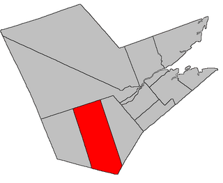
Brighton is a geographic parish in Carleton County, New Brunswick, Canada, northeast of Woodstock, extending from the eastern bank of the Saint John River to the York County line.

<span class="mw-page-title-main">Hillsborough Parish, New Brunswick</span> Parish in New Brunswick, Canada

Hillsborough is a geographic parish in eastern Albert County, New Brunswick, Canada.

<span class="mw-page-title-main">Alma Parish, New Brunswick</span> Parish in New Brunswick, Canada

Alma is a geographic parish on the Bay of Fundy in the southwestern corner of Albert County, New Brunswick, Canada.

<span class="mw-page-title-main">West Isles Parish, New Brunswick</span> Parish in Canada

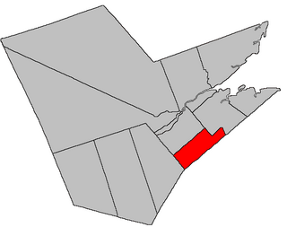
West Isles is a geographic parish in Charlotte County, New Brunswick, Canada.

<span class="mw-page-title-main">Saint George Parish, New Brunswick</span> Parish in Canada

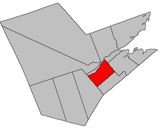
Saint George is a geographic parish in Charlotte County, New Brunswick, Canada, located between St. Stephen and Saint John.

<span class="mw-page-title-main">Grand Manan Parish, New Brunswick</span> Parish in Canada

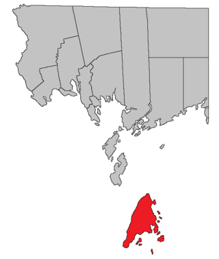
Grand Manan is a geographic parish in Charlotte County, New Brunswick, Canada, comprising one village and part of a rural district; the rural district portion was formerly a local service district (LSD); both of which are members of the Southwest New Brunswick Service Commission (SNBSC). The parish includes Grand Manan Island and numerous lesser islands, only one of which has permanent year-round inhabitants.

A regional service commission (RSC) is an administrative entity in the province of New Brunswick, Canada. As the name implies, an RSC administers services on a regional level.

<span class="mw-page-title-main">Administrative divisions of New Brunswick</span> Local governance in New Brunswick

The Canadian province of New Brunswick is divided into 89 local entities, consisting of 77 local governments and 12 rural districts.

References

  1. "Chapter T-3 Territorial Division Act" (PDF). Government of New Brunswick. Retrieved 28 December 2020.
  2. "Chapter I-13 Interpretation Act" (PDF). Government of New Brunswick. Retrieved 28 December 2020.
  3. Graham, G. E.; Lanteigne, L.; Cloutier, Mrs. Benoit; Dick, W. B.; Jonah, H. N. (1974). "Appendix A". Report of the Representation and Electoral Districts Boundaries Commission. Government of New Brunswick.
  4. Creaghan, William L.M.; Jean, Bernard-A.; Clarke, Janice L.; Thériault, Nicole; Doiron, Claire; Toole, Frederick D.; Groom, Mabel (October 1993). A New Electoral Map for New Brunswick: The Final Report of The Representation and Electoral District Boundaries Commission. Province of New Brunswick. pp. 25–133.
  5. Larlee, Margaret; Robichaud, Brigitte; Brown, David; Carrier, Normand; Myers, Richard; Paulin, Réginald; Ward, Pam (20 February 2006). "Appendix B". A New Electoral Map for New Brunswick: Final Report of the Electoral Boundaries and Representation Commission. Province of New Brunswick.
  6. "Regional Health Authorities Act (R.S.N.B. 2011, c.217)". Government of New Brunswick. Retrieved 11 July 2021.
  7. "NEW BRUNSWICK REGULATION 2009-141 under the Public Health Act (O.C. 2009-460)". Government of New Brunswick. Retrieved 11 July 2021.
  8. "NEW BRUNSWICK REGULATION 83-120 under the Judicature Act (O.C. 83-707)". Government of New Brunswick. Retrieved 11 July 2021.
  9. LeBlanc, Valmond (11 September 2020). "Legislate Assembly of New Brunswick Parliamentary Stylebook" (PDF). Government of New Brunswick. p. 92. Retrieved 28 December 2020.
  10. Let's Grow Together: Your future is in your hands! (Report). Government of New Brunswick. 8 October 2014. p. 6.
  11. "Public Vote for Residents of the Local Service District of Springfield re: Hampton Regional Multipurpose Facility". Town of Hampton website. 2016.[ dead link ]
  12. "Population and dwelling counts: Canada, provinces and territories, and census subdivisions (municipalities)". Statistics Canada. Retrieved 26 March 2022.
  13. Figure derived from counting parishes still used as Census subdivisions. [12]