

Sign at the winery's entrance
Llano Estacado Winery is a winery located in Lubbock, Texas. It is one of the oldest wineries in Texas. [1]
Llano Estacado Winery is a winery located in Lubbock, Texas. It is one of the oldest wineries in Texas. [1]
In 1976, Llano Estacado Winery was established in southeast Lubbock County, Texas, while it was still a dry county. [2] The state legislature passed a bill two years later permitting wine production in dry counties. [2] The winery planted its first vineyard in 1978. [3]

Crosby County is a county located in the U.S. state of Texas. As of the 2010 census, its population was 6,059. The county seat is Crosbyton. The county was founded in 1876 and later organized in 1886. Both the county and its seat are named for Stephen Crosby, a land commissioner in Texas.

Brownfield is a city in Terry County, Texas, United States. The population was 9,657 at the 2010 census. Located 39 miles southwest of Lubbock, it is the county seat of Terry County

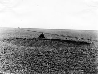
The Llano Estacado, commonly known as the Staked Plains, is a region in the Southwestern United States that encompasses parts of eastern New Mexico and northwestern Texas. One of the largest mesas or tablelands on the North American continent, the elevation rises from 3,000 feet (900 m) in the southeast to over 5,000 feet (1,500 m) in the northwest, sloping almost uniformly at about 10 feet per mile (1.9 m/km).

West Texas is a loosely defined part of the U.S. state of Texas, generally encompassing the arid and semi-arid lands west of a line drawn between the cities of Wichita Falls, Abilene, and Del Rio.

The South Plains is a region in northwest Texas, consisting of 24 counties. The main crop is cotton.
The High Plains are a subregion of the Great Plains mostly in the Western United States, but also partly in the Midwest states of Nebraska, Kansas, and South Dakota, generally encompassing the western part of the Great Plains before the region reaches the Rocky Mountains. The High Plains are located in eastern Montana, southeastern Wyoming, southwestern South Dakota, western Nebraska, eastern Colorado, western Kansas, eastern New Mexico, western Oklahoma, and to just south of the Texas Panhandle. The southern region of the Western High Plains ecology region contains the geological formation known as Llano Estacado which can be seen from a short distance or on satellite maps. From east to west, the High Plains rise in elevation from around 1,800 feet (550 m) to over 7,000 feet (2,100 m).

Lubbock Lake Landmark, also known as Lubbock Lake Site, is an important archeological site and natural history preserve in the city of Lubbock, Texas. The preserve is 336 acres and is a protected state and federal landmark. There is evidence of ancient people and extinct animals at Lubbock Lake Landmark. It has evidence of nearly 12,000 years of use by ancient cultures on the Llano Estacado. It is run by the Museum of Texas Tech University.

The Caprock Escarpment is a term used in West Texas and Eastern New Mexico to describe the geographical transition point between the level High Plains of the Llano Estacado and the surrounding rolling terrain. In Texas, the escarpment stretches around 200 mi (320 km) south-southwest from the northeast corner of the Texas Panhandle near the Oklahoma border. The escarpment is especially notable, from north to south, in Briscoe, Floyd, Motley, Crosby, Dickens, Garza, and Borden Counties. In New Mexico, a prominent escarpment exists along the northernmost extension of the Llano Estacado, especially to the south of San Jon and Tucumcari, both in Quay County, New Mexico. Along the western edge of the Llano Estacado, the portion of the escarpment that stretches from Caprock to Maljamar, New Mexico, is called the Mescalero Ridge.

Texas has a long history of wine production. The sunny and dry climate of the major winemaking regions in the state have drawn comparison to Portuguese wines, in addition to other regions in Europe like Spain, France, and Italy. Some of the earliest recorded Texas wines were produced by Spanish missionaries in the 1650s near El Paso. Texas ranked as the fifth largest wine producing state by 2019.

Slide is an unincorporated community in Lubbock County, Texas, United States. It lies at the junction of FM 1730 and FM 41, 13 miles south of Lubbock, and has an estimated population of 44. The community is part of the Lubbock metropolitan area.
Woodrow is an unincorporated community in southern Lubbock County, Texas, United States. It lies on U.S. Route 87, ten miles south of Lubbock, and has an estimated population of 85. It is part of the Lubbock Metropolitan Statistical Area.

Southland is an unincorporated community in Garza County, Texas, United States. It lies along the eastern edge of the Llano Estacado on U.S. Route 84, twenty miles northwest of Post.

The Texas High Plains AVA is an American Viticultural Area located on the Llano Estacado region of Texas. The appellation is the second largest American Viticultural Area in Texas, and covers an area of over 8,000,000 acres (32,375 km2). Most of the vineyards are on flat terrain at elevations between 3,000 feet (914 m) and 4,000 feet (1,219 m) above sea level. The Texas plains can be extremely dry, so most vineyards are irrigated with water from the Ogallala Aquifer. The hardiness zones are 7a and 7b.

Yellow House Draw is an ephemeral watercourse about 236 km (147 mi) long, heading about 20 km (12 mi) southwest of Melrose, New Mexico, and tending generally east-southeastward across the Llano Estacado to the city of Lubbock, where it joins Blackwater Draw to form Yellow House Canyon at the head of the North Fork Double Mountain Fork Brazos River. It stretches across Roosevelt, Curry, Bailey, Cochran, Hockley, and Lubbock Counties of eastern New Mexico and West Texas, and drains an area of 9,790 km2 (3,780 sq mi).

Fieldton is an unincorporated community in Lamb County, Texas, United States. Although it is unincorporated, Fieldton has a post office, with the ZIP code of 79326.

Yellow House Canyon is about 32 km (20 mi) long, heading in Lubbock, Texas, at the junction of Blackwater Draw and Yellow House Draw, and trending generally southeastward to the edge of the Llano Estacado about 10 km (6.2 mi) east of Slaton, Texas; it forms one of three major canyons along the east side of the Llano Estacado and carries the waters of the North Fork Double Mountain Fork Brazos River.

Posey is a small, unincorporated, community located on the level plains of the Llano Estacado about 11 mi (18 km) southeast of Lubbock in southeastern Lubbock County, Texas.
Heckville is an unincorporated community located on the high plains of the Llano Estacado about 16 mi (26 km) northeast of Lubbock or 7 mi (11 km) north of Idalou in northeastern Lubbock County, Texas. This small town was named after Henry Heck, who built a cotton gin to serve the community in 1948.

Becton is an unincorporated community in northeast Lubbock County, about 18 mi (29 km) northeast of Lubbock, Texas. This small rural community lies on the high plains of the Llano Estacado in West Texas.
The Salt Fork Brazos River is a braided, highly intermittent stream about 150 mi (240 km) long, heading along the edge of the Llano Estacado about 26 mi (42 km) east-southeast of Lubbock, Texas. From its source, it flows generally east-southeastward to join the Double Mountain Fork to form the Brazos River about 12 mi (19 km) west-northwest of Haskell, Texas. The Salt Fork stretches across portions of Crosby, Garza, Kent, and Stonewall counties of West Texas.
| This winery-related article is a stub. You can help Wikipedia by expanding it. |