Lookout Mountain, Georgia

Last updated

Lookout Mountain, Georgia
High Falls at Rock City.jpg
Walker County Georgia Incorporated and Unincorporated areas Lookout Mountain Highlighted.svg
Location in Walker County and the state of Georgia
Coordinates: 34°58′31″N85°21′17″W / 34.97528°N 85.35472°W / 34.97528; -85.35472
Country United States
State Georgia
County Walker
Area
[1]
  Total2.66 sq mi (6.89 km2)
  Land2.66 sq mi (6.89 km2)
  Water0.00 sq mi (0.00 km2)
Elevation
1,801 ft (549 m)
Population
 (2020)
  Total1,641
  Density617.15/sq mi (238.29/km2)
Time zone UTC-5 (Eastern (EST))
  Summer (DST) UTC-4 (EDT)
ZIP code
30750
Area code(s) 706/762
FIPS code 13-47336 [2]
GNIS feature ID0332265 [3]
Website www.lookoutmtnga.com

Lookout Mountain is a city entirely within Walker County, Georgia, United States. Bordering its sister town of Lookout Mountain, Tennessee, Lookout Mountain is part of the Chattanooga metropolitan statistical area. The population was 1,641 at the 2020 census. The city is located on Lookout Mountain, home to such attractions as Rock City. This city is often named as home to Covenant College, but the college is actually across the county line in Dade County.

Contents

Geography

Lookout Mountain is located at 34°58′31″N85°21′17″W / 34.97528°N 85.35472°W / 34.97528; -85.35472 (34.975307, -85.354826). [4]

According to the United States Census Bureau, the city has a total area of 2.7 square miles (6.9 km2), all of it land.

Demographics

Historical population
CensusPop.Note
1970 1,538
1980 1,505−2.1%
1990 1,6368.7%
2000 1,617−1.2%
2010 1,602−0.9%
2020 1,6412.4%
U.S. Decennial Census [5]
1850-1870 [6] 1870-1880 [7]
1890-1910 [8] 1920-1930 [9]
1940 [10] 1950 [11] 1960 [12]
1970 [13] 1980 [14] 1990 [15]
2000 [16]

2020 census

Lookout Mountain racial composition [17]
RaceNum.Perc.
White (non-Hispanic)1,52292.75%
Black or African American (non-Hispanic)80.49%
Native American 10.06%
Asian 60.37%
Other/Mixed 774.69%
Hispanic or Latino 271.65%

As of the 2020 United States census, there were 1,641 people, 612 households, and 465 families residing in the city.

2000 census

As of the census [2] of 2000, there were 1,617 people, 618 households, and 441 families residing in the city. The population density was 608.3 inhabitants per square mile (234.9/km2). There were 657 housing units at an average density of 247.2 per square mile (95.4/km2). The racial makeup of the city was 99.01% White, 0.19% Asian, 0.25% from other races, and 0.56% from two or more races. Hispanic or Latino of any race were 0.80% of the population.

There were 618 households, out of which 36.4% had children under the age of 18 living with them, 65.5% were married couples living together, 4.5% had a female householder with no husband present, and 28.6% were non-families. 24.8% of all households were made up of individuals, and 11.8% had someone living alone who was 65 years of age or older. The average household size was 2.62 and the average family size was 3.16.

In the city, the population was spread out, with 29.8% under the age of 18, 5.3% from 18 to 24, 27.7% from 25 to 44, 21.8% from 45 to 64, and 15.4% who were 65 years of age or older. The median age was 37 years. For every 100 females, there were 93.7 males. For every 100 females age 18 and over, there were 88.5 males.

The median income for a household in the city was $62,045, and the median income for a family was $76,580. Males had a median income of $52,071 versus $30,962 for females. The per capita income for the city was $31,227. About 3.5% of families and 5.6% of the population were below the poverty line, including 5.2% of those under age 18 and 1.8% of those age 65 or over.

Colleges

Covenant College, a Presbyterian college, is located in neighboring Dade County. The college became infamous for Mark David Chapman, the assassin of John Lennon, who briefly attended in the early 1970s. Covenant is affiliated with the Presbyterian Church in America (PCA).

Related Research Articles

<span class="mw-page-title-main">Cherokee County, Alabama</span> County in Alabama, United States

Cherokee County, Alabama is a county located in the northeastern part of the U.S. state of Alabama. As of the 2020 census, the population was 24,971. Its county seat is Centre. The county is named for the Cherokee tribe.

<span class="mw-page-title-main">Cleburne County, Alabama</span> County in Alabama, United States

Cleburne County is a county located in the east central portion of the U.S. state of Alabama. As of the 2020 census, the population was 15,056. Its county seat is Heflin. Its name is in honor of Patrick R. Cleburne of Arkansas who rose to the rank of major general in the Confederate States Army. The eastern side of the county borders the state of Georgia.

<span class="mw-page-title-main">Walker County, Georgia</span> County in Georgia, United States

Walker County is a county located in the northwestern part of the U.S. state of Georgia. As of the 2020 census, the population was 67,654, down from 68,756 in 2010. The county seat is LaFayette. The county was created on December 18, 1833, from land formerly belonging to the Cherokee Indian Nation.

<span class="mw-page-title-main">Polk County, Georgia</span> County in Georgia, United States

Polk County is a county located in the northwestern part of the U.S. state of Georgia. As of the 2020 census, the population was 42,853. The county seat is Cedartown. The county was created on December 20, 1851, by an act of the Georgia General Assembly and named after James K. Polk, the eleventh President of the United States.

<span class="mw-page-title-main">Hart County, Georgia</span> County in Georgia, United States

Hart County is a county located in the northeastern part of the U.S. state of Georgia. As of the 2020 census, the population was 25,828. The county seat is Hartwell.

<span class="mw-page-title-main">Franklin County, Georgia</span> County in Georgia, United States

Franklin County is a county located in the northeastern part of the U.S. state of Georgia. As of the 2020 census, the population was 23,424. The county seat is Carnesville. On February 25, 1784, Franklin and Washington became Georgia's eighth and ninth counties, with Franklin named in honor of patriot Benjamin Franklin.

<span class="mw-page-title-main">Floyd County, Georgia</span> County in Georgia, United States

Floyd County is a county located in the northwestern part of the U.S. state of Georgia. As of the 2020 United States Census, the population was 98,584. The county seat is Rome.

<span class="mw-page-title-main">Dade County, Georgia</span> County in Georgia, United States

Dade County is a county in the U.S. state of Georgia. It occupies the northwest corner of Georgia, and the county's own northwest corner is the westernmost point in the state. As of the 2020 census, the population is 16,251. The county seat and only incorporated municipality is Trenton. Dade County is part of the Chattanooga, TN–GA Metropolitan Statistical Area. In 1860, residents of Dade County voted to secede from the state of Georgia and from the United States, but no government outside the county ever recognized this gesture as legal. In 1945, the county symbolically "rejoined" Georgia and the United States.

<span class="mw-page-title-main">Chattooga County, Georgia</span> County in Georgia, United States

Chattooga County is a county located in the northwestern part of the U.S. state of Georgia. As of the 2020 census, the population was 24,965. The county seat is Summerville. The county was created on December 28, 1838.

<span class="mw-page-title-main">Mentone, Alabama</span> Town in Alabama, United States

Mentone is a town in DeKalb County, Alabama, United States. It is located atop Lookout Mountain.

<span class="mw-page-title-main">Fort Oglethorpe, Georgia</span> City in Georgia, United States

Fort Oglethorpe is a city predominantly in Catoosa County with some portions in Walker County in the U.S. state of Georgia. As of the 2020 census, the city had a population of 10,423. It is part of the Chattanooga, TN–GA Metropolitan Statistical Area. It is home to Lakeview – Fort Oglethorpe High School.

<span class="mw-page-title-main">Menlo, Georgia</span> City in Georgia, United States

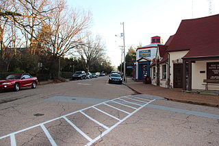
Menlo is a small city in Chattooga County, Georgia, United States. The population was 480 at the 2020 census.

<span class="mw-page-title-main">Trenton, Georgia</span> City in Georgia, United States

Trenton is a city and the only incorporated municipality in Dade County, Georgia, United States—and as such, it serves as the county seat. The population was 2,195 at the 2020 census. Trenton is part of the Chattanooga, Tennessee–GA Metropolitan Statistical Area.

<span class="mw-page-title-main">Lindale, Georgia</span> Place in Georgia, United States

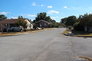
Lindale is an unincorporated community and census-designated place (CDP) in Floyd County, Georgia, United States. It is part of the Rome, Georgia Metropolitan Statistical Area. The population was 4,191 at the 2010 census.

<span class="mw-page-title-main">Aragon, Georgia</span> City in Georgia, United States

Aragon is a city in Polk County, Georgia, United States. As of the 2020 census, the city had a population of 1,440.

<span class="mw-page-title-main">LaFayette, Georgia</span> City in Georgia, United States

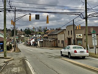
LaFayette is a city in, and the county seat of, Walker County, Georgia, United States. As of the 2020 census, the city population was 6,888. It was founded as Chattooga.

<span class="mw-page-title-main">Rossville, Georgia</span> City in Georgia, United States

Rossville is a city in Walker County, Georgia, United States. The population was 3,980 at the 2020 census. It is part of the Chattanooga, TN–GA Metropolitan Statistical Area.

<span class="mw-page-title-main">Tunnel Hill, Georgia</span> City in Georgia, United States

Tunnel Hill is a city in northwest Whitfield County and southern Catoosa County, Georgia, United States. It is part of the Dalton Metropolitan Statistical Area. The population was 963 at the 2020 census. The city is named for the Chetoogeta Mountain Tunnel, a 1,497-foot (456 m) railroad tunnel built in the late 1840s.

<span class="mw-page-title-main">Harrison City, Pennsylvania</span> Census-designated place in Pennsylvania, United States

Harrison City is a census-designated place (CDP) in Westmoreland County, Pennsylvania, United States. The population was 174 at the 2020 census.

<span class="mw-page-title-main">Lookout Mountain, Tennessee</span> Town in Tennessee, United States

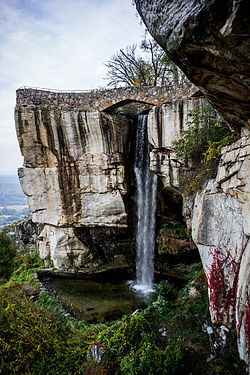
Lookout Mountain is a town in Hamilton County, Tennessee, United States. The population was 2,058 at the 2020 census. Bordering its sister city of Lookout Mountain, Georgia to the south, Lookout Mountain is part of the Chattanooga, TN–GA Metropolitan Statistical Area.

References

  1. "2020 U.S. Gazetteer Files". United States Census Bureau. Retrieved December 18, 2021.
  2. 1 2 "U.S. Census website". United States Census Bureau . Retrieved January 31, 2008.
  3. "US Board on Geographic Names". United States Geological Survey. October 25, 2007. Retrieved January 31, 2008.
  4. "US Gazetteer files: 2010, 2000, and 1990". United States Census Bureau. February 12, 2011. Retrieved April 23, 2011.
  5. "Decennial Census of Population and Housing by Decade". United States Census Bureau.
  6. "1870 Census of Population - Georgia - Population of Civil Divisions less than Counties" (PDF). United States Census Bureau. 1870.
  7. "1880 Census of Population - Georgia - Population of Civil Divisions less than Counties" (PDF). United States Census Bureau. 1880.
  8. "1910 Census of Population - Georgia" (PDF). United States Census Bureau. 1930.
  9. "1930 Census of Population - Georgia" (PDF). United States Census Bureau. 1930. pp. 251–256.
  10. "1940 Census of Population - Georgia" (PDF). United States Census Bureau. 1940.
  11. "1950 Census of Population - Georgia" (PDF). United States Census Bureau. 1980.
  12. "1960 Census of Population - Population of County Subdivisions - Georgia" (PDF). United States Census Bureau. 1960.
  13. "1970 Census of Population - Population of County Subdivisions - Georgia" (PDF). United States Census Bureau. 1970.
  14. "1980 Census of Population - Number of Inhabitants - Georgia" (PDF). United States Census Bureau. 1980.
  15. "1990 Census of Population - Summary Social, Economic, and Housing Characteristics - Georgia" (PDF). United States Census Bureau. 1990.
  16. "2000 Census of Population - General Population Characteristics - Georgia" (PDF). United States Census Bureau. 2000.
  17. "Explore Census Data". data.census.gov. Retrieved December 17, 2021.