Loomis, South Dakota

Last updated

Loomis, South Dakota
CDP
Davison County South Dakota Incorporated and Unincorporated areas Loomis Highlighted.svg
Location in Davison County and the state of South Dakota
Coordinates: 43°47′35″N98°06′17″W / 43.79306°N 98.10472°W / 43.79306; -98.10472
Country United States
State South Dakota
County Davison
Area
[1]
  Total0.20 sq mi (0.51 km2)
  Land0.20 sq mi (0.51 km2)
  Water0.00 sq mi (0.00 km2)
Elevation
[2]
1,303 ft (397 m)
Population
 (2020) [3]
  Total33
  Density166.67/sq mi (64.36/km2)
Time zone UTC-6 (Central (CST))
  Summer (DST) UTC-5 (CDT)
ZIP code
57301
Area code 605
FIPS code 46-39020 [4]
GNIS feature ID2393108 [2]

Loomis is a census-designated place (CDP) in Davison County, South Dakota, United States. The population was 33 at the 2020 census. [5] It is part of the Mitchell, South Dakota Micropolitan Statistical Area.

Contents

Loomis was laid out in 1902. [6]

Geography

According to the United States Census Bureau, the CDP has a total area of 0.2 square miles (0.52 km2), all land.

Demographics

Historical population
CensusPop.Note
2020 33
U.S. Decennial Census [7]

As of the census [4] of 2000, there were 47 people, 18 households, and 14 families residing in the CDP. The population density was 242.8 inhabitants per square mile (93.7/km2). There were 19 housing units at an average density of 98.1 per square mile (37.9/km2). The racial makeup of the CDP was 97.87% White and 2.13% Native American.

There were 18 households, out of which 44.4% had children under the age of 18 living with them, 66.7% were married couples living together, 5.6% had a female householder with no husband present, and 22.2% were non-families. 16.7% of all households were made up of individuals, and 5.6% had someone living alone who was 65 years of age or older. The average household size was 2.61 and the average family size was 2.86.

In the CDP, the population was spread out, with 27.7% under the age of 18, 4.3% from 18 to 24, 31.9% from 25 to 44, 29.8% from 45 to 64, and 6.4% who were 65 years of age or older. The median age was 36 years. For every 100 females, there were 123.8 males. For every 100 females age 18 and over, there were 142.9 males.

The median income for a household in the CDP was $28,750, and the median income for a family was $28,750. Males had a median income of $28,750 versus $0 for females. The per capita income for the CDP was $13,123. None of the population or families were below the poverty line.

Related Research Articles

<span class="mw-page-title-main">Fort Thompson, South Dakota</span> CDP in South Dakota, United States

Fort Thompson is a census-designated place (CDP) in Buffalo County, South Dakota, United States. The population was 1,282 at the 2010 census, making it the largest settlement on the Crow Creek Reservation.

<span class="mw-page-title-main">Marty, South Dakota</span> CDP in South Dakota, United States

Marty is a census-designated place (CDP) in southern Charles Mix County, South Dakota, United States. The population was 677 at the 2020 census.

<span class="mw-page-title-main">Whitehorse, South Dakota</span> CDP in South Dakota, United States

Whitehorse is a census-designated place (CDP) in Dewey County, South Dakota, United States. The population was 106 at the 2020 census.

<span class="mw-page-title-main">New Holland, South Dakota</span> CDP in South Dakota, United States

New Holland is a census-designated place (CDP) in Douglas County, South Dakota, United States. The population was 77 at the 2020 census.

<span class="mw-page-title-main">St. Charles, South Dakota</span> CDP in South Dakota, United States

St. Charles or Saint Charles is a census-designated place (CDP) in Gregory County, South Dakota, United States. The population was 15 at the 2020 census.

<span class="mw-page-title-main">Kaylor, South Dakota</span> CDP in South Dakota, United States

Kaylor is a census-designated place (CDP) in Hutchinson County, South Dakota, United States. The population was 30 at the 2020 census.

<span class="mw-page-title-main">Milltown, South Dakota</span> CDP in South Dakota, United States

Milltown is a census-designated place (CDP) in Hutchinson County, South Dakota, United States. The population was 8 at the 2020 census.

<span class="mw-page-title-main">Wanblee, South Dakota</span> Census-designated place in South Dakota, United States

Wanblee is a census-designated place on the Pine Ridge Indian Reservation, located in Jackson County, South Dakota, United States. The population was 674 at the 2020 census, virtually all of whom are members of the Oglala band of Lakota Sioux. Wanbli is the Lakota word for eagle, and the town was named for its proximity to Wanbli hohpi paha. Wanblee is a few miles directly northeast of the North American continental pole of inaccessibility.

<span class="mw-page-title-main">Okaton, South Dakota</span> CDP in South Dakota, United States

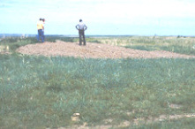
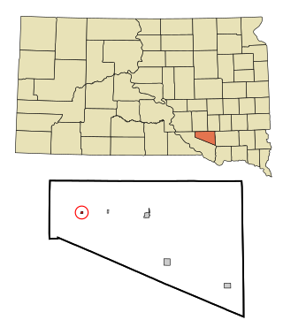
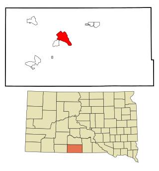
Okaton is a hamlet in Jones County, South Dakota, United States. As of the 2020 census, the population was 31. There are no services or businesses there; Okaton had last been the location of an old-west town exhibit, but it closed when the owner(s) died.

<span class="mw-page-title-main">North Spearfish, South Dakota</span> Census-designated place in South Dakota, United States

North Spearfish is a census-designated place (CDP) in Lawrence County, South Dakota, United States. The population was 2,366 at the 2020 census.

<span class="mw-page-title-main">Lower Brule, South Dakota</span> Census-designated place in South Dakota, United States

Lower Brule is a census-designated place (CDP) in Lyman County, South Dakota, United States. The population was 703 at the 2020 census. The community is located within the Lower Brule Indian Reservation, from which it takes its name.

<span class="mw-page-title-main">Roswell, South Dakota</span> Census-designated place in South Dakota, United States

Roswell is a CDP in Miner County, South Dakota, United States. The population was 8 at the 2020 census. It disincorporated as a town in 2012.

<span class="mw-page-title-main">Ashland Heights, South Dakota</span> CDP in South Dakota, United States

Ashland Heights is a census-designated place (CDP) and unincorporated community in Pennington County, South Dakota, United States. The population was 678 at the 2020 census.

<span class="mw-page-title-main">Colonial Pine Hills, South Dakota</span> CDP in South Dakota, United States

Colonial Pine Hills is a census-designated place (CDP) and unincorporated community in Pennington County, South Dakota, United States. The population was 1,903 at the 2020 census.

<span class="mw-page-title-main">Green Valley, South Dakota</span> CDP in South Dakota, United States

Green Valley is a census-designated place (CDP) and unincorporated community in Pennington County, South Dakota, United States. The population was 1,051 at the 2020 census.

<span class="mw-page-title-main">Kyle, South Dakota</span> CDP in South Dakota, United States

Kyle is a census-designated place (CDP) in Oglala Lakota County, South Dakota, United States. Its population was 943 at the 2020 census. Located within the Pine Ridge Indian Reservation of the Oglala Lakota, it is one of two settlements which are closest to the North American continental pole of inaccessibility.

<span class="mw-page-title-main">Oglala, South Dakota</span> CDP in South Dakota, United States

Oglala is a census-designated place (CDP) in West Oglala Lakota Unorganized Territory equivalent, Oglala Lakota County, South Dakota, United States. The population was 1,282 at the 2020 census. Its location is in the northwest of the Pine Ridge Indian Reservation.

<span class="mw-page-title-main">Rosebud, South Dakota</span> CDP in South Dakota, United States

Rosebud also Sicanġu is a census-designated place (CDP) in Todd County, South Dakota, United States. The population was 1,455 at the 2020 census.

<span class="mw-page-title-main">Two Strike, South Dakota</span> CDP in South Dakota, United States

Two Strike is a census-designated place (CDP) in Todd County, South Dakota, United States, named after Brulé, Lakota chief Two Strike who lived at that location for a period of time. The population was 282 at the 2020 census.

<span class="mw-page-title-main">White Horse, South Dakota</span> CDP in South Dakota, United States

White Horse also Šuŋgská oyáŋke is a census-designated place (CDP) in Todd County, South Dakota, United States. The population was 234 at the 2020 census.

References

  1. "ArcGIS REST Services Directory". United States Census Bureau. Retrieved October 15, 2022.
  2. 1 2 U.S. Geological Survey Geographic Names Information System: Loomis, South Dakota
  3. "Census Population API". United States Census Bureau. Retrieved October 15, 2022.
  4. 1 2 "U.S. Census website". United States Census Bureau . Retrieved January 31, 2008.
  5. "U.S. Census Bureau: Loomis CDP, South Dakota". www.census.gov. United States Census Bureau. Retrieved January 30, 2022.
  6. Federal Writers' Project (1940). South Dakota place-names, v.1-3. University of South Dakota. p. 48.
  7. "Census of Population and Housing". Census.gov. Retrieved June 4, 2016.