Los Ybanez, Texas

Last updated

Los Ybanez, Texas
TXMap-doton-LosYbanez.PNG
Location of Los Ybanez, Texas
Dawson County LosYbanez.svg
Coordinates: 32°43′5″N101°55′9″W / 32.71806°N 101.91917°W / 32.71806; -101.91917
CountryUnited States
State Texas
County Dawson
Area
[1]
  Total0.08 sq mi (0.22 km2)
  Land0.08 sq mi (0.22 km2)
  Water0.00 sq mi (0.00 km2)
Elevation
2,972 ft (906 m)
Population
 (2010)
  Total19
  Estimate 
(2019) [2]
19
  Density228.92/sq mi (88.06/km2)
Time zone UTC-6 (Central (CST))
  Summer (DST) UTC-5 (CDT)
FIPS code 48-44170 [3]
GNIS feature ID1388571 [4]

Los Ybanez is a city in Dawson County, Texas, United States. The population was 19 at the 2010 census, making it the municipality with the smallest population in Texas. [5]

Contents

Geography

Los Ybanez is located at 32°43′5″N101°55′9″W / 32.71806°N 101.91917°W / 32.71806; -101.91917 (32.717986, –101.919052). [6]

According to the United States Census Bureau, the city has a total area of 0.1 square miles (26 ha), all land.

History

Los Ybanez was organized in the late 1970s (formally incorporated in 1983) as one of several Texas municipalities that were organized in order to legalize local sale of alcoholic spirits. These were usually small areas of land, adjacent to larger towns or cities. Others included Impact near Abilene, TX and Orbit near Monahans, TX.

Texas law provides that all its 254 counties are essentially "dry"; that is, liquor sales are not allowed. Local governments can opt for these sales through "local option" elections. The western half of Texas is generally and historically dry, though as the metro areas grew, most allow liquor in clubs, some on sale in stores.

Los Ybanez was founded by members of the family of Israel G. and Mary Ybanez. Ybanez purchased a tract of land outside all towns from the state of Texas (which had obtained title from the federal government after World War II.) The land had been used for soldiers' barracks during military training exercises at an adjoining glider base. Family members were moved to the land to occupy the houses and establish residency. Later they incorporated as a town, got a US Post Office, and legalized liquor sales. The store operates to this day as a drive through only operation, accepting only cash.

The Ybanez family also founded a local radio station, KYMI (later KJJT) as a vehicle for advertising for the liquor store business. KYMI began on 107.9 MHz, but moved to 98.5 in 1996 when a station in Odessa upgraded facilities. KYMI received money for a new transmitter and antenna in return for agreeing to change channels. [7]

Demographics

Historical population
CensusPop.Note
1990 83
2000 32−61.4%
2010 19−40.6%
2019 (est.)19 [2] 0.0%
U.S. Decennial Census [8]

As of the census [3] of 2000, there were 32 people, 10 households, and 9 families residing in the city. The population density was 365.1 inhabitants per square mile (141.0/km2). There were 12 housing units at an average density of 136.9 per square mile (52.9/km2). The racial makeup of the city was 50.00% White, 6.25% African American, 21.88% from other races, and 21.88% from two or more races. Hispanic or Latino of any race were 75.00% of the population.

There were 10 households, out of which 40.0% had children under the age of 18 living with them, 60.0% were married couples living together, 20.0% had a female householder with no husband present, and 10.0% were non-families. 10.0% of all households were made up of individuals, and 10.0% had someone living alone who was 65 years of age or older. The average household size was 3.20 and the average family size was 3.44.

In the city, the population was spread out, with 31.3% under the age of 18, 12.5% from 18 to 24, 21.9% from 25 to 44, 31.3% from 45 to 64, and 3.1% who were 65 years of age or older. The median age was 27 years. For every 100 females, there were 100.0 males. For every 100 females age 18 and over, there were 83.3 males.

The median income for a household in the city was $11,250, and the median income for a family was $11,250. Males had a median income of $9,750 versus $0 for females. The per capita income for the city was $22,324. There were 50.0% of families and 56.8% of the population living below the poverty line, including 100.0% of under eighteens and none of those over 64.

Education

The City of Los Ybanez is served by the Lamesa Independent School District.

Related Research Articles

<span class="mw-page-title-main">Dawson County, Texas</span> County in Texas, United States

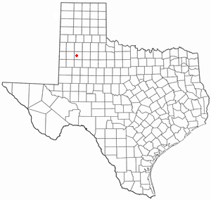
Dawson County is a county in the U.S. state of Texas. As of the 2020 census, its population was 12,456. The county seat is Lamesa. The county was created in 1876 and later organized in 1905. It is named for Nicholas Mosby Dawson, a soldier of the Texas Revolution. Dawson County comprises the Lamesa, TX Micropolitan Statistical Area (μSA), and it is, by population, the smallest Micropolitan Statistical Area in the United States.

Tolsona is a census-designated place (CDP) in Copper River Census Area, Alaska, United States. The population was 12 at the 2020 census, down from 30 in 2010.

<span class="mw-page-title-main">Winchester, Arkansas</span> Town in Arkansas, United States

Winchester is a small town in northeast Drew County, Arkansas, United States. The population was 167 at the 2010 census, declining from its 20th-century high of 279 in 1980.

<span class="mw-page-title-main">Aubrey, Arkansas</span> Town in Arkansas, United States

Aubrey is a town in Lee County, Arkansas, United States. The population was 170 at the 2010 census.

<span class="mw-page-title-main">Middleborough Center, Massachusetts</span> Census-designated place in Massachusetts, United States

Middleborough Center is a census-designated place (CDP) in the town of Middleborough in Plymouth County, Massachusetts, United States. The population was 7,319 at the 2010 census.

<span class="mw-page-title-main">Federal Dam, Minnesota</span> City in Minnesota, United States

Federal Dam is a city in Cass County, Minnesota, United States, near Leech Lake. The population was 110 at the 2010 census. It is part of the Brainerd Micropolitan Statistical Area.

<span class="mw-page-title-main">Tynan, Texas</span> Census-designated place in Texas, United States

Tynan is a census-designated place (CDP) in Bee County, Texas, United States. The population was 278 at the 2010 census.

<span class="mw-page-title-main">Morgan, Texas</span> City in Texas, United States

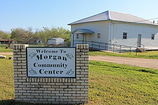
Morgan is a city in Bosque County in Central Texas, United States. The city's population was 490 at the 2010 census.

<span class="mw-page-title-main">North Pearsall, Texas</span> Census-designated place in Frio County, Texas, United States

North Pearsall is a census-designated place (CDP) in Frio County, Texas, United States. The population was 614 at the 2010 census.

<span class="mw-page-title-main">Neylandville, Texas</span> Town in Texas, United States

Neylandville is a town in Hunt County, Texas, United States. The population was 97 at the 2010 census, up from 56 at the 2000 census.

<span class="mw-page-title-main">Reese Center, Texas</span> Former CDP in Texas, United States

Reese Center is an unincorporated community and former census-designated place (CDP) in Lubbock County, Texas, United States. The population was 42 at the 2000 census. Its population was not recorded separately for the 2010 census. It is part of the Lubbock Metropolitan Statistical Area.

<span class="mw-page-title-main">Stanton, Texas</span> City in Texas, United States

Stanton is a city in and the county seat of Martin County, Texas, United States. Stanton was founded as Marienfeld by German immigrants that were some of the first settlers in this region of Texas. The population was 2,492 at the 2010 census.

<span class="mw-page-title-main">Appleby, Texas</span> City in Texas, United States

Appleby is a city in Nacogdoches County, in the U.S. state of Texas. The population was 474 at the 2010 census.

<span class="mw-page-title-main">Mobile City, Texas</span> City in Texas, United States

Mobile City is a city in Rockwall County, Texas, United States on the outskirts of Rockwall. The population was 142 at the 2020 census. It currently has the highest population density of any city in Texas, and is the only Texas city with a population density of over 10,000 people per square mile.

<span class="mw-page-title-main">Roma Creek, Texas</span> CDP in Texas, United States

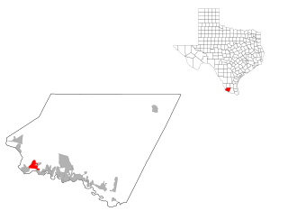
Roma Creek is a former census-designated place (CDP) in Starr County, Texas, United States. The population was 350 at the 2010 census down from 610 at the 2000 census.

<span class="mw-page-title-main">Impact, Texas</span> Town in Texas, United States

Impact is a town in Taylor County, Texas, United States. The population was 22 as of the 2020 census, down from 35 at the 2010 census. It is part of the Abilene, Texas Metropolitan Statistical Area.

Bausell and Ellis is a former census-designated place (CDP) in Willacy County, Texas, United States. The population was 112 at the 2000 census.

Lower Red Lake is an unorganized territory in Beltrami County, Minnesota, United States.The territory is located on the Red Lake Indian Reservation, and the town of Red Lake is located in the area. The population of the Lower Red Lake territory was 5,790 at the 2010 census.

<span class="mw-page-title-main">Ackerly, Texas</span> City in Texas, United States

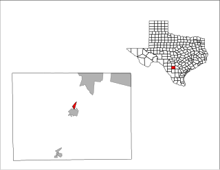
Ackerly is a city in Dawson and Martin Counties in the U.S. state of Texas. As of the 2020 Census, the population was 264. The Martin county portion of Ackerly is part of the Midland-Odessa metropolitan area.

Grantsburg is a town in Burnett County in the U.S. state of Wisconsin. The population was 1,136 at the 2010 census. The village of Grantsburg is located within the town. The unincorporated communities of Branstad and Lind are located in the town.

References

  1. "2019 U.S. Gazetteer Files". United States Census Bureau. Retrieved August 7, 2020.
  2. 1 2 "Population and Housing Unit Estimates". United States Census Bureau. May 24, 2020. Retrieved May 27, 2020.
  3. 1 2 "U.S. Census website". United States Census Bureau . Retrieved January 31, 2008.
  4. "US Board on Geographic Names". United States Geological Survey. October 25, 2007. Retrieved January 31, 2008.
  5. Rivero, Nicolas (August 25, 2017). "The Smallest Town in Each of the 50 States". Mental Floss. Retrieved June 25, 2018.
  6. "US Gazetteer files: 2010, 2000, and 1990". United States Census Bureau. February 12, 2011. Retrieved April 23, 2011.
  7. Federal Communications Commission decision regarding change in channels http://www.fcc.gov/Bureaus/Mass_Media/Orders/1995_Orders/da950395.txt . Sources: 1)"Texas Almanac" published Annually by Belo Corporation. 2)Ongoing coverage of liquor election controversy Lubbock Avalanche Journal Archives 1980-1982. 3) Interview with Israel Ybanez published in Broadcasting Magazine (now Broadcasting & Cable) 1991.
  8. "Census of Population and Housing". Census.gov. Retrieved June 4, 2015.