Related Research Articles

The Sabine River is a 360-mile (580 km) long river in the Southern U.S. states of Texas and Louisiana, From the 32nd parallel north and downstream, it serves as part of the boundary between the two states and empties into Sabine Lake, an estuary of the Gulf of Mexico.

Bridge City is a city in Orange County, Texas, United States. It is 100 miles east of Houston, near the Gulf of Mexico. The population was 9,546 at the 2020 census. The town borders the Neches River and Cow Bayou. It is part of the Beaumont–Port Arthur Metropolitan Statistical Area. The area is mostly known for its association with the petroleum products (oil) industry.
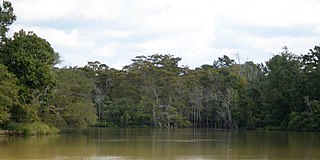
The Neches River begins in Van Zandt County west of Rhine Lake and flows for 416 miles (669 km) through the piney woods of east Texas, defining the boundaries of 14 counties on its way to its mouth on Sabine Lake near the Rainbow Bridge. Two major reservoirs, Lake Palestine and B. A. Steinhagen Reservoir are located on the Neches. The Angelina River is a major tributary with its confluence at the north of Lake B. A. Steinhagen. Tributaries to the south include Village Creek and Pine Island Bayou, draining much of the Big Thicket region, both joining the Neches a few miles north of Beaumont. Towns and cities located along the river including Tyler, Lufkin, and Silsbee, although significant portions of the Neches River are undeveloped and flow through protected natural lands. In contrast, the lower 40 miles of the river are a major shipping channel, highly industrialized, with a number of cities and towns concentrated in the area including Beaumont, Vidor, Port Neches, Nederland, Groves, and Port Arthur.
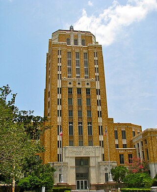
Jefferson County is a county in the Coastal Plain or Gulf Prairie region of Southeast Texas. The Neches River forms its northeastern boundary. As of the 2020 census, the population was 256,526. The county seat is Beaumont. Jefferson County has the highest percentage of African Americans in the state of Texas.

The Gulf Intracoastal Waterway (GIWW) is the portion of the Intracoastal Waterway located along the Gulf Coast of the United States. It is a navigable inland waterway running approximately 1,300 mi (2,100 km) from Saint Marks, Florida, to Brownsville, Texas.

Sabine Lake is a bay on the Gulf coasts of Texas and Louisiana, located approximately 90 miles (140 km) east of Houston and 160 miles (260 km) west of Baton Rouge, adjoining the city of Port Arthur. The lake is formed by the confluence of the Neches and Sabine Rivers and connects to the Gulf of Mexico through Sabine Pass. It forms part of the Texas–Louisiana border, falling within Jefferson and Orange Counties in Texas and Cameron Parish, Louisiana.

The French Broad River is a river in the U.S. states of North Carolina and Tennessee. It flows 218 miles (351 km) from near the town of Rosman in Transylvania County, North Carolina, into Tennessee, where its confluence with the Holston River at Knoxville forms the beginning of the Tennessee River. The river flows through the counties of Transylvania, Buncombe, Henderson, and Madison in North Carolina, and Cocke, Jefferson, Sevier, and Knox in Tennessee. It drains large portions of the Pisgah National Forest and the Cherokee National Forest.

The Big Thicket is the name given to a somewhat imprecise region of a heavily forested area of Southeast Texas in the United States. This area represents a portion of the mixed pine-hardwood forests of the Southeast US. The National Park Service established the Big Thicket National Preserve (BTNP) within the region in 1974 and it is recognized as a biosphere reserve by UNESCO. The diversity of animals in the area is high, with over 500 vertebrates, and it is the complex mosaic of ecosystems and plant diversity that is particularly remarkable. Biologists have identified at least eight, and up to eleven, ecosystems in the Big Thicket area. More than 160 species of trees and shrubs, 800 herbs and vines, and 340 types of grasses are known to occur in the Big Thicket, and estimates as high as over 1000 flowering plant species and 200 trees and shrubs have been made, plus ferns, carnivorous plants, and more. The Big Thicket has historically been the most dense forest region in what is now Texas.

Buffalo Bayou is a slow-moving body of water which flows through Houston in Harris County, Texas. Formed 18,000 years ago, it has its source in the prairie surrounding Katy, Fort Bend County, and flows approximately 53 miles (85 km) east through the Houston Ship Channel into Galveston Bay and the Gulf of Mexico. In addition to drainage water impounded and released by the Addicks and Barker reservoirs, the bayou is fed by natural springs, surface runoff, and several significant tributary bayous, including White Oak Bayou, Greens Bayou, and Brays Bayou. Additionally, Buffalo Bayou is considered a tidal river downstream of a point 440 yards (400 m) west of the Shepherd Drive bridge in west-central Houston.

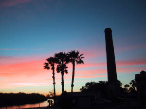
The Port of Beaumont is a deep-water port located in Beaumont, Texas near the mouth of the Neches River.
Texas has many irrigation canals with the majority of large canal networks in the Rio Grande Valley and the Gulf Coast, though smaller systems are located throughout the state. Canals provide water to dry climates to irrigate crops.

The Kananaskis River is a mountain river in western Alberta, Canada. It is a tributary of the Bow River, crossing the length of Kananaskis Country.

Lake O’ the Pines is a reservoir on Big Cypress Bayou, also known as Big Cypress Creek, chiefly in Marion County, Texas, USA. The reservoir also occupies a small part of Upshur and Morris Counties. The dam is located approximately 8.5 miles (13.7 km) west of Jefferson.
The Schooner Bayou Control Structure is a flood control structure located in Vermilion Parish, Louisiana, and operated by the U.S. Army Corps of Engineers. It is part of the Mississippi Valley Division, New Orleans District, which encompasses the southern half of the state of Louisiana.

Pine Island Bayou is a tributary of the Neches River located in southeast Texas. It runs about 55 miles from the northwest corner of Hardin County, Texas and flows in a southeastern direction through western Hardin County, turning east and defining the southern Hardin and Jefferson County boundary for about 20 miles until its confluence with the Neches River. Two significant tributaries of Pine Island Bayou are Mayhaw Creek and Little Pine Island Bayou. The lower ten miles of Pine Island Bayou and much of Little Pine Island Bayou are protected from development in the Big Thicket National Preserve. Excluding the last few miles north of Beaumont, the area is not densely populated, and some small towns include Sour Lake and Saratoga, the latter the birthplace of country singer George Jones.

B A Steinhagen Reservoir is located near the town of Jasper, Texas in the east Texas Piney Woods at 30.85 North Latitude and 94.19 West Longitude. The borders of Tyler County and Jasper County are defined by the bed of the Neches River, and therefore bisect the lake on a North/South line. The lake was created as part of a project that focused on creating lakes for recreation, power generation, and water conservation on the Neches River and the Angelina River. For many years, locals have referred to both the lake and dam as "Dam B".

The Sabine–Neches Waterway is located in southeast Texas and Calcasieu Parish, Louisiana, United States. The waterway includes parts of the Neches River, Sabine River, Sabine Lake, and Taylor Bayou. The waterway ranks as third-busiest waterway in the U.S. in terms of cargo tonnage, according to the American Association of Port Authorities. It also ranks as the top bulk liquid cargo waterway, the top U.S. crude-oil importer, and is projected to become the largest LNG exporter in the United States. The Gulf Intracoastal Waterway crosses the waterway near Port Arthur.
The Angelina & Neches River Authority (ANRA) is an independent government agency in Texas. It was established in 1949 or 1950, though it did not become active until the 1970s.

The U.S. state of Texas has a series of estuaries along its coast on the Gulf of Mexico, most of them bounded by the Texas barrier islands. Estuaries are coastal bodies of water in which freshwater from rivers mixes with saltwater from the sea. Twenty-one drainage basins terminate along the Texas coastline, forming a chain of seven major and five minor estuaries: listed from southwest to northeast, these are the Rio Grande Estuary, Laguna Madre, the Nueces Estuary, the Mission–Aransas Estuary, the Guadalupe Estuary, the Colorado–Lavaca Estuary, East Matagorda Bay, the San Bernard River and Cedar Lakes Estuary, the Brazos River Estuary, Christmas Bay, the Trinity–San Jacinto Estuary, and the Sabine–Neches Estuary. Each estuary is named for its one or two chief contributing rivers, excepting Laguna Madre, East Matagorda Bay, and Christmas Bay, which have no major river sources. The estuaries are also sometimes referred to by the names of their respective primary or central water bodies, though each also includes smaller secondary bays, inlets, or other marginal water bodies.
References
- 1 2 3 4 5 "LNVA". Lower Neches Valley Authority. Archived from the original on July 19, 2013. Retrieved November 10, 2015.
- ↑ "H.B. Zachery wins $33.8 mil. pact with the U.S. Army Corps". San Antonio Business Journal. October 22, 2000. Retrieved November 10, 2015.
- 1 2 "Neches River Saltwater Barrier". Cooperative Conservation America. Retrieved November 11, 2015.
- ↑ "Port of Beaumont". Healthy Texas Ports. Retrieved November 10, 2015.
From 1934-1993 temporary saltwater barriers were installed in 26 of the years. A permanent barrier's cost was estimated at $74.7 million by the U.S. Army Corps of Engineers showing a clear benefit. In 2003, a saltwater barrier was completed about eight miles north of Beaumont. The barrier, with its adjustable gates, keeps salt water from moving up the river during periods of low flows.
- ↑ "61st Texas paddling trail unveiled on Neches River". Hearst Newspapers II, LLC . Retrieved November 10, 2015.