Related Research Articles

Intelsat S.A. is a multinational satellite services provider with corporate headquarters in Luxembourg and administrative headquarters in Tysons Corner, Virginia, United States. Originally formed as International Telecommunications Satellite Organization, from 1964 to 2001, it was an intergovernmental consortium owning and managing a constellation of communications satellites providing international telecommunications and broadcast services.

A communications satellite is an artificial satellite that relays and amplifies radio telecommunication signals via a transponder; it creates a communication channel between a source transmitter and a receiver at different locations on Earth. Communications satellites are used for television, telephone, radio, internet, and military applications. Many communications satellites are in geostationary orbit 22,300 miles (35,900 km) above the equator, so that the satellite appears stationary at the same point in the sky; therefore the satellite dish antennas of ground stations can be aimed permanently at that spot and do not have to move to track the satellite. Others form satellite constellations in low Earth orbit, where antennas on the ground have to follow the position of the satellites and switch between satellites frequently.

Skynet is a family of military communications satellites, now operated by Airbus Defence and Space on behalf of the United Kingdom's Ministry of Defence (MoD). They provide strategic and tactical communication services to the branches of the British Armed Forces, the British intelligence agencies, some UK government departments and agencies, and to allied governments. Since 2015 when Skynet coverage was extended eastward, and in conjunction with an Anik G1 satellite module over America, Skynet offers near global coverage.

STS-51-A was the 14th flight of NASA's Space Shuttle program, and the second flight of Space Shuttle Discovery. The mission launched from Kennedy Space Center on November 8, 1984, and landed just under eight days later on November 16, 1984.

The Indian National Satellite System or INSAT, is a series of multipurpose geostationary satellites launched by ISRO to satisfy telecommunications, broadcasting, meteorology, and search and rescue operations. Commissioned in 1983, INSAT is the largest domestic communication system in the Indo-Pacific Region. It is a joint venture of the Department of Space, Department of Telecommunications, India Meteorological Department, All India Radio and Doordarshan. The overall coordination and management of INSAT system rests with the Secretary-level INSAT Coordination Committee.

The Anik satellites are a series of geostationary communications satellites launched for Telesat Canada for television, voice and data in Canada and other parts of the world, from 1972 through 2013. Some of the later satellites in the series remain operational in orbit, while others have been retired to a graveyard orbit. The naming of the satellite was determined by a national contest, and was won by Julie-Frances Czapla of Saint-Léonard, Québec. In Inuktitut, Anik means "little brother".

Palapa is a series of Communications satellites owned by Indosat, an Indonesian telecommunications company. Starting with the first in July 1976, at which time Indonesia became the first developing country to operate its own domestic satellite system. The estimated cost for the project was US$1 billion.
The Orbital Test Satellite(OTS) programme was an experimental satellite system inherited by the European Space Agency (ESA) in 1975 from its predecessor, the European Space Research Organisation (ESRO). OTS was the first three-axis-stabilised Ku-band satellite, and its design has inspired the conception of almost 30 other satellites in Europe. Its successors, the Maritime European Communications Satellite (MARECS) and European Communications Satellite (ECS) series of satellites, consolidated Europe's position in communications satellite technology and manufacturing.

Inmarsat is a British satellite telecommunications company, offering global mobile services. It provides telephone and data services to users worldwide, via portable or mobile terminals which communicate with ground stations through fifteen geostationary telecommunications satellites.
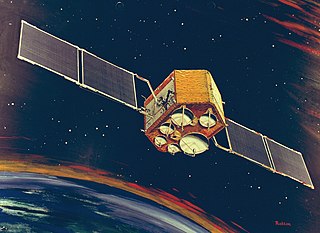
AsiaSat 1 was a Hong Kong communications satellite, which was owned, and was operated, by the Hong Kong based Asia Satellite Telecommunications Company. It was originally launched in February 1984 as Westar 6, but following a booster motor failure it was retrieved and returned to Earth in November of that year by Space Shuttle mission STS-51-A. After being sold to AsiaSat and refurbished, it was relaunched in April 1990, and positioned in geostationary orbit at a longitude of 100.5° East. It spent its operational life at 100.5° East, from where it was used to provide fixed satellite services, including broadcasting, audio and data transmission, to Asia and the Pacific Ocean.

The OTC Satellite Earth Station Carnarvon, an Earth station in Australia, was established to meet the need for more reliable and higher quality communications for the Apollo program. NASA contracted Australia's Overseas Telecommunications Commission (OTC) "to provide an earth station near Carnarvon, Western Australia to link the NASA tracking station in that area to the control centre in the USA", also contracting COMSAT to launch three Intelsat-2 communications satellites.

Sentinel-3 is an Earth observation heavy satellite series developed by the European Space Agency as part of the Copernicus Programme. It currently consists of 2 satellites: Sentinel-3A and Sentinel-3B. After initial commissioning, each satellite was handed over to EUMETSAT for the routine operations phase of the mission. Two recurrent satellites— Sentinel-3C and Sentinel-3D— will follow in approximately 2025 and 2028 respectively to ensure continuity of the Sentinel-3 mission.
Marisat satellites were the first maritime telecommunications satellites and were designed to provide dependable telecommunications for commercial shipping and the U.S. Navy from stable geosynchronous orbital locations over the three major ocean regions. The three Marisat satellites, F1, F2, and F3, were built by Hughes Aircraft Corporation (HAC) for COMSAT Corporation starting in 1973. The satellites were designed to provide maritime telecommunications services in three large ocean areas, the Atlantic Ocean, the Pacific Ocean, and the Indian Ocean, and were located at 72.5° East longitude, 176.5° E, and 345° E in the geosynchronous orbital arc. The three-satellite Marisat system served as the initial INMARSAT constellation.

GOES-3, known as GOES-C before becoming operational, was an American geostationary weather and communications satellite. It was originally built for the National Oceanic and Atmospheric Administration as part of the Geostationary Operational Environmental Satellite system, and was launched in June 1978. It was positioned in geostationary orbit, from where it was initially used for weather forecasting in the United States. Since ceasing to function as a weather satellite in 1989, it was used as a communications satellite, and spent over thirty-eight years in operation. GOES-3 was decommissioned 29 June 2016 at the Center for Southeastern Tropical Advanced Remote Sensing facility in Miami, Florida.
The European Data Relay System (EDRS) system is a European constellation of GEO satellites that relay information and data between satellites, spacecraft, UAVs, and ground stations. The first components were launched in 2016 and 2019.

USA 211, or Wideband Global SATCOM 3 is a United States military communications satellite operated by the United States Air Force as part of the Wideband Global SATCOM programme. Launched in 2009, it was the third WGS satellite, and final Block I satellite, to reach orbit. It was originally stationed in geostationary orbit at 12° West.
INTELSAT 34 or IS-34 is communications satellite built on Space Systems/Loral's 1300-series satellite platform. The satellite broadcasts television to homes in Brazil, distributes video programming for companies like HBO and Fox across Latin America, and beams Internet broadband services to travelers aboard airplanes and ships crossing the North Atlantic Ocean.

JCSAT-16 is a geostationary communications satellite operated by SKY Perfect JSAT Group and designed and manufactured by SSL on the SSL 1300 platform. It has a launch weight of 4,600 kg (10,100 lb), a power production capacity of 8.5 kW and a 15-year design life. Its payload is composed of Ku band and Ka band transponders. SKY Perfect JSAT Group plans to use JCSAT-16 as an in-orbit backup satellite for the Ku- and Ka-band satellites serving the Japanese market.
The JSAT constellation is a communication and broadcasting satellite constellation formerly operated by JSAT Corporation and currently by SKY Perfect JSAT Group. It has become the most important commercial constellation in Japan, and fifth in the world. It has practically amalgamated all private satellite operators in Japan, with only B-SAT left as a local competitor.
Superbird-B3, known as Superbird-8 before launch, and DSN-1 (Kirameki-1) for its military payload, is a geostationary communications satellite operated by SKY Perfect JSAT Group and designed and manufactured by Mitsubishi Electric on the DS2000 satellite bus.