
Parksville is a city on Vancouver Island in British Columbia, Canada. As of the 2021 Census, Parksville's population was 13,642, representing a 9.5% increase over the 2016 Census.

Lasqueti Island is an island off the east coast of Vancouver Island in the Strait of Georgia, qathet Regional District, British Columbia, Canada and has a population of 498. A passenger-only ferry connects the island to the community of French Creek, near Parksville. The ferry makes two to three runs per day, six days per week, weather permitting. The ferry service is run by Western Pacific Marine for BC Ferries.
Garden Bay Marine Provincial Park is a provincial park in British Columbia, Canada at the northwest end of the Sechelt Peninsula on the lower Sunshine Coast, near the community of Madeira Park. Established in 1969, it contains approximately 163 ha.

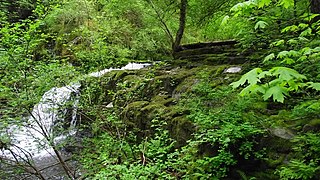
Little Qualicum Falls Provincial Park is a provincial park in British Columbia, Canada, on central Vancouver Island, that encompasses the entire southern shore of Cameron Lake. The Island Rail Corridor line to Port Alberni passes through the park.
Norbury Lake Provincial Park is a 97-hectare (240-acre) provincial park in British Columbia, Canada.
Sandy Island Marine Provincial Park, formerly Sandy Island Provincial Park and also known as Tree Island Park, is a 30 hectare provincial park in British Columbia, Canada, located off the north end of Denman Island, on the west side of the Strait of Georgia to the south of Comox. The park comprises Sandy Island and the Seal Islets. It is accessible by boat and, at low tide, by foot across tidal flats from Longbeak Point on Denman Island.

Fanny Bay is a small hamlet in the Canadian province of British Columbia. It is located on Baynes Sound on the east coast of Vancouver Island. In 2001, its population was listed as 815. It is best known for its fine oysters. The area is served by the Island Highway and Island Rail Corridor.
Honeymoon Bay is an unincorporated community in the Canadian province of British Columbia. It is located on Cowichan Lake in the southeastern part of Vancouver Island — approximately 75 kilometres (47 mi) northwest of Victoria — at 48°49′N124°10′W. In 2011, its population was listed at 580.

Harewood is the name of a lake and a plain of the Canadian province of British Columbia. It is located in Nanaimo, on the east coast of Vancouver Island. Its geographical coordinates are 49°08′N123°57′W The name has been in use since at least 1913, when Harewood referred to a small mining village in the area, no longer existing, having been overtaken by Nanaimo. The mine was owned in part by the seventh son of Henry Lascelles, 3rd Earl of Harewood who served on the BC coast as captain of the gunboat HMS Forward and set up the Harewood Coal Mining Company to work deposits he acquired.
Errington is a small community on Vancouver Island, British Columbia, Canada, located on Errington Road, off Highway 4, just south of Parksville and Qualicum Beach.

Omineca River is a river of the North American boreal forest, in northern British Columbia, Canada. It flows into the Williston Lake, and is part of the Peace River basin. It was originally a tributary of the Finlay River before the creation of Lake Williston. According to Father Adrien-Gabriel Morice the name is derived from a Sekani word meaning 'lake-like or sluggish river'.

De Courcy Island is one of the Gulf Islands of the coast of southwestern British Columbia, Canada, located between the Pylades and Stuart Channels approximately 16 km (9.9 mi) southeast of Nanaimo and approximately 38 km (24 mi) west of Vancouver.

Mansons Landing is an unincorporated community near the southern tip of Cortes Island, British Columbia, Canada.
Douglas is a locality in Surrey, British Columbia, Canada, just southeast and outside of the boundary of White Rock, that is the Canadian side of the Peace Arch Border Crossing between British Columbia and Whatcom County, Washington in the United States. Douglas is the location of the Peace Arch Provincial Park portion of the International Peace Arch Park, which it shares with Peace Arch State Park in Blaine, Washington. The community is named for Benjamin Douglas, an early pioneer and railroad surveyor.
Silverdale is a semi-rural neighbourhood of the District of Mission, British Columbia, Canada, located about 40 km east of Vancouver on the east bank of the Stave River at its confluence with the Fraser. Noted for its historic Italian Canadian community, its economy was farming, fishing and logging based until the general suburbanization of Fraser Valley life in the 1960s and 1970s. Of its Italian community, notable offspring include Phil Gaglardi, former BC Highways minister, and speed-skater Eden Donatelli. Silverdale is also notable as the site of Canada's first train robbery, by the "Gentleman Bandit" Billy Miner, and it is there he is supposed to have first used the polite "Hands Up!" in the course of the robbery.
Robson Bight is a small Vancouver Island bay at the west end of Johnstone Strait across from West Cracroft Island in British Columbia, Canada that includes a protected killer whale habitat famous for its whale-rubbing beaches. The bight is adjacent to Lower Tsitika River Provincial Park. The nearest access point is Telegraph Cove on the east coast of Northern Vancouver Island.

The Ashnola River is a tributary of the Similkameen River, rising in the northeastern part of the North Cascades in Washington, United States, and flowing north into British Columbia, Canada, to join the Similkameen River about halfway along that river's course between the towns of Princeton and Keremeos. The river crosses the international boundary at 49°00′00″N120°19′37″W and transits Cathedral Provincial Park. It has one main tributary, Ewart Creek, which is about 25 kilometres (16 mi) long and begins virtually at the border and is entirely within Cathedral Park.

The Ballenas Islands are a pair of islands in the Strait of Georgia off the coast of British Columbia, Canada. West Ballenas Island is a BC Provincial Park while South Ballenas Island remains Crown land held by the Government of Canada. The Ballenas Island Light is on the northern tip of West Ballenas Island.
Cape Lazo is a headland at the tip of the Comox Peninsula on Vancouver Island, British Columbia, Canada. The community of Lazo is located near the cape.
