
Malda district, also spelt Maldah or Maldaha, is a district in West Bengal, India. It lies 347 km north of Kolkata, the capital of West Bengal. Mango, jute and silk are the most notable products of this district. The special variety of mango, Fazli, produced in this region is popularly known by the name of the district and is exported across the world and is internationally acclaimed. The folk culture of gombhira is a feature of the district, being a unique way of representation of joy and sorrow in daily life of the common people, as well as the unique medium of presentation on national and international matters. According to the National Investigation Agency Malda is believed to be a hub of a fake currency racket. It is reported that 90 percent of the fake currency that enters India originates in Malda.
Habra is a city and a municipality under Barasat sadar subdivision in North 24 Parganas district of the Indian state of West Bengal. It is situated on the Jessore Road between Kolkata and the Bangladesh border at Petrapole. Its location makes it an important town for export and import of goods between India and Bangladesh.

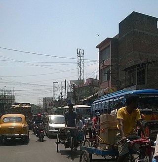
Chanchal is a census town in Malda district in the state of West Bengal, India. It is the headquarters of the Chanchal subdivision.
Harishchandrapur I is a community development block that forms an administrative division in Chanchal subdivision of Malda district in the Indian state of West Bengal.
Ratua I is a community development block that forms an administrative division in Chanchal subdivision of Malda district in the Indian state of West Bengal.
Gazole is a community development block that forms an administrative division in Malda Sadar subdivision of Malda district in the Indian state of West Bengal.
Banshihari is a community development block that forms an administrative division in Gangarampur Subdivision of Dakshin Dinajpur District in the Indian state of West Bengal.
Kaliachak I is a community development block that forms an administrative division in Malda Sadar subdivision of Malda district in the Indian state of West Bengal.
Habibpur is a community development block that forms an administrative division in Malda Sadar subdivision of Malda district in the Indian state of West Bengal.
Bamangola is a community development block that forms an administrative division in Malda Sadar subdivision of Malda district in the Indian state of West Bengal.
Old Malda is a community development block that forms an administrative division in Malda Sadar subdivision of Malda district in the Indian state of West Bengal.
Chanchal II is a community development block that forms an administrative division in Chanchal subdivision of Malda district in the Indian state of West Bengal.
Harishchandrapur is a village in the Harishchandrapur I CD block in the Chanchal subdivision of Malda district in the state of West Bengal, India.
Bamangola is a village in Bamangola CD Block in Malda Sadar subdivision of Malda district in the state of West Bengal, India.
Gazole is a town in Malda district in the Indian state of West Bengal. Gazole police station serves this city. The headquarters of Gazole block is Gazole.
Malatipur is a village in the Chanchal II CD block in the Chanchal subdivision of Malda district in the state of West Bengal, India.
Bandhail is a census town in the Gazole CD block in the Malda Sadar subdivision of Malda district in the state of West Bengal, India.
Rangabhita is a census town in the Gazole CD block in the Malda Sadar subdivision of Malda district in the state of West Bengal, India.
Hatimari is a village in the Gazole CD block in the Malda Sadar subdivision of Malda district in the state of West Bengal, India.
Jhangra is a census town in the Old Malda CD block in the Malda Sadar subdivision of Malda district in the state of West Bengal, India.


