
The Marchfeld ( Morava Field) is the north area of the Vienna Basin which is a sedimentary basin between the Eastern Alps and the Western Carpathians.
The Marchfeld ( Morava Field) is the north area of the Vienna Basin which is a sedimentary basin between the Eastern Alps and the Western Carpathians.
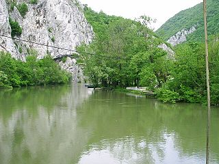
This historical region is known from the Battle on the Marchfeld. It is located in the southeast of the Weinviertel, Gänserndorf District and is a river basin formed by the river Morava. [1]


The Vardar or Axios is the longest river in North Macedonia and the second longest river in Greece. It is 388 km (241 mi) long, out of which 76 km are in Greece, and drains an area of around 25,000 km2 (9,653 sq mi). The maximum depth of the river is 4 m (13 ft).

The Morava is a river in Central Europe, a left tributary of the Danube. It is the main river of Moravia, which derives its name from it. The river originates on the Králický Sněžník mountain in the north-eastern corner of Pardubice Region, near the border between the Czech Republic and Poland and has a vaguely southward trajectory. The lower part of the river's course forms the border between the Czech Republic and Slovakia and then between Austria and Slovakia.

The Great Morava is the final section of the Morava, a major river system in Serbia.
West Morava is a river in Central Serbia, a 184 km-long headstream of the Great Morava, which it forms with the South Morava. It was known as Brongos in antiquity.

The Battle on the Marchfeld at Dürnkrut and Jedenspeigen took place on 26 August 1278 and was a decisive event for the history of Central Europe for the following centuries. The opponents were a Bohemian (Czech) army led by the Přemyslid king Ottokar II of Bohemia and the German army under the German king Rudolph I of Habsburg in alliance with King Ladislaus IV of Hungary. With 15,300 mounted troops, it was one of the largest cavalry battles in Central Europe during the Middle Ages. The Hungarian cavalry played a significant role in the outcome of the battle.

The Battle of Kressenbrunn was fought in July 1260 near Groissenbrunn in Lower Austria between the Kingdom of Bohemia and the Kingdom of Hungary for the possession of the duchies of Austria and Styria. The Bohemian forces were led by King Ottokar II Přemysl, while the Hungarians were led by King Béla IV.

The Nišava or Nishava is a river in Bulgaria and Serbia, a right tributary, and with a length of 218 km also the longest one, of the South Morava.

The South Morava is a river in eastern Kosovo and in southern Serbia, which represents the shorter headwater of Great Morava. Today, it is 295 km long, including its source river Binačka Morava. It flows generally in the south to north direction, from the Macedonian border to Kosovo and onwards to Central Serbia, where it meets West Morava at Stalać, to create Great Morava.

The Rasina is a river in south central Serbia. The 92 km (57 mi) long river flows through the Rasina region, gives its name to the modern Rasina District of Serbia, and flows into the Zapadna Morava near the city of Kruševac.
The Jablanica is an 85-kilometre-long (53 mi) river in southern Serbia. A left tributary of the South Morava river, it gives its name to the region of Jablanica and to modern Serbia's Jablanica District, with the region contributing about one third of the district's area.

The Morava Valley, is a general term which in its widest sense marks valleys of any of three Morava rivers in Serbia: the West Morava, the South Morava and the Great Morava. In the narrow sense, the term is applied only to the Great Morava Valley. The Serbian term follows the general manner of coining river valley names in Serbian using the prefix po- and suffix -je, meaning literally "(land) along the Morava". Morava valley lies in the central Balkans, at the crossroads which lead eastwards, towards the Black sea and Asia Minor, and further south, down the Vardar river into the Aegean sea.

Moravian Serbia or Realm of Prince Lazar is the name used in historiography for the largest and most powerful Serbian principality to emerge from the ruins of the Serbian Empire (1371). Moravian Serbia is named after Morava, the main river of the region. Independent principality in the region of Morava was established in 1371, and attained its largest extent in 1379 through the military and political activities of its first ruler, prince Lazar Hrebeljanović. In 1402 it was raised to the Serbian Despotate, which would exist until 1459.

Angern an der March is a market town in the district of Gänserndorf in the Austrian state of Lower Austria. The municipality consists of the Katastralgemeinden Angern, Grub, Mannersdorf, Ollersdorf and Stillfried.

The Vienna Basin is a geologically young tectonic burial basin and sedimentary basin in the seam area between the Alps, the Carpathians and the Pannonian Plain. Although it topographically separates the Alps from the Western Carpathians, it connects them geologically via corresponding rocks underground.

The Lower Morava Valley is a geomorphological formation in the Moravia. It is formed by the depression in the Western Carpathians in the west and Bílé Karpaty and Chvojnice hills in the east. The drainage to the River Morava of the Danube basin runs finally to the Black Sea.

Kosovo Pomoravlje or Anamorava, is a valley in Kosovo, in the southern part of the District of Gjilan surrounding the Binač Morava River. It stretches eastward to the Preševo Valley in southern Serbia. The mountains in this region, rising to an altitude of 1,000–1,200 metres (3,300–3,900 ft), border the Skopska Crna Gora region in neighboring North Macedonia north of Skopje. Gjilan, Kosovska Kamenica, Novo Brdo and Vitina are municipalities located in the region. The region gave its name to Kosovo-Pomoravlje District. It is known for recording the lowest temperature in Kosovo: −32.5 °C (−26.5 °F), on 25 January 1963.

The Jezava is a river in central Serbia. Formerly a distributary of the Great Morava that flowed into the Danube in Smederevo at the Smederevo Fortress, its upper course was separated from the Great Morava by a dam after floods in 1897. In the 1970s the lower course of the Jezava was diverted into a new stream bed, leading to the Great Morava. The old bed of the Jezava in Smederovo has been retained for drainage of the urban area of Smederovo. The Jezava drains an area of 692 km², belonging to the Black Sea drainage basin.
| Wikimedia Commons has media related to Marchfeld . |
| | This Lower Austria location article is a stub. You can help Wikipedia by expanding it. |