Brigadier General Francis Marion, also known as the "Swamp Fox", was an American military officer, planter, and politician who served during the French and Indian War and the Revolutionary War. During the American Revolution, Marion supported the Patriot cause and enlisted in the Continental Army, fighting against British forces in the Southern theater of the American Revolutionary War from 1780 to 1781.

Dupont Circle is a historic roundabout park and neighborhood of Washington, D.C., located in Northwest D.C. The Dupont Circle neighborhood is bounded approximately by 16th Street NW to the east, 22nd Street NW to the west, M Street NW to the south, and Florida Avenue NW to the north. Much of the neighborhood is listed on the National Register of Historic Places. However, the local government Advisory Neighborhood Commission and the Dupont Circle Historic District have slightly different boundaries.
Capitol Hill is the largest historic residential neighborhood in Washington, D.C., stretching easterly in front of the United States Capitol along wide avenues. It is one of the oldest residential neighborhoods in Washington, D.C., and, with roughly 35,000 people in just under 2 square miles (5 km2), it is also one of the most densely populated. The name is also frequently used as a metonym for the United States Congress.

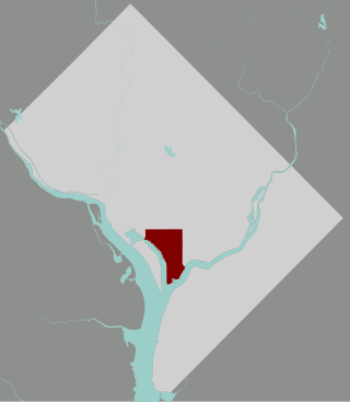
Southwest is the southwestern quadrant of Washington, D.C., the capital of the United States, and is located south of the National Mall and west of South Capitol Street. It is the smallest quadrant of the city, and contains a small number of named neighborhoods and districts, including Bellevue, Southwest Federal Center, the Southwest Waterfront, Buzzard Point, and the military installation known as Joint Base Anacostia–Bolling.

Mission Dolores Park, often abbreviated to Dolores Park, is a city park in San Francisco, California. It is located two blocks south of Mission Dolores at the western edge of the Mission District.

Meridian Hill Park is an urban park in Washington, D.C., located in the Meridian Hill neighborhood that straddles the border between Adams Morgan and Columbia Heights, in Northwest D.C. The park was built between 1912-40 and covers 12-acre (49,000 m2). Meridian Hill Park is bordered by 15th, 16th, W, and Euclid streets NW, and sits on a prominent hill 1.5 miles (2.4 km) directly north of the White House. Since 1969, the name Malcolm X Park is used by some in honor of Malcolm X.

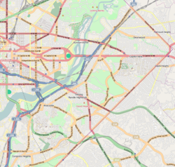
Neighborhoods in Washington, D.C., United States are distinguished by their history, culture, architecture, demographics, and geography. The names of 131 neighborhoods are unofficially defined by the D.C. Office of Planning. Neighborhoods can be defined by the boundaries of wards, historic districts, Advisory Neighborhood Commissions, civic associations, and business improvement districts (BIDs); these boundaries will overlap. The eight wards each elect a member to the Council of the District of Columbia and are redistricted every ten years.
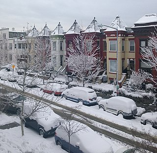
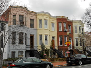
Bloomingdale is a neighborhood in the Northwest quadrant of Washington, D.C., less than two miles (3 km) north of the United States Capitol building. It is a primarily residential neighborhood, with a small commercial center near the intersection of Rhode Island Avenue and First Street NW featuring bars, restaurants, and food markets.

Thomas Circle is a traffic circle in Northwest Washington, D.C., United States. It is located at the intersection of 14th Street, M Street, Massachusetts Avenue, and Vermont Avenue NW. A portion of Massachusetts Avenue travels through a tunnel underneath the circle. The interior of the circle includes the equestrian statue of George Henry Thomas, a Union Army general in the Civil War.

Truxton Circle, sometimes known as East Shaw, is a neighborhood of Washington, D.C., located in Northwest D.C.

Barney Circle is a small residential neighborhood located between the west bank of the Anacostia River and the eastern edge of Capitol Hill in southeast Washington, D.C., in the United States. The neighborhood is characterized by its sense of community, activism, walkability, and historic feel. The neighborhood's name derives from the eponymous former traffic circle Pennsylvania Avenue SE just before it crosses the John Philip Sousa Bridge over the Anacostia. The traffic circle is named for Commodore Joshua Barney, Commander of the Chesapeake Bay Flotilla in the War of 1812.

Stanton Park, previously known as Stanton Square, is a national park in Washington D.C. It is located at the intersection of Maryland Avenue and Massachusetts Avenue in the Capitol Hill neighborhood of Northeast, Washington, D.C. It is bounded by 4th Street to the west and 6th Street to the east. North and south of the park are the respective westbound and eastbound lanes of C Street, NE.
The Southwest Waterfront is a neighborhood in Southwest Washington, D.C. The Southwest quadrant is the smallest of Washington's four quadrants, and the Southwest Waterfront is one of only two residential neighborhoods in the quadrant; the other is Bellevue, which, being east of the Anacostia River, is frequently, if mistakenly, regarded as being in Southeast

Bellevue is a residential neighborhood in far Southeast and Southwest in Washington, D.C., United States. It is bounded by South Capitol Street, one block of Atlantic Street SE, and 1st Streets SE and SW to the north and east; Joliet Street SW and Oxon Run Parkway to the south; Martin Luther King Jr. Avenue SE, Shepherd Parkway, 2nd Street SW, and Xenia Street SW to the west. Bellevue was created from some of the earliest land patents in Maryland, and draws its name from a 1795 mansion built in the area. Subdivisions began in the 1870s, but extensive residential building did not occur until the early 1940s. Bellevue is adjacent to a number of federal and city agency buildings.

Northeast Boundary is small neighborhood located in the northeast quadrant of Washington, D.C., in the United States. Along with the Capitol View neighborhood, it is the easternmost neighborhood of the District of Columbia.

The following outline is provided as an overview of and topical guide to District of Columbia:
Oxon Run Park is a recreational park in Southeast Washington, D.C., that features sports areas, trails, playgrounds and the Southeast Tennis and Learning Center. The park was created in 1971 from land that was previously part of the federally-controlled Oxon Run Parkway.

Garfield Park is a neighborhood park in Washington D.C. Named after President Garfield, it is located at the intersection of 2nd Street and G Street in the Capitol Hill neighborhood of Southeast, Washington, D.C. It is bounded by 3rd street on the east and New Jersey Avenue on the west. South Carolina Avenue and F Street bound it on the north, and its southern border is Interstate 695.

Washington, D.C., the capital of the United States, has a unique and diverse architectural history. Encompassing government, monumental, commercial, and residential buildings, D.C. is home to some of the country's most famous and popular structures designed by some of the leading architects of their time. The popularity of the city's buildings is reflected in the findings of a 2007 poll of Americans by the American Institute of Architects, which found that six of the top 10 most popular U.S. structures were located in Washington, D.C. Overall, the poll found, 17 of the top 150 most popular structures were located in the capital.