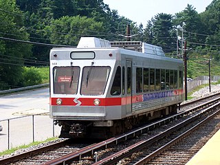
The Norristown High Speed Line is a 13.4-mile (21.6 km) interurban light rapid transit line operated by SEPTA, running between the 69th Street Transportation Center in Upper Darby and the Norristown Transportation Center in Norristown, Pennsylvania. Originally the Philadelphia and Western Railroad line, the line runs entirely on its own right-of-way. By 2020, the Norristown High Speed Line had an average weekday ridership approaching 11,000 passengers.

The 69th Street Transportation Center is a SEPTA terminal in the Terminal Square section of Upper Darby Township, Pennsylvania. It serves the Market–Frankford Line, Norristown High Speed Line, and SEPTA Routes 101 and 102 trolleys, and multiple bus routes. It is located at the end of 69th Street, a major retail corridor in Upper Darby Township across Market Street from the Tower Theater. Until 2011, the station was primarily known as 69th Street Terminal.
The SEPTA subway–surface trolley lines are a collection of five SEPTA trolley lines that operate on street-level tracks in West Philadelphia and Delaware County, Pennsylvania, and also underneath Market Street in Philadelphia's Center City. The lines, Routes 10, 11, 13, 34, and 36, collectively operate on about 39.6 miles (63.7 km) of route.
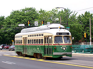
Route 15, the Girard Avenue Line, is a trolley line operated by the Southeastern Pennsylvania Transportation Authority (SEPTA) along Girard Avenue through North and West Philadelphia, Pennsylvania, United States. As of 2007, it is the only surface trolley line in the City Transit Division that is not part of the Subway–Surface Trolley Lines. SEPTA PCC II vehicles are used on the line.

Clifton–Aldan station is a SEPTA station in Clifton Heights, Pennsylvania. It serves the Media/Wawa Line and is nearby the Clifton–Aldan station of the SEPTA Route 102 trolley. It is located at Springfield Road and West Maryland Avenue and has a 110-space parking lot. In 2013, this station saw 351 boardings and 329 alightings on an average weekday.

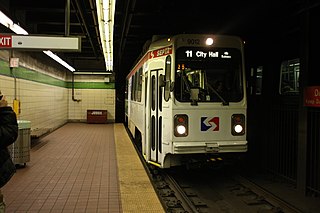
Route 11, also known as the Woodland Avenue Line, is a trolley line operated by the Southeastern Pennsylvania Transportation Authority (SEPTA) that connects the 13th Street station in downtown Philadelphia, Pennsylvania, to Darby Transportation Center in Darby, Pennsylvania. It is one of five lines that are part of the subway–surface trolley system. Sitting at an average of 13,580 riders per weekday in 2019, it is the most used subway-surface trolley route, even though it lacks overnight service. This route will be rebranded as the T4 as part of the transition to SEPTA Metro.

SEPTA Route 13, also known as the Chester Avenue Line, is a trolley line operated by the Southeastern Pennsylvania Transportation Authority (SEPTA) that connects 13th Street Station in downtown Philadelphia, Pennsylvania, with Yeadon and Darby, Pennsylvania. It is one of five lines that are part of the Subway-Surface Trolley system. Route 13 will be rebranded as the T3 as part of the transition to SEPTA Metro.

SEPTA's Subway-Surface Trolley Route 36 is a trolley line operated by the Southeastern Pennsylvania Transportation Authority (SEPTA) that connects the 13th Street station in downtown Philadelphia, Pennsylvania, to the Eastwick Loop station in Eastwick section of Southwest Philadelphia, although limited service is available to the Elmwood Carhouse. It is the longest of the five lines that are part of the Subway-Surface Trolley system, and was even longer between 1956 and 1962 when the western terminus was at 94th Street and Eastwick Avenue. From 1962 through the 1970s, it was at 88th Street and Eastwick Avenue, making the route 16.2 miles (26.1 km) long. Since 1975, it only goes as far as what was once 80th Street at the southern edge of the Penrose Plaza shopping center parking lot. Route 36 will be rebranded as the T5 as part of the transition to SEPTA Metro.

SEPTA Route 10, also known as the Lancaster Avenue Line, to be known as the T1 after rebrand, is a trolley line operated by the Southeastern Pennsylvania Transportation Authority (SEPTA) that connects the 13th Street station in Center City Philadelphia, Pennsylvania, to the 63rd Street–Malvern Avenue station in the Overbrook section of West Philadelphia. It is one out of five lines that is part of the SEPTA's subway–surface trolley system and is 11.6 mi (18.7 km) long. It is the least used subway-surface trolley line, but unlike Route 11, the most used subway-surface trolley line, it has overnight service.
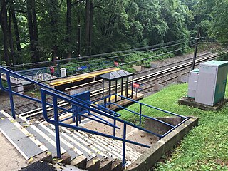
Parkview station is a SEPTA rapid transit located in the Highland Park section of Upper Darby Township, Pennsylvania. It serves the Norristown High Speed Line and is located along Parkview Road and Pennock Road although SEPTA gives the address as Fairview Avenue and Parkview Road. Only local trains stop at Parkview. The station lies 0.7 track miles (1.1 km) from 69th Street Terminal.

County Line station is an interurban rapid transit station on the SEPTA Norristown High Speed Line. The station is located on County Line Road near Matsonford Road in Radnor Township, Pennsylvania. All trains all stop at County Line. Trains running south of this station cross under the Keystone Corridor that carries the Paoli/Thorndale Line as well as Amtrak's Pennsylvanian and Keystone Service trains. The station lies 8.6 track miles (13.8 km) from 69th Street Terminal.
Girard station is an elevated rapid transit station which is located in Philadelphia, Pennsylvania, on SEPTA's Market–Frankford Line. It is situated at the corner of Front Street and Girard Avenue in the Fishtown neighborhood.
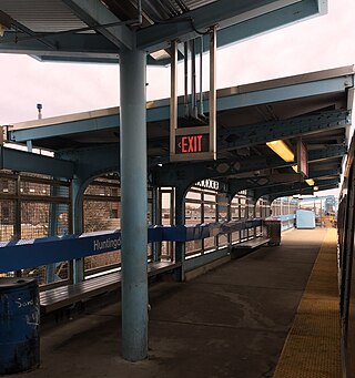
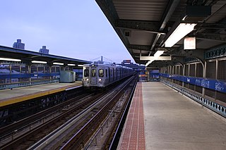
Huntingdon station is a SEPTA elevated rapid transit station in Philadelphia, Pennsylvania, serving the Market–Frankford Line. It is located at the intersection of Kensington Avenue, Huntingdon Street, and B Street in the Kensington neighborhood of the city. It is the westernmost station on the line located above Kensington Avenue and is also served by SEPTA bus routes 3, 39, and 54.

Somerset station is an elevated rapid transit station on SEPTA's Market–Frankford Line, located at the intersection of Somerset Street, D Street, and Kensington Avenue in the Kensington neighborhood of Philadelphia, Pennsylvania. The station is also served by SEPTA City Bus routes 3 and 54.
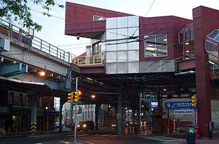
Arrott Transportation Center is an elevated rapid transit station and bus station serving SEPTA's Market–Frankford Line and City Bus routes. It is located at the intersection of Frankford Avenue, Oxford Avenue, Arrott Street, Paul Street, and Margaret Street in the Frankford neighborhood of Northeast Philadelphia, Pennsylvania. The terminal was originally known by two separate names, Margaret–Orthodox station for the Market–Frankford Line and Arrott Bus Terminal for bus routes.

Pennsylvania Route 320 is a north–south state highway in southeastern Pennsylvania. The southern terminus of the 18.8-mile (30.3 km) long route is at U.S. Route 13 /PA 291 in Chester. The northern terminus is at PA 23 in Swedeland. The route passes through suburban areas in Delaware and Montgomery counties to the west of Philadelphia, serving Swarthmore, Springfield, Broomall, Villanova, and Gulph Mills. PA 320 intersects many important highways including US 13 Business and Interstate 95 (I-95) in Chester, US 1 in Springfield, US 30 in Villanova, and I-76 in Gulph Mills. PA 320 runs parallel to I-476 for much of its length and crosses it four times. Even though there are no direct interchanges between I-476 and PA 320, several roads that intersect PA 320 provide access to I-476.
The City Transit Division of the Southeastern Pennsylvania Transportation Authority (SEPTA) operate almost all of Philadelphia's public transit, including all six trolley, three trackless trolley, and 70 bus lines within city limits. Some of the bordering municipalities are served by the City Transit division, despite not being part of the city. For example, Cheltenham Township has 13 city division routes and no Suburban Division ones. The City Transit division also operates the 400 Series routes which are designed to serve students attending schools in the city of Philadelphia.

Drexel Hill Junction is a SEPTA Media-Sharon Hill Trolley Line station in Drexel Hill, Pennsylvania. It is located near Hillcrest Road and Shadeland Avenue, and serves both Routes 101 and 102. Drexel Hill Junction is the last stop where Routes 101 and 102 share the same right-of-way.
Callowhill Depot is a bus and trolley barn operated by the Southeastern Pennsylvania Transportation Authority (SEPTA), located in West Philadelphia, near the Delaware County border. It was built in 1913 by the Philadelphia Rapid Transit Company (PRT) and was later operated by the Philadelphia Transportation Company (PTC) before being taken over by SEPTA. The depot was constructed as part of the Thomas E. Mitten modernization program. Since its construction, the depot has suffered fire damage and reconstruction in 1949, 1950, and 1995.

SEPTA Trolley Route 50 is a former streetcar line that was operated by SEPTA in Philadelphia, Pennsylvania.


