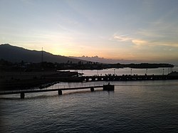
Sikka is a regency within East Nusa Tenggara province, Indonesia, on the island of Flores. It is bordered to the west by Ende Regency and to the east by East Flores Regency. It covers an area of 1,675.36 km2 and had a population of 300,301 at the 2010 census and 321,953 at the 2020 Census; the official estimate as at mid 2023 was 335,360 - comprising 163,060 males and 172,300 females). The capital is the town of Maumere, which comprises the districts of Alok Barat, Alok and Alok Timur.

Wonosobo Regency is a regency in Central Java province in Indonesia. The administrative centre of the regency is located in the town of Wonosobo, located at 7.3684940°S 109.8983841°E, about 120 km from Semarang on the Dieng Plateau. The regency's area is 984.68 km2 and its population was 754,883 at the 2010 census and 879,124 at the 2020 census; the official estimate as at mid 2023 was 909,664.

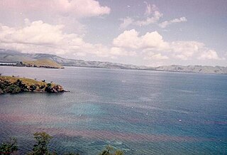
Ende Regency is a regency on the island of Flores, within East Nusa Tenggara Province of Indonesia. The capital is the town of Ende, on the south coast of the Regency. The regency covers an area of 2,085.19 km2, and it had a population of 260,605 at the 2010 Census and 270,763 at the 2020 Census; the official estimate as at mid 2023 was 278,581. It is bordered to the west by Nagekeo Regency and to the east by Sikka Regency, while the Flores Sea lies to the north and the Savu Sea to the south.

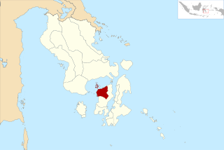
Ende is the seat capital of the Ende Regency, East Nusa Tenggara province of Indonesia. Ende is located on the southern coast of Flores Island. The town had a population of 87,269 residents at the 2020 census, divided administratively between four districts (kecamatan) of the regency – Ende Selatan, Ende Timur, Ende Tengah, and Ende Utara. Note that this does not include Ende District. The official estimate as at mid 2023 was 88,921.

Tangerang Regency is a regency of Banten Province, Indonesia. It is located in the northwest of the island of Java. The current regent is Ahmed Zaki Iskandar. Though commonly misunderstood as being a part of Jakarta, Tangerang is actually outside Jakarta City but is part of Greater Jakarta. Since 1993, the regency has lost territory as first Tangerang city was split off on 27 February 1993 and subsequently South Tangerang city was split off on 29 October 2008. The residual Regency now has an area of 1,034.54 km2 and a population of 2,834,376 at the 2010 census, growing to 3,245,619 at the 2020 census; the latest official estimate is 3,309,365, reflecting a recent slowing down in the rate of population growth since 2020. The town of Tigaraksa is the regency seat.

Pamekasan Regency is a regency (kabupaten) of the province of East Java, Indonesia. It is located on Madura Island approximately 120 kilometres (75 mi) east of Surabaya, the provincial capital. The regency covers an area of 792.30 square kilometres (305.91 sq mi), and at the 2010 census it had a population of 795,918 ; at the 2020 census the total was 850,057 and the official estimate as of mid-2023 was 882,837 – comprising 431,891 males and 450,946 females. The administrative capital is the town of Pamekasan.

Pelalawan is a regency (kabupaten) of Riau Province, Indonesia. It is located on the island of Sumatra. The regency was created on 4 October 1999 as a result of the division of Kampar Regency, of which it was previously the eastern 43%. It now has an area of 13,408.72 km2 and had a population of 301,829 at the 2010 Census and 390,046 at the 2020 Census; the official estimate as at mid 2022 was 410,988. The administrative centre is in the town of Pangkalan Kerinci.

Barito Kuala Regency is one of the regencies (kabupaten) in the Indonesian province of South Kalimantan. It is situated in the southwest of the province, bordering Central Kalimantan province to its immediate west and separated from Banjarmasin city to its east by the lower reaches of the Barito River. The regency's land area is 2,996.46 km2, and the population was 276,147 at the 2010 Census and 313,021 at the 2020 Census; the official estimate was 324,502. The capital is the town of Marabahan. The Motto of the Regency is "Selidah".
Central Hulu Sungai Regency is one of the regencies in the Indonesian province of South Kalimantan. The area is 1,770.77 km2 and the population was 243,460 at the 2010 Census and 258,721 at the 2020 Census; the official estimate as at mid 2023 was 268,360. The administrative centre is the town of Barabai.

East Flores Regency is a regency in East Nusa Tenggara province of Indonesia. Established in 1958, the regency has its seat (capital) in Larantuka on Flores Island. It covers a land area of 1,812.58 km2, and it had a population of 232,605 as of the 2010 census and 276,896 at the 2020 Census; the official estimate as of mid-2023 was 288,310 - comprising 141,738 males and 146,572 females. The regency encompasses the eastern tip of the island of Flores, together with all of the adjacent islands of Adonara and Solor to the east of Flores, with some much smaller offshore islands. On 4 October 1999, the island of Lembata at the eastern end of the Solor Archipelago was separated from the East Flores Regency to create its own Regency.

Manggarai Regency is a regency in East Nusa Tenggara province of Indonesia, situated on the island of Flores. Established in 1958 the regency was reduced in size and population by the separation of the more western districts to form West Manggarai Regency in 2003 and of the more eastern districts to form East Manggarai Regency in 2007. The area of the residual Manggarai Regency is 1,343.83 km2 and its population was 292,037 at the 2010 census and 312,855 at the 2020 census; the official estimate as at mid 2023 was 328,758. The capital of the regency is the town of Ruteng.

East Tanjung Jabung Regency is a regency of Jambi Province, Indonesia. It is located on the island of Sumatra. The regency was created on 4 October 1999 by the division of the then Tanjung Jabung Regency into eastern and western halves. It now has an area of 5,085.71 km2 and had a population of 205,272 at the 2010 census and 229,813 at the 2020 census; the official estimate as at mid 2022 was 234,164. The capital lies at Muara Sabak.

East Kotawaringin Regency is one of the thirteen regencies which comprise the Central Kalimantan Province on the island of Kalimantan (Borneo), Indonesia. It originally covered a much larger part of the province, having been split from a single Kotawaringin Regency on 26 June 1959 into separate regencies for East and West Kotawaringin, but on 10 April 2002 several districts in the west of the regency were split off to form the new Seruyan Regency, and several districts in the east of the regency were similarly split off to form the new Katingan Regency. The area of the residual East Kotawaringin Regency is 16,796 km2, and its population was 374,175 at the 2010 Census, and 428,900 at the 2020 Census; the official estimate as at mid 2023 was 443,359. The town of Sampit is the capital of East Kotawaringin Regency.

Jeneponto Regency is a regency of South Sulawesi Province of Indonesia. It covers most of the south coast of the southern peninsula of Sulawesi, with a total area of 796.00 km2 and a population of 342,222 at the 2010 Census and 401,610 at the 2020 Census. The official estimate for mid 2023 was 420,123. The principal town lies at Bontosunggu. The northern part of the regency consists of a plateau with an altitude of 500 to 1400 metres above sea level, the middle part has an altitude of 100 to 500 metres, while the south includes lowland areas with an altitude of 0 to 150 metres, including a coastline of 114 km on the Flores Sea.

South Konawe Regency is a regency of Southeast Sulawesi Province, Indonesia. The regency was created on 25 February 2003 from what had been the southern districts of Konawe Regency. It covers an area of 4,237.74 km2 and had a population of 264,587 at the 2010 Census and of 308,524 at the 2020 Census; the official estimate as at mid 2023 was 322,946 - comprising 165,487 males and 157,459 females.< The administrative centre is in the town of Andoolo.

Manokwari Regency is a regency in West Papua, Indonesia. Following the splitting away of twenty of its former districts in 2013, it now covers an area of 2,762.89 km2 and had a population of 192,663 at the 2020 Census; the official estimate as at mid 2023 was 201,821. The administrative centre is presently at the town of Manokwari, which is also the capital of the province.

Blitar Regency is a regency in East Java, Indonesia. It covers an area of 1,558.79 km2 and had a population of 1,116,639 at the 2010 Census and 1,223,745 at the 2020 Census; the official estimate as at mid 2023 was 1,252,242. These figures exclude Blitar city, which is now a separate administrative entity, enclaved within the regency but completely independent from it. Since 2010, the regency's capital has been located in the town of Kanigoro, after sharing the same capital with Blitar city for more than a century.

Penukal Abab Lematang Ilir Regency is a regency of South Sumatra Province, Indonesia. It takes its name from the three main rivers which flow through that area - the Penukal River, Abab River and Lematang River - while the name Ilir means "downstream". The town of Talang Ubi is the administrative centre of this regency. The regency borders Musi Banyuasin Regency to the north, Banyuasin Regency, and Muara Enim Regency to the east and the south, and by Musi Rawas Regency, and Muara Enim Regency to the west.

North Morowali Regency is a regency in the province of Central Sulawesi, Indonesia. The regency was established on 12 April 2013, partitioned from the northwestern districts of Morowali Regency. It covers an area of 10,004.28 km2 and the component districts which were then in Morowali Regency had a combined population of 104,094 at the 2010 Census. The new regency had 120,789 inhabitants at the 2020 Census; the official estimate as at mid 2023 was 126,049. The principal town lies at Kolonodale.
West Muna Regency is a new regency of Southeast Sulawesi Province of Indonesia,and is situated in the northwest corner of Muna Island and smaller ilsands of its coast. It was established under Act No.14 of 2014, dated 23 July 2014 by separation from the Muna Regency. It covers an area of 906.28 km2, and the districts comprising it had a population of 71,632 at the 2010 Census; the 2020 Census resulted in a population of 84,590, and the official estimate as at mid 2022 was 85,706, comprising 42,242 males and 43,464 females. The administrative centre lies at Laworo in the Tiworo Islands District.