
El Paso is a city in and the county seat of El Paso County, Texas, United States. The 2020 population of the city from the U.S. Census Bureau was 678,815, making it the 22nd-most populous city in the U.S., the most populous city in West Texas, and the sixth-most populous city in Texas. The city has the largest Hispanic population share of main cities in the U.S. at 81%. Its metropolitan statistical area covers all of El Paso and Hudspeth counties in Texas, and had a population of 868,859 in 2020.

El Capitan is a peak in Culberson County, Texas, located within Guadalupe Mountains National Park. The 10th-highest peak in Texas at 8,085 ft, El Capitan is part of the Guadalupe Mountains, an exposed portion of a Permian period reef uplifted and exposed by tectonic activity during the late Cretaceous period. The southern terminus of the Guadalupe Mountains, El Capitan looms over U.S. 62/180, where its imposing height and stark outline have made it one of the iconic images of the Trans-Pecos to generations of travelers.
Sugarloaf Mountain is a small mountain and park about 10 miles (16 km) south of Frederick, Maryland. The closest village is Barnesville, located just over one mile from the foot of the mountain. The peak of this relatively low mountain is approximately 800 feet higher than the surrounding farmland. It is visible from many parts of northern Montgomery County and southern Frederick County, notably from I-270 north of the town of Germantown. Because of its geological and natural history interest, it was designated a National Natural Landmark in 1969. It is a notable example of an admission-free, privately owned scenic park.

Franklin Mountains State Park is a Texas state park in El Paso, Texas, that protects the Franklin Mountains. Park headquarters are located at an elevation of 5,426 feet (1,654 m) with the highest peak, North Franklin Mountain, reaching 7,192 feet (2,192 m). It is one of the largest urban parks in the nation lying completely within city limits, covering 24,247.56 acres (9,813 ha). Franklin Mountains State Park is open year-round for recreational hiking, mountain biking, picnicking and scenic driving and vistas.
The Franklin Mountains of Texas are a small range 23 miles (37 km) long, 3 miles (5 km) wide that extend from El Paso, Texas, north into New Mexico. The Franklins were formed due to crustal extension related to the Cenozoic Rio Grande rift. Although the present topography of the range and adjoining basins is controlled by extension during rifting in the last 10 million years, faults within the range also record deformation during the Laramide orogeny, between 85 and 45 million years ago.
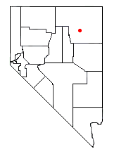
The Ruby Crest National Recreation Trail is a National Recreation Trail in the upper elevations of the central Ruby Mountains, in Elko County, Nevada, United States. Approximately 38 miles (61 km) in length, the trail is used by hikers and pack trains to experience some of the most spectacular scenery in the western United States.

Northeast El Paso is part of the city of El Paso, Texas and is located north of Central El Paso, and east of the Franklin Mountains. Its southern boundary is variously given as Fred Wilson Boulevard or Cassidy Road and Van Buren Avenue, and it extends northward to the New Mexico state line; some portions of this region lie outside the city limits, including parts of Franklin Mountains State Park and areas of Fort Bliss: the Logan Heights area of Fort Bliss around Chapin High School and Castner Range National Monument, an old firing range northwest of Hondo Pass Drive and Gateway South Boulevard. Development of Northeast El Paso, which had begun before the Second World War around the Logan Heights area, started in earnest during the 1950s, when many homes were demolished in the process of the construction of Interstate 10. It is one of the more ethnically diverse areas of town due to a high concentration of military families. Northeast El Paso has historically not developed at a rate comparable to East El Paso and Northwest El Paso, but in recent years, it has seen an increase in development. It is expected that the population in Northeast El Paso will grow more rapidly as a result of the troop increase for Fort Bliss in the coming years. Northeast El Paso has gained recognition throughout the city for schools like Parkland, Irvin, Andress and Chapin because of their outstanding athletic programs.

North Franklin Mountain is a mountain in the Franklin Mountains of El Paso, Texas, located in the Southwestern United States. North Franklin, at 7,192 feet (2,192 m), is the highest point in El Paso, and the 27th-highest mountain in the state of Texas. Surrounded by a state park and with a maintained trail leading to its summit, the mountain is a popular hiking destination. The eastern slope extends into Castner Range National Monument.

Eaton Canyon is a major canyon beginning at the Eaton Saddle near Mount Markham and San Gabriel Peak in the San Gabriel Mountains in the Angeles National Forest, United States. Its drainage flows into the Rio Hondo river and then into the Los Angeles River. It is named after Judge Benjamin S. Eaton, who lived in the Fair Oaks Ranch House in 1865 not far from Eaton Creek.

The Wilkie Sugarloaf Trail is a hiking trail in northern Cape Breton Island in the Canadian province of Nova Scotia. The trail leads to the 411.8 metres (1,351 ft) summit of Wilkie Sugar Loaf in the Cape Breton Highlands.
Bell Canyon Park is a large open-space regional park located in the Simi Hills at the western end of the San Fernando Valley in West Hills, Los Angeles and Bell Canyon, California. Bell Creek, a primary tributary to the Los Angeles River, flows through the park with riparian zone vegetation along its natural banks. The geographic landmark Escorpión Peak is high above it to the south in adjacent El Escorpión Park.

Sugarloaf Mountain or Mount Sugarloaf, is a butte-like mountain located in South Deerfield, Massachusetts, United States, with two summits, North Sugarloaf Mountain 791 ft (241 m) and its more popular knee, South Sugarloaf Mountain 652 ft (199 m). Its cliffs, made of arkose sandstone, are a very prominent landscape feature visible for miles. Despite low elevations relative to the Berkshire Mountains to the west, dramatic cliff faces and a rise of 500 feet (150 m) to 600 feet (180 m) from the nearby Connecticut River make the mountain a popular tourist and hiking destination. Sugarloaf Mountain is the southern terminus of the Pocumtuck Range.

Wyler Aerial Tramway is an aerial tramway in El Paso, Texas, United States. The tramway is operated by the Texas Parks and Wildlife Department and is located in Franklin Mountains State Park. The tramway complex covers 196 acres (0.79 km2) on the east side of the Franklin Mountains. The gondolas travel along two 2600 foot 1 3/8" diameter steel cables to Ranger Peak, 5,632 feet (1,717 m) above sea level. The trip takes about four minutes and lifts riders up 940 vertical feet above the boarding area. From Ranger Peak you can see three states and two countries on a clear day. The tramway was closed indefinitely to the public in September 2018.

Blodgett Peak is a mountain summit in El Paso County, Colorado. Blodgett Peak is located in Pike National Forest. and at its base is Blodgett Peak Open Space of Colorado Springs.

The El Paso Formation is a geologic formation that is exposed from the Permian Basin of New Mexico and Texas to southeastern Arizona. It preserves fossils dating back to the Ordovician period.
St. Peter's Dome is a granite-topped peak on Pikes Peak massif in the Pike National Forest. The peak, at 9,528 feet (2,904 m) in elevation, is located in El Paso County, Colorado, above Colorado Springs. It is located about 8 miles (13 km) from Colorado Springs along Old Stage and Gold Camp Roads. Old Stage Road is picked up behind The Broadmoor and Gold Camp Road winds through Cheyenne Canyon.
The culture of El Paso, Texas is influenced both heavily by American and Mexican cultures due to its position as a border town, its large Hispanic population, and its history as part of the Southwest, Spanish America and Mexico. El Paso is home to a number of cultural events and festivals. El Paso also hosts various theaters, museums, and other cultural sites.

Castner Range National Monument is a national monument in El Paso County, Texas, that covers 6,672 acres (27 km2) of the Franklin Mountains. It was established by President Joe Biden on March 21, 2023. The monument, a former weapons testing range, is part of Fort Bliss and is managed by the U.S. Army as the only land conservation national monument within the Department of Defense. The monument includes the eastern slopes of North Franklin Mountain, the highest peak in the area. It is adjacent to Franklin Mountains State Park and Northeast El Paso and near the Organ Mountains–Desert Peaks National Monument in New Mexico. As remediation is ongoing, the site is closed to the public.

